The best running trails around Guderhandviertel
4.4
(576)
10,280
runners
543
runs
Jogging around Guderhandviertel offers a blend of natural landscapes and cultural features, ideal for outdoor activity. The region is characterized by the extensive apple orchards of Altes Land and the scenic Elbe River, providing diverse backdrops for runners. Terrain is generally flat, with minimal elevation changes, making it suitable for various fitness levels. Running paths often follow riverside banks and wind through tranquil orchard areas.
Best jogging routes around Guderhandviertel
- The most popular jogging route is Lühe Sluice – Hogendiek…
Last updated: July 5, 2026
5.0
(1)
31
runners
8.82km
00:58
10m
10m
Moderate run. Good fitness required. Mostly paved surfaces. Suitable for all skill levels.
5.0
(1)
22
runners
Moderate run. Good fitness required. Mostly paved surfaces. Suitable for all skill levels.

Sign up for free
5.0
(1)
16
runners
8.52km
00:53
10m
10m
Moderate run. Good fitness required. Mostly paved surfaces. Suitable for all skill levels.
5.0
(3)
22
runners
Moderate run. Good fitness required. Mostly paved surfaces. Suitable for all skill levels.
5.0
(1)
17
runners
8.21km
00:51
10m
10m
Moderate run. Good fitness required. Mostly paved surfaces. Suitable for all skill levels.
Get access to more routes and recommendations from other explorers.
Sign up for free
Already have an account?
Our route recommendations are based on thousands of hikes, rides, and runs completed by other people on komoot.
Start today with a free account
Your next adventure awaits.
Login or Signup
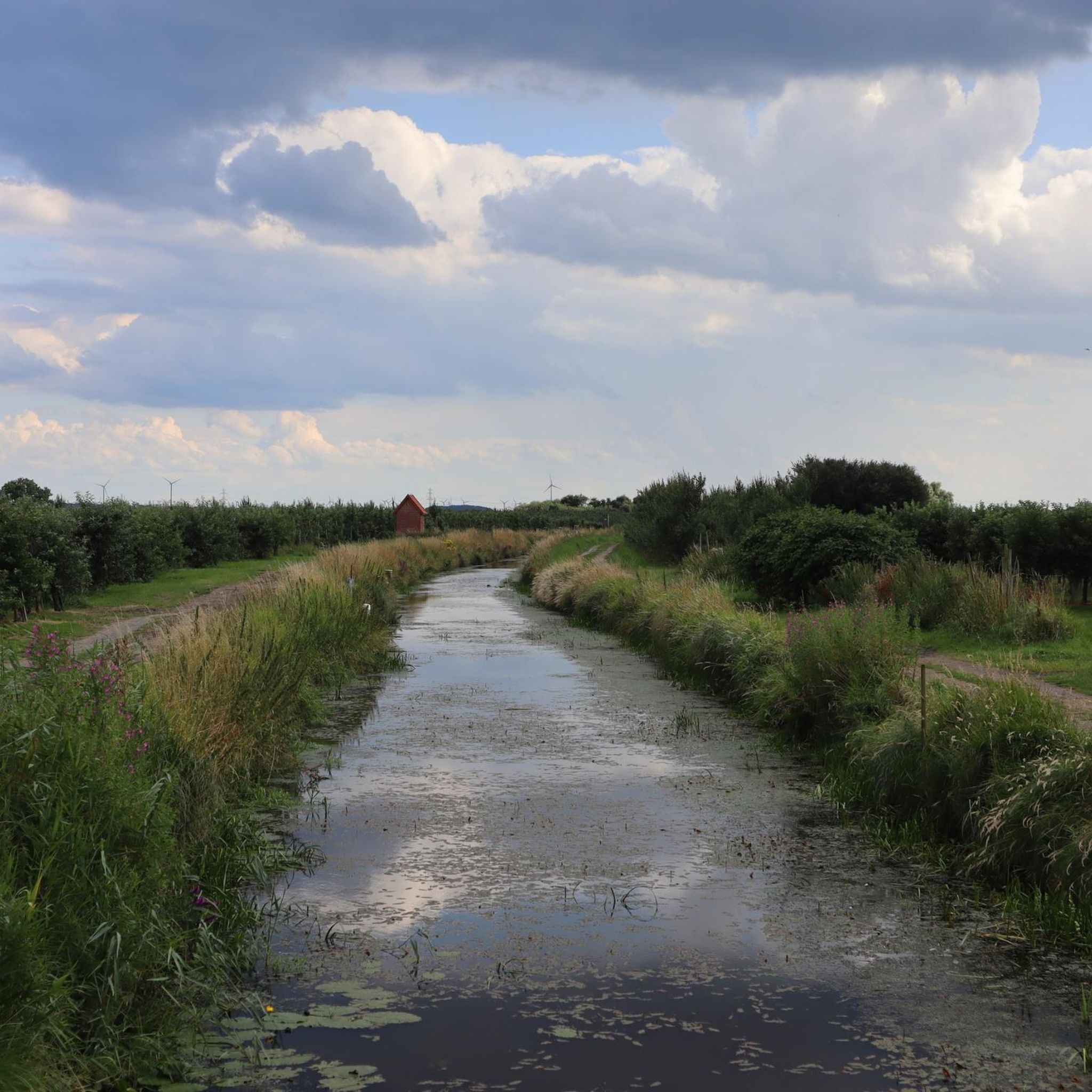
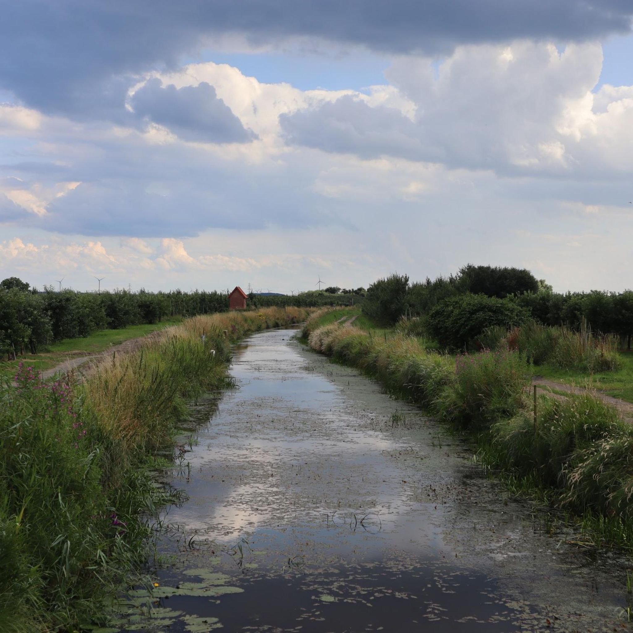
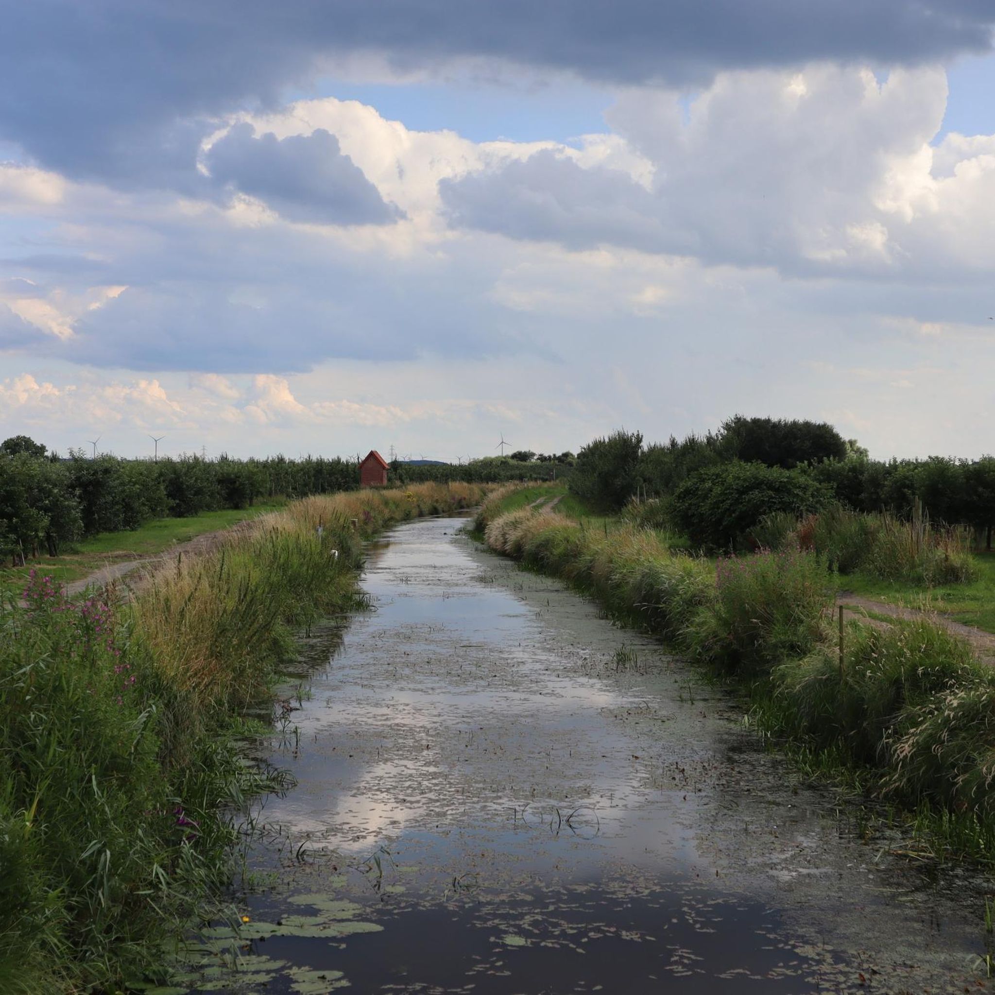
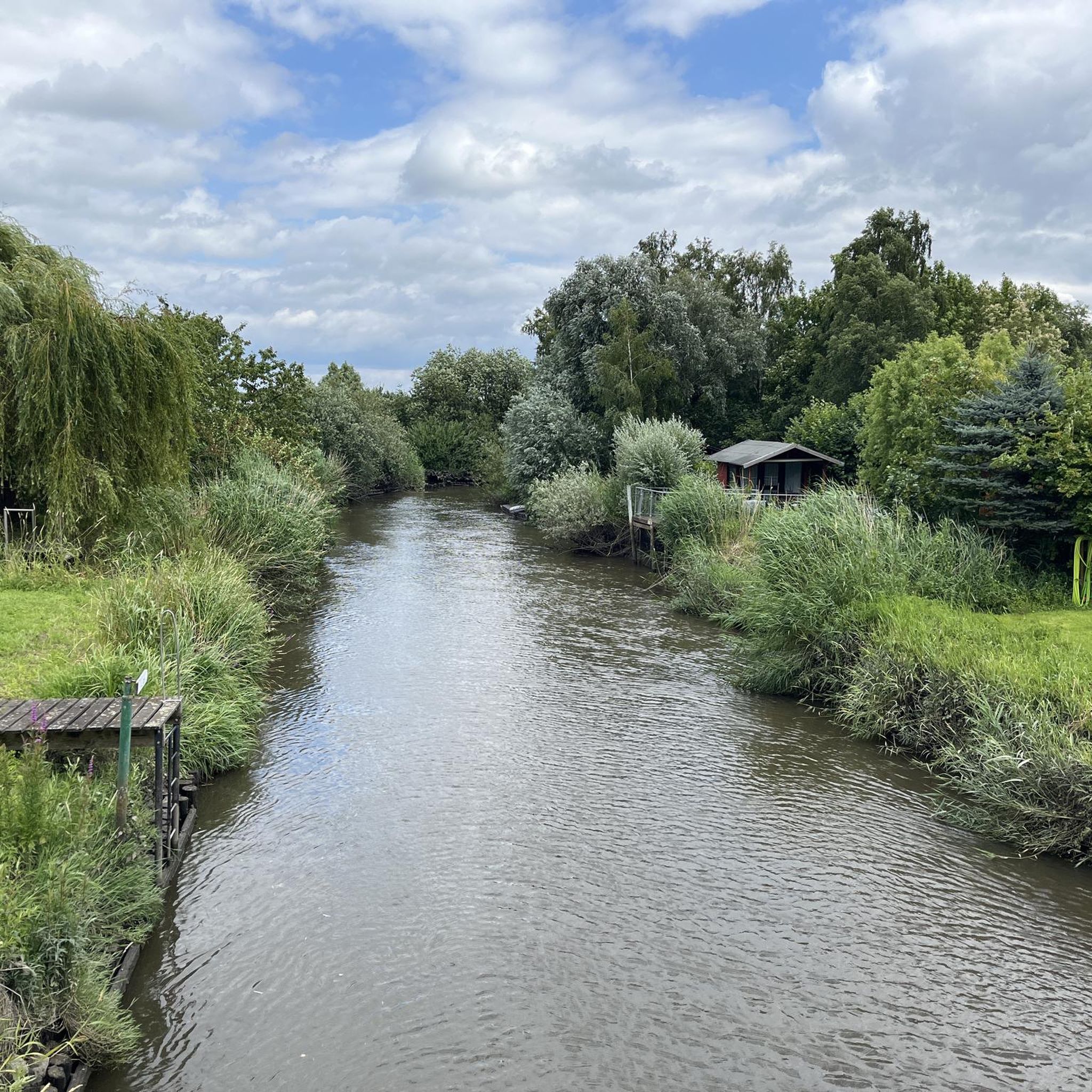
Tips from the Community

The Lühe pier in Altes Land is a popular destination on the Elbe. The Lühe-Schulau ferry connection is located here, connecting Lower Saxony with Schleswig-Holstein (Wedel). The pier is a central meeting point for cyclists, hikers, tourists, and ship enthusiasts. The surrounding area is characterized by the Altes Land orchards and is located near Hamburg.
0
0

The dykes on the Lühe are listed as historical monuments. The villages on both sides of the Lühe: Mittelnkirchen Ort, Mittelnkirchen Hohenfelde, Neuenkirchen east of the river and Bergfried and Guderhandviertel west of the river are typical, historic dyke-strip villages of the Altes Land – just like Leeswig, Königreich, Hove and Moorende on the Este –. They follow the curves of the river, as do the dyke and the road. The farmhouses face the dyke with their decorated gables, separated from each other by ditches, with the typical front gardens. The farm buildings, orchards, the historic strips of the agricultural land extend behind the houses in long strips.
0
0
A great cycling and hiking route runs along here at the Lühe Anleger. A visit is recommended at any time of the year. The Lühe Schulau ferry runs back and forth to Schulau several times a day. A large playground for children is located here with many beautifully landscaped seating areas. Many kiosks offer their delicacies, a visit is recommended. Opposite the Lühe Anleger, there is a public toilet right next to the tourist information office.
7
0
Starting from Horneburg, you can do a circular tour from here via Guderhandviertel over the bridge. Possibly as a hike, Nordic Walking tour or bicycle route. It leads along the road for a while and later back to Horneburg through the fantastic nature reserve along the Lühe. Highly recommended and interesting at the same time 👍🏼.
2
0
A dreamlike beautiful hiking and cycling route leads here through beautiful nature 💚.
1
0
A great bike and hiking route leads here in Mittelkirchen over the bridge. A beautiful tour along the dike and past the half-timbered houses of the Altländer.
2
0
A great bike and hiking route leads along here amidst beautiful nature on the Lühe Deich.
1
0

Frequently Asked Questions
How many running routes are available in Guderhandviertel?
Guderhandviertel offers a wide selection of running routes, with over 500 trails available. These range from easy jogs to more challenging distances, ensuring options for all fitness levels.
What is the general terrain like for running in Guderhandviertel?
The terrain in Guderhandviertel is generally flat, making it suitable for various running styles. You'll find paths winding through the picturesque apple orchards of Altes Land and along the scenic Elbe River, offering a mix of natural beauty and open views.
What do other runners think about the trails in Guderhandviertel?
The running routes in Guderhandviertel are highly rated by the komoot community, holding an average score of 4.4 stars from over 470 reviews. More than 9,000 runners have explored the area, often praising the tranquil orchard paths and riverside views.
Are there running routes suitable for beginners or those looking for an easy jog?
Yes, Guderhandviertel has 72 easy running routes. These trails typically feature minimal elevation changes and well-maintained surfaces, perfect for a relaxed run or for those new to jogging. The region's flat landscape is ideal for accessible running.
Can I find circular running routes in Guderhandviertel?
Many of the running paths in Guderhandviertel are designed as loops, offering convenient circular routes. For example, the Lühe Sluice – Hogendiek Bridge loop from Samtgemeinde Lühe is a popular 8.8 km option that brings you back to your starting point.
What kind of landmarks or points of interest can I see while running?
While jogging in Guderhandviertel, you can encounter various points of interest. You might pass by the historic Hagener Mill or enjoy views of Auetal. The region also features several tranquil lakes like Neukloster Lake and Horstsee, and even the impressive Agathenburg Castle is nearby.
Are there any family-friendly running trails in the area?
Guderhandviertel's generally flat and scenic routes are well-suited for families. Many paths through the apple orchards and along the riverbanks offer a pleasant and safe environment for a family jog. The Höpenrig Children's Forest is also a nearby attraction that could be incorporated into a family outing.
What are the best seasons for running in Guderhandviertel?
The region is beautiful year-round, but spring and autumn are particularly pleasant. In spring, the apple orchards of Altes Land are in bloom, offering a stunning backdrop. Autumn brings vibrant colors and the harvest season. Summer mornings and evenings are also ideal for running along the Elbe River.
Is there parking available near the running routes?
Yes, parking options are generally available, especially near popular starting points for trails. You can often find designated parking areas or roadside spots in the villages and near access points to the Elbe cycle path. For example, there's a shelter and parking lot on the Jakobsweg via Baltica.
Can I reach the running trails using public transport?
Public transport connections are available to Guderhandviertel and surrounding areas, making it possible to access various running routes. Local bus services connect the villages, and some routes, particularly those along the Elbe, might be accessible from stops along their path.
Are there any running routes that offer views of the Elbe River?
Absolutely. The proximity of Guderhandviertel to the Elbe River means many running routes follow its banks, providing continuous scenic views. The Elbe cycle path, for instance, offers well-maintained sections perfect for running alongside the river, allowing you to watch ships pass by.
What is a good moderate-difficulty running route in Guderhandviertel?
For a moderate run, consider the Lühe Unterfeuer loop from Steinkirchen. This 9.7 km route offers a consistent running surface and takes you through varied landscapes, typically completed in just over an hour.
Are there any cafes or pubs near the running routes for a post-run refreshment?
Yes, the villages within Guderhandviertel and the broader Altes Land region offer various cafes and pubs where you can relax and refuel after your run. Many are located conveniently in the village centers or along main roads, providing local charm and refreshments.
Most popular routes around Guderhandviertel
Most popular attractions around Guderhandviertel

Get inspired with the komoot mobile app


Explore more
Browse the best Running Trails & Routes in other regions.
