The best running trails around Upper Glenariff Mountain East
195
runners
23
runs
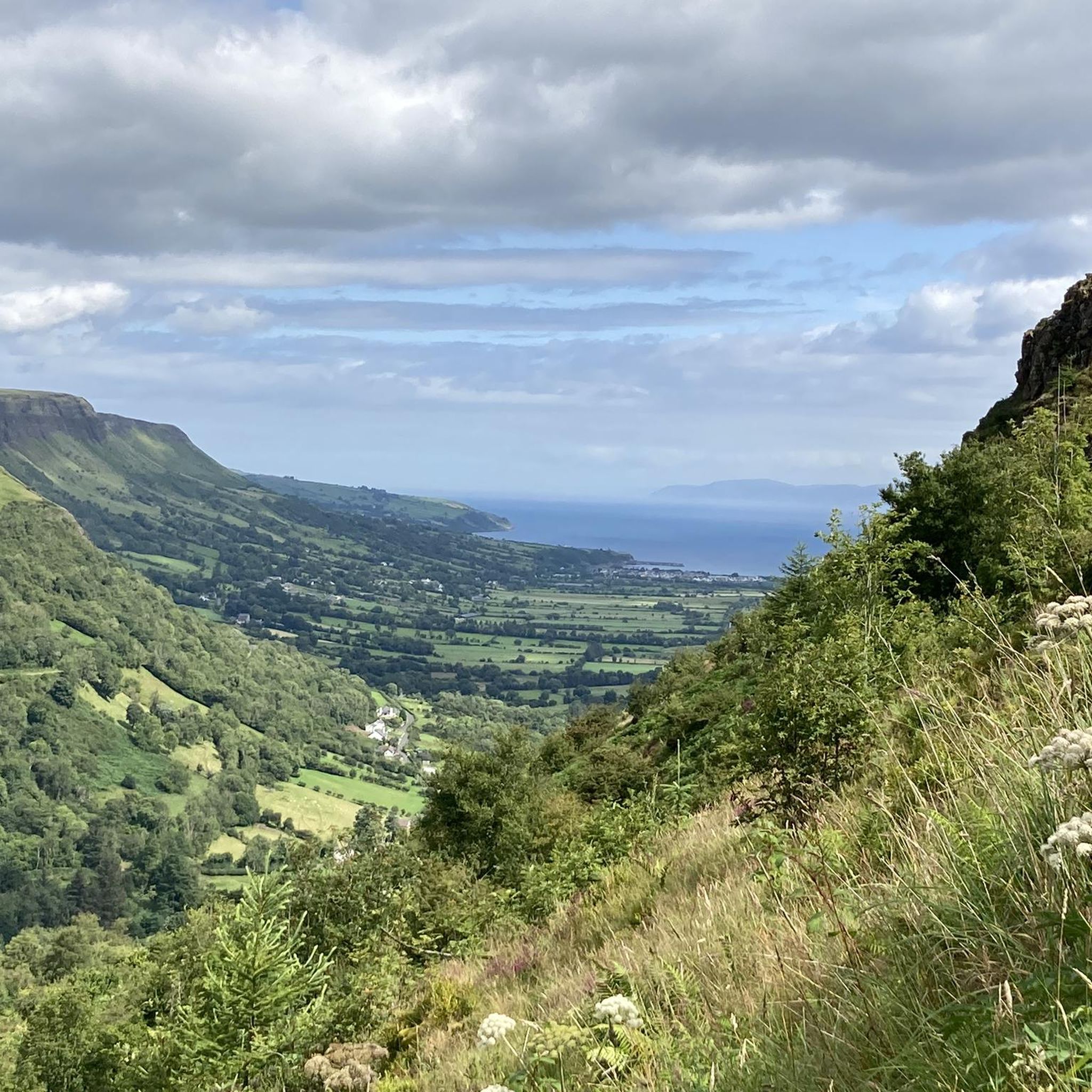
Jogging around Upper Glenariff Mountain East offers diverse terrain within a prominent U-shaped glaciated valley. The region features ancient woodlands, dramatic rocky gorges carved by waterfalls, and significant climbs. Trails wind through over 1000 hectares of planted woodland and conservation areas, providing varied running surfaces. The landscape includes mountainous sections with exposed areas, offering panoramic views of the surrounding mountains and the sea.
Best jogging routes around Upper Glenariff Mountain East
- The most popular jogging route is Glenariff Forest –…
Last updated: May 16, 2026
22
runners
9.39km
00:59
50m
50m
Moderate run. Good fitness required. Mostly paved surfaces. Suitable for all skill levels.
14
runners
Moderate run. Good fitness required. Mostly paved surfaces. Suitable for all skill levels.

Sign up for free
11
runners
Hard run. Very good fitness required. Mostly paved surfaces. Suitable for all skill levels.
9
runners
Moderate run. Good fitness required. Mostly paved surfaces. Suitable for all skill levels.
8
runners
11.5km
01:13
120m
120m
Moderate run. Good fitness required. Mostly paved surfaces. Suitable for all skill levels.
Get access to more routes and recommendations from other explorers.
Sign up for free
Already have an account?
Our route recommendations are based on thousands of hikes, rides, and runs completed by other people on komoot.
Start today with a free account
Your next adventure awaits.
Login or Signup
Popular around Upper Glenariff Mountain East

Tips from the Community

Glenariff is one of nine valleys in the Glens of Antrim. These impressive glens were created by glaciers millions of years ago during the Ice Age and shaped by the tides. Glenarm, Glenariff, Glendun, Glencorp, Glenaan, Glenbllyeamon, Glenshesk, Glencloy, and Glentaisie are a scenic gem located on the coast of Northern Ireland.
0
0

For walkers, Waterfoot is a pleasant alternative to the main road, as it passes close to the beach and behind the dunes, with beautiful views and no traffic.
1
0
Nice promenade with tables and a nice walk in front of the beach. It is dangerous to swim but the view is nice.
1
0

From the bridge you have a great view of the water
0
0
The water breaks on the stones, beautiful to look at
0
0
Beautiful to look at, the river is more than fascinating
0
0
Frequently Asked Questions
How many running trails are available in Upper Glenariff Mountain East?
Upper Glenariff Mountain East offers a diverse network of over 25 running trails. These routes cater to various fitness levels, ranging from easy forest paths to more challenging mountain runs.
Are there easy running routes suitable for beginners in the area?
Yes, there are several easier running options. While many routes are moderate, you can find trails that are less demanding. For example, the region offers paths through ancient woodlands that provide a gentler experience, though specific easy routes are not detailed in the provided data, the overall network includes options for different ability levels.
Can I find challenging mountain runs in Upper Glenariff Mountain East?
Absolutely. The landscape features significant climbs and exposed mountainous sections, perfect for challenging runs. The region is known for events like the 'Spud Run,' highlighting its demanding terrain. A difficult route like Glenariff Forest – View of Glenariff Valley loop from Antrim Coast & Glens AONB, covering 13.7 miles (22.1 km) with substantial elevation gain, offers a great test for experienced runners.
What kind of natural features can I expect to see while jogging here?
Upper Glenariff Mountain East is renowned for its spectacular natural beauty. You'll encounter stunning waterfalls, dramatic rocky gorges, and ancient woodlands. Highlights include Inver River Waterfall and Ess-na-Laragh Waterfall, which are part of the famous Waterfall Walk Trail. The trails also offer panoramic views of glaciated valleys and, on clear days, glimpses of the Mull of Kintyre in Scotland.
Are there any running routes that offer coastal views?
Yes, some routes provide beautiful coastal vistas. For instance, the Waterfoot Beach – Waterfoot Beach loop from Waterfoot is a moderate 5.9 miles (9.5 km) path that offers scenic coastal views and relatively flat sections along the beach, making for a refreshing run.
Are the running trails in Upper Glenariff Mountain East suitable for families?
Glenariff Forest Park, which encompasses much of the area, offers a variety of trails, including shorter, easier options like the Rainbow Trail (0.6km) and Viewpoint Trail (1km). While the guide focuses on jogging, these shorter, well-maintained paths within the park can be enjoyed by families, offering a chance to experience the natural beauty together.
Is Upper Glenariff Forest Park dog-friendly for runners?
Glenariff Forest Park generally welcomes dogs, but it's always advisable to check the specific park regulations regarding leash requirements and restricted areas before your visit. Many trails through woodlands and open areas are suitable for running with a well-behaved dog on a leash.
Are there circular running routes available?
Yes, many of the running routes in Upper Glenariff Mountain East are circular, allowing you to start and finish at the same point. Examples include the popular Glenariff Forest loop from Cargan and the Waterfoot Beach – Waterfoot Beach loop from Waterfoot, providing convenient options for your run.
What do other runners say about the trails in Upper Glenariff Mountain East?
The running routes in Upper Glenariff Mountain East are highly rated by the komoot community, with an average score of 5.0 stars. Runners often praise the diverse terrain, from ancient woodlands to challenging mountain paths, and the spectacular natural features like the waterfalls and panoramic views.
Are there facilities like cafes or picnic areas near the running routes?
Yes, Glenariff Forest Park, a central part of the region, provides excellent visitor facilities. You'll find a visitor center, picnic and barbeque areas, and a tea house, making it convenient to refuel or relax before or after your run.
What is the best time of year to go jogging in Upper Glenariff Mountain East?
The area is beautiful year-round, but spring offers woodlands bursting with wildflowers like wild garlic and primrose, while autumn brings vibrant foliage. The waterfalls are particularly impressive after rainfall. Given the exposed mountain sections, appropriate attire is recommended, especially during cooler or wetter months.
Are there any historical points of interest along the running trails?
Yes, the area has historical significance. Some trails follow the route of Ireland's first narrow-gauge railway, a mineral railway, and incorporate abandoned Victorian-era paths. A reconstructed timber walkway (boardwalk) winding through the glen also dates back about 100 years, adding an interesting historical dimension to your run.
Where can I park when visiting the running trails?
Glenariff Forest Park offers designated parking facilities for visitors. These are typically well-signposted and provide convenient access to the various trailheads within the park, including those for jogging routes.
Most popular routes around Upper Glenariff Mountain East
Most popular attractions around Upper Glenariff Mountain East

Get inspired with the komoot mobile app


Explore more
Browse the best Running Trails & Routes in other regions.
