The 20 Most Amazing Peaks around Montegrino Valtravaglia
Best mountain peaks around Montegrino Valtravaglia are located in the Province of Varese, within the Italian region of Lombardy. This area provides access to mountainous landscapes, including the Varesine Prealps. The region is characterized by its natural environment, offering opportunities for outdoor activities such as hiking and cycling. It features various trails and scenic viewpoints across its diverse terrain.
Best mountain peaks around Montegrino Valtravaglia
- The most popular mountain peaks is Cross at Pizzoni di Laveno, a summit that…
Last updated: October 11, 2026
Monte Lema
Highlight • Summit
Translated by Google •
Tip by

Cross at Pizzoni di Laveno
Highlight • Summit
Translated by Google •
Tip by

Sign up now to discover places like this
Get recommendations on the best single tracks, peaks, & plenty of other exciting outdoor places.
Monte Chiusarella — Summit and Summit Cross
Highlight • Summit
Translated by Google •
Tip by

Cuvignone Pass
Highlight • Mountain Pass
Translated by Google •
Tip by

Ridge Hike to Monte Lema
Highlight (Segment) • Trail
Translated by Google •
Tip by

Sign up for free to discover even more peaks around Montegrino Valtravaglia.
Already have an account?
Start today with a free account
Your next adventure awaits.
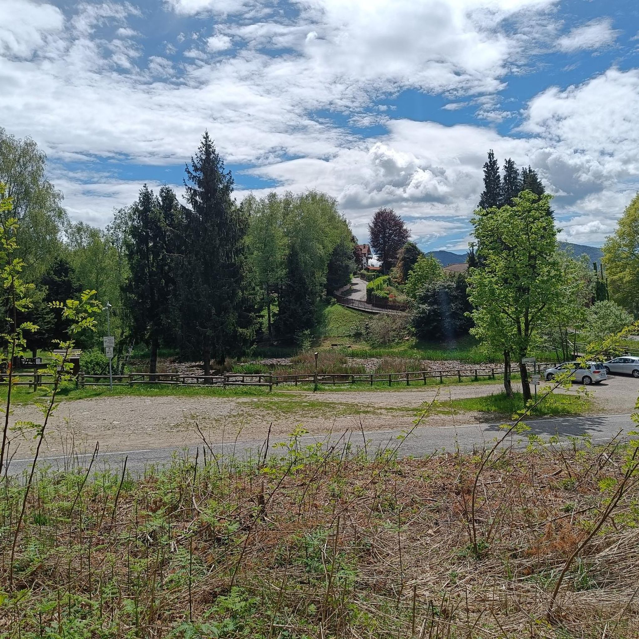

Tips from the Community

Passo S. Antonio Vararo / Cuvignone 1,036 m Passage at 1,036 meters above sea level From the South: Cittiglio to the North: Porto Valtravaglia About 200 hairpin bends on asphalt Strada Provinciale 8 https://stradedamoto.it/strade.asp?RicPas=4281
10
0
Passo del Monte Cuvignone Via Vararo, Cittiglio / Castelveccana VA The Cuvignone Pass (1,036 m above sea level) is a pass near Vararo, in the Varese area between Valcuvia and Luinese. In cycling, it is known for its demanding climb, which can be tackled from various sides (directly from Cittiglio or Castelveccana, or indirectly after climbing Sant'Antonio or crossing the San Michele Pass). It has been used for training since the time of Alfredo Binda (originally from the area) and offers particularly technical and demanding descents. Ivan Basso also trained there. The pass is also famous in the automotive world, as it has been the most selective timed section of the "ACI Varese Rally" since the 80s, today the "Rally dei Laghi". Even in motorsport, as in cycling, it has been tackled in all directions, and in all directions it has always stood out for its difficulty, consisting of fast sections, others slower but very technical, narrow hairpin bends uphill and downhill – all over a length of about 12/14 km at the discretion of the organizer. Text / Source: wikipedia.org/wiki/Passo_del_Cuvignone https://it.wikipedia.org/wiki/Passo_del_Cuvignone
10
0


a classic from the Varese area. It's worth it.
2
0

Pleasant. Be very careful when cutting through the woods or taking the short route. The gentlest route, starting from Rasa keeping to the right, is suitable for practically everyone.
0
0

For me, the hike from Monte Lema to Monte Tamaro is one of the most beautiful in Ticino. It offers a spectacular view. To the west, behind Lake Maggiore, you can see the Monte Rosa massif with the highest mountains in the Alps. In the video, you can see the snow-capped mountains rising above the clouds. To the north, you can see as far as the Po Valley with Milan. To the east, behind Lake Lugano, you can see Monte Generosso rising. The hike is 13.5 km long and you have to overcome 800 meters in altitude. The hike is made easier by the two cable cars at the beginning and end. Between 5.15 p.m. and 6 p.m., a bus transfer back to the starting station is offered. The trips are not cheap (Swiss prices), but they are worth every cent.
1
0


The top offers a breathtaking view!
0
0
Frequently Asked Questions
What are some notable mountain peaks to explore around Montegrino Valtravaglia?
Beyond the popular choices, you can explore Monte Lema, which sits on the border between Italy and Switzerland and offers surprising beauty. Another option is Monte Chiusarella — Summit and Summit Cross, known for its breathtaking 360° panorama of the lakes and the Alpine belt.
Are there any challenging mountain climbs in the Montegrino Valtravaglia area?
Yes, for a challenging experience, consider the ascent to the Cross at Pizzoni di Laveno. This climb involves a steep ascent over large boulders, rewarding you with a magnificent panorama over Lake Maggiore and the mountains on the western shore.
What kind of natural features can I expect to see on the mountain peaks?
The region offers diverse natural beauty. On Monte Sette Termini, you'll find abundant birch trees, giving it the local name 'I Bedroni,' along with beeches, oaks, and a pine forest. Monte Chiusarella is known for its 'Prati Magri' (lean meadows) on calcareous soil, which are of great naturalistic interest.
Are there family-friendly mountain walks or peaks suitable for beginners?
Yes, Monte Chiusarella — Summit and Summit Cross is categorized as family-friendly and offers an intermediate difficulty level, making it accessible for many. Additionally, the former military road leading to Monte Sette Termini is considered suitable for new cyclists and hikers as it's neither too steep nor overly long.
What historical sites can be found on the mountain peaks?
Monte Sette Termini holds historical significance from World War I. Its slopes feature remnants of fortifications, trenches, and tunnels, along with an old military road built during that period. The name 'Sette Termini' itself refers to seven ancient boundary boulders that marked local community lands.
What outdoor activities are available near the mountain peaks of Montegrino Valtravaglia?
Beyond hiking, the area is excellent for cycling and running. You can find various cycling routes, including the 'Valganna Cycle Path – Lake Ghirla Cycle Path loop' or more challenging road cycling routes like the 'Ascent of Alpe di Neggia'. For runners, there are trails such as the 'Lake Ghirla Cycle Path – Lake Ghirla loop'. You can explore more options in the Cycling around Montegrino Valtravaglia and Running Trails around Montegrino Valtravaglia guides.
Are there any mountain passes that offer scenic views?
The Cuvignone Pass, at an altitude of 1,050 meters, connects Valcuvia with Luinese. While the pass itself doesn't offer direct views, the roads leading to it are very scenic, providing vistas of Lake Maggiore. Various hiking trails also start from this pass.
Where can I find panoramic viewpoints in the region?
While the summit of Monte Sette Termini is forested, scenic viewpoints offering vistas of the Alps and Lake Maggiore can be found at lower elevations, particularly near a shed along the ascent. Monte Chiusarella also boasts a breathtaking 360° panorama from its summit.
What do visitors particularly enjoy about the mountain peaks around Montegrino Valtravaglia?
Visitors frequently praise the magnificent panoramas, especially from peaks like the Cross at Pizzoni di Laveno. The unique experience of being on the border at Monte Lema and the stunning 360° views from Monte Chiusarella are also highly appreciated. The overall natural beauty and the variety of trails for different activity levels are key attractions.
Are there any facilities or places to rest near the mountain peaks?
Yes, at Monte Lema, you can find the Monte Lema Summit Hostel. This facility offers a self-service restaurant with a panoramic terrace, where you can enjoy local specialties and the views. It also provides overnight accommodation.
Can I find trails that combine hiking with historical exploration?
Absolutely. Monte Sette Termini offers historical hikes that pass through World War I trenches and bunkers. These routes not only provide a glimpse into the past but also offer stunning views of Lakes Maggiore and Lugano.
What is the best time to visit the mountain peaks in this region?
While specific seasonal recommendations vary by trail, the area is generally beautiful for outdoor activities. Spring and autumn often provide pleasant temperatures for hiking and cycling, with vibrant foliage or blooming flora. Always check local weather conditions before your visit.
Most popular routes around Montegrino Valtravaglia
Most popular attractions around Montegrino Valtravaglia

Get inspired with the komoot mobile app


Explore more
See even more amazing summits around Montegrino Valtravaglia with these guides:
