The best running trails around Fiuminata
4.4
(7)
673
runners
87
runs
Jogging around Fiuminata offers a diverse range of routes through Italy's Marche region. The area features an extensive network of trails that traverse varied landscapes, from the flat floodplains of the River Potenza to more challenging mountainous terrain. Runners can explore shaded woodland paths, open grasslands, and routes that ascend to higher altitudes, providing panoramic views. This blend of natural environments ensures a stimulating experience for different jogging preferences.
Best jogging routes around Fiuminata
- The most popular jogging route is…
Last updated: May 11, 2026
1
runners
7.99km
01:07
340m
340m
Hard run. Very good fitness required. Mostly accessible paths. Some sure footedness required.
10.2km
01:12
240m
240m
Moderate run. Good fitness required. Mostly paved surfaces. Suitable for all skill levels.

Sign up for free
5.26km
00:38
120m
130m
Moderate run. Good fitness required. Mostly paved surfaces. Suitable for all skill levels.
5.83km
00:48
260m
260m
Moderate run. Good fitness required. Mostly paved surfaces. Suitable for all skill levels.
5.0
(1)
28
runners
14.8km
01:35
140m
140m
Moderate run. Good fitness required. Mostly paved surfaces. Suitable for all skill levels.
Get access to more routes and recommendations from other explorers.
Sign up for free
Already have an account?
Our route recommendations are based on thousands of hikes, rides, and runs completed by other people on komoot.
Start today with a free account
Your next adventure awaits.
Login or Signup

Tips from the Community

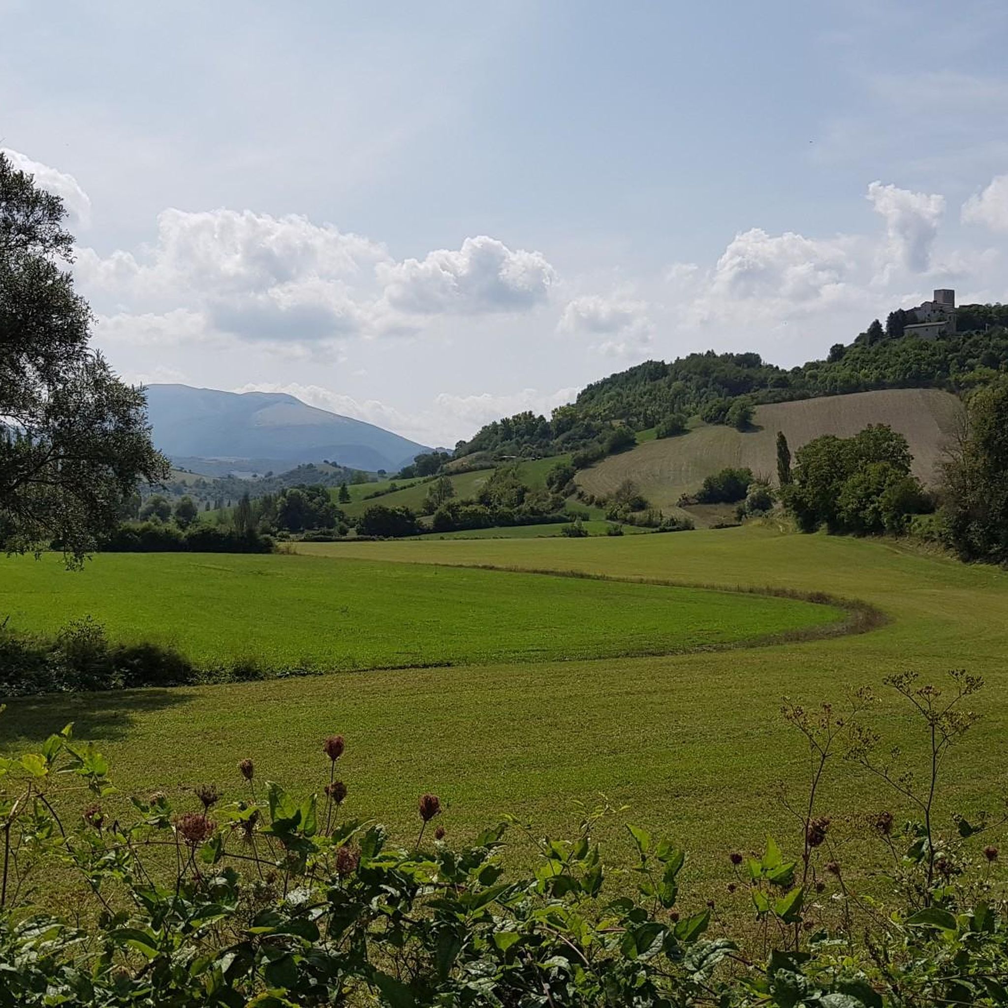
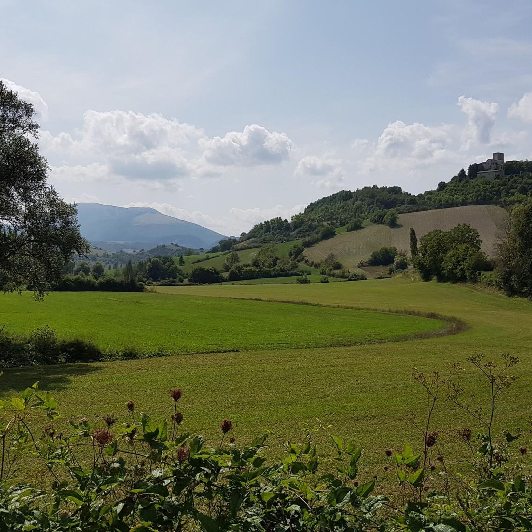
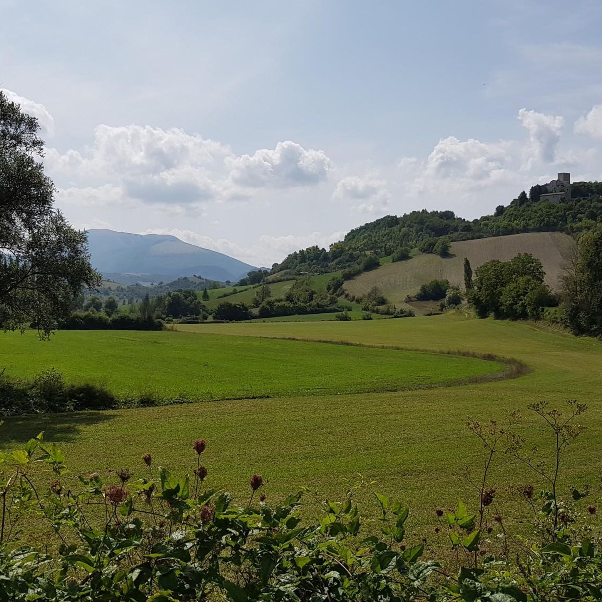
The gateway to our wonderful village.
0
0


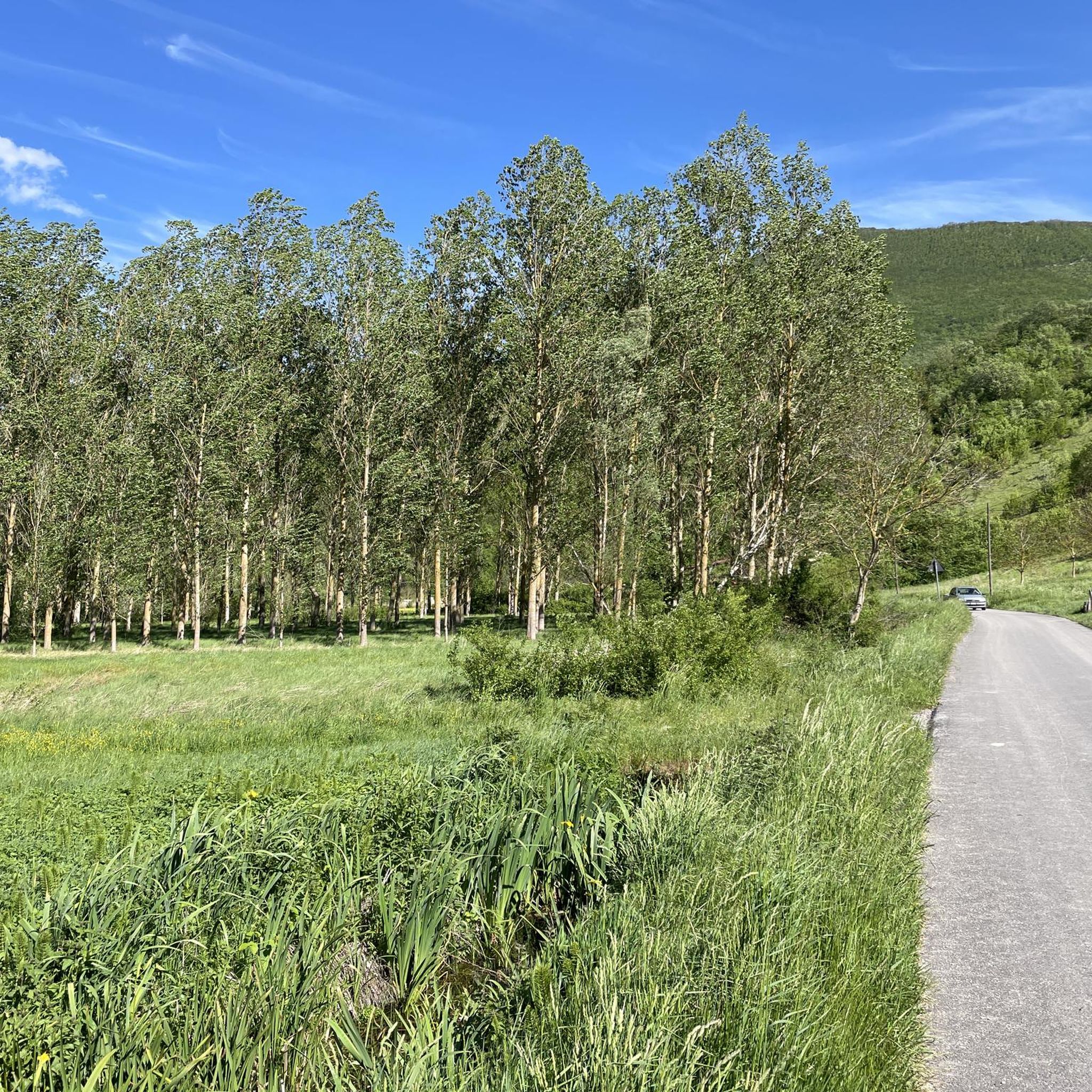
because in addition to being beautiful, especially in late spring, it is a very important site from a naturalistic, landscape and environmental point of view
0
0

Pioraco: "Ponte o passerella del Bacio" On the pedestrian walkway along the Potenza river, a sign indicates the obligation to stop and give each other a kiss, with the town in the background, nestled between the rocks
0
0

Pioraco is a small town at 443 meters, where the Potenza river passes through some rapids. Every 8 June the feast of the patron S. Vittorino is celebrated.
0
0
The Potenza river rises from Monte Pennio at about 800 meters, and is 95 kilometers long. There is a small dam at this point.
1
0
Here we see the Scurosa Valley, where beech trees can be seen, and holly trees are also present.
0
0

Panoramic point of the Scurosa valley, of the small underlying village of Sorti and of Monte Vermenone.
0
0
Frequently Asked Questions
How many running routes are available in Fiuminata?
Fiuminata offers a wide selection of running routes, with over 80 different trails to explore. These range from easy paths to more challenging mountain ascents, catering to various fitness levels.
Are there any easy running routes suitable for families or beginners in Fiuminata?
Yes, Fiuminata has several easy running routes perfect for families or those new to running. While specific easy routes aren't detailed here, the region's extensive trail network includes paths along the River Potenza floodplains, which are generally flatter and more accessible. Look for routes marked as 'easy' or 'moderate' on komoot.
What kind of terrain can I expect on the running trails around Fiuminata?
The running trails in Fiuminata offer a diverse range of terrain. You can expect everything from flat, refreshing paths along the River Potenza floodplains to shaded woodland trails, open grasslands, and more challenging mountainous terrain with significant elevation changes. Some routes also feature Mediterranean scrub vegetation.
Are there any circular running routes in Fiuminata?
Yes, Fiuminata features several circular running routes. For example, the Running loop from Fiuminata is a popular 9.2-mile (14.8 km) trail that takes you through diverse natural environments. Another option is the challenging Pioraco – ring tour, covering 5.0 miles (8.0 km).
What are some scenic highlights or landmarks I might see while running in Fiuminata?
Fiuminata's routes offer stunning natural beauty and glimpses of the region's character. You can experience diverse landscapes including caves, water springs like those at Lavacelli, delle Cocce, del Piscio, and Martimoro, lush forests, and expansive grasslands. Higher altitude routes provide panoramic views of the Sibillini Mountains and surrounding valleys. Notable natural monuments nearby include Piani di Montelago and various summits like Monte Igno.
Are the running trails in Fiuminata dog-friendly?
While Fiuminata's natural landscapes are generally welcoming for outdoor activities, specific leash rules for dogs on running trails can vary. It's always recommended to keep your dog on a leash, especially in areas with wildlife or near agricultural land, and to check local signage for any specific regulations.
What do other runners say about the trails in Fiuminata?
The running routes in Fiuminata are highly regarded by the komoot community, boasting an impressive average score of 4.7 stars from 7 reviews. Runners often praise the varied terrain, the beautiful natural environments, and the opportunities for both challenging ascents and refreshing riverside runs.
Is there parking available at the trailheads in Fiuminata?
Parking availability at trailheads in Fiuminata can vary. While many routes start from accessible points, it's advisable to check the specific route details on komoot for information regarding parking facilities near your chosen starting point. Some routes may have designated parking areas, while others might require street parking in nearby villages.
Are there any permits required for running on trails in Fiuminata?
Generally, no specific permits are required for running on the extensive trail network around Fiuminata. The trails are open for public use, allowing you to freely explore the diverse landscapes of the Marche region. However, always respect private property and any posted local regulations.
Can I access Fiuminata's running trails using public transport?
Public transport options to access specific trailheads in Fiuminata might be limited, as many routes venture into natural, less populated areas. While Fiuminata itself is a municipality, direct bus routes (like CONTRAM) to remote trail starting points may not be frequent. It's best to research local bus schedules or consider personal transport for greater flexibility.
Are there any running routes that explore water features or springs?
Yes, Fiuminata offers routes that highlight its natural water sources. For instance, the challenging Sorgente Bagno loop from Pioraco explores water springs and Mediterranean scrub vegetation. The region is also known for springs like Lavacelli, delle Cocce, del Piscio, and Martimoro, which can be found along various paths.
What is the best season for running in Fiuminata?
Fiuminata offers a stimulating environment for physical activity year-round due to its diverse natural landscapes. Spring and autumn generally provide pleasant temperatures and vibrant scenery, ideal for running. Summer can be warm, but shaded woodland paths and riverside routes offer cooler options. Winter running is possible, but higher mountain trails may be affected by snow or colder conditions.
Most popular attractions around Fiuminata

Get inspired with the komoot mobile app


Explore more
Browse the best Running Trails & Routes in other regions.
