The best MTB trails around Villar Focchiardo
4.5
(587)
3,726
riders
12
rides
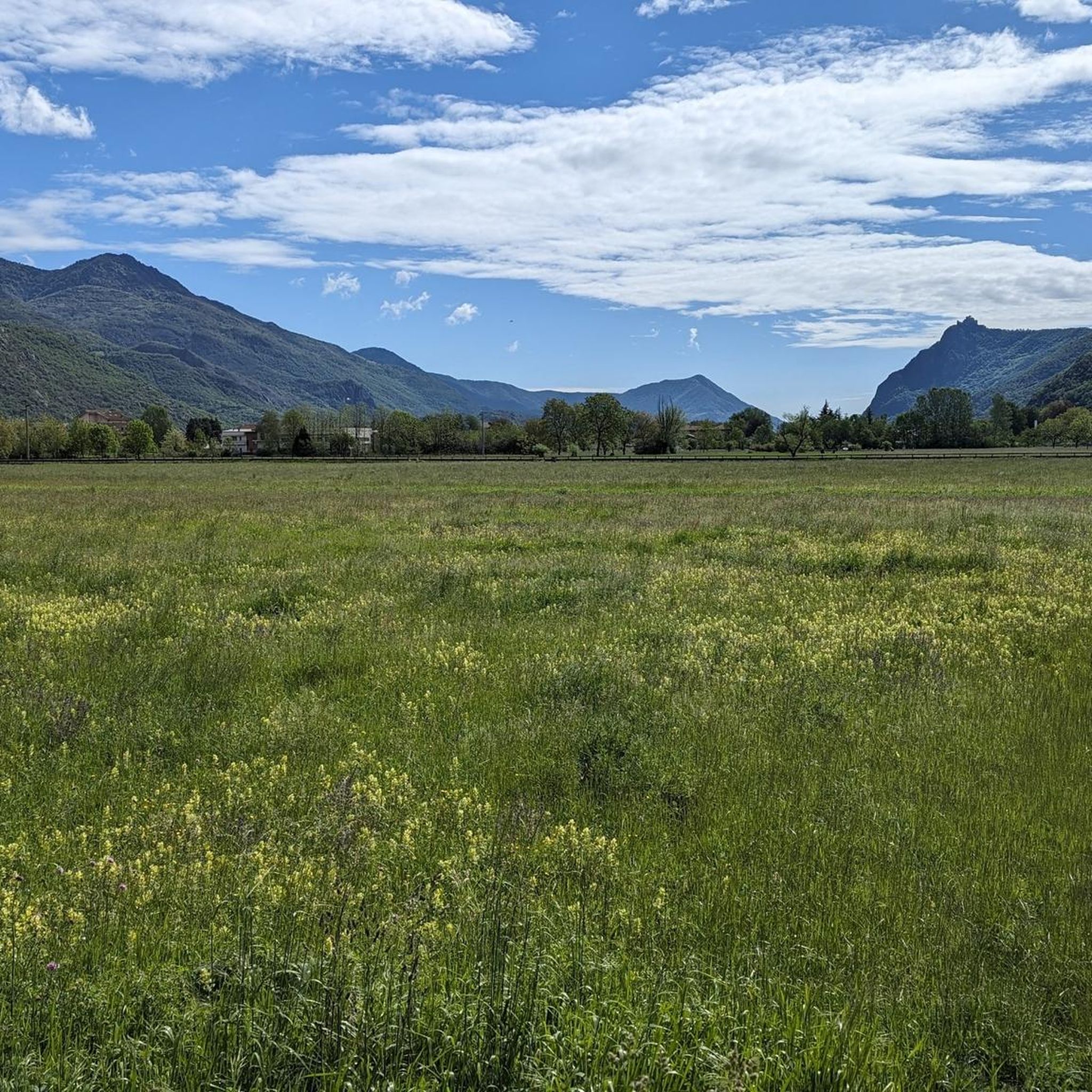
Mountain biking around Villar Focchiardo offers diverse terrain within the mountainous landscape of the Province of Turin, Italy. The region features pristine nature, lush forests, and impressive peaks, with many routes winding through the Orsiera Rocciavrè Natural Park. Landscapes vary from dense larch forests to expansive alpine meadows, providing varied backdrops for mountain bike trails. Riders can expect challenging ascents and rewarding descents, often including technical sections with roots and fixed stones.
Best mountain bike trails around Villar Focchiardo
- The most popular mountain bike trail is Path of the Princes – Colle Braida loop from Borgone di Susa, a 27.9 miles (44.9 km) trail that takes 3 hours 32 minutes to complete. This difficult route features significant elevation changes and panoramic views over the Susa Valley.
- Another top favourite among local mountain bikers is San Didero Fountain – Borgata Bigiardi loop from Borgone di Susa, a moderate 13.8 miles (22.2 km) path. This route offers a mix of paved and dirt roads, suitable for riders seeking a balanced challenge.
- Local mountain bikers also love the Certosa di Banda – Amprimo Mountain Hut loop from Borgone di Susa, a 23.0 miles (37.1 km) trail leading through mountainous terrain and towards a mountain hut, often completed in about 3 hours 32 minutes.
- Mountain biking around Villar Focchiardo is defined by mountainous terrain, dense larch forests, and technical singletracks within the Orsiera Rocciavrè Natural Park. The network offers options for different ability levels, from moderate paths to difficult routes with significant climbs.
- The routes in Villar Focchiardo are highly rated by the komoot community with an average score of 4.5 stars from over 780 reviews. More than 5,000 mountain bikers have used komoot to explore Villar Focchiardo's varied terrain.
Last updated: July 1, 2026
5.0
(2)
44
riders
24.0km
02:46
1,040m
1,040m
Hard mountain bike ride. Very good fitness required. Advanced riding skills necessary.
3.0
(3)
21
riders
27.2km
01:41
250m
250m
Easy mountain bike ride. Great for any fitness level. Suitable for all skill levels.

Sign up for free
3.0
(1)
8
riders
16.7km
02:19
1,050m
1,050m
Hard mountain bike ride. Very good fitness required. Advanced riding skills necessary. Some portions of the route may require you to push your bike.
11
riders
Easy mountain bike ride. Great for any fitness level. Suitable for all skill levels.
4.0
(1)
14
riders
24.0km
02:07
560m
560m
Moderate mountain bike ride. Good fitness required. Advanced riding skills necessary.
Get access to more routes and recommendations from other explorers.
Sign up for free
Already have an account?
Our route recommendations are based on thousands of hikes, rides, and runs completed by other people on komoot.
Start today with a free account
Your next adventure awaits.
Login or Signup
Popular around Villar Focchiardo


Other adventures around Villar Focchiardo

Tips from the Community

Splendid medieval fortress perched on the hill of San Giorio, easily reachable on foot from the inhabited center or by a comfortable dirt road also by bike.
0
0

The oldest part of the castle, the upper part, dates back to the 10th–11th centuries. In 1029, it was donated by the Marquis Olderico of Susa to the Abbey of San Giusto. The abbots ceded it to the Bertrandi family in the late 13th century. The imposing cylindrical tower, which stands at the northwest corner of the upper castle, was originally intended to house only a guard; the first floor was accessed through a bartizan, now lost. A document from 1226 attests that there was a shelter for the men of the village here, in addition to the core of the castle, but without the keep. In 1330, the Bertrandi family, having become feudal lords of San Giorio, made numerous and substantial modifications to the original castle, transforming it into a fortress and building the keep. (Quote from the Archeocarta website, Archaeological map of Piedmont).
0
0

The last 1.1 km of the approach before the parking lot (from the bridge) have been closed since 07.05.2025 due to rockfall and mudslides; you can only pass on foot (actually forbidden)
0
0

The road from Villarfocchiardo up to Banda certainly cannot be defined as "soft", given the presence of numerous sections with double-digit gradients, but the panorama that it offers, once at altitude, repays every effort! It is advisable, once you reach the crossroads, to continue to the village, with a little luck it is possible to access the church, if it is closed, the beautiful village is still worth a visit. At the crossroads, turning right, you take a dirt road, very panoramic, which first descends, then climbs towards Viglietti, in the middle of splendid chestnut groves. Be careful, if you do this tour in Autumn, DO NOT pick chestnuts, not even on the path ... they are rather strict, the owners!
0
1

The Chestnut Trail takes its name from the thick chestnut groves that surround it. In the period between 1950 and 1970 it was used by stonecutters to move blocks from the quarries not far away, In fact, walking along it, you can notice some stones lost along the path and, in the dry stone walls that delimit it, there are squared and semi-worked stones.
1
0

Unfortunately the road will soon be transformed into a cycle path with concrete pavement!
0
0

crossroads for paradise of frogs on the right, refuge val gravio on the left
1
0

Reachable entirely on a paved/dirt road starting from Villarfocchiardo. Possibility to buy excellent alpine cheeses.
0
0
Frequently Asked Questions
How many mountain bike trails are available around Villar Focchiardo?
There are over 160 mountain bike trails around Villar Focchiardo, offering a wide range of options for different skill levels. You'll find everything from moderate paths to challenging routes with significant climbs.
What kind of terrain can I expect on mountain bike trails in Villar Focchiardo?
The terrain around Villar Focchiardo is predominantly mountainous, featuring dense larch forests, expansive alpine meadows, and technical singletracks. Many routes wind through the spectacular Orsiera Rocciavrè Natural Park, often including sections with roots and fixed stones that require careful riding.
Are there any easy mountain bike trails suitable for beginners in Villar Focchiardo?
Yes, among the over 160 trails, there are 17 routes classified as easy, making them suitable for beginners or those looking for a more relaxed ride. These trails often feature a mix of paved and dirt roads.
What are some challenging mountain bike routes for experienced riders?
Experienced riders will find plenty of challenges, with 84 routes classified as difficult. An example is the Path of the Princes – Colle Braida loop from Borgone di Susa, which is 27.9 miles (44.9 km) long with significant elevation changes and panoramic views. Another demanding option is the Certosa di Banda – Amprimo Mountain Hut loop from Borgone di Susa, covering 23.0 miles (37.1 km) through mountainous terrain.
What natural features and viewpoints can I see along the mountain bike trails?
Many trails offer breathtaking panoramic views of the Susa Valley and the surrounding peaks. You'll ride through lush forests and alpine meadows within the Orsiera Rocciavrè Natural Park. Notable natural features include the Foresto Gorge and the Pera Furà Millstone Cave. From higher elevations, you can enjoy sweeping vistas.
Are there any waterfalls accessible from the mountain bike trails?
Yes, the region features several beautiful waterfalls. While mountain biking, you might be able to access or view highlights such as the Leuja Scura Waterfall or the Gravio Waterfall, which are popular spots for hikers and can be incorporated into longer rides.
What historical or cultural landmarks are near the mountain bike routes?
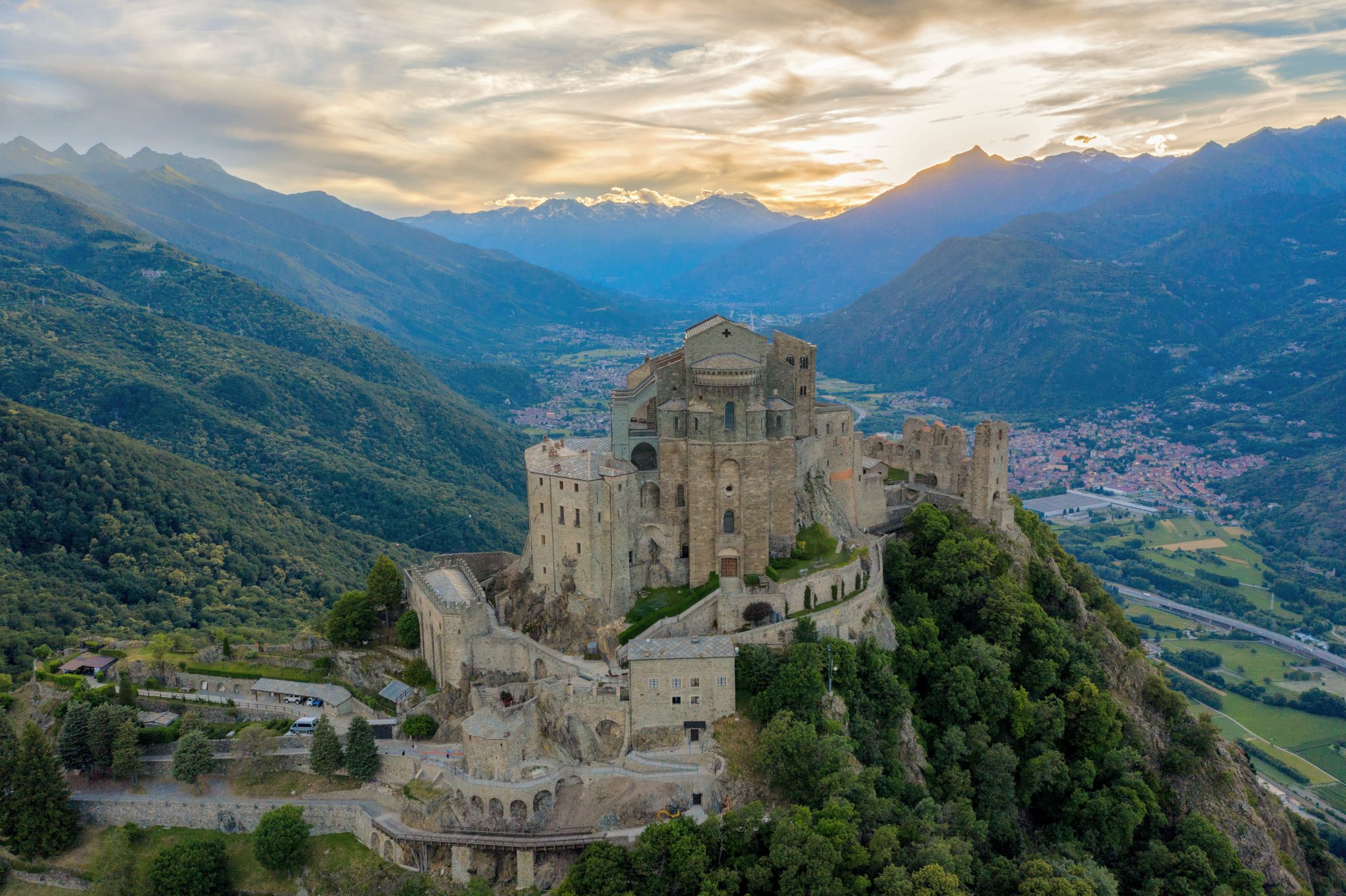
A significant landmark in the area is the Sacra di San Michele, an ancient abbey perched atop Mount Pirchiriano, offering splendid views of the valley. While not directly on every trail, it's a prominent feature of the landscape and can be a destination for some routes or a point of interest during your visit.
What is the best time of year for mountain biking in Villar Focchiardo?
The best time for mountain biking is typically from spring through autumn when the weather is mild and the trails are clear of snow. During winter, some higher elevation trails may be inaccessible due to snow and ice, especially within the Orsiera Rocciavrè Natural Park.
Are there any family-friendly mountain bike options?
While many trails involve challenging ascents and technical sections, the 17 easy routes provide good options for families or those seeking less strenuous rides. These often include more stable surfaces and gentler gradients, allowing for a pleasant experience for all skill levels.
What do other mountain bikers enjoy most about the trails in Villar Focchiardo?
The mountain bike trails around Villar Focchiardo are highly rated by the komoot community, with an average score of 4.5 stars from over 780 reviews. Riders frequently praise the diverse terrain, the stunning natural beauty of the Orsiera Rocciavrè Natural Park, and the rewarding descents after challenging climbs.
Are there any mountain huts or cafes along the trails?
Yes, some routes lead towards mountain huts that offer refreshments and accommodation. For example, the Certosa di Banda – Amprimo Mountain Hut loop from Borgone di Susa takes you towards the Amprimo Mountain Hut, which provides an easy-to-access refuge. The Rifugio Toesca, located in the Natural Park, also offers accommodation and typical Piedmontese cuisine.
What is the typical duration for mountain bike routes in this area?
Route durations vary significantly based on difficulty and distance. For instance, a moderate route like the San Didero Fountain – Borgata Bigiardi loop from Borgone di Susa can take around 1 hour 55 minutes, while more difficult and longer trails, such as the Church of San Biagio – View of the Ponte del Diavolo loop from Borgone di Susa, can take over 7 hours to complete.
Most popular routes around Villar Focchiardo
Most popular attractions around Villar Focchiardo

Get inspired with the komoot mobile app


Explore more
Browse the best MTB trails in other regions.
