The 20 Most Amazing Peaks around Gianico
Best mountain peaks around Gianico serve as a gateway to the mountainous Val Camonica region in Lombardy, Italy. This area features prominent mountain passes and peaks, offering diverse terrain for exploration. The landscape includes wooded environments, alpine slopes, and significant natural formations. Visitors can find a variety of mountain experiences, from accessible trails to challenging ascents.
Best mountain peaks around Gianico
- The most popular mountain peaks is Dosso Rotondo Hut, a hut that offers hospitality and food. It is…
Last updated: October 10, 2026
Mount Colombina
Highlight • Summit
Translated by Google •
Tip by

Dosso Rotondo Hut
Highlight • Mountain Hut
Translated by Google •
Tip by

Sign up now to discover places like this
Get recommendations on the best single tracks, peaks, & plenty of other exciting outdoor places.
Medelet Hut
Highlight • Mountain Hut
Translated by Google •
Tip by

Mount Altissimo
Highlight • Summit
Showing Translation
Tip by

Monte Altissimo – Borno Ski Area
Highlight • Mountain Hut
bornoskiarea.it
Translated by Google •
Tip by

Sign up for free to discover even more peaks around Gianico.
Already have an account?
Start today with a free account
Your next adventure awaits.
Tips from the Community

21-06-26 Borno Ski Arena : chairlift closed / refuge closed ...I do not agree with this choice even though work is planned for the renovation of the structures, in the official communications from the municipality it was clearly written that they would not affect the normal running of the services...
0
0

Especially on Saturdays and Sundays during the summer period (but better always) booking is recommended as it is very popular, you feel really good about the portions, the price and the services.
0
0

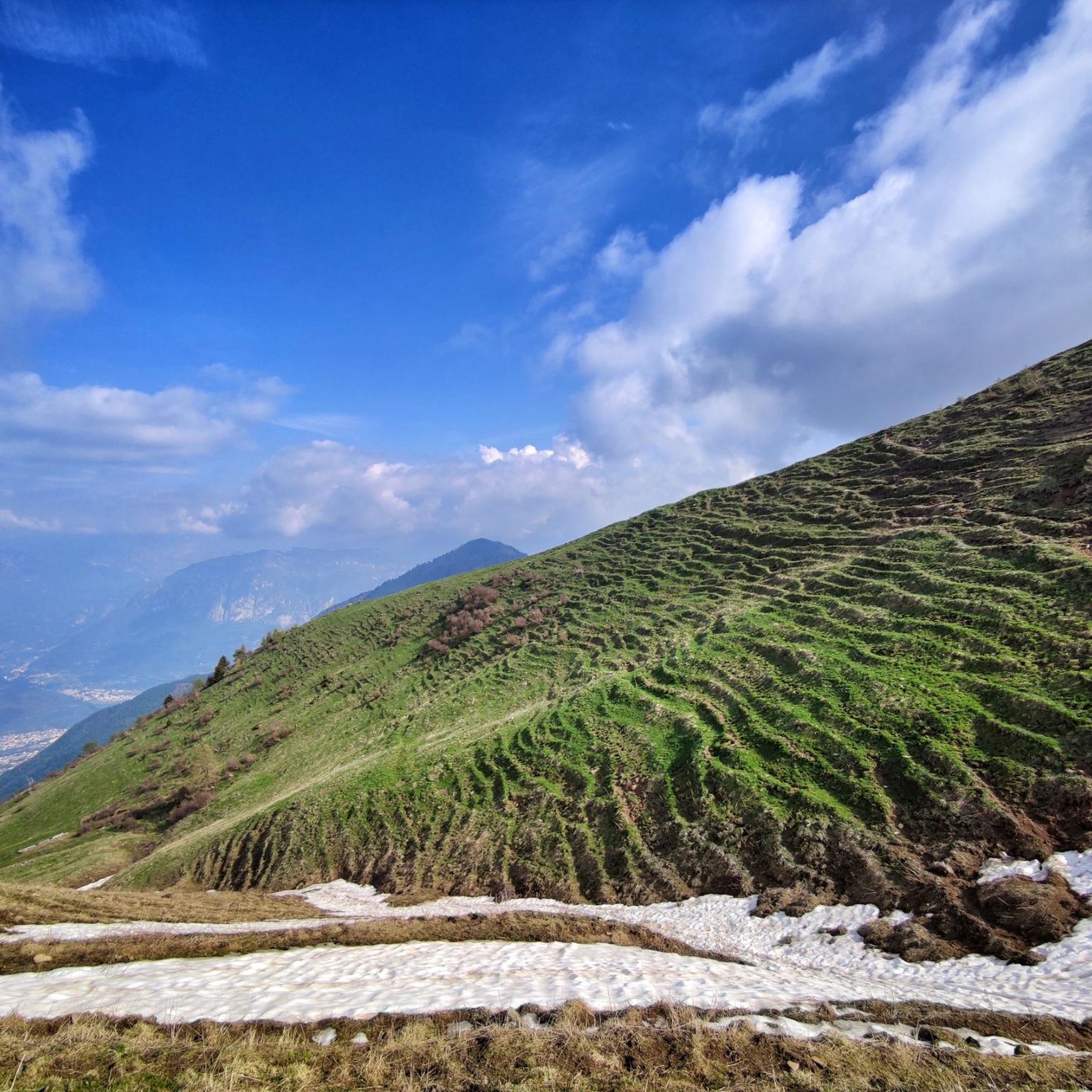
🏔️ Monte Altissimo (Val Camonica) — Identity and main characteristics Monte Altissimo is a mountain in the Bergamo Prealps, 1703 m high, located between the lower Val Camonica and the lower Val di Scalve. It is the highest peak in the mountain group that separates these two valleys and overlooks the Borno plateau. Two very different sides Southern side: steep, rocky, almost devoid of vegetation, with a difference in altitude of about 1500 m from the Oglio valley floor. Northern side: gentle slope towards Borno, covered with fir trees and dotted with mountain huts, chalets and ski slopes of the Borno Ski Area. 🚶♂️ Hiking — The main itineraries Monte Altissimo is very popular with hikers thanks to the good network of trails (difficulty E). Here are the best-known and documented routes. 1) From Erbanno – Trail 197 or 155 A steep and challenging itinerary, with a significant difference in altitude. Trail 197: Start: Erbanno (Darfo Boario Terme) Passes through: small church of San Valentino (690 m), Malga Mine, junction with trail 194 From the cross: spectacular view of the lower Val Camonica and Lake Iseo Summit reachable in 15 minutes from the final junction Trail 155 (more direct and strenuous): Difference in altitude: about 1460 m Steep sections, some chains on a slightly exposed traverse Remarkable panorama over the meadows of the “Segable” Arrival at the Monte Altissimo refuge and the ski lifts 2) From Gorzone – Trail 154 A wilder route on the south side, with a long and tough climb. 3) From Borno – North side (ski slope areas) A gentler and more panoramic itinerary, often chosen for loop tours that include refuges, mountain huts and small churches (as in your story). 🏞️ What makes Monte Altissimo special Sharp contrast between the two sides: one severe and rocky, the other gentle and wooded. Wide panoramas of the lower Val Camonica, Lake Iseo and Presolana. Network of mountain huts and chalets still active in summer. Presence of the Monte Altissimo refuge at the summit, also reached by ski lifts. Possibility of very varied loops, combining woods, slopes, ridges and small isolated churches.
0
0
Mount Altissimo is a mountain in the Bergamo Prealps, 1703 m high, located between the lower Val Camonica and the lower Val di Scalve. It is the highest peak of the mountain group that separates these two valleys and overlooks the Borno plateau. Two very different slopes Southern slope: steep, rocky, almost devoid of vegetation, with a difference in altitude of about 1500 m from the Oglio valley floor. Northern slope: gentle slope towards Borno, covered with fir trees and dotted with mountain huts, chalets and ski slopes of the Borno Ski Area. 🚶♂️ Hiking — The main itineraries Mount Altissimo is very popular with hikers thanks to the good network of trails (difficulty E). Here are the best-known and documented routes. 1) From Erbanno – Trail 197 or 155 A steep and challenging itinerary, with a significant difference in altitude. Trail 197: Start: Erbanno (Darfo Boario Terme) Passes through: small church of San Valentino (690 m), Malga Mine, junction with trail 194 From the cross: spectacular view of the lower Val Camonica and Lake Iseo Summit reachable in 15 minutes from the final junction Trail 155 (more direct and strenuous): Difference in altitude: about 1460 m Steep sections, some chains on a slightly exposed traverse Remarkable panorama of the meadows of "Segable" Arrival at the Monte Altissimo refuge and the ski lifts 2) From Gorzone – Trail 154 A wilder route on the south side, with a long and tough climb. 3) From Borno – North slope (ski slope areas) A gentler and more panoramic itinerary, often chosen for loop tours that include refuges, mountain huts and small churches (as in your story). 🏞️ What makes Mount Altissimo special Sharp contrast between the two slopes: one severe and rocky, the other gentle and wooded. Wide panoramas of the lower Val Camonica, Lake Iseo and Presolana. Network of mountain huts and chalets still active in summer. Presence of the Monte Altissimo refuge at the summit, also reached by ski lifts. Possibility of varied loop tours, combining woods, slopes, ridges and small isolated churches.
0
0

Beautiful summit with rest area and great panorama
0
0

Welcoming refuge, very good value for money. E-bike charging
0
0

We walked up the ridge from the South (marked as potentially dangerous) and it was fine on a clear July day
0
0
Frequently Asked Questions
What are some of the most popular mountain peaks and passes to explore near Gianico?
Beyond the immediate vicinity, the region offers several prominent mountain areas. Monte Guglielmo (Gölem) is highly popular for its panoramic views and diverse trails. The Presolana Massif, with its challenging routes and winter sports, is another significant destination. For scenic drives and cycling, the Croce Domini Pass and the gravel road connecting it to Passo del Maniva offer breathtaking Alpine landscapes.
Are there any mountain huts or refreshment points available on the trails?
Yes, several mountain huts provide hospitality and food. The Dosso Rotondo Hut is a strategic point between Val Trompia and Val Camonica, known for its excellent restaurant and being open almost all year. The Medelet Hut is another great refreshment point, immersed in nature with views of beech and fir trees.
What kind of views can I expect from the mountain peaks around Gianico?
The peaks offer spectacular panoramic views. From Monte Ario, despite its moderate altitude, you can enjoy a 360-degree vista of the surrounding valleys, including Valle Trompia, and distant mountain ranges like Monte Baldo and Monte Guglielmo. Monte Muffetto summit also provides a splendid panorama, encompassing the Orobie mountain range, Adamello massif, and the upper part of Lake Sebino.
Are there family-friendly hiking options in the mountains near Gianico?
Yes, there are options suitable for families. Monte Guglielmo features the 'Bosco degli Gnomi' (Gnome Forest), an enchanting trail with whimsical wooden sculptures that children particularly enjoy. Additionally, the San Fermo Chapel area offers a picnic spot with tables, benches, and a barbecue, making it a great family break point.
What outdoor activities can I do near these mountain peaks?
The region around Gianico is excellent for various outdoor activities. You can find numerous routes for mountain hiking, including moderate trails like 'Punta Caravina – Dosso Pedalta loop'. For cycling enthusiasts, there are gravel biking routes such as the 'Pass of the Seven Crosses – Maniva Pass loop'. The area also offers running trails, like the 'Lago Moro loop'.
What is the best time of year to visit the mountain peaks around Gianico?
The best time largely depends on your desired activity. For hiking and cycling, late spring to early autumn (May to October) generally offers the most favorable weather conditions. High mountain passes like Croce Domini are typically closed from November to May due to snow. Winter sports enthusiasts will find the Presolana ski areas ideal during the colder months.
Are there any historical or cultural sites among the mountain peaks?
Yes, the San Fermo Chapel is a notable historical and religious site. It features a small 19th-century church, renovated in 1902, and offers a peaceful spot for a break. The Croce di Salven Pass also has the intriguing ruins of an old sanatorium, blending natural beauty with historical elements.
What are the difficulty levels of hiking trails in the Gianico mountain region?
The region offers a range of difficulty levels. Many trails are classified as 'intermediate', such as those leading to Dosso Rotondo Hut, Medelet Hut, Monte Muffetto summit, and Monte Ario. More challenging routes can be found in areas like the Presolana Massif, which is known for its demanding trails and mountaineering opportunities.
Can I find accommodation or places to eat near the mountain trails?
Yes, mountain huts like Dosso Rotondo Hut and Medelet Hut offer hospitality, food, and sometimes accommodation. Along routes, you'll also find 'malgas' (alpine pastures) providing refreshments. The Rifugio di Passo Crocedomini is another popular stop for food at the Croce Domini Pass.
What makes the Presolana Massif a unique destination?
The Presolana Massif, with Pizzo della Presolana reaching 2,521 meters, is a prominent area known for its spectacular hiking trails, including the important Presolana Periplo. It's also a highly regarded destination for winter sports, featuring ski areas suitable for various skill levels. The diverse landscape, from wooded environments to exposed alpine slopes, offers wide views and attracts mountaineers.
Are there opportunities for wildlife spotting in the Gianico mountains?
The natural environments around Gianico's peaks offer chances for wildlife observation. At Medelet Hut, for instance, visitors can enjoy watching falcons in flight and listening to birdsong, especially in the serene atmosphere free of light pollution at sunset.
What do visitors appreciate most about the mountain peaks around Gianico?
Visitors highly appreciate the stunning panoramic views from summits like Monte Ario and Monte Muffetto. The hospitality and excellent food at huts like Dosso Rotondo Hut are also frequently praised. The overall tranquility, unspoiled nature, and the variety of trails for different activities contribute to a highly positive experience, as reflected by the 126 upvotes and 71 photos shared by the komoot community.
Most popular routes around Gianico
Most popular attractions around Gianico

Get inspired with the komoot mobile app


Explore more
See even more amazing summits around Gianico with these guides:
