The best MTB trails around Artogne
4.4
(1224)
6,978
riders
160
rides
Mountain bike trails around Artogne are set within a diverse landscape, characterized by the proximity of Lake Iseo, the prominent Monte Guglielmo, and the expansive Valle Camonica with the Oglio River. The terrain offers a mix of crests, forests, and varied paths, providing a range of experiences for mountain bikers. Elevations vary, with routes leading through valleys and towards mountain slopes, some featuring sections of asphalt, dirt, and singletrack. The region is part of the southern Rhaetian Alps, offering an extensive network of trails.
Best mountain bike trails around Artogne
- The most popular mountain bike trail is Lake Moro – Chiesetta di Anfurro loop from Monti, a difficult 16.1 miles (25.8 km) trail that takes 2 hours 47 minutes to complete. This route offers significant elevation gain and varied terrain around Lake Moro.
- Another top favourite among local mountain bikers is Start of DH trail – High-altitude ski resorts loop from Montecampione, a moderate 11.8 miles (19.1 km) path. This trail features a mix of asphalt, dirt, and singletrack sections, with some downhill portions.
- Local mountain bikers also love the Ponte di Cividate Camuno – Valle Camonica Cycle Path loop from Rogno, a 13.3 miles (21.5 km) trail leading through the scenic Valle Camonica, often completed in about 1 hour 11 minutes.
- Mountain biking around Artogne is defined by the presence of Lake Iseo, the slopes of Monte Guglielmo, and the extensive Valle Camonica. The network offers options for different ability levels, from easy cycle paths to challenging mountain ascents.
- The routes in Artogne are highly rated by the komoot community with an average score of 4.4 stars from over 900 reviews. More than 6000 mountain bikers have used komoot to explore Artogne's varied terrain.
Last updated: September 27, 2026
4.5
(8)
72
riders
35.5km
02:00
140m
140m
Moderate mountain bike ride. Good fitness required. Suitable for all skill levels.
4.0
(1)
41
riders
34.1km
03:29
1,280m
1,280m
Hard mountain bike ride. Very good fitness required. Suitable for all skill levels.

5.0
(3)
27
riders
19.0km
01:44
700m
700m
Moderate mountain bike ride. Good fitness required. Suitable for all skill levels.
4.0
(1)
33
riders
25.8km
02:46
1,040m
1,040m
Hard mountain bike ride. Very good fitness required. Advanced riding skills necessary.
5.0
(1)
17
riders
24.9km
02:47
1,080m
1,080m
Hard mountain bike ride. Very good fitness required. Suitable for all skill levels.
Get access to more routes and recommendations from other explorers.
Already have an account?
Our route recommendations are based on thousands of hikes, rides, and runs completed by other people on komoot.
Start today with a free account
Your next adventure awaits.
Tips from the Community

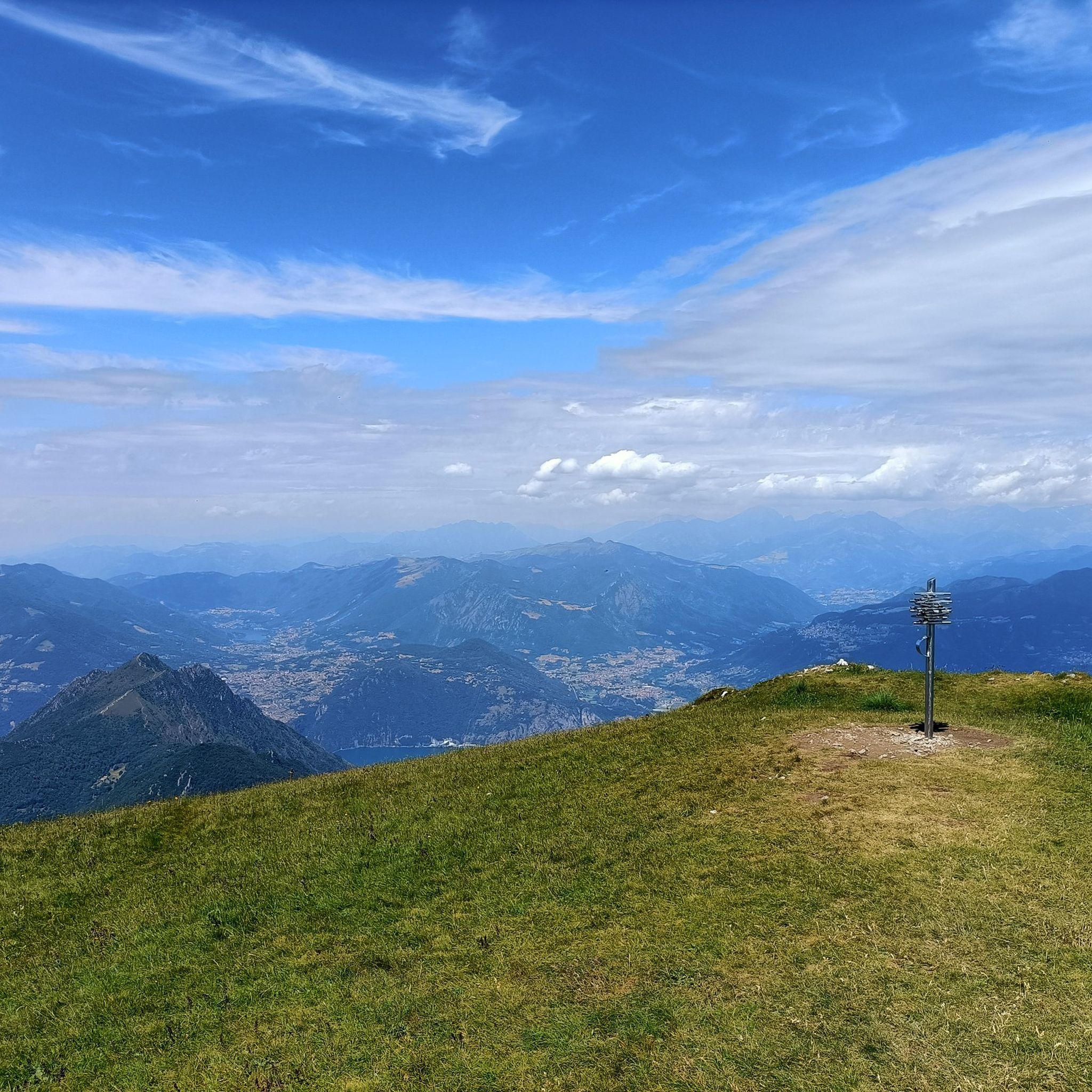
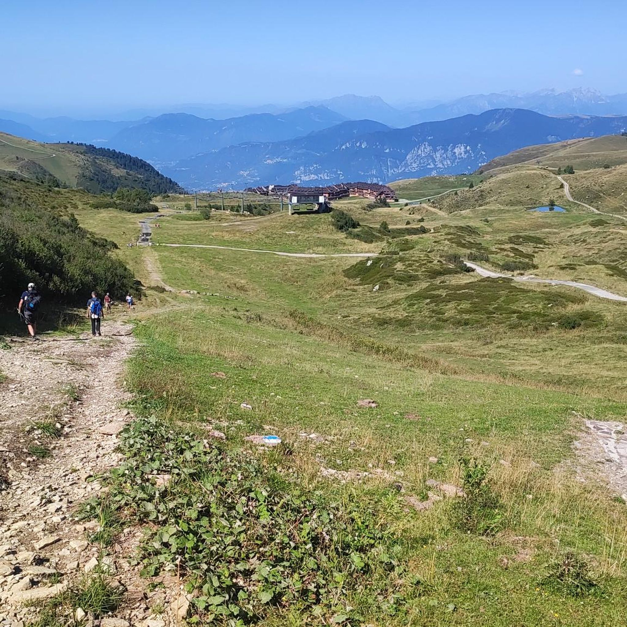
Pass that connects Plan di Montecampione to Val Grigna. Can be traversed both on foot and by off-road vehicle or Panda.
0
0
I reached this refuge at the end of the summer season, but still during the continuous opening period. For this reason and because the refuge is easily reachable by car, I expected much more from the managers: very limited choice of dishes, 2 first courses (pasta with tomato sauce or something with chickpeas), 2 second courses (polenta with shank or polenta with melted cheese), 2 cakes (drunken chocolate or panna cotta, I think), not even too much in line with the classics of mountain refuges or traditional dishes. The shank was undercooked and a bit dry. The polenta was too dry. I didn't have a very good experience, what a shame....
0
0

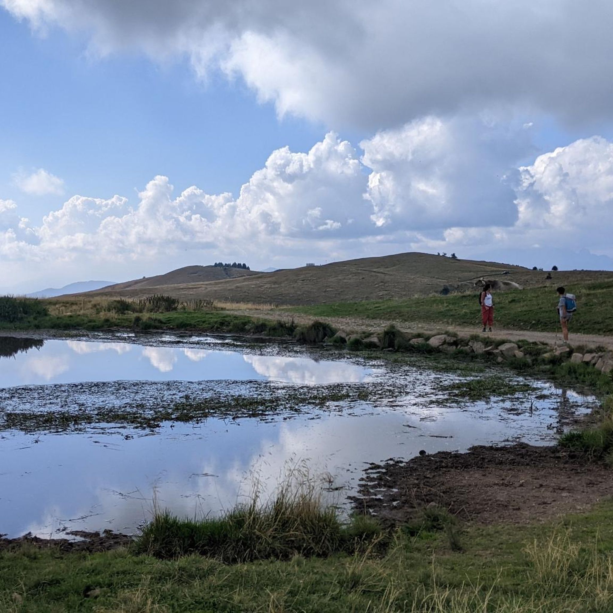
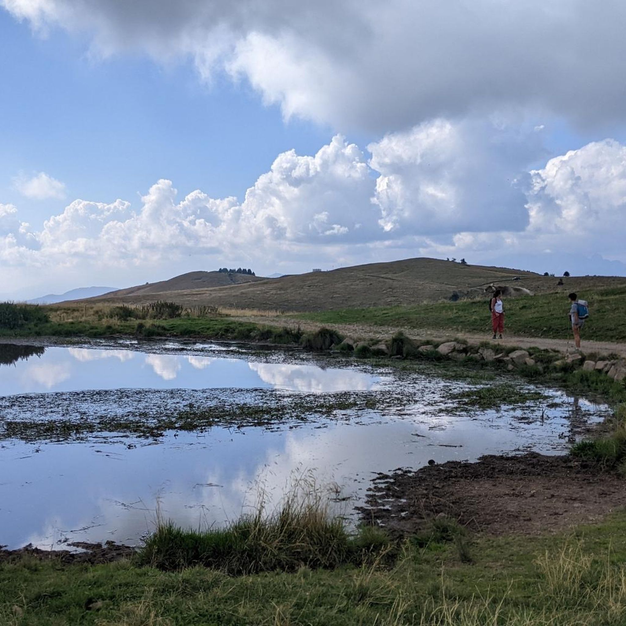
Truly unexpected. The short paved road near the small lake is very steep and very narrow, but worth it.
0
0

The Ciclovia dell'Oglio is an excellent cycle touring route of 282 kilometers that entirely follows the course of the Oglio river, connecting the mountains of Lombardy to the Po Valley. Considered the "most beautiful cycle path in Italy" (title received at the Italian Green Road Award 2019), it has a total negative elevation difference of almost 1,862 meters, starting from 1,883 meters at the Passo del Tonale to reach 21 meters of the Po at San Matteo delle Chiaviche. The route is 80% asphalt and 20% compact dirt road and is ideal for gravel, trekking, or e-bikes.
0
0

Especially on Saturdays and Sundays during the summer period (but better always) booking is recommended as it is very popular, you feel really good about the portions, the price and the services.
0
0
Important crossroads of trails: Montecampione 1800, Montecampione 1200, Bovegno, Colle di San Zeno...
0
0

Years of collaboration between organizations distributed along the Oglio River, the "backbone" of the route, have led to the development of a route approximately 280 km long that crosses Lombardy from north to south, crossing the provinces of Brescia, Bergamo, Cremona, and Mantua. The start is at the Tonale Pass, at an altitude of 1,883 meters in the heart of the Adamello Park mountains, while the finish is at an altitude of 21 meters, at the Ponte di Barche in San Matteo delle Chiaviche: the elevation gain is 1,862 meters along a route that is 80% asphalt and 20% dirt. The prestigious recognition of “most beautiful cycle path in Italy” for 2019 was awarded by the jury of experts of the Italian Green Road Award, presented in February 2019 during the Cosmobike Show event, held at the Verona Fair.
0
0
Frequently Asked Questions
How many mountain bike trails are available around Artogne?
Artogne offers a wide selection of mountain bike trails, with over 160 routes catering to various skill levels. You'll find everything from easy cycle paths to challenging mountain ascents.
What kind of difficulty levels can I expect for mountain biking trails in Artogne?
The trails around Artogne range from easy to difficult. There are 23 easy routes, 63 moderate routes, and 82 difficult routes, ensuring options for all experience levels.
Are there any family-friendly mountain bike trails in Artogne?
Yes, Artogne offers family-friendly options, particularly along the scenic Valle Camonica. The Ponte di Cividate Camuno – Valle Camonica Cycle Path loop from Rogno is an easy 13.3-mile trail that takes about 1 hour 11 minutes to complete, perfect for a relaxed family ride.
What natural features or landmarks can I see while mountain biking in Artogne?
The region is rich in natural beauty. You can enjoy routes around Lake Iseo, explore the slopes of Monte Guglielmo with its panoramic views, or ride through the expansive Valle Camonica along the Oglio River. Highlights include the Gola del Tinazzo and the Zerlo Valley.
Are there any circular mountain bike routes in the Artogne area?
Yes, many routes in Artogne are designed as loops. For example, the challenging Lake Moro – Chiesetta di Anfurro loop from Monti covers 16.1 miles with significant elevation gain. Another option is the moderate Lago Moro – Lago Moro loop from Monti, which is 15.5 miles long.
What kind of terrain should I expect on mountain bike trails around Artogne?
The terrain is diverse, featuring paths that alternate between crests and forests. You'll encounter a mix of asphalt, dirt, and singletrack sections, with some downhill portions, especially in areas like Montecampione. The region's proximity to the southern Rhaetian Alps means varied elevations.
Are there mountain bike trails suitable for e-bikes in Artogne?
Yes, Artogne offers trails that accommodate e-bikes, enhancing accessibility for riders who prefer electric assistance. This allows more people to enjoy the diverse landscapes and varied terrain of the region.
What do other mountain bikers enjoy the most about mountain biking in Artogne?
The mountain biking routes in Artogne are highly regarded by the komoot community, boasting an average rating of 4.4 stars from over 900 reviews. Riders often praise the diverse terrain, the stunning views of Lake Iseo and Monte Guglielmo, and the variety of trails suitable for different skill levels.
Are there any huts or places to stop for refreshments along the trails?
Yes, there are several huts in the vicinity that can serve as resting points or offer refreshments. Notable options include the Almici Hut – Monte Guglielmo and the Magnolini Hut, which are popular among trekkers and cyclists.
What is the best time of year to go mountain biking in Artogne?
The region offers suitable conditions for mountain biking throughout much of the year, with moderately challenging sections available. However, for the most pleasant experience, spring and autumn generally provide ideal temperatures and stable weather for exploring the diverse trails.
Are there any moderate mountain bike trails that offer a good mix of terrain?
Absolutely. The Start of DH trail – High-altitude ski resorts loop from Montecampione is a moderate 11.8-mile path that features a mix of asphalt, dirt, and singletrack sections, including some exciting downhill portions, making it a local favorite.
Most popular routes around Artogne
Most popular attractions around Artogne

Get inspired with the komoot mobile app


Explore more
Browse the best MTB trails in other regions.
