The best running trails around Cazzano Sant'Andrea
4.5
(102)
7,234
runners
278
runs
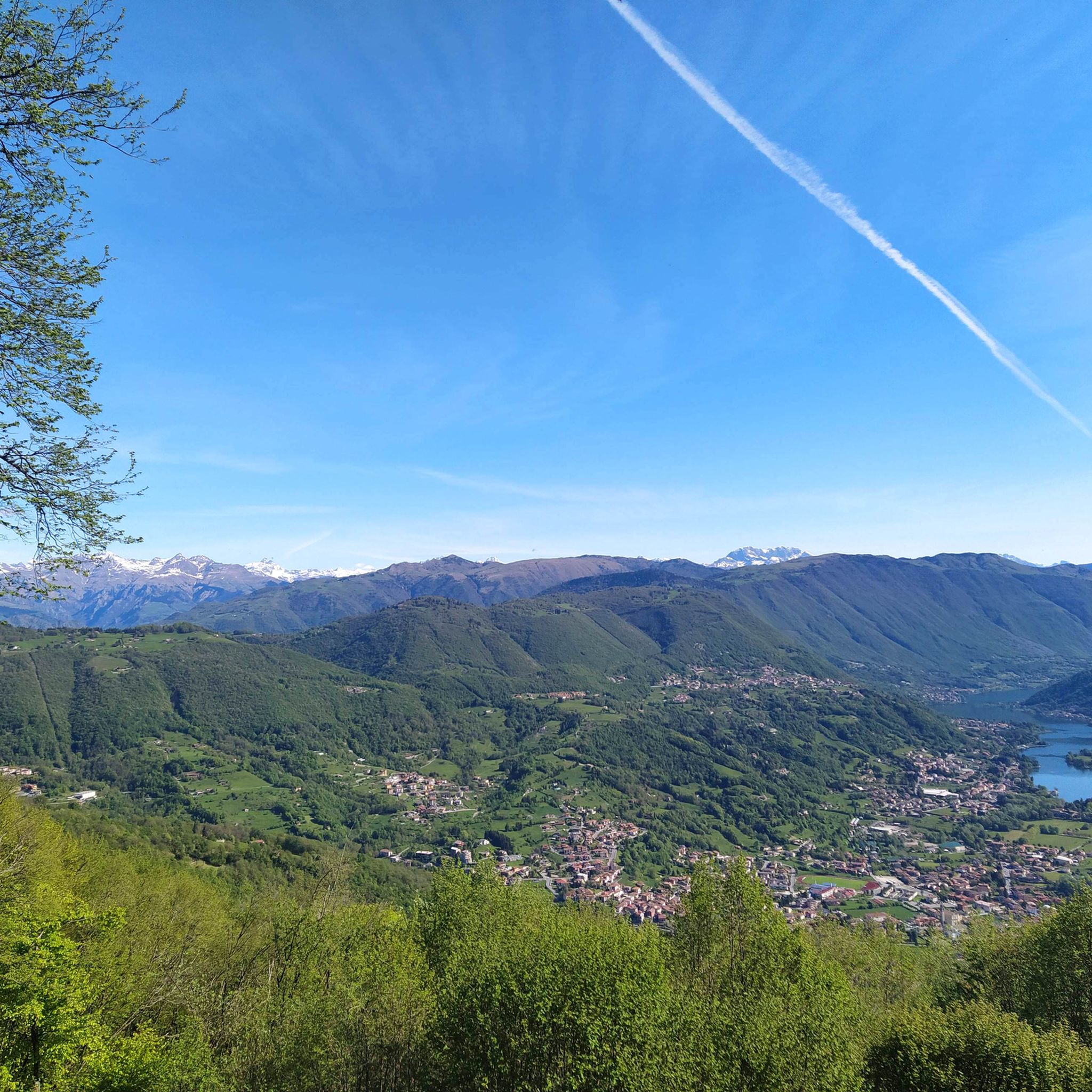
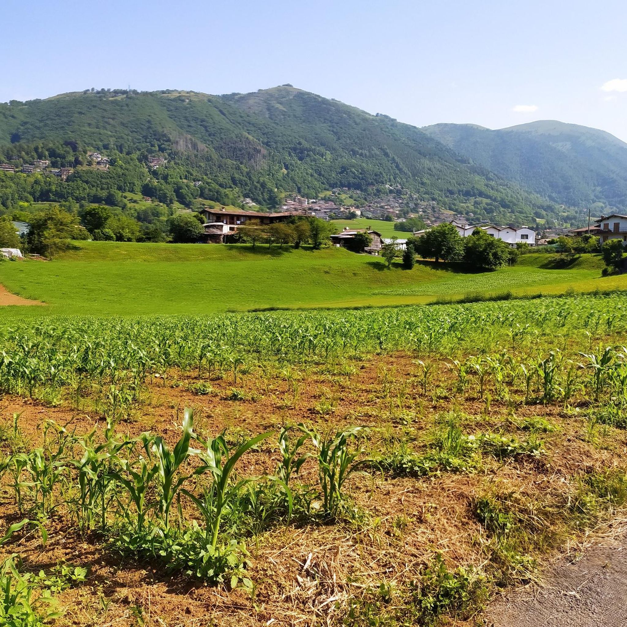
Jogging around Cazzano Sant'Andrea offers diverse landscapes within the Province of Bergamo, Italy. The municipality is situated on a high plain at approximately 504 meters above sea level, providing serene surroundings amidst hills and natural features. The area lies at the foot of Mount Farno and offers expansive views over Val Gandino and Val Seriana, with routes often traversing varied terrain from paved surfaces to natural paths.
Best jogging routes around Cazzano Sant'Andrea
- The most popular jogging route is Antichi…
Last updated: July 5, 2026
13
runners
9.71km
01:10
260m
260m
This moderate 6.0-mile (9.7 km) jogging loop near Gandino offers 857 feet (261 metres) of elevation gain and takes about 1 hour and 10 minut
3.0
(1)
102
runners
21.3km
03:16
1,010m
1,020m
Hard run. Very good fitness required. Sure-footedness, sturdy shoes and alpine experience required.

Sign up for free
62
runners
17.9km
02:07
530m
530m
Hard run. Very good fitness required. Sure-footedness, sturdy shoes and alpine experience required.
56
runners
8.96km
01:00
200m
200m
Moderate run. Good fitness required. Mostly paved surfaces. Suitable for all skill levels.
5.0
(1)
42
runners
23.0km
03:58
1,390m
1,390m
Hard run. Very good fitness required. Sure-footedness, sturdy shoes and alpine experience required.
Get access to more routes and recommendations from other explorers.
Sign up for free
Already have an account?
Our route recommendations are based on thousands of hikes, rides, and runs completed by other people on komoot.
Start today with a free account
Your next adventure awaits.
Login or Signup

Tips from the Community

Convenient starting point for reaching various places including Monte Sparavera. The parking lot can accommodate about thirty cars, and along the road about 7/8 more. Remember to get the scratch-off parking permit, available for purchase in the municipalities of Peia or Ranzanico (it is not the same one needed for M.Farno).
0
0

from here the path to Gandino is first quite flowy then becomes more technical with some engraved sections
1
0
from here you enter the pasture on the obvious ramp to climb to the top of the sparavera
0
0

This basilica, built on a structure dating back to the 12th century and gradually expanded over the centuries, reached its final structure in the 16th/17th centuries. It is considered one of the most interesting churches in the entire diocese, rivaling the cathedral and the city's basilicas in richness and beauty. It contains numerous works of art, from Lombard, Italian, and Central European artists. With three naves, divided by four imposing polylobed pillars, it features splendid Baroque frescoed vaults, capable of astonishing and captivating not only the faithful but also the lay visitor. The large hexagonal bell tower, with its unique and distinctive onion dome, completes its structure. It is worth taking the time for a prolonged and attentive visit.
7
0

PLEASE NOTE!!! Starting June 2025, parking at Forcella is subject to a fee. A small fee of €3 will be charged for parking. The goal is to use the proceeds to maintain Via Cadorna (this is what the municipality has declared. Whether this is fair or not, I'll leave it to others to decide), the main thoroughfare leading to Forcella.
1
1
Forcella Larga is a pass located along the hiking trail that connects Pizzo Formico (1636 m) to Montagnina, in Val Gandino, province of Bergamo. It is a panoramic point much appreciated by hikers for its view of the Orobie Bergamasche and Val Seriana. Characteristics of Forcella Larga: Altitude: About 1470 meters. Access: Reachable via the CAI 549 path, which connects Monte Farno to the Rifugio Parafulmine. Panorama: View of Val Seriana, Val Gandino and the surrounding mountains. Support points: Capanna Ilaria, located near the fork. Recommended route: The most common path starts from Conca del Farno, crosses Montagnina and reaches Forcella Larga before continuing towards the summit of Pizzo Formico. It is an excursion suitable for those who have experience in the mountains and want to enjoy a breathtaking view.
0
0
The Alpe Montagnina Trail is a hiking trail located in Val Gandino, in the province of Bergamo. It is a panoramic trail that connects Pizzo Formico to Rifugio Parafulmine, crossing the Montagnina area. Trail characteristics: Altitude: Varies between 1200 and 1600 meters. Route: CAI Trail 549, with connections to Monte Farno and Bivacco Baroncelli. Difficulty: Hiking (E), suitable for those with mountain experience. Panorama: View of Val Seriana, Val Gandino and the Orobie. Support points: Rifugio Parafulmine, Capanna Ilaria and Bivacco Baroncel
0
0
Capanna Ilaria is located at 1470 meters above sea level, in the Forcella Larga area, along the hiking trail that leads to Pizzo Formico (1636 m). It is a reference point for hikers who cross the Montagnina and head towards Rifugio Parafulmine. Characteristics of Capanna Ilaria: Altitude: 1470 m. Location: Forcella Larga, along the CAI 549 trail. History: The hut is a historic ruin, often used as a rest point. Route: Connections with Pizzo Formico, Monte Farno and Rifugio Parafulmine. Panorama: View of Val Seriana, Val Gandino and the Orobie. From Pizzo Formico, Capanna Ilaria can be reached in about 30 minutes, following the trail that crosses the Montagnina. It is a perfect place for a break before continuing towards the refuge or the summit.
0
0
Frequently Asked Questions
What types of running routes are available in Cazzano Sant'Andrea?
Cazzano Sant'Andrea offers a diverse range of running routes, from moderate paths to more challenging trails. You'll find options with mostly paved surfaces, as well as routes requiring sure-footedness on natural terrain. The area's high plains, surrounding hills, and views over Val Gandino and Val Seriana provide varied backdrops for your run.
Are there running routes suitable for beginners or those looking for an easier run?
Yes, there are routes suitable for various skill levels. While the guide highlights some more challenging options, the area offers 19 easy running routes. For example, the Antichi Condotti and Gandino Loop is a moderate route featuring mostly paved surfaces, making it accessible for many runners.
What natural attractions or landmarks can I see while running in Cazzano Sant'Andrea?
The region is rich in natural beauty and historical sites. You can enjoy expansive views over Val Gandino and Val Seriana, and some routes might offer glimpses of Mount Farno. The broader Province of Bergamo features stunning landscapes including the Bergamo Alps. For specific points of interest, consider exploring highlights like Lake Endine or the Pozza dei Sette Termini.
Are there any challenging running trails for experienced runners?
Absolutely. For those with very good fitness, routes like the Bridge over the Serio – Passage to Vertova loop from Casnigo or the Colle Petta loop from Casnigo offer significant elevation gain and demand sure-footedness. In total, there are 137 difficult routes in the area for seasoned runners.
Can I find circular running routes in Cazzano Sant'Andrea?
Yes, many of the running routes in the area are loops, providing a convenient way to start and end your run at the same point. Examples include the Laghetto Corrado – Chapel of San Rocco of Peia loop from Gandino, which is a challenging 18.2 km path, or the Church of San Martino, Leffe loop from Leffe, a moderate 8.4 km trail.
What do other runners enjoy most about the trails in Cazzano Sant'Andrea?
The running routes in Cazzano Sant'Andrea are highly rated by the komoot community, with an average score of 4.4 stars from over 80 reviews. Runners often praise the diverse landscapes, the serene surroundings amidst hills, and the expansive views over Val Gandino and Val Seriana.
Is the Serio River Cycle Path suitable for long-distance running?
The Serio River Cycle Path, stretching 59 kilometers from Bergamo to Valbondione, is primarily designed for cycling but offers a scenic route through nature, art, and mountains. Its length and natural setting make it potentially suitable for long-distance running or walking, providing a different experience from the more hilly trails.
Are there any historical sites to explore near the running paths?
Beyond the natural beauty, Cazzano Sant'Andrea has historical significance. You can find a 14th-century medieval tower, which now serves as municipal offices, and the 15th-century parish church of Sant'Andrea. While not directly on every running path, these sites are part of the local heritage and can be explored in conjunction with your outdoor activities.
What is the general elevation of the running routes in this region?
Cazzano Sant'Andrea is situated on a high plain at approximately 504 meters above sea level. Running routes often feature varied elevation gains, reflecting the area's hilly terrain and proximity to Mount Farno. You can expect a mix of flatter sections and climbs, offering a good workout with rewarding views.
Are there options for family-friendly running or walking in Cazzano Sant'Andrea?
While specific 'family-friendly' routes are not explicitly detailed, the presence of 19 easy routes and a Communal Park ('Parco Comunale') suggests there are gentler options suitable for families. Routes with mostly paved surfaces, like parts of the Antichi Condotti and Gandino Loop, could be good starting points for family outings.
Can I bring my dog on the running trails around Cazzano Sant'Andrea?
The region's diverse natural landscapes, including valleys and hills, generally offer many opportunities for outdoor activities with dogs. While specific dog-friendly regulations for each trail are not provided, it's common for natural paths in such areas to be accessible to well-behaved dogs on a leash. Always check local signage for any specific restrictions.
Most popular routes around Cazzano Sant'Andrea
Most popular attractions around Cazzano Sant'Andrea

Get inspired with the komoot mobile app


Explore more
Browse the best Running Trails & Routes in other regions.
