The best walks and hikes around Filattiera
4.4
(817)
3,906
hikers
28
hikes
Hiking around Filattiera offers diverse landscapes in the upper Lunigiana region of Italy. The area is situated on the left bank of the Magra River, surrounded by hills and overlooked by the Tuscan-Emilian Apennines. Hikers can explore ancient chestnut and beech forests, river valleys, and mountain ridges, with elevations leading to peaks like Monte Marmagna. The terrain includes woodlands, prairies, and ancient river terraces along the Magra River.
Best hiking trails around Filattiera
- The most popular hiking route is Cresta…
Last updated: July 5, 2026
5.0
(1)
3
hikers
22.9km
09:50
1,570m
1,560m
Hard hike. Very good fitness required. Sure-footedness, sturdy shoes and alpine experience required.
5.61km
02:12
310m
310m
Hard hike. Good fitness required. Sure-footedness, sturdy shoes and alpine experience required.

Sign up for free
4.4
(9)
54
hikers
21.1km
05:38
240m
240m
Hard hike. Very good fitness required. Easily-accessible paths. Suitable for all skill levels.
5.0
(1)
6
hikers
6.11km
02:04
270m
270m
Moderate hike. Good fitness required. Mostly accessible paths. Sure-footedness required.
3.0
(2)
29
hikers
9.11km
03:13
450m
450m
Moderate hike. Good fitness required. Mostly accessible paths. Sure-footedness required.
Get access to more routes and recommendations from other explorers.
Sign up for free
Already have an account?
Our route recommendations are based on thousands of hikes, rides, and runs completed by other people on komoot.
Start today with a free account
Your next adventure awaits.
Login or Signup


Tips from the Community

Turn-off for the demanding direct route leading to mount Bràiola
0
0


Nice panoramic point at the foot of M. Marmagna
0
0
Rifugio managed by the CAI of Pontremoli, usually closed except by contacting the local section. Located in a strategic position for those walking in multiple stages, crossing the Tuscan-Emilian ridge.
0
0
Wonderful meadows, always green and flowery in late spring. Excellent view of the Tuscan-Emilian ridge. Ideal for walks in nature or for a picnic.
0
0

Parma Spring of Badignana
0
0
At 826m above sea level, a lovely spot for a pleasant break. There's a small chapel, a drinking fountain, and a covered picnic table. There's also a first aid kit and a solar-powered cell phone charger.
0
0

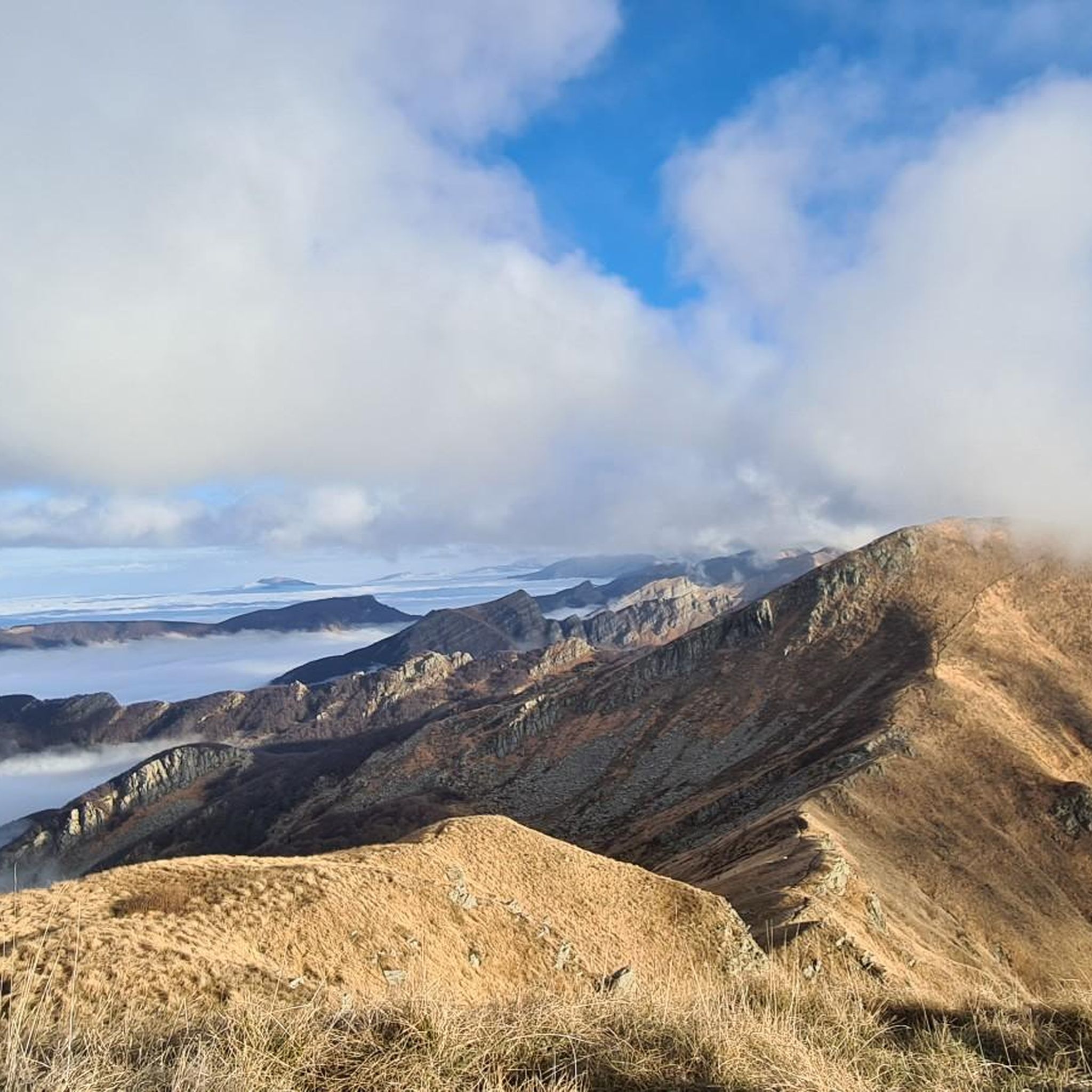
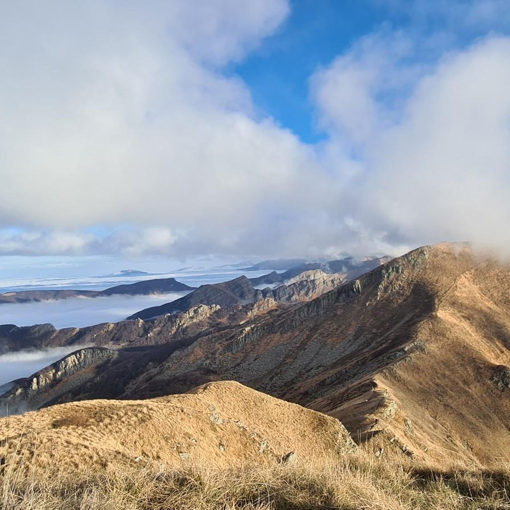
Wonderful trail on the crests that is absolutely worth a visit. Incredible views of the entire Po Valley and the sea of La Spezia.
0
0
Frequently Asked Questions
How many hiking trails are available around Filattiera?
Filattiera offers a diverse network of over 20 hiking routes. These trails cater to various skill levels, from easy walks through river valleys to challenging ascents in the Apennines.
What kind of terrain can I expect on hikes in Filattiera?
The terrain around Filattiera is highly varied. You'll find paths winding through ancient chestnut and beech forests, open prairies, and along mountain ridges. The area also features river terraces along the Magra River and significant elevation changes as you approach the Tuscan-Emilian Apennines.
Are there easy hiking options suitable for beginners in Filattiera?
Yes, Filattiera has several easy hiking trails. There are 7 routes classified as easy, perfect for those looking for a relaxed walk through the scenic countryside or along the Magra River plains.
Are there challenging hikes for experienced trekkers in Filattiera?
Absolutely. For experienced hikers, there are 6 difficult routes available. These often involve significant elevation gain and lead into the higher mountain terrain of the Tuscan-Emilian Apennines, offering rewarding views and demanding ascents. An example is the E1 Trail from Passo delle Guadine along Tuscan-Emilian Ridge.
Are there family-friendly hiking trails in Filattiera?
Yes, many trails around Filattiera are suitable for families. The area's diverse landscape includes easier paths through forests and along river valleys, which are ideal for walks with children. Look for routes with moderate distances and less elevation gain.
Can I bring my dog on hikes around Filattiera?
Most trails in the Filattiera region are dog-friendly, allowing you to explore the natural beauty with your canine companion. However, it's always recommended to keep dogs on a leash, especially in protected areas or near livestock, and to check specific trail regulations if available.
Are there circular hiking routes available in Filattiera?
Yes, the region offers several circular hiking routes, allowing you to start and end your journey in the same location. These loops often take you through varied landscapes, including forests, valleys, and sometimes historical villages. An example is the View of the Apuan Alps – Passo Colletta loop from Biglio.
What natural landmarks can I see along the hiking trails?
Hiking trails in Filattiera lead to several notable natural landmarks. You can explore the stunning landscapes of the Tuscan-Emilian Apennines, reach peaks like Monte Marmagna, or visit serene spots like Lake Santo Parmense and Lago Bozzo. The area is also rich in ancient forests and river valleys.
Are there any historical sites or points of interest along the hiking routes?
Filattiera's hiking routes are steeped in history. The ancient Via Francigena pilgrimage route passes directly through the area, offering walks through historic hamlets and past medieval structures. You can also encounter archaeological sites, medieval villages like Ponticello, and the Pieve di Santo Stefano, an 18th-century church built on ancient settlements.
What do other hikers enjoy the most about hiking in Filattiera?
The komoot community highly rates hiking in Filattiera, with an average score of 4.4 stars from over 700 reviews. Hikers often praise the diverse landscapes, from ancient forests to mountain vistas, and the rich historical context provided by the Via Francigena and medieval villages. The variety of trails catering to different abilities is also a frequently appreciated aspect.
What is the best time of year to hike in Filattiera?
The best time to hike in Filattiera is generally from spring to autumn. During these seasons, the weather is pleasant, and the landscapes are vibrant, with forests in full bloom or showcasing autumn colors. Summer offers warmer temperatures, ideal for higher altitude trails, while spring and autumn provide milder conditions for exploring lower valleys and historical routes.
Are there places to eat or stay near the hiking trails?
Filattiera and its surrounding villages offer various amenities, including cafes, pubs, and accommodation options. Many trails pass through or near charming towns where you can find places to refuel and rest after your hike. For more information on the region, you can visit visittuscany.com.
Most popular routes around Filattiera
Most popular attractions around Filattiera

Get inspired with the komoot mobile app


Explore more
Browse the best Hikes in other regions.
