The best running trails around Calice Al Cornoviglio
3.9
(122)
1,733
runners
104
runs
Jogging around Calice Al Cornoviglio offers diverse landscapes, characterized by pleasant hilly and wooded terrain, particularly on the left side of the Vara Valley. The region features dense chestnut and pine forests, providing shaded routes for running. Its varied inclines and declines cater to different fitness levels, making it a suitable destination for outdoor enthusiasts.
Best jogging routes around Calice Al Cornoviglio
- The most popular jogging route is Running loop from Tivegna, an 8.3 miles (13.4 km) moderate trail…
Last updated: October 30, 2026
11
runners
13.4km
01:24
80m
80m
Moderate run. Good fitness required. Mostly paved surfaces.
5.0
(1)
16
runners
13.4km
01:41
200m
200m
Hard run. Good fitness required. Sure-footedness, sturdy shoes and alpine experience required.

3
runners
13.1km
01:30
320m
320m
Hard run. Very good fitness required. Mostly paved surfaces.
3
runners
7.48km
00:50
30m
30m
Moderate run. Good fitness required. Mostly paved surfaces.
5
runners
30.1km
04:11
1,030m
1,030m
Hard run. Very good fitness required. Sure-footedness, sturdy shoes and alpine experience required.
Get access to more routes and recommendations from other explorers.
Already have an account?
Our route recommendations are based on thousands of hikes, rides, and runs completed by other people on komoot.
Start today with a free account
Your next adventure awaits.
Tips from the Community

December 28, 2025, wet trail, but completely doable even on gravel! Very nice
0
0

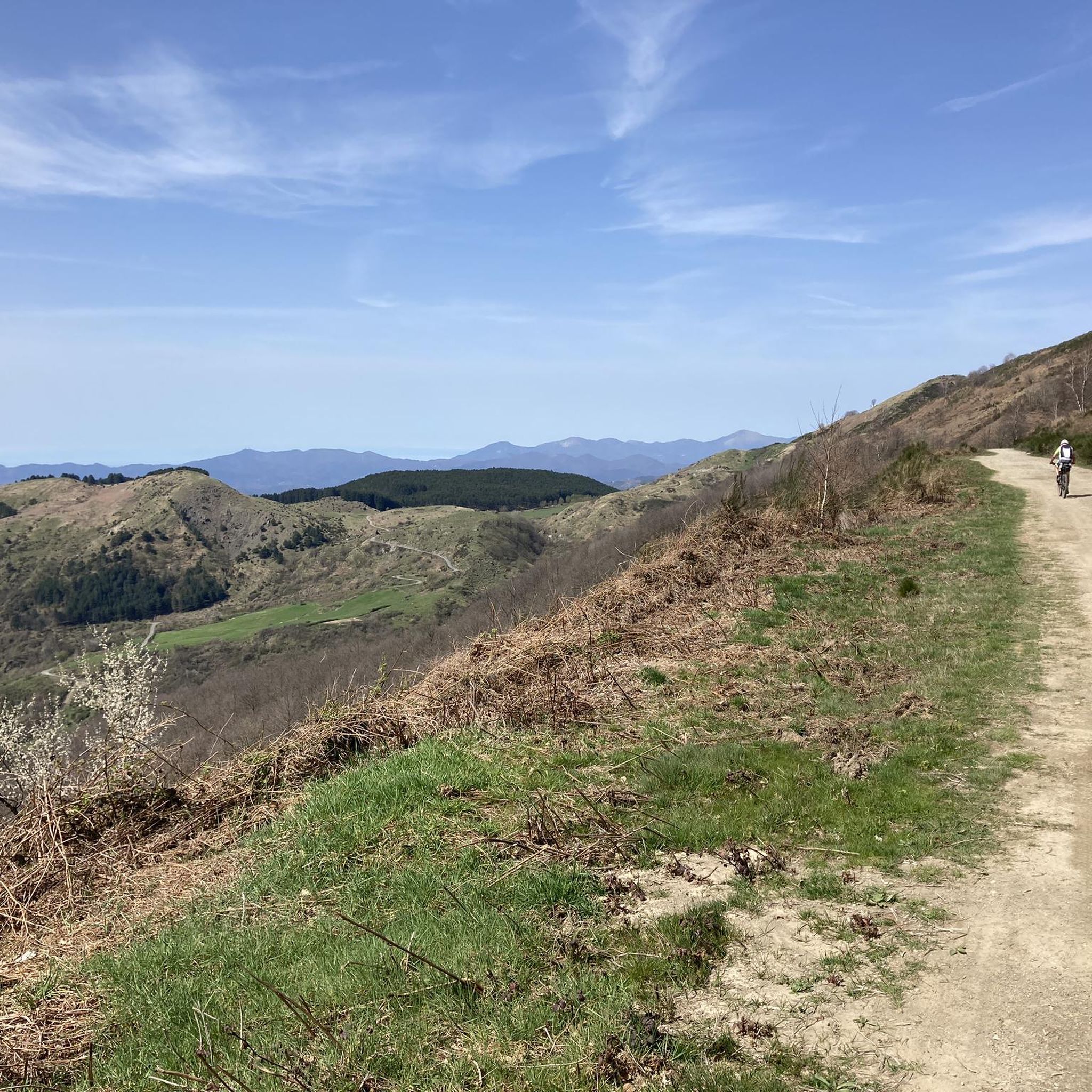
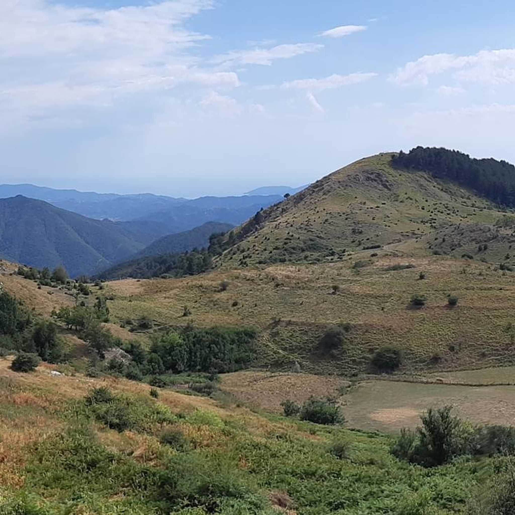
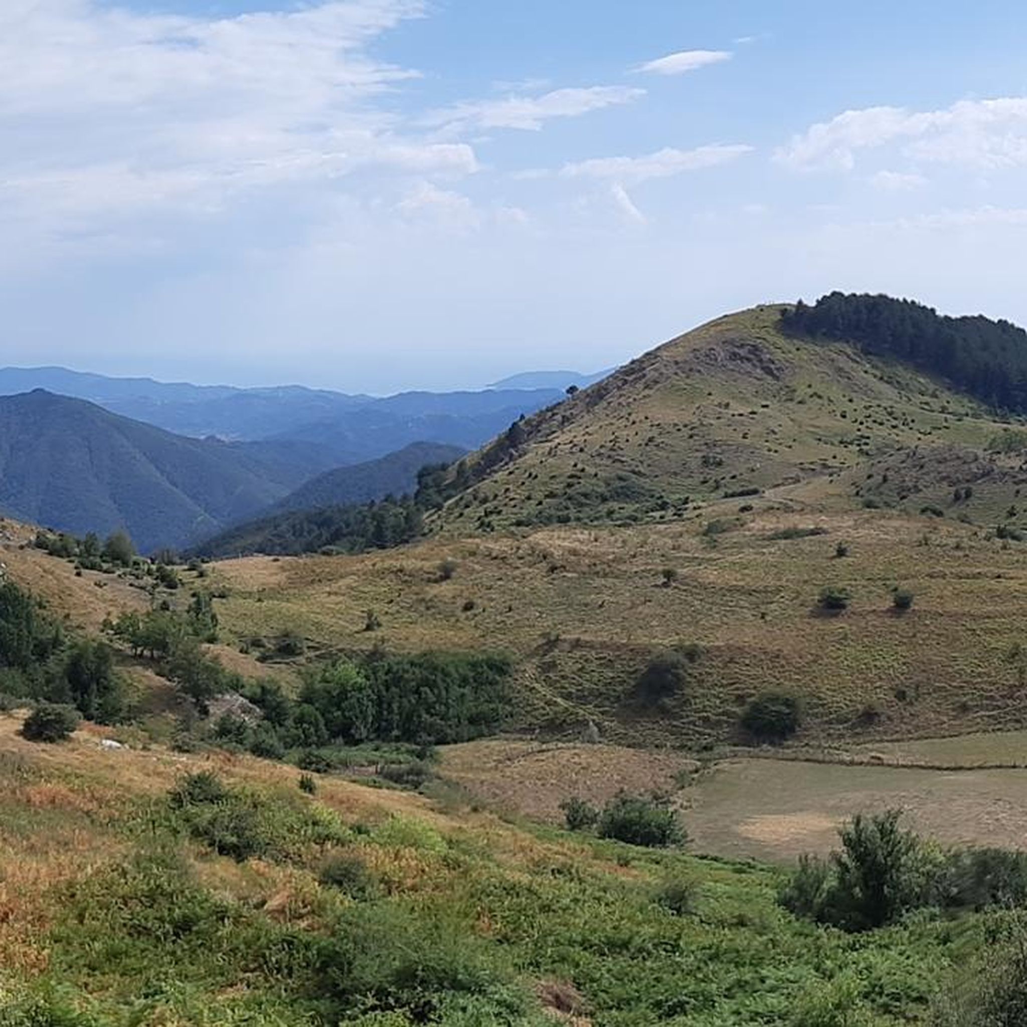
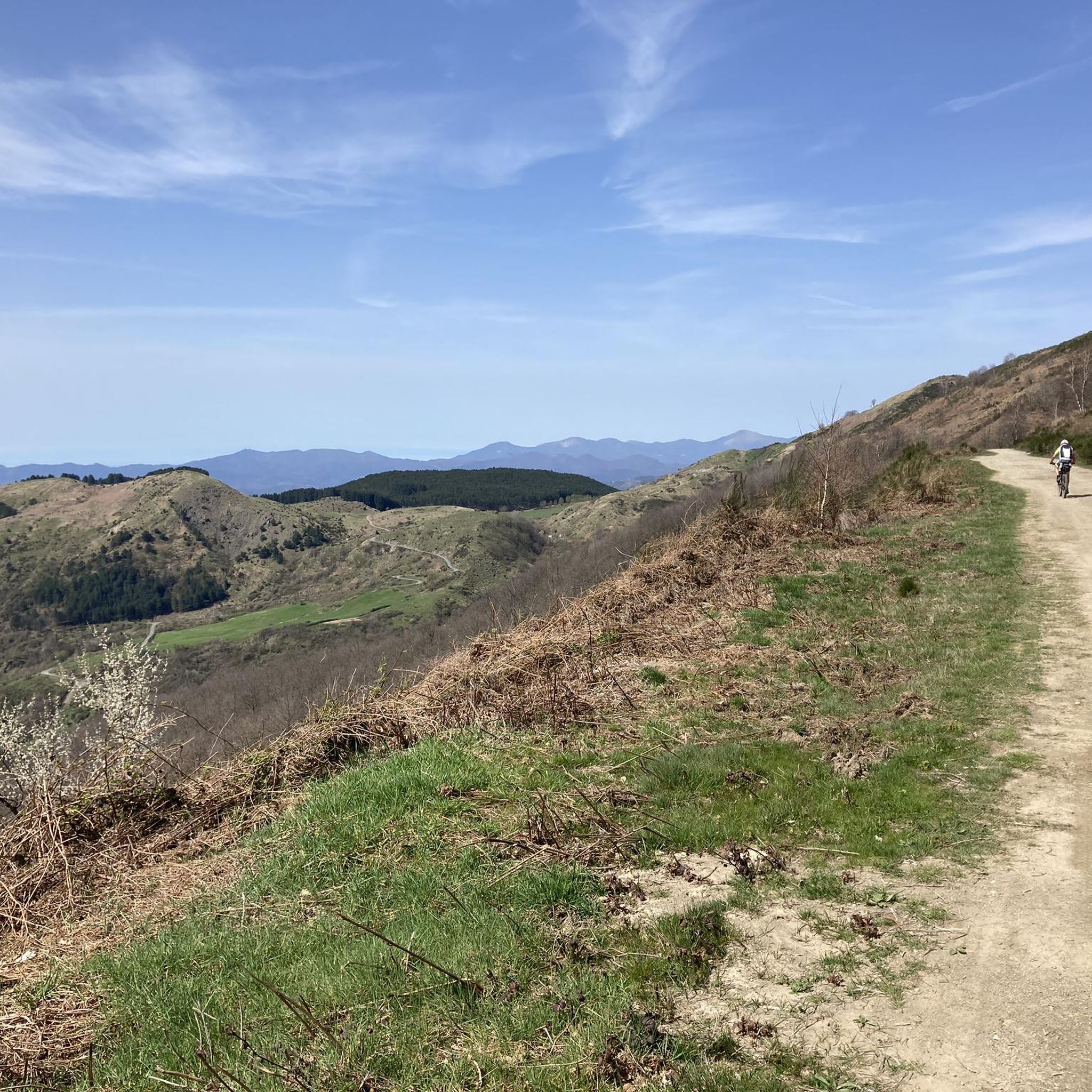
Passo Alpicella is located at 710m above sea level and is part of the 42nd stage of the Alta Via dei Monti Liguri. It is located on the watershed ridge between Val di Vara and Valle del Magra, offering open views that on clear days reach the Apuan Alps and the Gulf of Poets.
1
0

ALPICELLA PASS WHICH DIVIDES LIGURIA FROM TUSCANY PHOTO OF THE OLD RESTAURANT
2
0

The Strada dei Tedeschi is a path on the right side of the Vara river. This second stretch, which arrives in Piana Battola, is largely in the shade, making it ideal especially in summer.
0
0

The panoramic road of Mount Cornoviglio is located between the Alpicella pass and the Casoni pass: this offers a fantastic view of the coast and the entire region.
5
0

Between the Passo Alpicella and the Passo dei Casoni you have a fantastic view of the coast and the whole region. If you take one of the small branches up to the ridge, you have a nice view of the interior on the other side.
3
0

Beautiful stretch to be covered both on foot and by bicycle (preferable MTB or in any case with tires suitable for off-road). To be avoided during periods of rain or immediately following due to the increase in extremely muddy sections. Highly recommended.
2
0

Ups and down road suitable also for beginners, very nice
4
0
Frequently Asked Questions
How many running routes are available in Calice Al Cornoviglio?
Calice Al Cornoviglio offers nearly 100 running routes, providing a wide variety of options for joggers of all levels. These include 5 easy routes, 58 moderate routes, and 32 more challenging trails.
What types of terrain can I expect on the jogging trails in Calice Al Cornoviglio?
The jogging trails in Calice Al Cornoviglio are characterized by pleasant hilly and wooded terrain, especially on the left side of the Vara Valley. You'll find yourself running through dense chestnut and pine forests, offering shaded paths and varied inclines and declines typical of the Apennine landscape.
Are there any easy running routes suitable for beginners or a relaxed jog?
Yes, there are several easy running routes in the area. For a moderate option that's not overly strenuous, consider the Running loop from Ceparana, which is about 3.1 miles (5 km) long and features minimal elevation gain.
What are some scenic highlights or landmarks I can see while running in Calice Al Cornoviglio?
Many routes offer stunning views and historical sights. You can explore trails that connect medieval villages and castles, such as the Lusuolo Castle and Medieval Village, which provides ancient architecture and views overlooking the Magra River. Other trails might lead you past the ancient Romanesque church of Pieve di Santo Stefano di Sorano, dating back to the 11th and 12th centuries.
Are there any circular running routes in Calice Al Cornoviglio?
Yes, many of the running routes in Calice Al Cornoviglio are circular, allowing you to start and finish at the same point. For example, the Running loop from Tresana is a challenging 8.1-mile (13.1 km) circular route, perfect for a longer workout.
What do other runners enjoy most about jogging in Calice Al Cornoviglio?
The running routes in Calice Al Cornoviglio are highly rated by the komoot community, with an average score of 3.8 stars from over 70 reviews. Runners often praise the diverse landscapes, the tranquility of the forests, and the engaging hilly terrain that caters to different fitness levels.
Are the running trails in Calice Al Cornoviglio suitable for families?
While the region is known for its hilly terrain, there are routes that can be enjoyed by families. Look for the easier, shorter trails, especially those that pass through the more accessible parts of the chestnut and pine forests, offering shaded and pleasant conditions for a family outing.
Can I bring my dog on the running trails in Calice Al Cornoviglio?
Generally, many outdoor trails in the region are dog-friendly, allowing you to enjoy a run with your canine companion. However, it's always advisable to keep your dog on a leash, especially in more populated areas or near wildlife, and to check for any specific local regulations on individual trails.
Is parking available near the running routes?
Many trailheads and starting points for running routes in Calice Al Cornoviglio offer parking facilities, particularly in or near the villages. It's recommended to check the specific route details on komoot for information on parking availability at your chosen starting point.
What is the best season for running in Calice Al Cornoviglio?
Calice Al Cornoviglio is enjoyable for running throughout much of the year. Spring and autumn offer pleasant temperatures and beautiful scenery with blooming flora or vibrant fall foliage. Summer provides shaded routes through the dense forests, while winter can offer a unique experience, though some higher elevation trails might be less accessible due to weather conditions.
Are there any longer, more challenging running routes for experienced runners?
Absolutely. For experienced runners seeking a challenge, Calice Al Cornoviglio offers several difficult routes. The Running loop from Beverino is an 8.3-mile (13.4 km) trail with significant elevation changes, providing a demanding workout through varied terrain.
Are there any running routes that offer views of the Vara Valley?
Yes, the picturesque Vara Valley is a prominent feature of the region, and many running routes incorporate its scenic beauty. The Running loop from Tivegna, an 8.3-mile (13.4 km) moderate trail, specifically winds through the scenic Vara Valley, offering beautiful vistas.
Most popular routes around Calice Al Cornoviglio
Most popular attractions around Calice Al Cornoviglio

Get inspired with the komoot mobile app


Explore more
Browse the best Running Trails & Routes in other regions.
