The best running trails around Borgo Velino
4.5
(7)
320
runners
34
runs
Jogging routes around Borgo Velino offer a diverse range of terrain, from mountainous paths to gentler riverside trails. The region is situated at the foot of Mount Nuria, providing challenging runs through extensive woods and chestnut groves. The Velino River also flows nearby, offering more level running surfaces and varied plant life. This combination of riverine and mountainous landscapes caters to different fitness levels and preferences.
Best jogging routes around Borgo Velino
- The most popular jogging route is Monte Terminillo…
Last updated: July 5, 2026
5.0
(1)
17
runners
Hard run. Very good fitness required. Sure-footedness, sturdy shoes and alpine experience required.
15
runners
7.09km
00:45
90m
90m
Moderate run. Good fitness required. Mostly paved surfaces. Suitable for all skill levels.

Sign up for free
14
runners
6.11km
00:47
190m
190m
Moderate run. Good fitness required. Mostly paved surfaces. Suitable for all skill levels.
13
runners
Hard run. Very good fitness required. Sure-footedness, sturdy shoes and alpine experience required.
11
runners
Hard run. Good fitness required. Sure-footedness, sturdy shoes and alpine experience required.
Get access to more routes and recommendations from other explorers.
Sign up for free
Already have an account?
Our route recommendations are based on thousands of hikes, rides, and runs completed by other people on komoot.
Start today with a free account
Your next adventure awaits.
Login or Signup
Tips from the Community


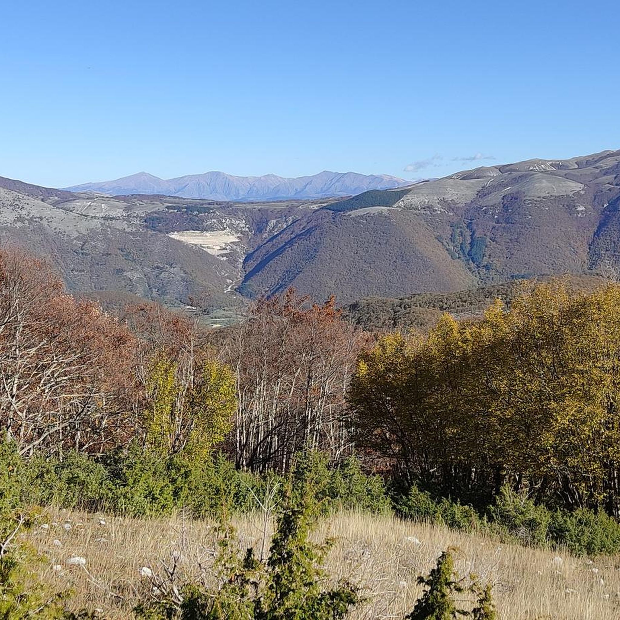
From the summit of Mount Terminillo, 2,216 meters, you can enjoy a breathtaking 360-degree panorama. You can admire the crests of Mount Elefante, Mount Brecciaro, Mount Valloni, Corno Grande, the Laga mountains, the Velino/Sirente massif, and on clear days even Mount Vettore and Gran Sasso. The view of the valleys below is fantastic, and from the highest point, it offers a unique panorama of the Sassetelli ridge, Mount Terminelletto, and the narrow saddle connecting the two peaks. On clear days, the view allows you to glimpse the magnificent mountains of the Central Apennines and the Gran Sasso.
0
0
From the summit of Mount Terminillo, at 2,216 meters, you can enjoy a breathtaking 360-degree panorama. You can admire the crests of Mount Elefante, Mount Brecciaro, Mount Valloni, Corno Grande, the Laga mountains, the Velino/Sirente massif, and on clear days even Mount Vettore and Gran Sasso. The view of the valleys below is spectacular; from the summit, you can admire the spectacular Sassetelli ridge and the ridge leading to Mount Terminelletto, as well as the magnificent mountains of the Central Apennines and the Sibillini Mountains.
1
0

The bar looks good with the two tarts. Last stop before reaching the top
0
0

The town of Pian de’ Valli, is located in the municipality of Rieti, stands at the foot of Terminillo, at an altitude of 1620 meters, hosts many accommodation and commercial activities, and the departure station of the ski lifts is located a few steps from the center. The famous Terminillo cable car is still in operation today both in the winter and summer seasons and is the historical symbol of Pian de’ Valli.
2
0

Wait for the sunset and you will cry :)
0
0
Large, well-kept and managed refuge where you can move and refresh yourself before the summit of Terminillo
0
0
Frequently Asked Questions
How many running routes are available around Borgo Velino?
There are over 35 running routes around Borgo Velino, offering a wide range of options for different fitness levels and preferences. These include 11 moderate routes and 24 more challenging trails.
What kind of terrain can I expect on jogging trails near Borgo Velino?
The region offers diverse terrain, from challenging mountainous paths on Mount Nuria and near Mount Terminillo to gentler riverside trails along the Velino River. You'll find extensive woods, shaded chestnut groves, and varied inclines, providing both scenic beauty and varied physical demands.
Are there any moderate or beginner-friendly jogging routes in Borgo Velino?
Yes, while many routes offer a challenge, there are 11 routes classified as moderate. These often feature gentler inclines, particularly along the Velino River, making them suitable for beginners or those looking for a less strenuous run. For example, the Pian de' Valli, Terminillo loop from Pian de' Valli is a moderate 6.6-mile path with varied terrain.
Can I find circular jogging routes around Borgo Velino?
Many of the running routes in Borgo Velino are designed as loops, allowing you to start and finish at the same point. For instance, the popular Monte Terminillo – Monte Terminilletto loop from Pian de' Valli is a challenging 9.5-mile circular trail, and the Colle delle Porrare loop from Pian de' Valli offers a moderate 4.4-mile option.
What are some notable natural features or landmarks I might see while running?
Jogging routes often take you through the extensive woods and chestnut groves of Mount Nuria, offering panoramic views. The Velino River provides a contrasting landscape with diverse plant life. You might also encounter highlights such as Rifugio Massimo Rinaldi or Angelo Sebastiani Hut, which are mountain huts in the area.
Are there any running trails with good viewpoints?
Absolutely. The mountainous terrain around Mount Nuria and Mount Terminillo provides numerous opportunities for breathtaking vistas. Routes like the Monte Terminillo – Monte Terminilletto loop are known for their significant elevation changes and rewarding panoramic views over the valleys and surrounding peaks.
What do other runners say about the trails in Borgo Velino?
The running routes in Borgo Velino are highly rated by the komoot community, with an average score of 4.3 stars from several reviews. Over 400 runners have explored the varied terrain, often praising the challenging ascents, scenic beauty, and the mix of mountain and riverside environments.
Are there any lakes or water features near the jogging routes?
While the Velino River flows near Borgo Velino, offering riverside jogging, the wider region also features several lakes. You can find highlights like Lake Salto and Lake Rascino, which are popular spots for outdoor activities and offer scenic views.
What is the best time of year for jogging in Borgo Velino?
The presence of extensive woods and chestnut groves around Mount Nuria provides shaded paths, making jogging particularly pleasant during warmer months. However, the varied terrain means that with appropriate gear, running can be enjoyed across different seasons, with winter offering a different kind of challenge in the higher elevations.
Are there any long-distance running options for experienced runners?
Yes, for experienced runners seeking a challenge, there are several difficult routes with significant elevation changes. The Cima di Vall'Organo – Monte Cardito loop from Pian de' Valli, for example, is an 8.4-mile trail with substantial climbs, often completed in about 2 hours 22 minutes.
Can I find routes that are suitable for trail running?
Many of the paths around Borgo Velino, while often described as hiking trails, are easily adaptable for trail running. The region's combination of mountainous terrain, varied inclines, and natural surfaces makes it an excellent destination for those seeking a more intense trail running experience.
Most popular attractions around Borgo Velino

Get inspired with the komoot mobile app


Explore more
Browse the best Running Trails & Routes in other regions.
