The best walks and hikes around Río Guadalete
4.4
(587)
2,854
hikers
141
hikes
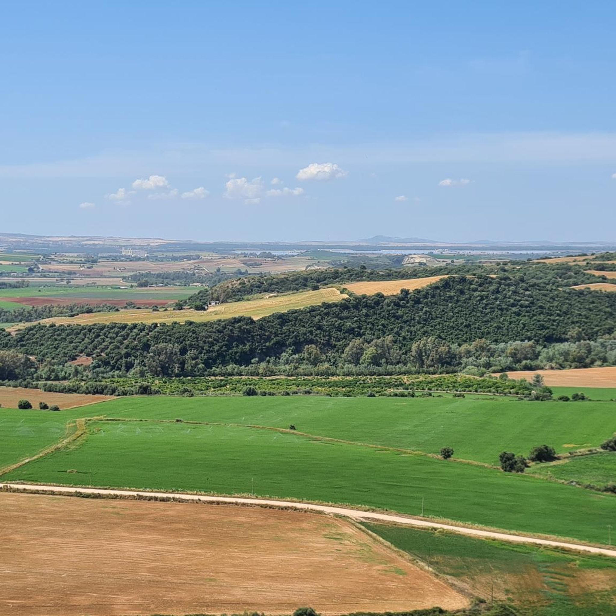
Hiking trails around Río Guadalete offer diverse landscapes in the Campiña de Jerez region. The area is characterized by the meandering Río Guadalete, which carves through a landscape of rolling hills and agricultural plains. Many routes incorporate historical towns like Arcos de la Frontera, providing a mix of natural and cultural exploration. The terrain generally features moderate elevation changes, making it accessible for various hiking abilities.
Best hiking trails around Río Guadalete
- The most popular hiking route is Guadalete River…
Last updated: May 23, 2026
3.9
(7)
40
hikers
6.10km
01:49
180m
180m
Easy 3.8-mile circular hike along the Guadalete River in Arcos de la Frontera, offering views of the iconic white village.
5.0
(1)
12
hikers
18.2km
04:48
170m
170m
Hike the Vía Verde de la Sierra Trail, a moderate 11.3-mile route through Andalusia's scenic landscapes, featuring tunnels and viaducts.

Sign up for free
4.7
(21)
175
hikers
Easy hike. Great for any fitness level. Easily-accessible paths. Suitable for all skill levels.
4.8
(9)
45
hikers
10.3km
03:33
550m
550m
Moderate hike. Good fitness required. Easily-accessible paths. Suitable for all skill levels.
4.6
(5)
18
hikers
12.0km
04:15
680m
680m
Moderate hike. Good fitness required. Easily-accessible paths. Suitable for all skill levels.
3.5
(2)
7
hikers
Moderate hike. Good fitness required. Easily-accessible paths. Suitable for all skill levels.
3.5
(2)
6
hikers
Moderate hike. Good fitness required. Easily-accessible paths. Suitable for all skill levels.
5.0
(2)
9
hikers
15.6km
04:29
370m
370m
Moderate hike. Good fitness required. Easily-accessible paths. Suitable for all skill levels.
4.5
(2)
14
hikers
13.7km
04:41
730m
730m
Moderate hike. Good fitness required. Easily-accessible paths. Suitable for all skill levels.
5.0
(2)
9
hikers
5.32km
01:22
20m
20m
Easy hike. Great for any fitness level. Easily-accessible paths. Suitable for all skill levels.
Get access to more routes and recommendations from other explorers.
Sign up for free
Already have an account?
Our route recommendations are based on thousands of hikes, rides, and runs completed by other people on komoot.
Start today with a free account
Your next adventure awaits.
Login or Signup

Other adventures around Río Guadalete

Tips from the Community

Great viewpoint to admire the complete beauty of this village, and you also have a good view of the reservoir.
1
0
According to historical research, the church was built in the 17th century in the Baroque style. Inside, a beautiful altarpiece can be admired.
1
0
Typical alley in Zahara, which always drops steeply somewhere at the end, as the whole village is built on the mountain.
1
0
Beautiful small white village, not as overrun by tourists as the others. Built in terraces on the mountain with a castle at the very top.
2
0

Parador Mirador de Abades
0
0
A very original route with significant descents and ascents, but it's worth it.
0
0

Zahara is a nice village, but nothing more. There's not much to do (out of season, when we were there). The streets in Zahara are challenging, both for driving and walking.
0
1

Because of their sins, the figures are supposed to retrace Jesus' path from Palm Sunday for a week.
1
0
Frequently Asked Questions
How many hiking trails are available around Río Guadalete?
There are nearly 130 hiking trails documented around Río Guadalete on komoot, offering a wide variety of options for different skill levels and preferences.
Are there easy hiking trails suitable for beginners in the Río Guadalete area?
Yes, the Río Guadalete region offers over 50 easy hiking trails. A great option for beginners is the Guadalete River Trail, which is 3.8 miles (6 km) long and follows the river, providing gentle terrain and scenic views. Another accessible choice is the Hiking loop from Basílica Menor de Santa María de la Asunción.
Can I find family-friendly hiking options around Río Guadalete?
Many of the easier trails are suitable for families. The Old Town of Arcos de la Frontera – View from the Mirador de Abades loop from Arcos de la Frontera is a shorter, easy route that combines natural views with exploration of a historic town, making it engaging for all ages.
Are dogs allowed on the hiking trails near Río Guadalete?
Generally, dogs are welcome on many of the natural trails in the Río Guadalete area, especially those in rural settings. However, it's always advisable to keep them on a leash, especially in areas with livestock or protected wildlife, and to check local regulations for specific routes or nature reserves. Always carry water for your dog and clean up after them.
What is the best time of year to go hiking in Río Guadalete?
The best time for hiking in Río Guadalete is typically during the spring (March to May) and autumn (September to November). During these seasons, the weather is milder, and the landscapes are vibrant with wildflowers or rich autumn colors. Summers can be very hot, making early morning or late afternoon hikes preferable, while winters are generally mild but can be wet.
Are there any circular hiking routes in the Río Guadalete region?
Yes, there are several circular routes available. For example, the Old Town of Arcos de la Frontera – View from the Mirador de Abades loop from Arcos de la Frontera offers a pleasant circular walk through the historic town and its viewpoints. Another option is the Fuente del Algarrobo loop from Algodonales, which is a moderate circular trail.
What kind of attractions or landmarks can I see while hiking near Río Guadalete?
The Río Guadalete area offers a mix of natural beauty and historical sites. You can explore parts of the Vía Verde de la Sierra, an old railway line converted into a trail, or admire engineering marvels like the Viaducto de Los Azares. Historic towns like Arcos de la Frontera feature viewpoints such as the Mirador de Abades and ancient structures like Puerta Matrera.
What do other hikers enjoy most about the trails in Río Guadalete?
The trails in Río Guadalete are highly rated by the komoot community, with an average score of 4.5 stars from over 500 reviews. Hikers frequently praise the diverse landscapes, which include river valleys, historic townscapes, and converted railway paths. The accessibility for various ability levels and the blend of natural and cultural exploration are also commonly highlighted.
Are there moderate hiking routes for more experienced hikers?
Yes, the region has 61 moderate hiking routes. The Vía Verde de la Sierra Trail is a popular moderate option, spanning 11.3 miles (18 km) along a former railway line. Another challenging but rewarding route is the Beautiful viewpoint – Zahara de la Sierra loop from Algodonales.
Can I find trails suitable for winter hiking in Río Guadalete?
Winter hiking in Río Guadalete is generally pleasant due to the mild climate of Andalusia. While some higher elevation trails might be cooler, many of the riverside and town-based routes remain accessible and enjoyable. It's always recommended to check the weather forecast for rain, as paths can become muddy, but snow is rare.
What should I wear for hiking in the Río Guadalete area?
Given the varied terrain and climate, it's best to dress in layers. Comfortable, breathable clothing is essential, along with sturdy hiking shoes or boots. Depending on the season, a hat, sunglasses, and sun cream are recommended, especially during warmer months. Always carry enough water, regardless of the season.
Are there any less crowded or 'hidden gem' trails in Río Guadalete?
While popular routes like the Vía Verde de la Sierra can attract more visitors, the Río Guadalete area has many smaller, less-trafficked trails, especially those that explore the agricultural plains and smaller villages away from the main tourist hubs. Exploring routes starting from towns like Algodonales, such as the Fuente del Algarrobo loop, can offer a quieter experience.
Most popular routes around Río Guadalete
Most popular attractions around Río Guadalete

Get inspired with the komoot mobile app


Explore more
Browse the best Hikes in other regions.
