Easy hikes and walks around Río Guadalete
4.4
(671)
3,237
hikers
140
hikes
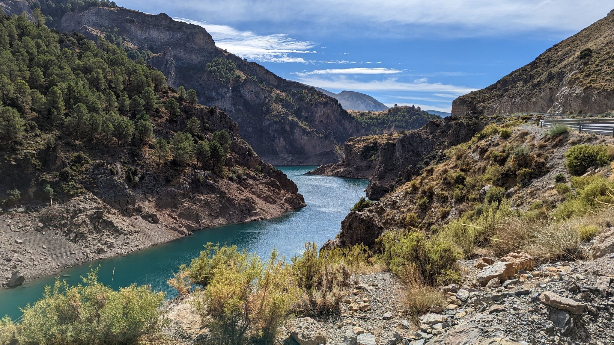
Easy hiking trails around Río Guadalete offer diverse landscapes, from lush riparian ecosystems along the riverbanks to scenic views of white villages. The river originates in the Sierra de Grazalema Natural Park, providing a backdrop of varied terrain, though easy routes focus on gentler paths. Hikers can experience verdant corridors with native vegetation and picturesque vistas of the river and reservoirs. The region's geology features limestone formations and fertile river plains, creating a mix of environments for accessible walks.
Best…
Last updated: June 30, 2026
3.9
(8)
42
hikers
6.10km
01:49
180m
180m
Easy hike. Great for any fitness level. Easily-accessible paths. Suitable for all skill levels.
4.7
(21)
175
hikers
Easy hike. Great for any fitness level. Easily-accessible paths. Suitable for all skill levels.

Sign up for free
4.8
(5)
21
hikers
3.76km
01:12
160m
160m
Easy hike. Great for any fitness level. Easily-accessible paths. Suitable for all skill levels.
5.0
(2)
9
hikers
Easy hike. Great for any fitness level. Easily-accessible paths. Suitable for all skill levels.
4.0
(2)
4
hikers
Easy hike. Great for any fitness level. Easily-accessible paths. Suitable for all skill levels.
5.0
(2)
6
hikers
Easy hike. Great for any fitness level. Easily-accessible paths. Suitable for all skill levels.
5.0
(1)
6
hikers
5.41km
01:27
60m
60m
Easy hike. Great for any fitness level. Easily-accessible paths. Suitable for all skill levels.
5.0
(2)
7
hikers
Easy hike. Great for any fitness level. Easily-accessible paths. Suitable for all skill levels.
3.5
(4)
30
hikers
Easy hike. Great for any fitness level. Easily-accessible paths. Suitable for all skill levels.
4.0
(1)
2
hikers
Easy hike. Great for any fitness level. Easily-accessible paths. Suitable for all skill levels.
Get access to more routes and recommendations from other explorers.
Sign up for free
Already have an account?
Our route recommendations are based on thousands of hikes, rides, and runs completed by other people on komoot.
Start today with a free account
Your next adventure awaits.
Login or Signup
Popular around Río Guadalete
Other adventures around Río Guadalete

Tips from the Community

Parador Mirador de Abades
0
0
A very original route with significant descents and ascents, but it's worth it.
0
0

Because of their sins, the figures are supposed to retrace Jesus' path from Palm Sunday for a week.
1
0

It's one of Andalusia's most iconic villages, perched on a rock with spectacular views of the Guadalete River. Its narrow, steep streets, whitewashed houses, and viewpoints invite you to wander leisurely. Furthermore, its historic center, declared a Historic-Artistic Site, perfectly reflects the essence of the White Villages.
0
0

This house-palace is located in Modesto Gómez Square number 1 (in the lower quarter) and was built in the 18th century. The facade of the building has a stone entrance, crowned by a coat of arms, also made of stone and finished with a marquis crown; it represents the surnames García, Veas, Gómez, Guerra, Sevillano, Lara and Ayllón. Inside there is a central patio around which the place is arranged.
7
0
The Mirador de Abades in Arcos de la Frontera is a wonderful place to admire the impressive views. From here you can see the Guadalete River and the beautiful Lago de Arcos, as well as the surrounding nature and the historic center of the city. It is a great place to enjoy a sunny day and the tranquility of nature. Please note that you will have to cycle back up, this is a dead end.
9
0
El Belén artístico El Camborio is a beautiful and impressive creation located in Arcos de la Frontera. It is a small museum that looks like a cave carved into the rock, in which beautiful treasures and scenes from the Gospel are depicted with great detail and craftsmanship. It is a place where the landscape changes from day to night, which makes it even more special.
9
0
The imposing tower of the Iglesia de Santa Maria dominates the central square of the old town. Here are also the town hall, the parador, located in the former home of the public prosecutor (Casa del Crooegidor), and the castle, now private. The terrace on the west side is above the valley and offers a beautiful view of the river gorge and the Iglesia de San Pedro. But when I passed by it was not accessible due to works.
9
0
Frequently Asked Questions
How many easy hiking trails are available around Río Guadalete?
There are over 50 easy hiking trails available around Río Guadalete, offering diverse landscapes from riverside paths to scenic views of historic white villages. In total, the region boasts more than 120 routes across various difficulty levels.
Are there family-friendly easy hikes along the Río Guadalete?
Yes, the Río Guadalete region is excellent for family-friendly easy hikes. Many routes feature gentle paths along the riverbanks, suitable for all ages. A notable option is the Majaceite River Trail, located in the Sierra de Grazalema, which is a 5km path (10km return) known for its low difficulty and beautiful clear water, perfect for families.
Can I bring my dog on easy trails in the Río Guadalete area?
While specific dog-friendly regulations can vary by trail and protected areas, many natural paths along the Río Guadalete are generally suitable for dogs, especially if kept on a leash. Always check local signage, particularly within natural parks like the Sierra de Grazalema, for any restrictions. The open nature of many riverside trails often makes them a good choice for walking with pets.
What kind of natural features or landmarks can I expect to see on easy hikes?
Easy hikes around Río Guadalete offer a variety of natural features and landmarks. You can expect lush riparian ecosystems with diverse vegetation like tamarisk and wild olive trees, scenic river views, and glimpses of reservoirs such as Embalse de Bornos. For specific points of interest, consider routes that pass by highlights like the View from the Mirador de Abades, offering panoramic vistas of Arcos de la Frontera, or sections of the Via Verde de la Sierra, which features old railway tunnels and viaducts.
Are there any easy circular routes around Río Guadalete?
Yes, several easy circular routes are available. For instance, the Guadalete River Trail is a 3.8-mile (6.1 km) circular path offering pleasant riverside views. Another popular choice is the Old Town of Arcos de la Frontera – View from the Mirador de Abades loop from Arcos de la Frontera, an easy 2.4-mile (3.9 km) loop providing stunning views of the iconic white village.
What is the best time of year for easy hiking around Río Guadalete?
The best time for easy hiking around Río Guadalete is typically during the spring (March to May) and autumn (September to November). During these seasons, temperatures are mild, and the landscapes are vibrant, with spring bringing wildflowers and autumn offering pleasant colors. Summers can be very hot, making early mornings or late afternoons preferable, while winters are generally mild but can have more rainfall.
Are there options for parking near the easy trailheads?
Yes, many easy hiking trails around Río Guadalete, especially those near towns like Arcos de la Frontera, offer accessible parking options. For routes starting directly from villages or popular viewpoints, you'll often find designated parking areas. It's always advisable to check specific route details for the most convenient parking locations.
How can I reach easy hiking trails around Río Guadalete using public transport?
Public transport options to reach trails around Río Guadalete vary. Towns like Arcos de la Frontera are generally well-connected by bus services from larger cities in the Cádiz province. From these towns, some easy trails, such as the Guadalete River Trail, are often accessible directly on foot. For more remote trailheads, a combination of public transport and a short taxi ride might be necessary.
What do other hikers say about the easy trails around Río Guadalete?
The easy trails around Río Guadalete are highly rated by the komoot community, with an average score of 4.5 stars from over 500 reviews. Hikers often praise the picturesque riverside paths, the stunning views of white villages like Arcos de la Frontera, and the overall accessibility of the routes. Many appreciate the blend of natural beauty and cultural sights.
What is the typical length and duration of easy hikes in this area?
Easy hikes around Río Guadalete typically range from 2.5 to 4.5 miles (4 to 7 kilometers) in length. Most can be completed within 1.5 to 2.5 hours, depending on your pace and how often you stop to enjoy the scenery. For example, the St. Peter's Church – Old Town of Arcos de la Frontera loop is about 4.0 miles (6.4 km) and takes approximately 1 hour 50 minutes.
Are there any easy trails that offer views of the white villages, like Arcos de la Frontera?
Absolutely! Many easy trails provide stunning views of the region's famous white villages. The Old Town of Arcos de la Frontera – View from the Mirador de Abades loop is a prime example, offering panoramic vistas of Arcos de la Frontera perched dramatically on its cliff. Another route, the View from the Mirador de Abades – St. Peter's Church loop, also provides excellent opportunities to admire the village's iconic architecture.
Are there cafes or places to eat near the easy hiking trails?
Yes, especially for trails that start or pass through towns and villages like Arcos de la Frontera or El Bosque. These locations offer a variety of cafes, restaurants, and bars where you can enjoy local cuisine and refreshments before or after your hike. For trails in more rural settings, it's advisable to pack your own snacks and drinks.
Are there any trails suitable for wheelchairs or strollers around Río Guadalete?
While many easy trails are relatively flat, dedicated wheelchair or stroller-accessible trails are less common in the natural areas. The Paseo del Río Guadalete in El Puerto de Santa María is a scenic riverfront promenade that is well-paved and suitable for leisurely strolls with wheelchairs or strollers. For natural trails, surfaces can be uneven, so checking specific route conditions is recommended.
Most popular routes around Río Guadalete
Most popular attractions around Río Guadalete

Get inspired with the komoot mobile app


Explore more
Browse the best Hikes in other regions.
