The best walks and hikes around Niederdorfelden
4.3
(88)
484
hikers
40
hikes
Hiking around Niederdorfelden offers varied landscapes, including the Nidda River and its renaturalized sections, as well as the confluence of the Nidder and Nidda rivers. The region features a network of trails with diverse terrain, ranging from easy paths to moderate routes with elevation gains. Many routes provide panoramic views of the Frankfurt skyline, blending natural scenery with distant urban vistas.
Best hiking trails around Niederdorfelden
- The most popular hiking route is View of the Frankfurt skyline – Große Loh Steles loop from Niederdorfelden, a 6.9 miles (11.1 km) trail that takes 2 hours 56 minutes to complete. This moderate route offers impressive panoramic views of the Frankfurt skyline.
- Another top favourite among local hikers is View of the Frankfurt skyline – View of the Frankfurt Skyline loop from Große Loh, an easy 4.6 miles (7.4 km) path. This trail is suitable for all fitness levels and features scenic river landscapes.
- Local hikers also love the Sundowner Place Hohe Loh – View of the Frankfurt Skyline loop from Niederdorfelden, a 4.1 miles (6.6 km) trail leading through varied terrain with distant views of the Frankfurt skyline, often completed in about 1 hour 47 minutes.
- Hiking around Niederdorfelden is defined by views of the Frankfurt skyline, the Nidda River landscape, and varied terrain. The network offers options for different ability levels, from easy strolls to more challenging moderate routes.
- The routes in Niederdorfelden are highly rated by the komoot community with an average score of 4.3 stars from over 80 reviews. More than 400 hikers have used komoot to explore Niederdorfelden's varied terrain.
Last updated: October 4, 2026
4.6
(23)
75
hikers
Moderate hike. Good fitness required. Easily-accessible paths. Suitable for all skill levels.
4.7
(6)
23
hikers
Moderate hike. Good fitness required. Easily-accessible paths. Suitable for all skill levels.

5.0
(2)
56
hikers
Moderate hike. Good fitness required. Easily-accessible paths. Suitable for all skill levels.
5.0
(7)
25
hikers
Easy hike. Great for any fitness level. Easily-accessible paths. Suitable for all skill levels.
4.7
(3)
17
hikers
Moderate hike. Good fitness required. Easily-accessible paths. Suitable for all skill levels.
Get access to more routes and recommendations from other explorers.
Already have an account?
Our route recommendations are based on thousands of hikes, rides, and runs completed by other people on komoot.
Start today with a free account
Your next adventure awaits.


Tips from the Community

From here you can start wonderful tours in several directions, great.
1
0
A section of the "Jakobsweg" from Fulda to Frankfurt also runs along the Hohen Straße.
1
0
The "gallows swing" and the "bird's nest swing" near the wind turbines on the Galgenberg are very popular.
1
0
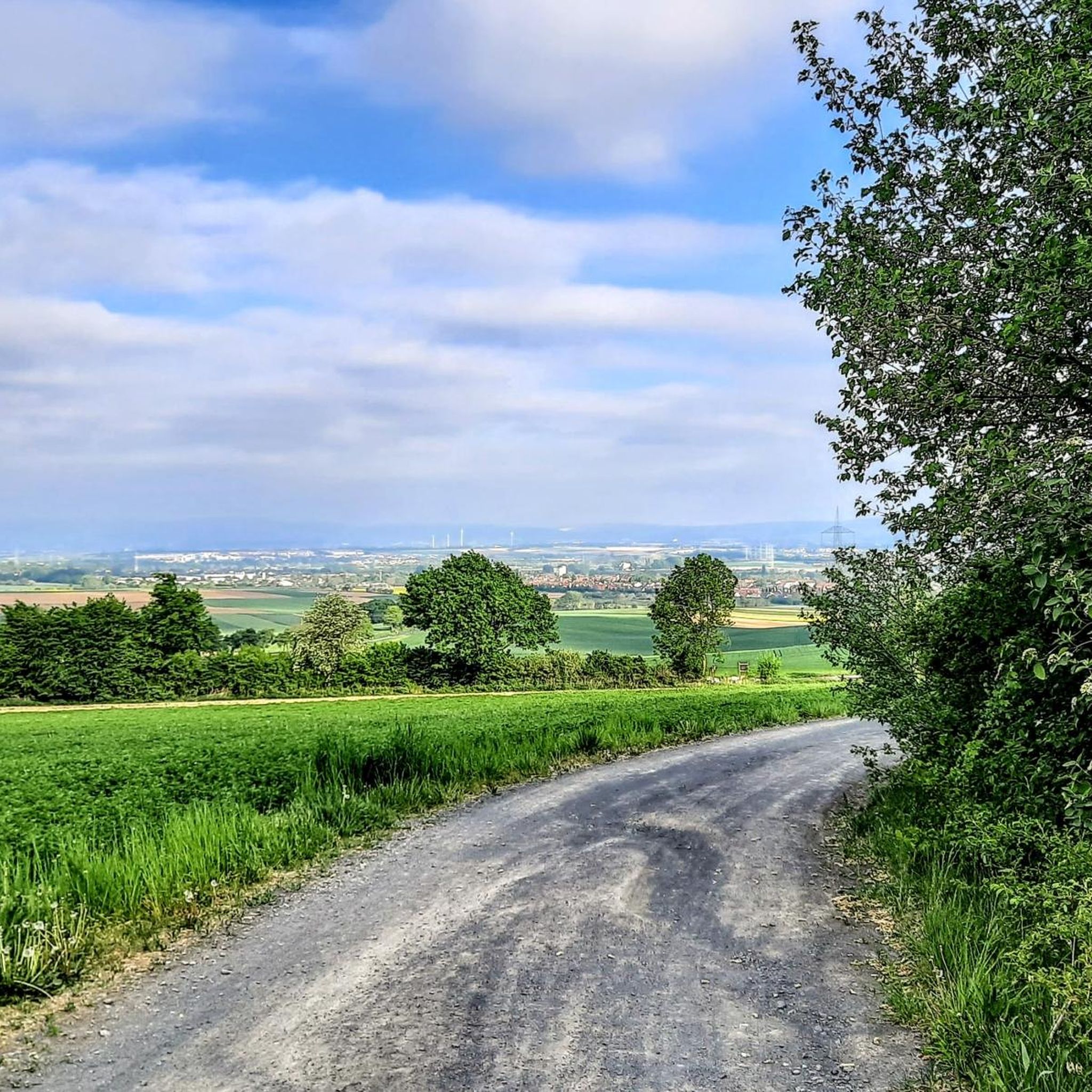
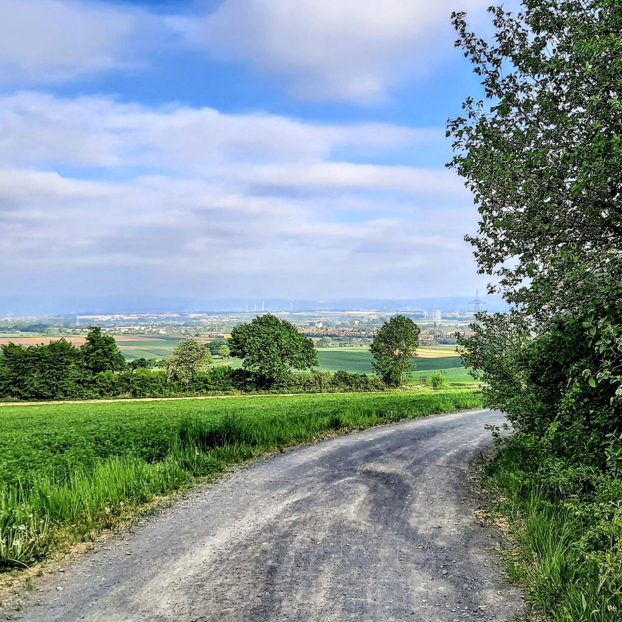
It is an ideal and idyllic spot on the edge of the forest near Hühnerberg, to take a break or rest and enjoy the view of the fantastic Frankfurt skyline.
2
0
Here you have a great panorama. You can see both the Spessart and the Odenwald. The Staudinger power plant with its tall chimneys is also clearly visible, great.
1
0
From here you have a great panoramic view.
2
0

Very nice
0
0
The view of the skyline is fascinating.
1
0
Frequently Asked Questions
How many hiking trails are available around Niederdorfelden?
There are over 40 hiking trails around Niederdorfelden, offering a variety of experiences for all skill levels. Approximately 30 of these routes are considered easy, making them suitable for casual walkers and families.
Are there easy hiking trails suitable for beginners or families in Niederdorfelden?
Yes, Niederdorfelden offers many easy and accessible paths suitable for all fitness levels, including families. For example, the View of the Frankfurt skyline – View of the Frankfurt Skyline loop from Große Loh is an easy 7.4 km path that takes about 2 hours to complete and features scenic river landscapes.
What kind of views can I expect on hikes around Niederdorfelden?
Many hiking routes in and around Niederdorfelden offer impressive panoramic views of the Frankfurt skyline, blending natural scenery with distant urban vistas. You can also enjoy the magnificent Nidda River landscape, especially in areas undergoing renaturalization, and the secluded confluence of the Nidder and Nidda rivers.
Are there any circular hiking routes in Niederdorfelden?
Yes, many trails around Niederdorfelden are designed as loops, providing convenient circular routes. Examples include the moderate View of the Frankfurt skyline – Große Loh Steles loop from Niederdorfelden and the easier Sundowner Place Hohe Loh – View of the Frankfurt Skyline loop from Niederdorfelden.
What are the typical distances and durations for hikes in Niederdorfelden?
Hikes in Niederdorfelden vary in length and duration. Easy trails can be as short as 6.6 km, taking around 1 hour 48 minutes, while moderate routes can extend to about 11.1 km, typically completed in under 3 hours. There are options for both shorter strolls and longer, more engaging walks.
What do other hikers enjoy most about hiking in Niederdorfelden?
The area is highly rated by the komoot community, with an average score of 4.3 stars from over 80 reviews. Hikers often praise the varied terrain, the beautiful Nidda River landscape, and the unique distant views of the Frankfurt skyline. The well-marked and maintained trails are also frequently highlighted.
Are there any notable natural attractions or landmarks to see along the trails?
Absolutely. A particularly beautiful and secluded spot is the Confluence of the Nidder and the Nidda rivers, which serves as an excellent resting point. You can also find viewpoints like the View of the Frankfurt skyline from Lohrberg and the View of the Vogelsberger See and Canyon Bridge. The Oberwaldsee near Dietesheim is another natural highlight in the vicinity.
What is the terrain like on hiking trails in Niederdorfelden?
The terrain around Niederdorfelden is varied, ranging from easy, accessible paths suitable for all fitness levels to moderate hikes that include some elevation gains. You'll find a mix of flat sections along the river and gentle ascents offering panoramic views.
Is Niederdorfelden a good destination for dog-friendly hiking?
While specific dog-friendly regulations can vary, the natural and varied landscapes of Niederdorfelden, with its extensive network of trails and river paths, generally offer a welcoming environment for hikers with dogs. Always ensure your dog is on a leash where required and respect local wildlife.
Are there any historical sites or cultural landmarks near the hiking routes?
Yes, in the broader region, you can explore sites such as Friedberger Warte, a historical site that can be incorporated into longer excursions or visited separately. The area primarily focuses on natural beauty but offers glimpses into regional history.
What is the best season for hiking in Niederdorfelden?
Niederdorfelden is enjoyable for hiking throughout much of the year. Spring and autumn offer pleasant temperatures and beautiful scenery, with blooming flowers or vibrant fall foliage. Summer is also suitable, especially for walks along the river, while winter can provide a unique, tranquil experience, though some paths might be muddy or icy.
Are there any longer, more challenging routes for experienced hikers?
While most routes are easy to moderate, some trails offer more extended distances and greater elevation changes for those seeking a challenge. For instance, the View of the Frankfurt skyline – Große Loh Steles loop from Hühnerberg is a moderate 12 km route with over 120 meters of elevation gain, providing a more demanding experience.
Most popular routes around Niederdorfelden
Most popular attractions around Niederdorfelden

Get inspired with the komoot mobile app


Explore more
Browse the best Hikes in other regions.
