The best traffic-free bike rides in Lake Tahoe Basin Management Unit
4.0
(1)
24
riders
6
rides
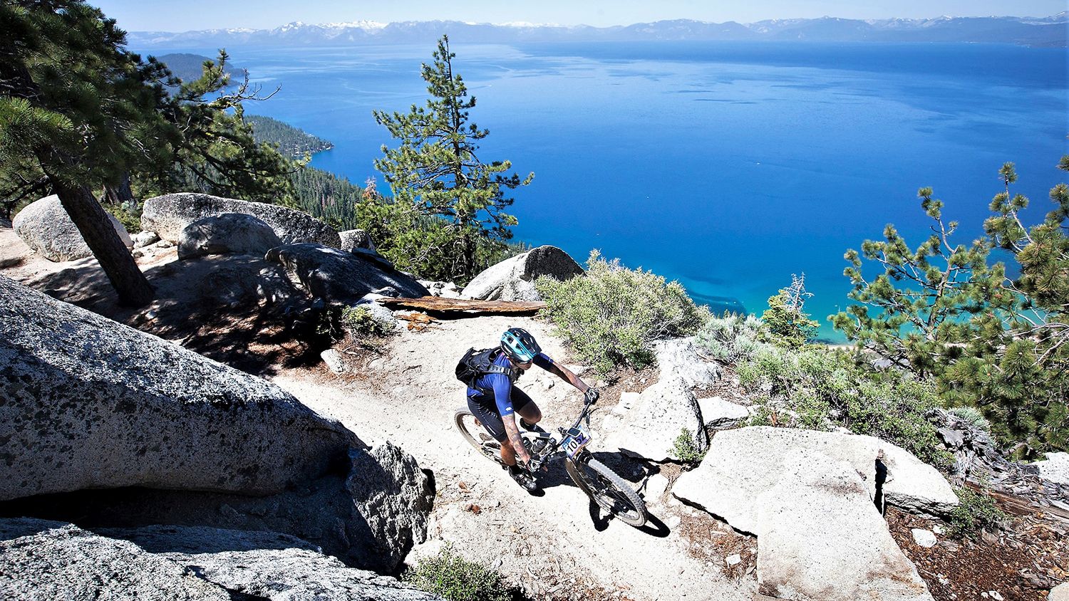
Gravel biking in Lake Tahoe Basin Management Unit offers diverse landscapes, from high mountain peaks to extensive pine forests and clear alpine lakes. The region's mountainous terrain, with elevations ranging from 6,225 feet to over 10,000 feet, provides varied challenges and scenic backdrops for no traffic gravel bike trails. Riders can expect a mix of paved segments, double track, and single track paths suitable for gravel bikes, often featuring panoramic mountain views and rolling terrain. This extensive trail network provides numerous opportunities for quiet routes away from vehicle traffic.
Best no traffic gravel bike trails in Lake Tahoe Basin Management Unit
- The most popular no traffic gravel bike trail is Marlette Flume and Tahoe Rim Trail Loop, a 22.4 miles (36.1 km) trail that takes 4 hours 16 minutes to complete. This difficult route combines two well-known trails, offering varied terrain and expansive views.
- Another top favourite among local gravel bikers is Antone Meadows Loop, a difficult 8.4 miles (13.5 km) path. This loop leads through open meadows, providing scenic vistas and a sense of solitude.
- Local gravel bikers also love the Marlette Lake – Marlette Flume Trail loop from Glenbrook, a 21.0 miles (33.9 km) trail leading through forested slopes and around Marlette Lake, often completed in about 3 hours 24 minutes.
- Gravel biking in Lake Tahoe Basin Management Unit is defined by mountainous terrain, dense pine forests, and alpine lakes. The network offers options for both challenging rides and more moderate excursions.
- The routes in Lake Tahoe Basin Management Unit are highly rated by the komoot community with an average score of 4.0 stars from a single review. More than 20 gravel bikers have used komoot to explore Lake Tahoe Basin Management Unit's varied terrain.
Last updated: July 7, 2026
2
riders
36.1km
04:17
930m
930m
Hard gravel ride. Very good fitness required. Mostly paved surfaces. Suitable for all skill levels.
2
riders
13.5km
01:23
150m
150m
Hard gravel ride. Good fitness required. You may need to push your bike for some segments of this route.

Sign up for free
7
riders
33.9km
03:25
730m
730m
Hard gravel ride. Very good fitness required. Mostly paved surfaces. Suitable for all skill levels.
1
riders
Moderate gravel ride. Good fitness required. Mostly paved surfaces. Suitable for all skill levels.
52.5km
06:14
1,380m
1,380m
Hard gravel ride. Very good fitness required. Mostly paved surfaces. Suitable for all skill levels.
Our route recommendations are based on thousands of hikes, rides, and runs completed by other people on komoot.
Start today with a free account
Your next adventure awaits.
Login or Signup
Popular around Lake Tahoe Basin Management Unit

American Discovery Trail — Walking from sea to shining sea

Tahoe Rim Trail — Hiking along the Jewel of the Sierra

American Discovery Trail — Riding coast to coast

California to Nevada – hiking between Volcanoes, Water & Forest
Rocky trails and magical views – MTB Tours in Nevada

Circumnavigating Lake Tahoe in the Sierra Nevada – Tahoe Rim Trail

Unforgettable MTB Adventures – IMBA Epic Trails in USA and Canada

Traffic-free bike rides in Lake Tahoe Basin Management Unit

Traffic-free bike rides in Lake Tahoe Basin Management Unit
Other adventures in Lake Tahoe Basin Management Unit


Tips from the Community

This is a fun, non-technical ride in its own right, and also an access route for the Capital to Tahoe Trail. Actually, it's arguably the longest access route — but it comes with the bonus of being able to bike straight to Lake Tahoe from urban Carson City.
0
0
Expect access to Marlette Lake to be pretty much nonexistent through 2026, as the nearby trails are closed for repairs at the Marlette Lake dam. You can get closure updates from Nevada State Parks: https://parks.nv.gov/news/trail-closures-at-spooner-lake-state-park-backcountry-for-marlette-dam-repairs
1
0
This forest service road is a popular approach route to Marlette Lake, but it's expected to be closed through 2026 for repairs to the Marlette Lake dam. Until this trail reopens, the Capital to Tahoe Trail is a good riding alternative in the area. You can get updates on the trail closure at Nevada State Parks: https://parks.nv.gov/news/trail-closures-at-spooner-lake-state-park-backcountry-for-marlette-dam-repairs
0
0

If you need a stop to refuel your energy levels, this is the spot for you. Enjoy the idyll and tranquility that you will find here.
1
0

Sunnyside Restaurant & Lodge is an upscale dining establishment right on the water of Lake Tahoe. It is also a getaway lodge with 23 guest rooms. It is a pretty place to visit year-round, as it is open in the summer and the winter.
0
0

This waterfront area at Lake Tahoe Park is known as William Kent Beach. It's common to spot boats out on the waters of the lake from here, and you can also find a restroom and water fountain.
0
0
The West Shore Trail takes walkers, bikers, and hikers on a paved route from Tahoe City to Meeks Bay. It can get busy, and for good reason; it's scenic and separate from cars. Enjoy this trail for most of the year; even sometimes during the winter, it can be clear from the snow, depending on the severity of the winter.
0
0

Dollar Property is a part of the Burton Creek State Park and hosts multiple nice multi-use tracks. They lead through the forested area and along little ponds and the name giving Dollar Creek.
0
0
Frequently Asked Questions
How many no-traffic gravel bike trails are available in the Lake Tahoe Basin Management Unit?
The Lake Tahoe Basin Management Unit offers a selection of 6 dedicated no-traffic gravel bike trails. These routes are carefully curated to provide a serene and car-free cycling experience amidst the stunning natural beauty of the region.
What makes the Lake Tahoe Basin Management Unit ideal for no-traffic gravel biking?
The Lake Tahoe Basin Management Unit is exceptional for no-traffic gravel biking due to its vast 156,000 acres of National Forest lands, offering diverse terrain from forested paths to high mountain views. The extensive trail networks, including segments of the Tahoe Rim Trail and various backcountry roads, provide a mix of surfaces perfect for gravel bikes, all while minimizing encounters with vehicle traffic for a peaceful ride.
What is the best time of year for no-traffic gravel biking in Lake Tahoe?
The best time for no-traffic gravel biking in the Lake Tahoe Basin Management Unit is typically from late spring through early fall. During these months, snowmelt has receded, and trails are generally dry and accessible. The region experiences pleasant temperatures and clear skies, making for ideal riding conditions. Winter riding is possible on some trails, but conditions can be challenging due to snow and ice, and many routes may be inaccessible.
What kind of terrain can I expect on these quiet gravel bike trails?
You can expect a varied terrain on the quiet gravel bike trails in the Lake Tahoe Basin Management Unit. Routes often feature a mix of double track, forest roads, and some single track, suitable for gravel bikes. You'll pedal through dense pine forests, rolling meadows, and ascend to granite peaks, offering both challenging climbs and scenic, undulating paths. The elevation ranges significantly, providing diverse experiences from lakeside routes to higher mountain trails.
Are there any beginner-friendly no-traffic gravel bike routes in the area?
While many routes in the Lake Tahoe Basin Management Unit are rated as difficult, there are options that can be more approachable. For a moderate challenge with beautiful scenery, consider the Sunnyside Restaurant & Lodge – West Shore Trail loop from Sunnyside-Tahoe City. This route offers a good introduction to gravel biking in the area without the extreme elevation gains of some other trails.
Are there challenging no-traffic gravel bike routes for experienced riders?
Absolutely. Experienced gravel bikers looking for a significant challenge will find several demanding no-traffic routes. The Marlette Flume and Tahoe Rim Trail Loop, for example, covers over 36 km with nearly 930 meters of elevation gain, offering a strenuous ride with incredible views. Another option is the Capital to Tahoe Trail, which is over 52 km long with more than 1380 meters of climbing.
Can I find any circular no-traffic gravel bike routes?
Yes, several no-traffic gravel bike routes in the Lake Tahoe Basin Management Unit are designed as loops, allowing you to start and end at the same point. Notable circular routes include the challenging Marlette Flume and Tahoe Rim Trail Loop, the shorter Antone Meadows Loop, and the scenic Marlette Lake – Marlette Flume Trail loop from Glenbrook.
What scenic viewpoints can I expect on these quiet gravel bike trails?
The quiet gravel bike trails in the Lake Tahoe Basin Management Unit offer numerous scenic viewpoints. Many routes provide stunning panoramic views of Lake Tahoe's clear blue waters, surrounding granite peaks, and dense forests. Specific highlights include vistas overlooking Emerald Bay, views from the Tahoe Rim Trail, and picturesque meadows. The mountainous terrain ensures dramatic backdrops throughout your ride.
Are there any waterfalls or lakes accessible from these no-traffic gravel bike routes?
Yes, the region is rich with natural water features. While directly on a gravel bike route, you might find access points or nearby trails leading to beautiful spots. For instance, the area around Eagle Falls Trailhead and View of Emerald Bay offers stunning views and access to Upper Eagle Falls and Eagle Lake (Desolation Wilderness). Other notable lakes include Granite Lake and Lower Echo Lake, which can be explored via connecting trails or nearby access points.
What do other gravel bikers enjoy most about gravel biking in Lake Tahoe Basin Management Unit?
The komoot community highly rates the Lake Tahoe Basin Management Unit for gravel biking, with an average score of 4.0 stars. Reviewers frequently praise the unparalleled natural beauty, the challenging yet rewarding terrain, and the opportunity to escape traffic and immerse themselves in the quiet wilderness. The stunning lake views, diverse ecosystems, and well-maintained trails are often highlighted as key attractions.
Are these no-traffic gravel bike trails suitable for families?
While many of the listed no-traffic gravel bike trails in the Lake Tahoe Basin Management Unit are rated as difficult, some sections or shorter routes might be suitable for families with older, more experienced children. For a more family-friendly experience, look for routes with less elevation gain and smoother surfaces. Always check the specific route details for distance and difficulty before heading out with children.
Can I bring my dog on these no-traffic gravel bike trails?
Regulations regarding dogs on trails in the Lake Tahoe Basin Management Unit can vary. While many National Forest lands are dog-friendly, some specific trails, especially within wilderness areas or sensitive habitats, may have restrictions or require dogs to be on a leash. It's always best to check the specific rules for each trail or area you plan to visit to ensure compliance and a safe experience for your pet and local wildlife.
Where can I find parking for these quiet gravel bike routes?
Parking for quiet gravel bike routes in the Lake Tahoe Basin Management Unit is typically available at designated trailheads or nearby public parking areas. Many popular routes, such as those accessing the Tahoe Rim Trail or areas around Marlette Lake, will have established parking lots. It's advisable to check the starting point of your chosen route on komoot for specific parking information and any potential fees or restrictions.
Most popular routes in Lake Tahoe Basin Management Unit
Most popular attractions in Lake Tahoe Basin Management Unit

Get inspired with the komoot mobile app


Explore more
Browse the best Gravel rides in other regions.
