The best family-friendly hikes and walks in Lake Tahoe Basin Management Unit
4.7
(523)
7,504
hikers
249
hikes
Family friendly hiking trails in Lake Tahoe Basin Management Unit traverse a landscape characterized by granite peaks, dense pine forests, and alpine lakes within the Sierra Nevada mountains. The region features glacially-carved valleys and basins, with common rock types including granodiorite and andesite. Many routes offer views of Lake Tahoe's clear waters. This area provides a diverse network of trails for various outdoor activities.
Best family friendly hiking trails in Lake Tahoe Basin Management Unit
- The most popular family friendly hiking route is Bayview and Eagle Lake Trail Loop, a 6.8 miles (10.9 km) moderate trail that takes 4 hours 9 minutes to complete, offering views of Eagle Lake and the surrounding wilderness.
- Another top favourite among local hikers is Vikingsholm, Lower Eagle Falls, and Rubicon Trail Loop, a moderate 7.5 miles (12.1 km) path. This route explores Emerald Bay, passing historic Vikingsholm Castle and Lower Eagle Falls.
- Local hikers also love the Spooner Lake Trail, a 2.7 miles (4.3 km) trail leading through forested areas around Spooner Lake, often completed in about 1 hour 10 minutes.
- Hiking in Lake Tahoe Basin Management Unit is defined by granite peaks, alpine lakes, and dense pine forests. The network offers options for various ability levels, from easy lakeside walks to more challenging mountain ascents.
- The routes in Lake Tahoe Basin Management Unit are highly rated by the komoot community with an average score of 4.7 stars from over 520 reviews. More than 7,400 hikers have used komoot to explore Lake Tahoe Basin Management Unit's varied terrain.
Last updated: July 8, 2026
4.9
(26)
177
hikers
10.9km
04:09
570m
570m
The Bayview and Eagle Lake Trail Loop takes you on a spectacular journey through the Desolation Wilderness, transitioning from shaded pine forests to open granite slabs and rugged alpine scenery. You'll encounter pristine alpine lakes like Granite Lake and Eagle Lake, and be rewarded with sweeping panoramic views of Lake Tahoe and the iconic Emerald Bay, including glimpses of Fannette Island. The route's diverse terrain and stunning natural features make it a memorable experience for those seeking a challenging day in the Sierra Nevada.
Planning your trip requires a bit of foresight, as permits are necessary for day hikes into the Desolation Wilderness and are typically available at the trailhead. The trail starts with a substantial uphill climb from the Bayview Trailhead, so an early start is advisable to make the most of your day. Be aware that winter conditions can bring frozen waterfalls and icy patches, potentially requiring specialized gear like crampons.
This 6.8-mile (10.9 km) loop, with its 1860 feet (567 metres) of elevation gain and estimated duration of 4 hours and 9 minutes, is officially rated moderate but often feels more demanding due to its continuous ascent and rocky sections. It serves as an excellent gateway into the raw beauty of the Desolation Wilderness, offering some of the most expansive views of Lake Tahoe and the surrounding Sierra Nevada mountains, making it a standout choice for experienced hikers.
4.6
(12)
111
hikers
12.1km
03:31
330m
330m
Embark on a scenic adventure around Emerald Bay with the Vikingsholm, Lower Eagle Falls, and Rubicon Trail Loop, a moderate 7.5-mile (12.1 km) hike that takes roughly 3 hours and 31 minutes. This route immerses you in continuous, sweeping vistas of Emerald Bay's striking turquoise waters, framed by towering granite cliffs and dense forests. You'll descend to the unique Vikingsholm mansion, explore the serene Lower Eagle Falls, and traverse sections of the Rubicon Trail, offering an intimate lakeside experience with views of Fannette Island.
While the initial descent to Vikingsholm is relatively easy, be ready for a strenuous uphill climb on the return, gaining approximately 400-500 feet in about a mile. The path to Lower Eagle Falls involves stairs, and parts of the Rubicon Trail can be steep and slick, especially after rain or in winter. Parking is available, but given the trail's popularity, arriving early is recommended to ensure a spot, particularly during peak season.
This loop is a must-do for anyone wanting to experience the iconic Lake Tahoe views and historical charm. It uniquely combines natural beauty, like the powerful cascades of Lower Eagle Falls fed by snowmelt in spring, with the architectural marvel of Vikingsholm Castle. The diverse scenery and blend of natural and historical landmarks make it one of the most rewarding and popular routes in the region.

Sign up for free
4.5
(4)
106
hikers
8.32km
02:15
120m
120m
Embark on the Emerald Point Trail for a moderate hike that takes you along Lake Tahoe's stunning shoreline. This 5.2-mile (8.3 km) route involves a gentle ascent of 385 feet (117 metres), typically completed in about 2 hours and 15 minutes. As you walk, you'll pass through fragrant forests of red firs and mixed pines, with constant views of the vibrant turquoise waters of Emerald Bay. The path eventually leads to Emerald Point, where a quiet, secluded beach awaits, offering a perfect spot to relax by the water. You can also catch glimpses of Fannette Island, the lake's only island, from various points along the way.
The trail is open throughout the year, but be aware that winter conditions might require you to bring microspikes or snowshoes for safe travel. Since this is a very popular destination, especially during peak season, consider starting your hike early in the morning for a more peaceful experience. Parking can be difficult to find, and you should expect to pay a fee to enter Emerald Bay State Park.
This route offers a unique perspective of Lake Tahoe's only island, Fannette Island, which sits prominently within Emerald Bay. The trail provides a chance to observe boaters, kayakers, and paddleboarders enjoying the alpine waters during warmer months. Reaching Emerald Point gives you access to a tranquil, secluded beach, making it a rewarding destination for a quiet break away from the main crowds.
5.0
(6)
94
hikers
17.0km
05:11
490m
460m
Embark on a challenging hike along the Pacific Crest Trail from Echo Lake to Lake of the Woods, a difficult route covering 10.6 miles (17.0 km). You will gain 1597 feet (487 metres) in elevation over approximately 5 hours and 10 minutes of hiking. As you traverse this section of the Desolation Wilderness, you will encounter dramatic rock outcroppings and ancient Sierra Juniper trees rooted in granite. The path winds past picturesque Lower and Upper Echo Lakes, offering expansive views towards Tamarack Lake and the majestic Crystal Range, including Pyramid Peak, before you climb towards the beautiful glacial Lake of the Woods.
Planning your visit requires careful attention to permits, as entry into the Desolation Wilderness is regulated. If you intend to stay overnight, remember that bear canisters are mandatory for your safety and to protect the wildlife. While the initial stretch along Echo Lakes presents a relatively flat start, be prepared for a consistent and demanding climb as you venture deeper into the wilderness. Always check current conditions and regulations before heading out.
This segment of the Pacific Crest Trail is renowned for its unique blend of rugged terrain and serene alpine beauty. You will experience a varied landscape, moving between rocky sections, open granite expanses, and welcome patches of tree cover. The route offers a profound sense of immersion in a pristine natural environment, making it a notable and rewarding experience for those seeking a strenuous yet scenic adventure in the Sierra Nevada.
5.0
(6)
93
hikers
4.34km
01:09
40m
50m
The Spooner Lake Trail offers a wonderfully accessible and scenic escape into the Lake Tahoe Nevada State Park. This easy 2.7-mile (4.3 km) loop takes you around the tranquil Spooner Lake, with a barely noticeable 137 feet (42 metres) of elevation gain, typically completed in just over an hour. You'll wander through fragrant pine forests and groves of aspens, enjoying continuous views of the lake, especially vibrant with wildflowers in spring or golden leaves in autumn. It's a perfect, gentle hike for all ages and fitness levels.
Planning your visit is straightforward, but remember there's an entrance fee to the state park. Dogs are welcome on the trail, provided they are on a leash. Beyond hiking, the lake is a popular spot for picnicking and fishing, though a Nevada fishing license is required for anglers. Spring and fall are particularly beautiful times to experience the trail, offering distinct seasonal charms.
More than just a simple loop, Spooner Lake Trail is a significant access point to a broader network of trails within the Lake Tahoe Basin. It connects to more challenging routes like sections of the Tahoe Rim Trail and the renowned Flume Trail, making it a versatile starting point for various adventures. Keep an eye out for local wildlife, including deer and various bird species, and learn about the area's natural history from informational signs along the path.
Get access to more routes and recommendations from other explorers.
Sign up for free
Already have an account?
Our route recommendations are based on thousands of hikes, rides, and runs completed by other people on komoot.
Start today with a free account
Your next adventure awaits.
Login or Signup
Popular around Lake Tahoe Basin Management Unit

American Discovery Trail — Walking from sea to shining sea

Tahoe Rim Trail — Hiking along the Jewel of the Sierra

California to Nevada – hiking between Volcanoes, Water & Forest

Circumnavigating Lake Tahoe in the Sierra Nevada – Tahoe Rim Trail

American Discovery Trail — Riding coast to coast
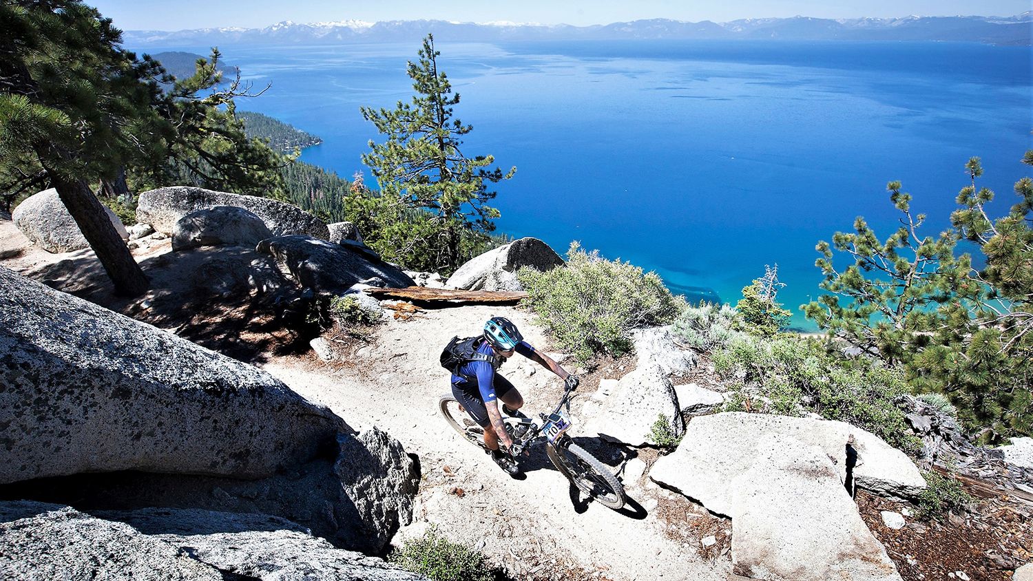
Rocky trails and magical views – MTB Tours in Nevada

Unforgettable MTB Adventures – IMBA Epic Trails in USA and Canada
Other adventures in Lake Tahoe Basin Management Unit


Tips from the Community

The Tahoe Rim Trail that is also the iconic Pacific Crest Trail in this section, the view of Lower Echo Lake is just breathtaking and a provides picture postcard scenery. Take your time, stop here and there and embrace this alpine paradise.
3
0

During our hike in mid October, we couldn’t see the waterfall as it was almost dried up. Considering the height of the bridge it must look stunning after the raining season.
0
0

Vikingsholm beach has a dock that is an L shape, and visitors can walk out on it and get a great view of Fannette Island and the white sandy shores of Emerald Bay. Enjoy the crystal clear blue water of Lake Tahoe, with an average clarity of 70.1 feet.
0
0

Vikingsholm is situated at the head of Emerald Bay in Lake Tahoe, and is renowned for its Scandinavian architectural style and stunning natural surroundings. Built in 1929 by Lora Josephine Knight, who was inspired by Scandinavian fjords, the estate is considered one of the finest examples of such architecture outside the Nordic countries. The property spans 232 acres, including Lake Tahoe's only island and a unique waterfall flowing directly into the lake. After Knight's death in 1945, the estate was sold to Lawrence Holland and later to Harvey West, who donated it to the State of California in 1953. Now part of the Harvey West Unit of Emerald Bay State Park, Vikingsholm is open for tours from June to September, accessible via a one-mile trail or by boat. There is a visitor center, beach access, hiking trail access at this spot.
0
0
The trailhead for the popular hike up to Eagle Falls is right off of the main Emerald Bay Road in South Lake Tahoe. Before you even begin your hike you get great views of Emerald Bay. Although there is a large parking lot, it can fill up fast, so be sure to get here early or carpool.
0
0

This is a pretty little lake, nestled in the heart of a dense poplar forest. A small quiet corner where it is good to take a break.
0
0

This backcountry gem is right on the path to and from Maggie's Peaks — a great opportunity to take a relaxing dip or just enjoy the beauty if you want to keep running past.
0
0
This is a pretty little lake, nestled in the heart of a dense poplar forest. A small quiet corner where it is good to take a break.
0
0
Frequently Asked Questions
How many family-friendly hiking trails are available in the Lake Tahoe Basin Management Unit?
The Lake Tahoe Basin Management Unit offers a fantastic selection of family-friendly hikes. You'll find over 240 routes in total, with more than 120 specifically categorized as easy, making them perfect for families with children of all ages.
What do other hikers enjoy most about the family-friendly trails in Lake Tahoe Basin Management Unit?
The komoot community highly rates the family-friendly trails in this area, with an average score of 4.7 out of 5 stars from over 500 reviews. Hikers often praise the stunning panoramic views of Lake Tahoe, the clear alpine lakes, and the well-maintained paths that make for enjoyable outings with kids.
Are there any family-friendly trails with waterfalls in the Lake Tahoe Basin Management Unit?
Yes, several family-friendly trails offer beautiful waterfall views. For a rewarding experience, consider the area around Cascade Falls Trailhead or Upper Eagle Falls. The Vikingsholm, Lower Eagle Falls, and Rubicon Trail Loop is a moderate option that includes views of Lower Eagle Falls.
Which trails are suitable for strollers or toddlers?
For families with strollers or toddlers, flatter and well-maintained paths are ideal. The Spooner Lake Trail is an excellent easy option, offering a relatively flat loop around the lake. Many sections of the Tahoe Rim Trail also offer gentle terrain suitable for younger children, though specific stroller accessibility can vary.
Can I bring my dog on family-friendly hikes in the Lake Tahoe Basin Management Unit?
Many trails within the Lake Tahoe Basin Management Unit are dog-friendly, but it's crucial to check specific regulations for each trail and always keep your dog on a leash. Remember to pack out all waste. Areas within the Desolation Wilderness, however, have stricter rules and require permits, which also apply to dogs.
Are there any circular routes that are good for families?
Absolutely! Circular routes are great for families as they bring you back to your starting point without retracing steps. The Spooner Lake Trail is a popular easy loop. For a moderate option with stunning views, consider the Bayview and Eagle Lake Trail Loop.
What are some interesting landmarks or attractions to see along the family-friendly trails?
The region is rich with natural beauty and historical sites. Along many trails, you'll encounter breathtaking views of Lake Tahoe. The Vikingsholm, Lower Eagle Falls, and Rubicon Trail Loop offers a chance to see the historic Vikingsholm Castle and the scenic Emerald Bay. You might also spot Upper Eagle Falls or the serene Eagle Lake.
What is the best time of year for family hiking in the Lake Tahoe Basin Management Unit?
The best time for family hiking is typically from late spring through early fall (May to October). During these months, trails are generally clear of snow, temperatures are pleasant, and wildflowers are in bloom. Summer offers warm weather perfect for swimming in alpine lakes, while fall brings beautiful foliage. Always check current trail conditions before heading out.
Is parking available at the trailheads for family-friendly hikes?
Most popular trailheads in the Lake Tahoe Basin Management Unit have designated parking areas. However, during peak season and on weekends, these can fill up quickly. Arriving early in the morning is highly recommended. Some parking areas may require a fee, so be prepared with cash or a credit card.
Are there any permits required for family hikes in the Lake Tahoe Basin Management Unit?
For most day hikes on established trails, permits are not required. However, if your family plans to venture into the federally designated Desolation Wilderness, a permit is mandatory, even for day use. It's always best to check with the Lake Tahoe Basin Management Unit for the most current permit requirements before your trip.
Can we reach any family-friendly trailheads using public transport?
While many trailheads are best accessed by car, some public transportation options exist, particularly around the more developed areas of Lake Tahoe. The Tahoe Transportation District (TART) operates routes that may get you close to certain trailheads. It's advisable to check their schedules and routes in advance to plan your journey.
Are there any easy, shorter hikes perfect for young children?
Yes, there are several easy and short options ideal for young children. The Spooner Lake Trail is a gentle loop that's perfect for little legs. Many interpretive trails, like the Taylor Creek Rainbow Trail (not in guide data, but a known easy trail in the region), also offer short, engaging walks with educational signage.
Most popular routes in Lake Tahoe Basin Management Unit
Most popular attractions in Lake Tahoe Basin Management Unit

Get inspired with the komoot mobile app


Explore more
Browse the best Hikes in other regions.
