The best traffic-free bike rides in Dixie National Forest
6
riders
4
rides
If you've ever tried to plan gravel biking in Dixie National Forest, you know how quickly the sheer number of options can become overwhelming. It’s tough to tell which routes are genuinely worth your time and effort, and which are just filler. That's where we come in. Our komoot community has ridden, reviewed, and curated the very best routes, so you don't have to spend hours sifting through maps. Consider this your shortcut to the good stuff.
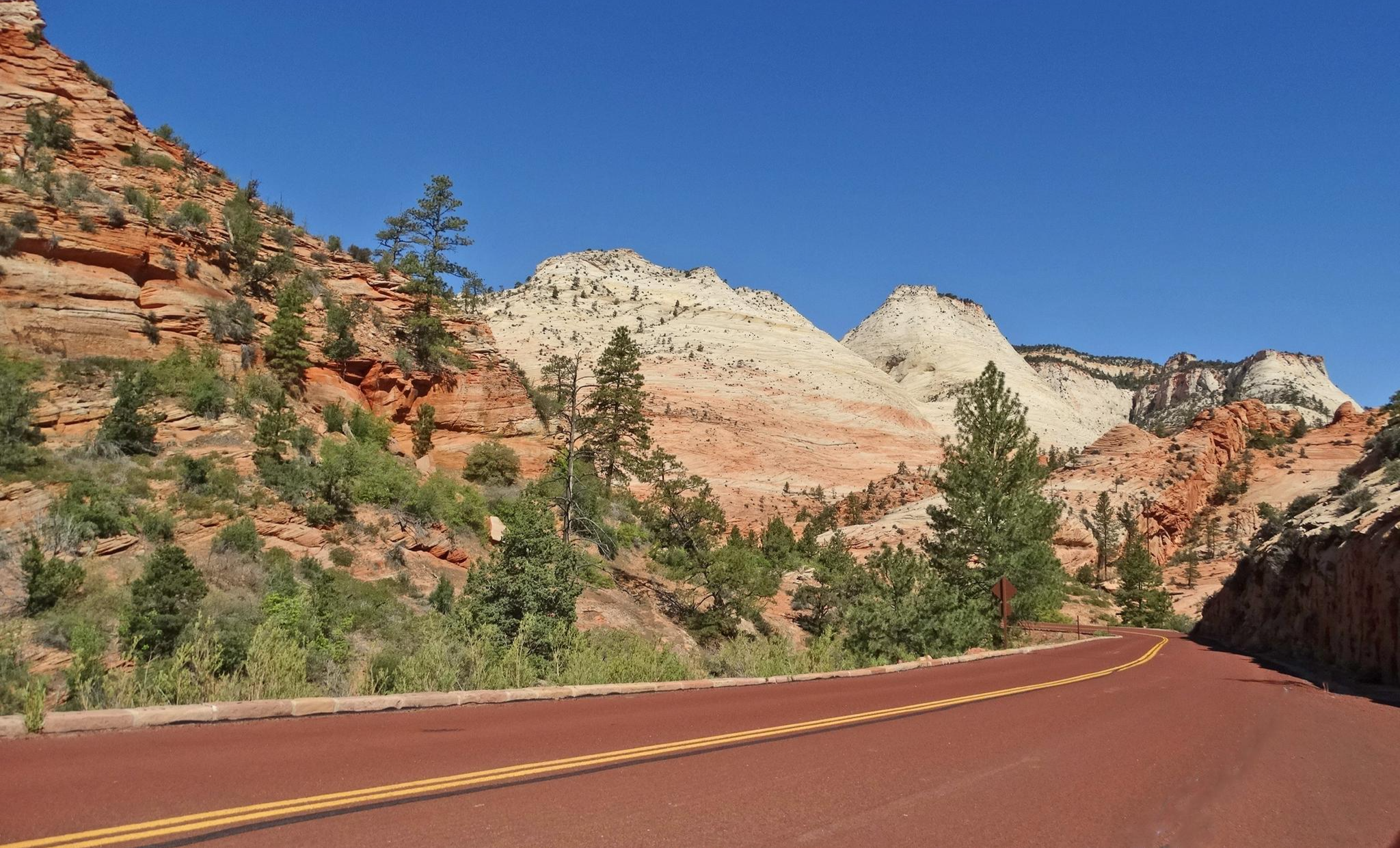
Gravel biking here is an experience unlike any other, defined by a stunning contrast of vibrant red rock formations and cool, high mountain forests. You'll find everything from expansive plateaus to deep canyons, with significant elevation changes that keep things interesting. The terrain ranges from desert-like plants at lower elevations to dense pine, juniper, aspen, and conifer forests higher up. Just remember, the prime season for gravel biking in Dixie National Forest runs from late spring to early fall, offering the best conditions before the snows arrive.
If you're looking for an easy, scenic introduction, the Daves Hollow Loop is a fantastic choice, offering 10.1 miles (16.2 km) through beautiful ponderosa pine forests. For something a bit more challenging that still delivers incredible views, we love the Kanarra Mountain Road – C-Overlook loop from Cedar City, a demanding 35.0 miles (56.4 km) with substantial elevation gain through varied mountain terrain. With komoot, you're ready to explore the best of Dixie National Forest.
Last updated: May 11, 2026
16.2km
01:26
160m
160m
The Daves Hollow Loop offers a scenic gravel biking experience through the Dixie National Forest, winding through beautiful ponderosa pine forests and open meadows. You'll ride on a largely unpaved doubletrack dirt road, which can become muddy and rutted after rain, particularly past the old watering troughs. Keep an eye out for an osprey family nesting in the trees, especially when traveling south towards Tropic Reservoir, adding a touch of wildlife viewing to your ride.
This 10.1-mile (16.2 km) route, with 512 feet (156 metres) of elevation gain, is rated as difficult and typically takes around 1 hour and 26 minutes. It's easily accessible directly from Ruby's Inn guest rooms and RV/campground sites, making it a convenient option for those staying nearby. Always check trail conditions, especially after rain, and note the spring along Dave's Hollow for water refills.
The Daves Hollow Loop is notable for its historical interest, traversing an old sheep herding area from the late 1800s, complete with 120-year-old dug-out trees that once served as watering troughs. It's also part of the Great Western Trail - Utah and connects with the Bryce Canyon Multi-use Path, offering a versatile and well-maintained path that's even groomed for cross-country skiing in winter.
12.2km
00:59
80m
80m
The Navajo Lake Loop Trail offers a unique gravel biking adventure, circling the beautiful Navajo Lake through diverse terrain. You'll ride through cool pine, fir, and aspen forests, encountering sections of packed dirt and singletrack. A distinctive feature is navigating ancient lava fields on the eastern side, where the trail can be bumpy with "toothed boulders" and broken lava chunks, providing a memorable experience for those seeking natural features on Navajo Lake gravel biking routes.
Planning your visit is straightforward; the trail is generally open from late June through September, providing a high-altitude escape from summer heat. No permits or fees are typically needed for day use, and leashed dogs are welcome. Given its popularity, arriving early for parking is advisable, and always carry enough water for this 7.6-mile (12.2 km) loop.
This difficult route, with 272 feet (83 metres) of elevation gain and an estimated duration of 59 minutes, is notable for its unique geology, as the lake itself was formed by an ancient lava flow. It also connects to other trails like the Virgin River Rim Trail, offering options for extended rides. The high altitude, around 9,100 feet, adds an extra layer of challenge and makes it a cool destination.

Sign up for free
2
riders
56.4km
04:57
1,340m
1,340m
Hard gravel ride. Very good fitness required. Mostly paved surfaces. Suitable for all skill levels.
3
riders
Embark on a demanding gravel biking journey through the heart of Utah's stunning red rock country with the Scenic Byway 12 – Escalante Petrified Forest loop. This route plunges you into a world of vibrant sandstone cliffs and high mesas, offering panoramic views across the Grand Staircase–Escalante National Monument. You'll navigate a challenging mix of paved and gravel surfaces, winding past ancient petrified wood formations near the State Park and through diverse desert landscapes. It's a ride that promises geological marvels and a sense of remote adventure.
This difficult 42.1-mile (67.8 km) gravel biking loop, with its substantial 3690 feet (1125 metres) of elevation gain, is best suited for riders with very good fitness and advanced skills. Expect to spend around 4 hours and 34 minutes on the saddle, tackling strenuous climbs and descents. The route begins at Escalante Petrified Forest State Park, so plan for parking there and ensure you carry all necessary supplies, as services are scarce in this remote area.
What makes this route truly stand out is its integration of the iconic All-American Road Scenic Byway 12, renowned for its unparalleled beauty, with the rugged backcountry of the Grand Staircase–Escalante National Monument. Beyond the challenging ride, you'll be cycling through a landscape rich in geological history, with the vibrant petrified wood at the State Park offering a unique starting point. This is a top-rated gravel biking experience for those seeking both a physical test and breathtaking scenery.
Our route recommendations are based on thousands of hikes, rides, and runs completed by other people on komoot.
Start today with a free account
Your next adventure awaits.
Login or Signup


Other adventures in Dixie National Forest

Tips from the Community

This is a well-paved road with open views of the valley, good visibility for traffic, and space for cars to pass. You can connect to a handful of other roads which take you further into the canyons.
0
0

Escalante Petrified Forest State Park preserves a stunning collection of fossilized trees, some over 135 million years old, scattered across a high desert mesa. Here, you'll see colorful logs turned to stone and panoramic views of Wide Hollow Reservoir. There are places to camp, canoe, hike, or ride through this beautiful area, making it a great place to spend a weekend just outside of Escalante.
0
0

This multi-use path runs from Bryce Canyon City to Inspiration Point, offering an easy ride with amazing views of the park. The trail is family-friendly and a great way to explore away from the main roads.
0
0
Ruby's Inn Road is connected with Daves Hollow Road and Bryce Canyon Multi-use Path, making a loop around Bryce Canyon City. The road is mostly dirt mixed with rock compacted, suitable for an easy-going gravel trip with beautiful views.
0
0

The singletrack loop around this lake is one of the most popular trails in Dixie National Forest. You have some altitude here — the lake sits at more than 9,000 feet in elevation — but the trail is only somewhat technical, so it's reasonably accessible for a lot of riders.
0
0
Kanarra Mountain Road is a dirt road that provides a steady climb with some rough sections. It's a good option for those seeking for a mix of gravel and rocky terrain. Be prepared for some steep grades and carry plenty of water, as there are limited amenities along the route.
0
0

The East Bench Trail is a paved, 5.5-mile trail that runs along the eastern part of Cedar City. It is a popular trail, so there is a good chance you will see others out on the trail.
0
0

Petrified wood is a type of fossilized wood created when tree remains undergo a mineralization process, often involving replacement by stone. While individual pieces of petrified wood are common, this area features several large trunks shimmering in various colors. The hike through this area is stunning, offering many views of colorful, fossilized tree stumps, a rewarding experience.
0
0
Frequently Asked Questions
How many no-traffic gravel bike trails are available in Dixie National Forest?
Dixie National Forest offers a selection of no-traffic gravel bike trails. This guide features 4 routes that are specifically curated for a traffic-free experience, ranging from moderate to challenging.
What kind of terrain can I expect on gravel bike trails in Dixie National Forest?
You'll encounter a diverse range of terrain, from smooth gravel roads winding through ponderosa pine forests to more rugged paths with significant elevation changes. The forest transitions dramatically from vibrant red rock formations to high mountain forests and alpine lakes, offering varied surfaces and scenic backdrops.
When is the best time of year to go gravel biking in Dixie National Forest?
The best time for gravel biking in Dixie National Forest is typically from late spring through early fall (May to October). During these months, the weather is generally pleasant, and most trails are free of snow. Higher elevations might remain snow-covered into early summer, so checking local conditions is always recommended.
Are there any scenic loop trails for gravel biking in Dixie National Forest?
Yes, there are several scenic loop options. For example, the Navajo Lake Loop Trail offers beautiful lake views and traverses unique lava field terrain. Another option is the Daves Hollow Loop, which takes you through peaceful ponderosa pine forests.
What natural features or landmarks can I see while gravel biking in Dixie National Forest?
The forest is rich with unique geological formations. You can encounter stunning red rock formations, especially around the Red Canyon area, which features distinctive scarlet hues. Highlights like the Pink Ledges Trail and the Red Canyon Visitor Center are great places to experience these. You might also see alpine lakes, high mountain forests, and panoramic viewpoints like Powell Point.
Is parking readily available near the gravel bike trails?
Parking is generally available at trailheads and visitor centers throughout Dixie National Forest. The Red Canyon Visitor Center, for instance, serves as a hub with parking and information for nearby biking routes. It's always a good idea to check specific route details for recommended parking areas.
Are there any specific regulations or permits needed for gravel biking in Dixie National Forest?
Generally, no special permits are required for gravel biking on established forest roads and trails within Dixie National Forest. However, always respect posted signs, stay on designated routes, and be aware of any specific regulations for wilderness areas or sensitive ecosystems. For general information about the forest, you can visit Visit Utah's Dixie National Forest page.
Can I bring my dog on the gravel bike trails in Dixie National Forest?
Many trails and forest roads in Dixie National Forest are dog-friendly, provided your dog is on a leash and you practice Leave No Trace principles. Always check specific trail regulations before heading out, as some areas, particularly within designated wilderness or sensitive wildlife habitats, may have restrictions.
Are there options for family-friendly gravel biking?
While many routes in this guide are rated as 'difficult' due to elevation and distance, Dixie National Forest does offer easier gravel paths suitable for families. Routes like the Daves Hollow Loop, though listed as difficult in this guide, are described in regional research as easy gravel experiences through ponderosa pine forests, which might be suitable for more adventurous families.
What towns are good bases for gravel biking in Dixie National Forest, offering amenities?
Towns like Cedar City and Escalante serve as excellent bases for exploring the gravel trails in Dixie National Forest. These towns offer various amenities including accommodation, dining, and supplies. Cedar City is a good starting point for routes like the Kanarra Mountain Road – C-Overlook loop, while Escalante is ideal for the Scenic Byway 12 – Escalante Petrified Forest loop.
What makes the Red Canyon area special for gravel biking?
The Red Canyon area, often called a 'mini-Bryce Canyon,' is renowned for its brilliant scarlet rock formations set against deep green ponderosa pines. Gravel biking here offers stunning visual contrasts and unique geological features. The Red Canyon Visitor Center is a central point for accessing trails and learning more about the area's distinct beauty.
What wildlife might I encounter while gravel biking?
Dixie National Forest is home to a diverse array of wildlife. Depending on the elevation and habitat, you might spot bighorn sheep, elk, deer, antelope, and various bird species. Black bears also inhabit the forest, so it's important to be aware of your surroundings and practice bear-safe habits.
Most popular routes in Dixie National Forest
Most popular attractions in Dixie National Forest

Get inspired with the komoot mobile app


