The best traffic-free bike rides in Dixie National Forest
4.6
(44)
398
riders
11
rides
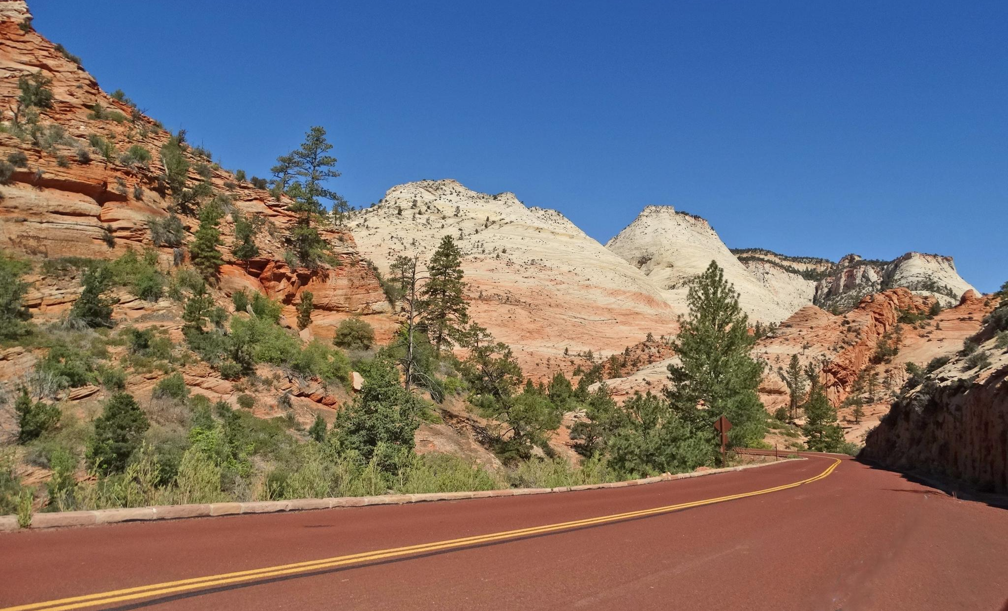
No traffic touring cycling routes in Dixie National Forest traverse nearly two million acres of diverse landscapes across southern Utah. The region is characterized by vibrant red rock formations, high mountain forests, and alpine lakes, offering varied terrain for cyclists. Elevations range significantly, providing both desert and lush mountain environments. This varied topography creates a scenic and engaging backdrop for touring cyclists.
Best no traffic touring cycling routes in Dixie National Forest
- The most popular no traffic touring cycling route is Powell Point, a difficult 21.3 miles (34.4 km) trail that takes 3 hours 42 minutes to complete. This route offers panoramic views of southern Utah's expansive landscapes.
- Another top favourite among local touring cyclists is Long Canyon Overlook loop from Boulder, a difficult 34.6 miles (55.8 km) path. This trail winds through high mountain forests and offers views of alpine lakes in the Boulder Mountain area.
- Local touring cyclists also love the Petrified Forest and Sleeping Rainbows Trail, a 2.3 miles (3.7 km) trail leading through distinctive red rock formations, often completed in about 26 minutes.
- Touring cycling in Dixie National Forest is defined by red rock formations, high mountain forests, and alpine lakes. The network offers options for different ability levels, from easy paths to challenging climbs.
- The routes in Dixie National Forest are highly rated by the komoot community with an average score of 4.5 stars from more than 30 reviews. More than 400 touring cyclists have used komoot to explore Dixie National Forest's varied terrain.
Last updated: July 7, 2026
34.4km
03:42
840m
840m
The Powell Point touring cycling route offers a challenging ride through Dixie National Forest, leading to some of southern Utah's most expansive vistas. You'll traverse unpaved, rough roads and singletrack, passing through mixed conifer forests and ancient bristlecone pines, before reaching the stunning 'Titanic viewpoint' at Powell Point. From this high-altitude perch, you'll be treated to nearly 300-degree panoramic views of iconic landscapes like Bryce Canyon National Park and the Grand Staircase-Escalante National Monument.
This difficult 21.3 miles (34.4 km) route, with its 2768 feet (844 metres) of elevation gain, typically takes around 3 hours and 42 minutes to complete. Be prepared for high-altitude conditions, including potential quick weather changes and cold temperatures year-round. There is no water available on the trail, so carry all you need. Early in the season, expect possible snowy patches and downed trees, making a robust gravel or mountain bike essential.
Powell Point is not just about the views; it's also geologically significant, showcasing the highest layer of the Colorado Plateau's Grand Staircase-Escalante National Monument. The white rocks at the point are from the Claron Formation, similar to those in Bryce Canyon. Historically, John Wesley Powell's expedition made the first ascent here in 1872, adding another layer of intrigue to this remarkable touring cycling destination.
5.0
(1)
17
riders
14.4km
00:59
180m
180m
Pedal through the heart of Bryce Canyon National Park on the Lower Inspiration Point – Bryce Point loop, a touring cycling route that delivers stunning vistas of the Bryce Amphitheater. This moderate 9.0-mile (14.4 km) ride, with 586 feet (179 metres) of elevation gain, guides you along a paved Shared-Use Path, offering close-up views of the park's iconic hoodoos. You'll pass through diverse ecosystems, from pine forests to high meadows, culminating in panoramic overlooks like Inspiration Point and Bryce Point, where the 'Silent City' of hoodoos unfolds before you.
While the 58-minute duration suggests a quick ride, be ready for some notably steep sections, especially as you approach Inspiration Point. The path is generally accessible, making it a great option for families, and e-bikes are a smart choice to help conquer the inclines. Remember that all cycling must remain on paved surfaces within the park, and a convenient park shuttle service can transport bikes, allowing for a mostly downhill return if you prefer.
This loop is a fantastic way to experience Bryce Canyon's unique geology and vibrant colors without the constant presence of vehicle traffic, thanks to the dedicated Shared-Use Path. The contrasting white, pink, and orange limestone and sandstone formations create a visual spectacle unlike anywhere else. It's an ideal route for those seeking a rewarding touring cycling experience that combines natural beauty with a good workout.

Sign up for free
9
riders
54.9km
03:44
950m
950m
The "Long Canyon Overlook loop from Boulder" is a demanding touring cycling route that plunges you into the heart of Boulder's challenging terrain. While the Long Canyon itself is a lush, singletrack hiking trail known for ancient paper birch trees and spring wildflowers, this cycling route likely skirts the area, focusing instead on the region's formidable climbs. You'll experience the dramatic changes in scenery that Boulder is famous for, from the urban fringe to the rugged foothills, with views of the iconic Flatirons unfolding as you gain elevation.
Planning your ride requires preparation for significant effort. This difficult 34.1-mile (54.9 km) route involves a substantial 3116 feet (950 metres) of elevation gain, typically taking around 3 hours and 43 minutes to complete. Access to many of Boulder's challenging cycling routes is convenient from the city itself. Be sure to carry adequate hydration and nutrition, and consider tackling this ride in the spring or fall when weather conditions are most favorable for sustained climbs.
Boulder is renowned as a training ground for professional cyclists, and this route embodies that spirit, offering a taste of the area's demanding topography. Beyond the specific loop, the region boasts an extensive network of roads, including famous climbs like Flagstaff Mountain and Magnolia Road, providing endless opportunities for advanced cycling. The vibrant cycling culture and stunning natural features, from high mountain vistas to picturesque canyons, make Boulder a premier destination for those seeking a serious two-wheeled adventure.
5.0
(25)
13
riders
21.1km
01:22
210m
210m
Moderate bike ride. Good fitness required. Mostly paved surfaces. Suitable for all skill levels.
3.69km
00:26
130m
130m
Step into a landscape frozen in time on the Petrified Forest and Sleeping Rainbows Trail, where ancient logs have transformed into vibrant, colorful stone. This rugged path, best explored on foot, winds through pinyon and juniper trees, revealing an extraordinary concentration of petrified wood specimens. The highlight is the "Sleeping Rainbows" section, where logs shimmer with reds, oranges, and blues, offering a truly unique visual experience.
While Komoot lists this as an easy touring cycling route, the 2.3-mile (3.7 km) trail with 415 feet (127 metres) of elevation gain is actually quite challenging due to its rocky terrain and steep sections, especially on the Sleeping Rainbows loop. It's primarily a hiking trail, taking about 26 minutes for a cyclist, but much longer and more strenuous for hikers. Plan to arrive early to secure parking and bring plenty of water, as the trail offers little shade.
This trail is a geological marvel, showcasing the incredible process of petrification that turned ancient trees into stone, colored by various minerals. You'll also enjoy scenic views of Wide Hollow Reservoir and the distant pink cliffs of Bryce Canyon National Park. It's a fantastic option for those seeking a short, impactful hike with a high concentration of unique natural features in Escalante Petrified Forest State Park.
Get access to more routes and recommendations from other explorers.
Sign up for free
Already have an account?
Our route recommendations are based on thousands of hikes, rides, and runs completed by other people on komoot.
Start today with a free account
Your next adventure awaits.
Login or Signup


Other adventures in Dixie National Forest

Tips from the Community

From here the entire canyon unfolds before you, from Grand Staircase-Escalante to Bryce Canyon. The jeep road becomes a singletrack a little ways before you reach the overlook, with teaser views out across the multicolored cliffs and bluffs.
0
0

The Sleeping Rainbows Trail is a scenic 0.8-mile loop celebrated for its vibrant display of petrified wood. As you explore the trail, you’ll encounter fossilized logs with brilliant hues of red, purple, and gold, shaped by mineral deposits over millions of years. Though it's a short loop, the trail provides a fascinating look into ancient geological processes, and will definately leave a lasting impression.
0
0
The Petrified Forest Trail climbs steeply from the parking lot, with breathtaking views of Wide Hollow Reservoir before looping through a piñon-juniper woodland. Along the ridge, you'll see plenty of chunks of petrified wood—fossilized trees transformed by minerals over millions of years. The trail connects to Sleeping Rainbows Trail— a steeper loop with the park's densest concentration of beautiful and colorful petrified logs.
0
0
Escalante Petrified Forest State Park preserves a stunning collection of fossilized trees, some over 135 million years old, scattered across a high desert mesa. Here, you'll see colorful logs turned to stone and panoramic views of Wide Hollow Reservoir. There are places to camp, canoe, hike, or ride through this beautiful area, making it a great place to spend a weekend just outside of Escalante.
0
0
Lower Inspiration Point is a fantastic spot over Bryce Amphitheater, with views of the dense clusters of hoodoos known as the Silent City. The short, unpaved trail from the parking area leads to a fenced overlook with sweeping views to the north. It’s a quieter alternative to the park’s busier viewpoints and is especially stunning at sunrise or after dark under the starry sky.
0
0
The Long Canyon Overlook is a fantastic spot with incredible sweeping views of the Circle Cliffs and the Henry Mountains in the distance. The overlook is typically quiet, with minimal traffic—making it a perfect spot to take a break in solitude and enjoy the beauty of Grand Staircase-Escalante.
0
0

Coal Creek Trail is a paved path that runs alongside the river and passes by Veterans Park, connecting with the park and other trails in the area. The park serves as a memorial to those who fought in various wars, with dedicated sections, including one honoring the 240 Korean soldiers who won a battle against a much larger army without any casualties.
0
0
This is a smooth paved trail following the river all the way. It’s a perfect trail to contemplate the landscape and see the different layers of rock that form the canyon. Along the way, you can find informative boards explaining the geology.
0
0
Frequently Asked Questions
How many no traffic touring cycling routes are available in Dixie National Forest?
Dixie National Forest offers a good selection of no traffic touring cycling routes. There are 13 routes in total, with 4 easy, 7 moderate, and 2 difficult options to choose from, catering to various skill levels.
What do other touring cyclists enjoy most about these routes in Dixie National Forest?
The komoot community highly rates the no traffic touring cycling routes in Dixie National Forest, with an average score of 4.5 out of 5 stars from 35 ratings. Cyclists frequently praise the stunning red rock formations, the diverse landscapes ranging from high mountain forests to alpine lakes, and the peaceful, car-free experience these routes provide.
Are there easy no traffic touring cycling routes suitable for beginners or families?
Yes, there are several easy no traffic touring cycling routes perfect for beginners or families. One excellent option is the Petrified Forest and Sleeping Rainbows Trail, which is just under 4 km long. Additionally, the Bryce Canyon Multi-use Path is a moderate, paved, and family-friendly option offering excellent views near Bryce Canyon National Park.
Are there challenging no traffic touring cycling routes for experienced riders?
Absolutely. For experienced riders seeking a challenge, the Powell Point route is a difficult 34 km ride with over 840 meters of elevation gain, offering stunning panoramic views of southern Utah. Another demanding option is the Long Canyon Overlook loop from Boulder, a 55 km route with nearly 1000 meters of ascent.
What natural monuments can I see along these routes?
Dixie National Forest is rich in natural monuments. Along or near these routes, you can encounter the distinctive red rock landscapes and unique hoodoos, particularly in areas like Red Canyon. Specific highlights include the Pink Ledges Trail and the Red Canyon Arch, both showcasing the region's striking geology.
Are there specific attractions or points of interest near the no traffic touring cycling routes?
Yes, there are several attractions and points of interest. The Red Canyon Visitor Center is a great starting point for information and maps. You can also find the Bryce Canyon Multi-use Path, which provides access to incredible views of Bryce Canyon National Park. For those looking to stay overnight, Ruby's Inn RV Park and Campground is also nearby.
What is the best time of year for no traffic touring cycling in Dixie National Forest?
The best time for touring cycling in Dixie National Forest is typically from late spring through early fall. During these months, the weather is generally mild, and the higher elevation routes are free of snow. Summer offers lush greenery in the mountain areas, while spring and fall provide comfortable temperatures and vibrant colors, especially the red rock formations.
Are there any loop touring bike trails in Dixie National Forest?
Yes, loop routes are available for touring cyclists. The Long Canyon Overlook loop from Boulder is a challenging 55 km option. For a moderate experience, consider the Lower Inspiration Point – Bryce Point loop from Bryce Canyon Lodge, which is about 14 km long.
Where can I find parking for these no traffic touring cycling routes?
Parking is generally available at key access points and visitor centers throughout Dixie National Forest. For routes near Red Canyon, the Red Canyon Visitor Center often serves as a convenient hub with parking facilities. For other routes, look for designated parking areas at trailheads or near popular attractions mentioned in the route descriptions.
Are permits required for touring cycling in Dixie National Forest?
Generally, permits are not required for day-use touring cycling on established trails and roads within Dixie National Forest. However, if you plan to camp overnight in undeveloped areas, engage in commercial activities, or access specific wilderness areas, special permits might be necessary. It's always best to check the official U.S. Forest Service website or contact a local ranger district for the most current regulations.
Can I cycle near Bryce Canyon National Park on a no traffic route?
Yes, you can! The Bryce Canyon Multi-use Path is a fantastic option. This paved, moderate, and family-friendly path extends from Bryce Canyon City to Inspiration Point, offering excellent views of Bryce Canyon National Park without vehicle traffic.
Most popular routes in Dixie National Forest
Most popular attractions in Dixie National Forest

Get inspired with the komoot mobile app


Explore more
Browse the best Cycling routes in other regions.
