The best traffic-free bike rides in Warren County
44
riders
6
rides
Road cycling in Warren County offers diverse terrain across its share of the Allegheny National Forest. The region is characterized by hilly landscapes, dense woodlands, and scenic routes along the Allegheny River and Conewango Creek. Cyclists can expect a mix of moderate climbs and winding paths, with elevations generally under 200m considered hills. This environment provides varied no traffic road cycling routes suitable for different experience levels.
Best no traffic road cycling routes in Warren County
- The most popular no…
Last updated: July 7, 2026
8
riders
77.8km
05:44
530m
530m
Hard road ride. Very good fitness required. Some segments of this route may be unpaved and difficult to ride.
9
riders
21.3km
00:55
120m
120m
Easy road ride. Great for any fitness level. Mostly well-paved surfaces and easy to ride.

Sign up for free
3
riders
62.1km
03:39
420m
420m
Moderate road ride. Good fitness required. Some segments of this route may be unpaved and difficult to ride.
3
riders
64.9km
03:13
530m
530m
Moderate road ride. Good fitness required. Mostly well-paved surfaces and easy to ride.
2
riders
81.8km
03:35
610m
610m
Moderate road ride. Good fitness required. Mostly well-paved surfaces and easy to ride.
Our route recommendations are based on thousands of hikes, rides, and runs completed by other people on komoot.
Start today with a free account
Your next adventure awaits.
Login or Signup
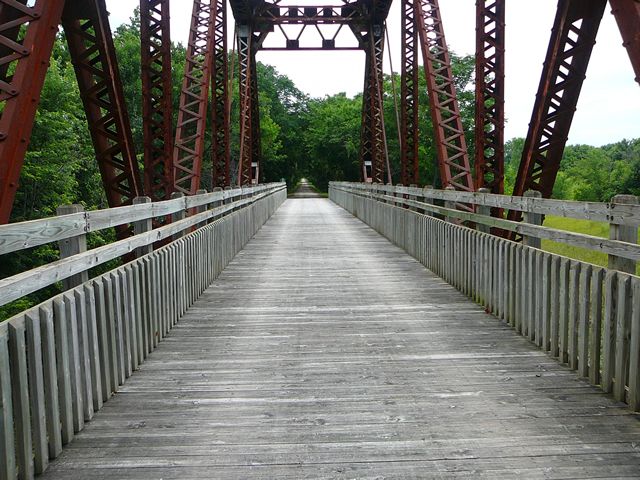
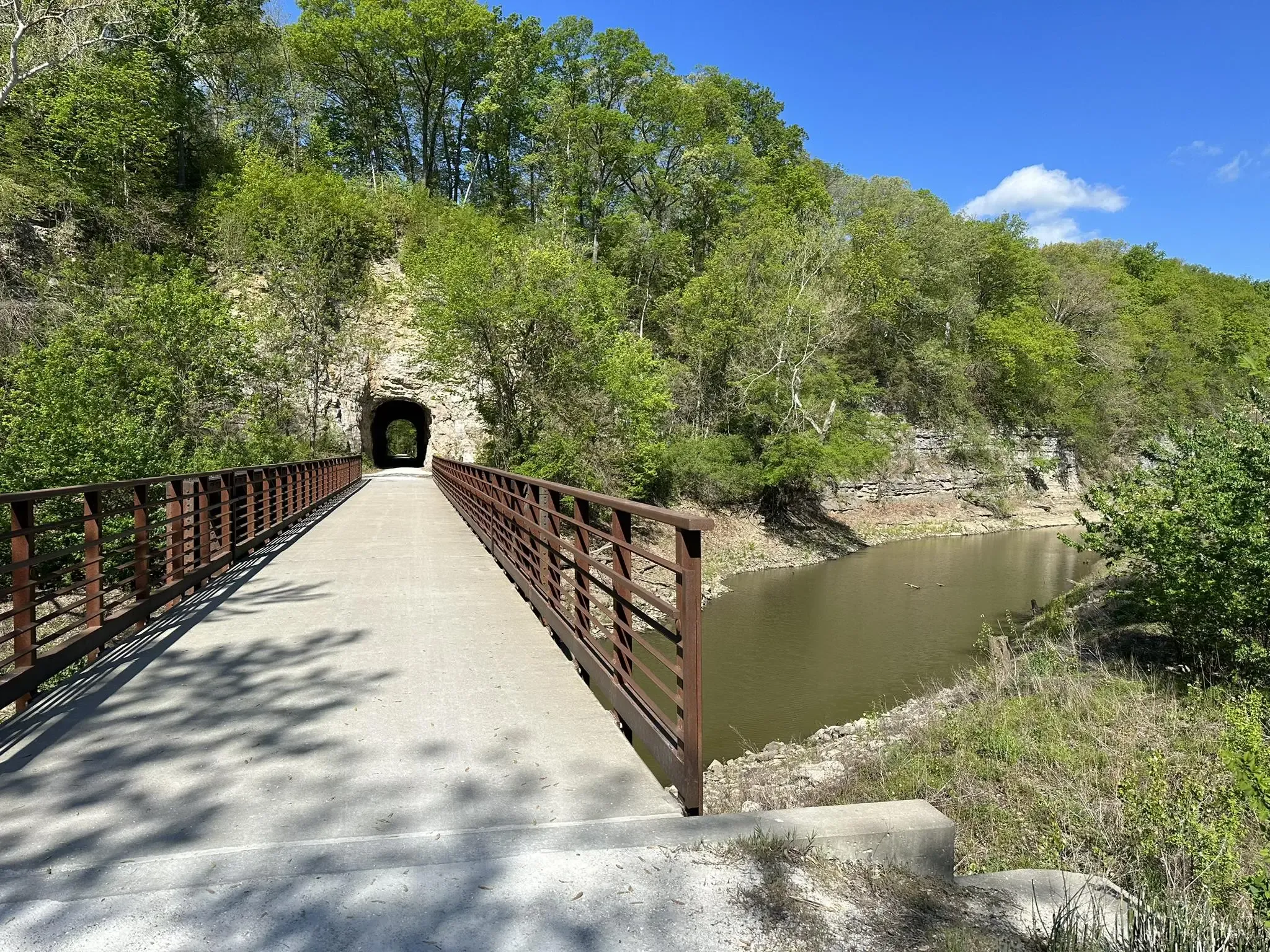


Tips from the Community

Known locally as “Devil’s Boot Cave,” this natural overhang carved in sandstone resembles the shape of a boot and stretches roughly 25 feet deep and wide, near Marthasville. Once used as a pioneer shelter and noted by local schools for nature trips, the site offers a little geological curiosity beside the trail—a hands-on reminder of Missouri’s limestone landscape and early frontier life. Great for a quick stop and photo op!
0
0

Fantastic trail along the Missouri. Can be busy with pedestrians.
0
0
Frequently Asked Questions
How many no-traffic road cycling routes are available in Warren County?
There are currently 6 dedicated no-traffic road cycling routes available in Warren County, offering a range of distances and difficulties for various skill levels.
What kind of terrain and elevation can I expect on no-traffic road cycling routes in Warren County?
Warren County, situated on the Allegheny Plateau, features a hilly and varied terrain. You can expect routes with moderate climbs and descents, offering both challenging sections and scenic, winding paths. For example, the Bums Cave loop from Marthasville includes over 530 meters of elevation gain, while the Rotary Riverfront Trail loop is much flatter with just over 100 meters of elevation.
Are there any easy, flat, no-traffic road cycling routes suitable for beginners or families?
Yes, for an easier and flatter experience, the Rotary Riverfront Trail loop from Washington High School is classified as easy, covering about 21.8 kilometers with minimal elevation gain. Additionally, the Warren to North Warren Bike Trail, a paved multi-use path along Conewango Creek, offers a pleasant, off-road experience, with plans for expansion to 11 miles.
What natural features and viewpoints can I see along these routes?
Many routes offer stunning views of the Allegheny National Forest, Allegheny Reservoir, and the Allegheny River. You might encounter breathtaking vistas at locations like Rimrock Overlook or Jakes Rocks Overlook. The Longhouse National Scenic Byway, a 29-mile paved route, provides stunning views around the Kinzua arm of the Allegheny Reservoir. While specific waterfalls like Hector Falls or Bent Run Waterfall might require a short detour or hike, the general landscape is rich with natural beauty.
What is the best time of year for no-traffic road cycling in Warren County?
The spring, summer, and fall months generally offer the best conditions for road cycling in Warren County. The vibrant foliage in autumn provides particularly scenic rides. While winter cycling is possible, be prepared for colder temperatures and potential snow or ice, especially on less-maintained roads.
Are there any circular no-traffic road cycling routes available?
Yes, several routes are designed as loops. For instance, the Roadbike loop from Warrenton and the Aspenetter Lake – Alpine Lake loop from Brandi Lake are both moderate-difficulty circular routes, allowing you to start and end at the same point without retracing your path.
How long are the no-traffic road cycling routes in Warren County?
The routes vary significantly in length. You can find shorter options like the Rotary Riverfront Trail loop at approximately 21.8 kilometers, up to longer, more challenging rides such as the Bums Cave loop from Marthasville, which spans nearly 78 kilometers.
Are there any specific paved trails for no-traffic road cycling?
Yes, the Warren to North Warren Bike Trail is a notable paved, multi-use trail that offers a dedicated off-road experience along Conewango Creek. While currently 3 miles are open, there are plans to expand it to 11 miles, providing a safe and scenic option away from vehicular traffic.
What are some of the longer, more challenging no-traffic road cycling routes?
For those seeking a greater challenge, the Bums Cave loop from Marthasville is classified as difficult, covering almost 78 kilometers with over 530 meters of elevation gain. The Aspenetter Lake – Alpine Lake loop from Brandi Lake is another substantial moderate route at nearly 65 kilometers with significant climbing.
Are there any unique natural heritage areas accessible by road bike in Warren County?
Warren County is home to significant natural heritage areas like Hearts Content Scenic Area, Tamarack Swamp, and Tionesta Scenic and Research Natural Areas. While direct road access might vary, routes often traverse the Allegheny National Forest, providing a connection to the unique ecological features of the region. For more information on National Natural Landmarks in the county, you can visit the NPS website.
What other outdoor activities can I combine with a road cycling trip in Warren County?
Warren County offers a wealth of outdoor activities. Chapman State Park provides opportunities for hiking, swimming, fishing, and boating. The Allegheny Reservoir and River are popular for water sports, and the extensive Allegheny National Forest is ideal for hiking and wildlife viewing, making it easy to combine cycling with other adventures.

Get inspired with the komoot mobile app


Explore more
Browse the best Road cycling routes in other regions.
