Routes

Planner

Features

Updates

App

Login or Signup

Get the App

Login or Signup

Routes
Hikes
United States

Maryland

The best walks and hikes in Maryland

4.6

(815)

10,800

hikers

1,163

hikes

Hiking in Maryland offers diverse terrain, from the Appalachian Mountains in the west to coastal plains along the Atlantic. The state features extensive woodlands, river valleys, and varied elevation profiles. This landscape provides a range of hiking experiences, including mountain trails, riverside paths, and coastal routes.

Best hiking trails in Maryland

  • The most popular hiking route is Great Falls Overlook via Billy Goat Trail Section A, a 6.0 miles (9.7 km) trail that takes about 2 hours 37 minutes to complete. This difficult route involves rock scrambling along the Potomac River.
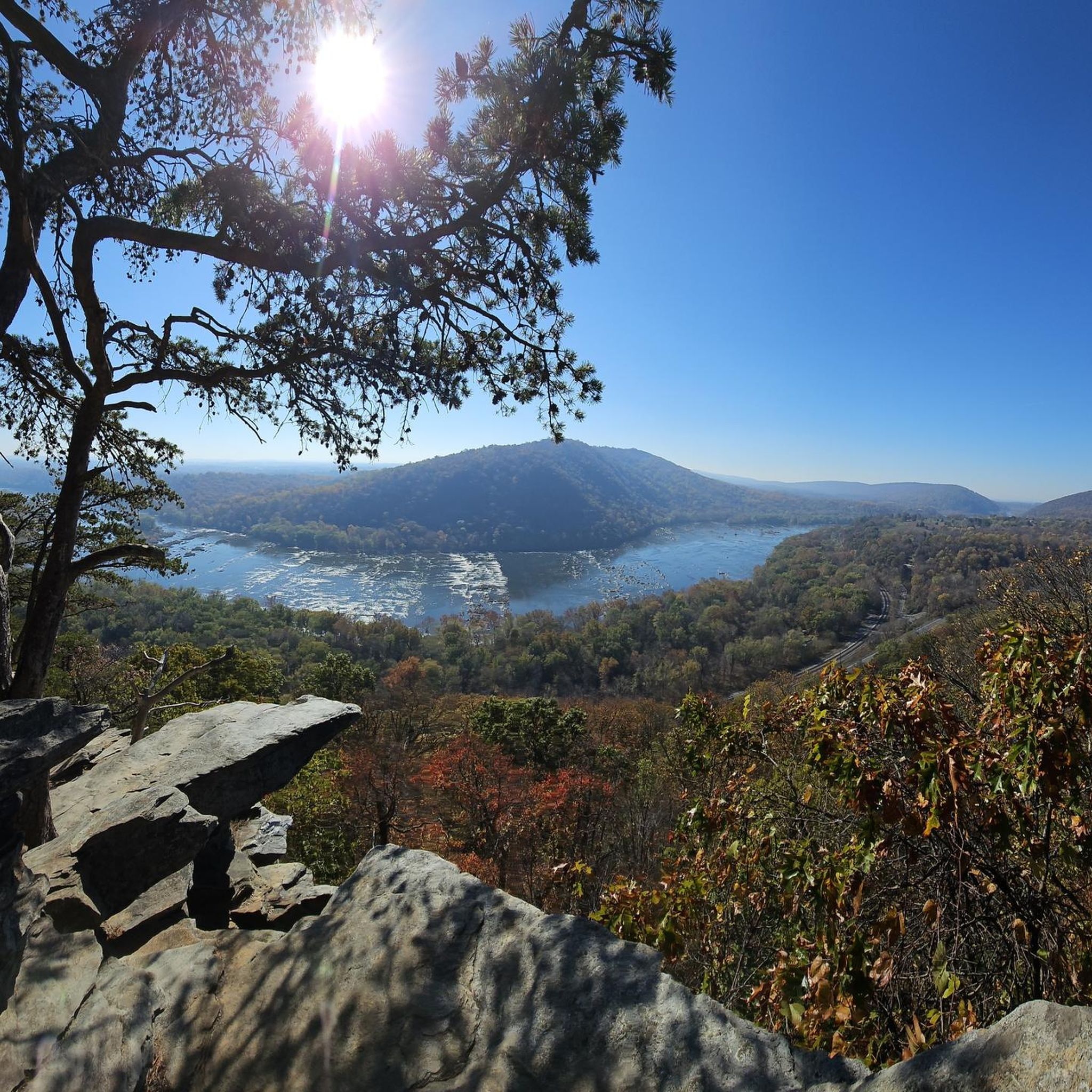
  • Another top favourite among local hikers is Maryland Heights via Harper's Ferry, a moderate 4.1 miles (6.6 km) path. This route offers views of the historic town of Harper's Ferry and the surrounding landscape.
  • Local hikers also love the Annapolis Rock and Black Rock via Appalachian Trail, a 6.6 miles (10.6 km) trail leading through South Mountain State Park, often completed in about 3 hours 3 minutes.
  • Hiking in Maryland is defined by mountain trails, riverside paths, and coastal routes. The trail network includes options for different ability levels, from easy family-friendly hikes to more challenging climbs.
  • The routes in Maryland are highly rated by the komoot community with an average score of 4.6 stars from over 790 reviews. More than 10,000 hikers have used komoot to explore Maryland's varied terrain.

Last updated: June 24, 2026

4.8

(40)

485

hikers

#1.

Great Falls Overlook via Billy Goat Trail Section A

9.70km

02:38

50m

70m

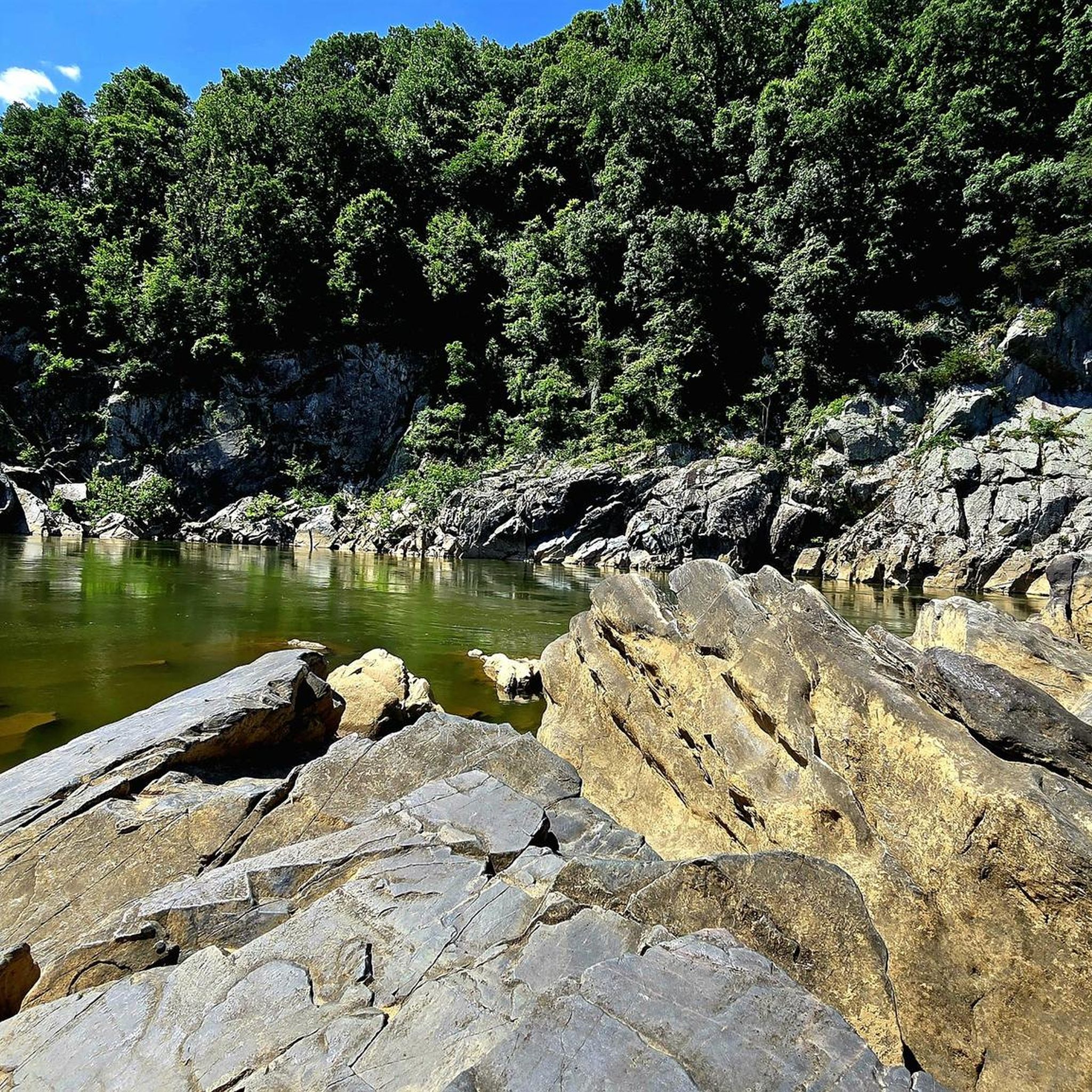
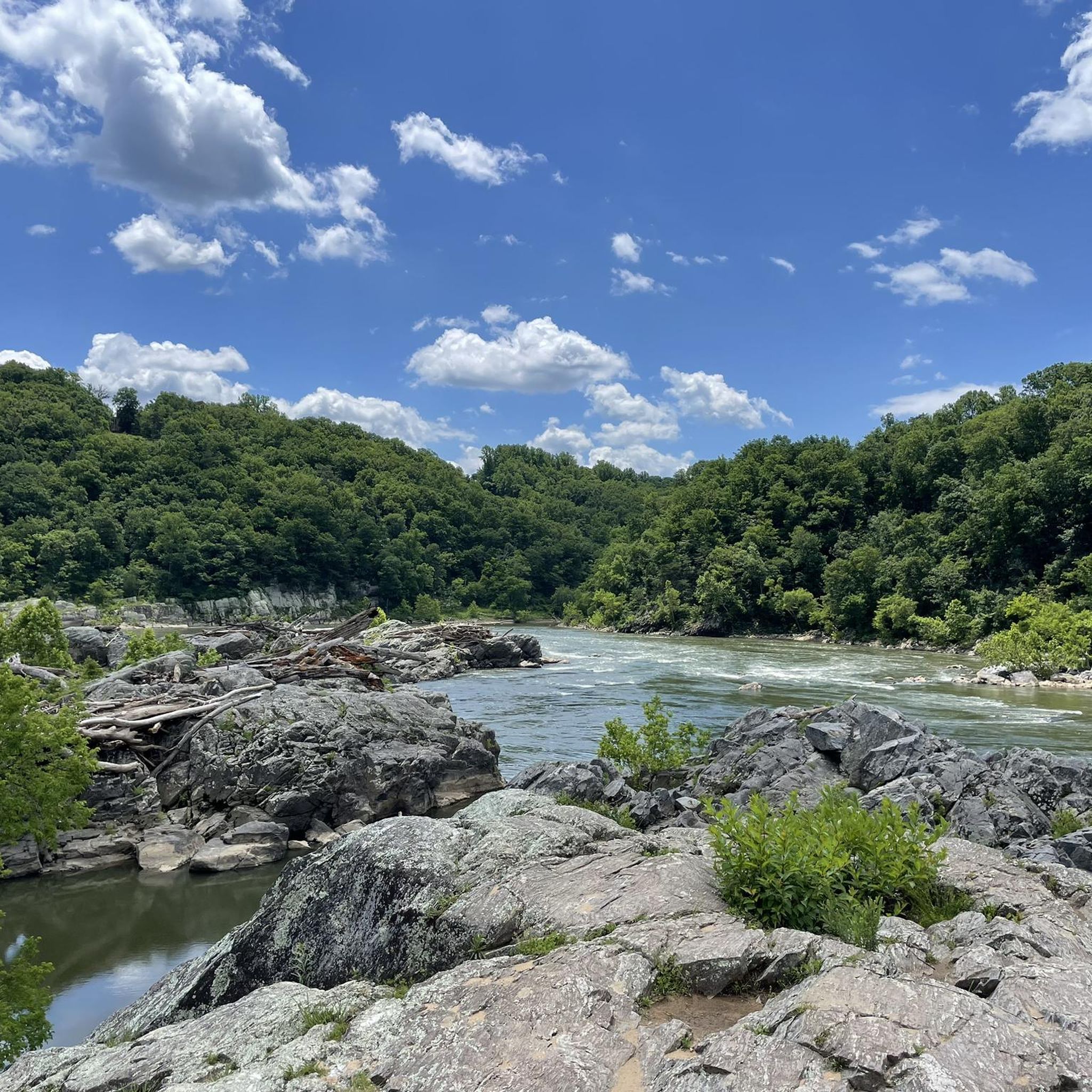
The Great Falls Overlook via Billy Goat Trail Section A offers an exhilarating and challenging hiking experience, distinguished by its unique terrain and continuous views of the Potomac River. This difficult 6.0-mile (9.7 km) hiking route, with a modest 164 feet (50 metres) of elevation gain, typically takes around 2 hours and 37 minutes, but don't let the low elevation fool you; it's packed with rock scrambles and hand-over-foot climbing. You'll navigate large boulders and steep sections, all while enjoying the dramatic Mather Gorge and the powerful cascades of Great Falls from various stony outcrops.

Planning your visit requires careful consideration: this trail is not suitable for young children, individuals with mobility issues, or dogs. Always check current trail conditions, especially after rain, as the rocks can become extremely slippery and hazardous, potentially leading to closures. Sturdy hiking boots with good ankle support are a must for tackling the rugged terrain.

What makes this trail truly stand out is its reputation as one of the most adventurous and iconic hikes near Washington D.C. It provides an immersive natural experience of the Potomac River landscape, offering a surprising sense of remoteness despite its proximity to a major metropolitan area. The significant sense of accomplishment upon completing this strenuous route contributes to its fame.

Navigate with device

Send to Phone

Save

Hard

4.8

(22)

372

hikers

Embark on the Maryland Heights via Harper's Ferry trail, a moderate hike that spans 4.1 miles (6.6 km) and climbs 704 feet (215 metres). You can expect to complete this route in about 2 hours and 3 minutes. As you ascend, you will pass through pleasant forested sections and encounter interesting rock formations, all leading to the iconic Maryland Heights Overlook. From there, you are treated to expansive views of historic Harpers Ferry, where the Potomac and Shenandoah Rivers meet, framed by the Blue Ridge Mountains.

To begin your hike, you will typically cross a footbridge from the charming town of Harpers Ferry, where parking is available. Keep in mind that this popular trail can become quite busy, especially on pleasant weekends, so planning your visit for off-peak times might offer a more serene experience. Consider starting early in the morning to avoid the largest crowds and secure parking more easily.

This route is a highlight within Harpers Ferry National Historical Park, renowned for its natural beauty and historical significance. The area's scenic vistas were even praised by Thomas Jefferson, underscoring its long-standing appeal. The trail offers a unique blend of natural exploration and a glimpse into a historically rich landscape, making it a notable destination for hikers in the region.

Moderate
guide_signup
Let us show you the way with the komoot mobile app
With a free komoot account, you can easily find, customize, and navigate endless outdoor adventures.

Sign up for free

4.8

(8)

83

hikers

7.25km

02:19

320m

240m

The Orange Trail offers a moderate hiking experience through varied terrain in Catoctin Mountain Park. You'll cover 4.5 miles (7.3 km) and gain 1049 feet (320 metres) in elevation, typically taking about 2 hours and 18 minutes to complete. As you hike, expect winding paths through the forest and some rocky sections underfoot. Keep an eye out for the impressive Wolf Rock, a notable natural monument along the way, and enjoy the panoramic views from Chimney Rock, providing expansive vistas of the surrounding landscape.

Accessing the Orange Trail is straightforward, with parking generally available at the trailhead. Before you head out, it's always a good idea to check the local park information for any specific alerts or current conditions. This ensures you are prepared for your visit and can enjoy the hike without unexpected issues. Consider starting your hike earlier in the day to make the most of the park's natural beauty and avoid potential crowds.

The Orange Trail is situated within Catoctin Mountain Park, an area known for its diverse natural features. The varied terrain, including rocky sections, highlights the geological character of the region. As you traverse the route, you'll experience the forest ecosystem firsthand, offering a glimpse into the local flora and fauna. This trail stands out for its combination of a challenging climb and rewarding scenic overlooks, making it a popular choice for hikers seeking both exercise and views.

Moderate

Embark on a moderate hike along the Appalachian Trail to Annapolis Rock and Black Rock, offering rewarding views and varied terrain. This 6.6-mile (10.6 km) route features a steady climb with 851 feet (259 metres) of elevation gain, taking approximately 3 hours and 3 minutes to complete. You'll traverse mostly dirt paths, but be prepared for some rocky sections and log steps as you ascend. The highlight of this journey is reaching Annapolis Rock, where you can enjoy sweeping vistas of the Cumberland and Hagerstown Valleys, along with Greenbrier Lake. A mile further, Black Rock Cliffs provides an even more expansive western view, stretching into Pennsylvania.

When planning your visit, be aware that this is one of Maryland's most popular trails, so you should expect many other hikers, especially on weekends and holidays. Parking is typically available at the trailhead, but spots can fill up quickly during peak times. Starting your hike early in the morning can help you secure parking and enjoy a quieter experience on the trail. The route is well-marked with white blazes, making navigation straightforward as you follow this section of the iconic Appalachian Trail.

This trail offers a classic Appalachian Trail experience, showcasing the natural beauty of South Mountain State Park. The path provides a great opportunity to immerse yourself in the region's diverse forest ecosystem. It's a fantastic choice if you're looking for a rewarding day hike that combines physical activity with stunning natural overlooks. The panoramic views from both Annapolis Rock and Black Rock Cliffs make this a memorable outing, perfect for connecting with nature and enjoying expansive landscapes.

Moderate

5.0

(5)

63

hikers

13.4km

04:05

390m

370m

The 8 Mile Loop Trail presents a moderate hiking challenge, spanning 8.3 miles (13.4 km) with an elevation gain of 1279 feet (390 metres). You can anticipate spending around 4 hours and 4 minutes to complete this journey. As you hike, you will navigate varied terrain, including sections that are steep, narrow, and rocky, sometimes requiring careful footing. The route guides you through diverse forest environments, leading to notable viewpoints such as Thurmont Vista, where you can take a moment to appreciate the scenery. This comprehensive loop combines several distinct paths, offering a rewarding experience through the park's natural features.

Before you set out, it is advisable to carry a trail map and a compass, as the loop integrates different trails marked with various blazes. Be aware that rattlesnakes may be present in areas near Chimney Rock and Wolf Rock, so stay alert. If you plan to bring your dog, they are welcome in the park on a leash, but please note they are not permitted in the immediate vicinity of the Wolf Rock, Chimney Rock, and Hog Rock formations.

This trail is designed to be a challenging and rewarding experience, weaving together multiple routes to showcase the park's natural beauty. You will find that the hike offers access to several significant natural features and scenic points. The varied landscape, from dense woods to rocky outcrops, makes this loop a distinctive option for exploring the region's outdoor environment.

Moderate

4.0

(1)

58

hikers

2.23km

00:36

40m

20m

The Canyon Trail offers a delightful, easy escape into nature, perfect for a quick refresh. You'll wander through mostly shaded paths, likely alongside a tranquil creek, enjoying the serene atmosphere. The highlight of this route is undoubtedly the journey past two stunning waterfalls, Upper Swallow Falls and Muddy Creek Falls, providing picturesque views and a refreshing natural soundtrack. It's a gentle experience, ideal for those seeking beauty without a strenuous climb.

Planning your visit to the Canyon Trail is straightforward, given its easy nature. While specific trailhead and parking details aren't available, easy trails like this are generally well-marked and accessible. It's a short 1.4-mile (2.2 km) hike with only 137 feet (42 metres) of elevation gain, taking about 36 minutes, so you don't need to dedicate a whole day. Consider going in the morning for cooler temperatures and a more peaceful experience.

This trail stands out as a fantastic option for a family-friendly outing or for beginner hikers looking for a rewarding experience without significant challenge. Its low difficulty and short length make it an excellent choice for a casual stroll, allowing you to soak in the natural beauty of the waterfalls and surrounding environment. It's a great way to experience the unique scenery of a canyon environment in Garrett County, Maryland, without the ruggedness often associated with other canyon trails.

Easy

The Cascade Falls, Morning Choice and Ridge Trail Loop offers a diverse journey through shaded forest, where you can spot local wildlife like deer. You'll navigate varied terrain, from soft singletrack to rooted descents and sustained uphill climbs, with river crossings and sections featuring large boulders and stone steps. The highlight is undoubtedly the picturesque Cascade Falls, especially impressive after a good rain, alongside the iconic Patapsco Swinging Bridge.

This moderate 8.9-mile (14.3 km) hiking route, with 764 feet (233 metres) of elevation gain, typically takes around 3 hours and 55 minutes to complete. Be prepared for potentially muddy sections after rainfall, making appropriate footwear a must. While specific trailhead parking information isn't detailed, arriving early is always a good strategy to ensure a spot, particularly during peak times.

What makes this trail truly notable is its blend of natural beauty and historical intrigue. Beyond the stunning Cascade Falls and the Patapsco Swinging Bridge, you'll encounter unique historical ruins, including old latrines and remnants of the Orange Grove Flour Mill. It's recognized as one of the best waterfall hikes in Maryland, offering a rewarding escape into nature without requiring advanced hiking skills.

Moderate

The Billy Goat Trail and C&O Canal Towpath Loop offers a unique blend of rugged adventure and serene riverside walking near Washington, D.C. You'll navigate challenging rock scrambles and boulder fields along the Potomac River, enjoying panoramic views of Mather Gorge and the powerful Great Falls. The trail then transitions to the flat, historic C&O Canal Towpath, providing a peaceful return past old locks and quiet waters, a perfect contrast to the initial thrill.

This moderate 6.8-mile (11.0 km) hike, with a gentle 195 feet (59 metres) of elevation gain, typically takes around 2 hours and 50 minutes. Be aware that the Billy Goat Trail section is technical and not suitable for young children or dogs, requiring good mobility and sturdy footwear. Due to its popularity, especially on weekends, arriving early is highly recommended to secure parking and enjoy a less crowded experience.

What truly sets this route apart is its dramatic contrast: the intense, hands-on rock scrambling of the Billy Goat Trail, a rare challenge so close to an urban center, paired with the leisurely, historic C&O Canal Towpath. This combination provides a diverse natural backdrop, from the powerful Potomac River to the tranquil canal, making it one of the most well-known and distinctive loop trails in the D.C. area.

Moderate

4.0

(2)

31

hikers

The Soapstone and Bull Run Loop offers a dynamic hiking experience through Patapsco Valley State Park, featuring a mix of refreshing singletrack, rooted paths, and rocky sections. You'll traverse gentle slopes, navigate stream crossings, and encounter some steep uphill climbs, particularly past a parking lot. The trail winds through a beautiful forest with a dense canopy, revealing meadows along the Santee Branch Trail bursting with wildflowers, berries, and butterflies, alongside scenic views of the river and various streams.

Planning your visit is straightforward, as you can often access the trail without needing to pay park entrance fees. It's a popular spot for both hikers and mountain bikers, so expect company on the path. Although generally well-marked with purple blazes, downloading a map is a good idea due to the many branching trails. A bathroom is conveniently located about two miles into the loop, making this 4.8-mile (7.8 km) moderate hike, with 541 feet (165 metres) of elevation gain and an estimated duration of 2 hours and 11 minutes, quite manageable.

This loop serves as a true "suburban oasis" within Maryland, providing a valuable natural escape. The lush greenery, enhanced by flowering Blackhaws and Dogwoods, creates a tranquil environment once you descend into the valley, away from initial road noise. It's a great option for those seeking a moderately challenging workout and a quick immersion in nature, offering a diverse landscape that feels far removed from urban life.

Moderate

4.7

(3)

34

hikers

9.55km

02:29

60m

50m

The Lakeside Loop Trail offers a delightful journey around Lake Habeeb, providing beautiful, near-constant views of the water and surrounding mountains. You'll experience a varied terrain of gravel, paved sections, and singletrack, winding through woodlands and along the shoreline. Keep an eye out for wetlands and wildlife, including deer and various bird species, as you cross four-foot bridges and pass over the dam and spillway.

This moderate 5.9-mile (9.6 km) hiking route, with a gentle 197 feet (60 metres) of elevation gain, typically takes about 2 hours and 28 minutes to complete. You can access the trail from parking lots at Rocky Gap State Park's beach or resort casino. It's a multi-use trail, popular for hiking, mountain biking, and trail running, and it's also Lakeside Loop Trail Rocky Gap State Park family friendly, welcoming dogs on leash.

What makes this trail stand out is its blend of accessibility and scenic beauty, making it one of the Lakeside Loop Trail best trails for a relaxed day outdoors. The park itself offers additional amenities like fishing and swimming in warmer months, allowing you to extend your visit beyond the hike. The changing seasons bring different charms, with fall foliage being particularly vibrant around the lake.

Moderate
Sign up for free to see 1,154 more hikes in Maryland.

Get access to more routes and recommendations from other explorers.

Sign up for free

Already have an account?

Our route recommendations are based on thousands of hikes, rides, and runs completed by other people on komoot.

Start today with a free account

Your next adventure awaits.
Login or Signup

Popular around Maryland

Hiking in Montgomery County

Hiking in Frederick County

Hiking in Washington County

Hiking in Baltimore County

Hiking in Howard County

Hiking in Garrett County

Hiking in Carroll County

Hiking in Calvert County

Hiking in Anne Arundel County

Hiking in Harford County

Other adventures in Maryland

American Discovery Trail — Walking from sea to shining sea

Hiking Collection by

Andrus

Tips from the Community

Khadijah Turnquist Moore
November 26, 2025, Swinging Bridge and Patapsco Riverbank

It gets very cold as you get close to Patapsco River near the bridge. The bridge does move a little but very secure as you cross it. Be mindful if you’re wearing a skirt (Ms Monroe)

0

0

28 Sept 2025: staircase closed as they rebuild it

0

0

maniboyflex
June 20, 2025, Widewater

As you ride onto the wide canal bend, you’re met with serene water views—Widewater is a beautiful lake that serves as habitat for many bird and wildlife species. It’s an ideal spot to pause, do some birdwatching, and soak in the calm before continuing your journey along the Potomac and the Chesapeake & Ohio canal.

0

0

Alex
May 15, 2025, Great falls

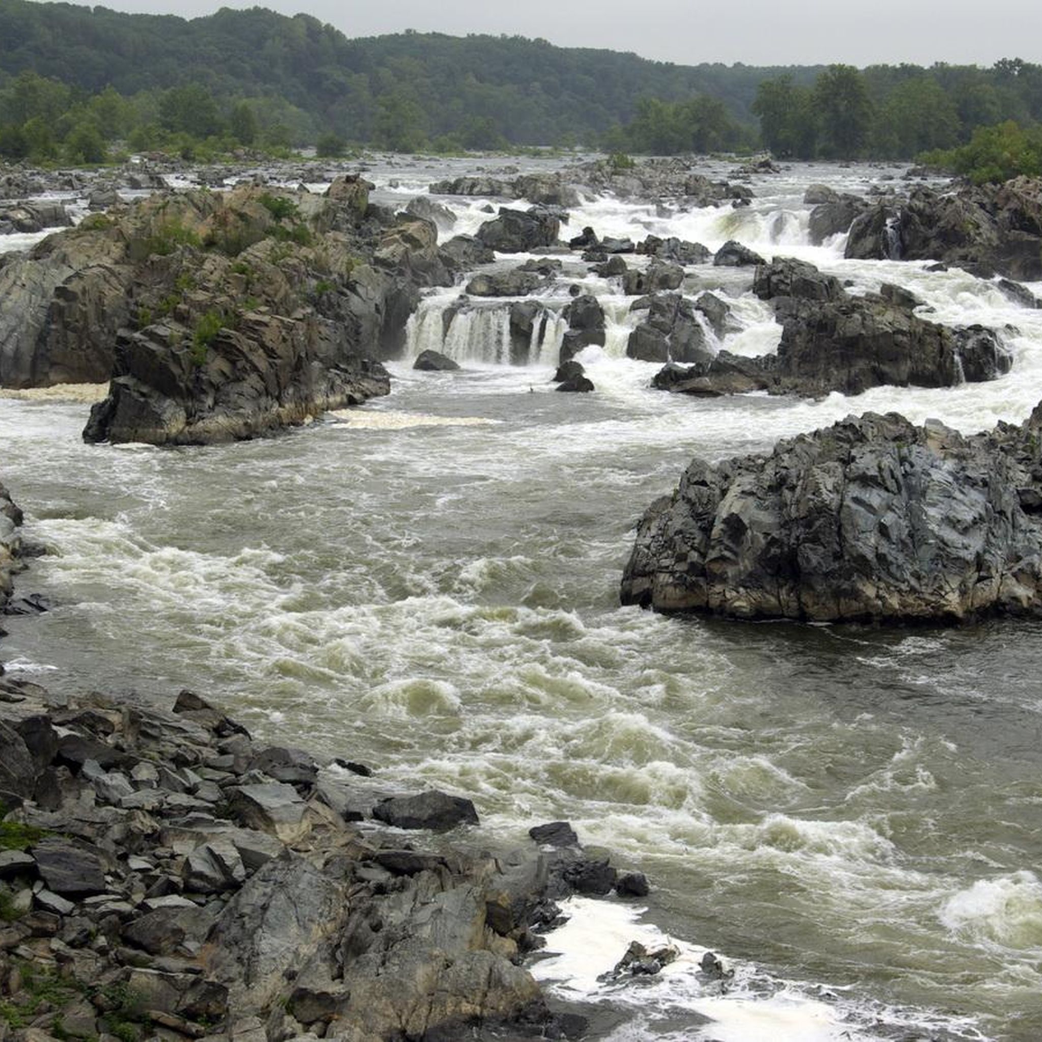
Enjoy easy access to the Great Falls, a popular destination for photographers, hikers, and expert kayakers. Though not exceptionally tall, the falls surge with force as the Potomac River carves through ancient, metamorphic rock.

1

0

Located at mile 14.3 on the C&O Canal Towpath in Potomac, Maryland, Great Falls Park is a must-visit highlight for hikers, cyclists, and history buffs alike. A short boardwalk leads to the Olmsted Island overlook, where the Potomac River dramatically crashes over jagged rocks—one of the most scenic views near D.C. For hikers, the popular Billy Goat Trail offers three segments, with Section A featuring challenging rock scrambles and breathtaking river views. The historic Great Falls Tavern, built in 1829, now serves as a visitor center and launch point for seasonal mule-drawn canal boat rides. The towpath itself is flat and easy to navigate, ideal for walking or biking. Amenities include restrooms, picnic spots, and interpretive exhibits. Parking is available at the visitor center (fee required), or you can park for free at nearby Swains Lock and walk or ride 2.5 miles to the falls.

1

0

to get from trail to Harper's Ferry, you have to go up these stairs. There are bike racks at the base, or you carry your bike up with you

0

0

Lock 15 marks the beginning of the "Six Locks" series, which raises the canal 50 feet past Great Falls. Built from red sandstone boulders transported from Seneca, these locks differ from the other granite-built "Seven Locks." From Lock 15, hikers can enjoy beautiful views of the Potomac River.

0

0

Great Falls has a scenic Horseshoe Bend where the river curves in a horseshoe shape around a rocky outcrop. It's a nice spot to stop for photos on the Chesapeake and Ohio Canal Trail.

0

0

More Information

FAQs about hikes in Maryland

  • What are the most popular hiking trails in Maryland?
    The most popular hiking route is the Billy Goat Trail Loop — Chesapeake and Ohio Canal National Historical Park, a moderate trail covering 7.66 km (02:09). Another highly rated option is the Sugarloaf Mountain & the Northern Peaks trail loop, a challenging 11.1 km (03:59) hike.

  • Are there easy hiking trails suitable for families in Maryland?
    Yes, Maryland offers several easy trails perfect for families. Consider the Centennial Lake Loop Trail — Columbia, Maryland, an easy 5.02 km (01:19) route, or the Clopper Lake loop — Seneca Creek State Park, another easy 5.37 km (01:23) option.

  • Where can I find challenging hikes in Maryland?
    For a more challenging experience, the Sugarloaf Mountain & the Northern Peaks trail loop (11.1 km, 03:59, difficult) is a top choice. This route demands good fitness and offers rewarding scenery.

  • Are there any hikes with waterfalls in Maryland?
    Yes, Maryland features beautiful waterfall hikes. The Morning Choice and Cascade Falls loop — Patapsco Valley State Park (7.45 km, 02:02, moderate) is a notable trail where you can enjoy scenic cascades.

  • What are some scenic parks for hiking in Maryland?
    Maryland boasts several scenic parks. Popular choices include Chesapeake and Ohio Canal National Historical Park, South Mountain State Park, and Catoctin Mountain Park, all offering diverse landscapes and well-maintained trails.

  • What is the longest hiking trail recommended in Maryland?
    The longest recommended hike is the Pogo Campsite & Black Rock via Appalachian Trail — South Mountain National Park, a moderate 14.0 km route that typically takes around 04:03 to complete.

  • What is the shortest hike I can do in Maryland?
    For a quick outdoor escape, the Lake Kittamaqundi loop from Symphony Woods Parking — Columbia, Maryland is the shortest recommended hike, at an easy 3.57 km, taking approximately 00:55.

  • How are hiking trail difficulties categorized on Komoot for Maryland?
    Komoot categorizes hiking difficulties into Easy, Moderate, and Difficult. Easy trails are typically under 2 hours and 300m elevation gain, suitable for any fitness level. Moderate trails can be up to 5 hours and 900m elevation gain, requiring good fitness and sure-footedness. Difficult routes exceed these, demanding very good fitness and alpine experience.

  • Can I find hikes near Baltimore?
    Absolutely! You can find excellent hiking opportunities in Baltimore County and directly around Baltimore, offering a mix of urban green spaces and more natural settings.

  • What types of terrain can I expect on Maryland hikes?
    Maryland's hikes feature a variety of terrain, including mountainous regions, dense forests, paths along canals and rivers, and some paved sections, catering to different preferences and skill levels.

  • Are there dog-friendly hiking options in Maryland?
    While many parks in Maryland welcome dogs, specific rules can vary by location and trail. It's advisable to check the current regulations for individual parks or trails like Rock Creek Regional Park before heading out with your canine companion.

Frequently Asked Questions

Are there any good family-friendly hikes in Maryland?

Yes, Maryland has many easy trails perfect for a family day out. A great option is the Centennial Lake Loop Trail, a gentle path around a scenic lake. Another popular choice is the Clopper Lake loop in Seneca Creek State Park, which offers a straightforward walk with lovely water views.

Where can I find hikes with waterfalls?

For waterfalls, head to Western Maryland. Swallow Falls State Park is a must-visit, featuring Muddy Creek Falls, the state's highest free-falling waterfall. In Central Maryland, Patapsco Valley State Park offers the popular Morning Choice and Cascade Falls loop, which leads to the picturesque Cascade Falls.

Are dogs allowed on hiking trails in Maryland?

Many state parks and trails in Maryland are dog-friendly, but policies can vary. Most require dogs to be on a leash. For example, Patapsco Valley State Park and South Mountain State Park generally welcome leashed dogs on their trails. However, sensitive areas like the main trail at Swallow Falls State Park or the Billy Goat Trail Section A have restrictions. Always check the specific park's regulations before you go.

What are some of the most challenging hikes in the state?

If you're looking for a strenuous climb, the Sugarloaf Mountain & the Northern Peaks trail loop offers a significant ascent with rewarding panoramic views. For a longer challenge, the hike to Black Rock via the Appalachian Trail is a demanding 8.7-mile (14 km) route with considerable elevation gain.

Are there any trails with rock scrambling?

Yes, the most famous rock scramble is the Billy Goat Trail along the Potomac River, which is known for its challenging sections over boulders. For a different experience, the Wolf Rock & Chimney Rock Trail loop in Catoctin Mountain Park also features fun and interesting rock formations to navigate.

What are the best viewpoints for hikers in Maryland?

For stunning vistas, the hike to Annapolis Rock in South Mountain State Park is a classic, offering expansive views of the Cumberland Valley. Another excellent spot is the Great Falls Overlook, accessible from the C&O Canal towpath, which provides dramatic views of the Potomac River's rapids.

How many hiking trails are there in Maryland?

There is a vast network of trails across the state. On Komoot alone, you can explore over 750 hiking routes, ranging from easy lakeside walks to difficult mountain climbs, ensuring there's a trail for every skill level.

Are there any long-distance or multi-day hiking options?

Yes, Maryland is home to two famous long-distance trails. The Appalachian Trail crosses the state for about 41 miles (66 km) along the ridge of South Mountain. Additionally, the C&O Canal Towpath offers a flat, 184.5-mile (297 km) trail from Washington, D.C., to Cumberland, with campsites available along the way for multi-day trips.

What do other hikers enjoy about the trails in Maryland?

The hiking routes in Maryland are highly rated by the Komoot community, with an average score of 4.7 stars. Hikers frequently praise the state's diverse scenery, from the rocky overlooks in the west to the serene riverside paths in the central region. The well-maintained trails and historical points of interest are also commonly highlighted.

Are there good circular hikes available?

Absolutely. Many of Maryland's most popular hikes are loops. The Lake Needwood loop in Rock Creek Regional Park is an easy circular walk perfect for a quick outing. For something more moderate, the Lake Kittamaqundi loop offers a pleasant circuit in Columbia.

What is the best time of year to go hiking in Maryland?

Hiking is possible year-round, but spring and autumn are particularly pleasant. Spring offers blooming wildflowers and comfortable temperatures, while autumn provides stunning fall foliage and cooler, crisp air. Summer can be hot and humid, especially in central and eastern Maryland, so early morning hikes are recommended. Winter hiking can be beautiful, but be prepared for ice and snow on western mountain trails.

Most popular routes in Maryland

Easy hikes in Maryland

Most popular attractions in Maryland

Natural Monuments

Store rating

Get inspired with the komoot mobile app

With a free komoot account, you can easily find, customize, and navigate endless outdoor adventures.

or

Join komoot Now

Store rating

Didn’t find what you were looking for?

Check out more Hikes throughout Maryland below and find the perfect route in your destination.

Baltimore CountyCarroll CountyDorchester CountyAnne Arundel CountyFrederick CountyPrince George'S CountyHoward CountyWorcester CountyAllegany CountyCharles CountyMontgomery CountyQueen Anne'S CountyTalbot CountyWashington CountyCaroline CountyCalvert CountyWicomico CountyKent CountyCecil CountyBaltimoreHarford CountySt. Mary'S CountyBaltimoreGarrett County

Other places to explore

Nearby adventure guides

Things to Do around Queen Anne

background

Get ready to conquer new peaks

Sign up for Free

Explore
RoutesRoute plannerFeaturesHikesMTB TrailsRoad cycling routesBikepackingSitemap
Download the app
Follow Us on Socials

© komoot GmbH

Privacy Policy