The best traffic-free bike rides around Niederassel
4.5
(339)
16,926
riders
40
rides
No traffic road cycling routes around Niederassel are situated on the left bank of the Rhine River, offering extensive river landscapes and natural floodplains. The region features a blend of residential areas and green spaces, including parks and nature reserves. Cyclists encounter mostly paved and asphalt surfaces, with quiet roads and pleasant paths. The terrain extends into areas like the Siegauen and Wahner Heide, providing a mix of natural forest and open fields.
Best no traffic road cycling routes around…
Last updated: October 6, 2026
4.7
(6)
400
riders
15.0km
01:03
530m
530m
Moderate road ride. Good fitness required. Mostly well-paved surfaces and easy to ride.
5.0
(2)
40
riders
30.7km
01:36
490m
490m
Moderate road ride. Good fitness required. Some segments of this route may be unpaved and difficult to ride.

5.0
(1)
30
riders
46.9km
02:05
320m
320m
Moderate road ride. Good fitness required. Some segments of this route may be unpaved and difficult to ride.
5.0
(2)
8
riders
18.9km
01:24
640m
640m
Moderate road ride. Good fitness required. Some segments of this route may be unpaved and difficult to ride.
19
riders
26.9km
01:20
330m
330m
Moderate road ride. Good fitness required. Some segments of this route may be unpaved and difficult to ride.
Get access to more routes and recommendations from other explorers.
Already have an account?
Our route recommendations are based on thousands of hikes, rides, and runs completed by other people on komoot.
Tips from the Community

This large lake is a popular stop along the cycling routes around Belfort, with beautiful views over the water and the surrounding nature.
6
0
The Étang du Malsaucy (often also called Lac du Malsaucy) is, with an area of 55 hectares, the largest lake in the French department of Territoire de Belfort. It is nestled in the Parc naturel régional des Ballons des Vosges, spread across the municipalities of Évette-Salbert, Lachapelle-sous-Chaux, and Sermamagny. Originally built at the end of the 15th century for fish farming, it is now one of the most important recreational and natural areas in the region.
6
0
La Planche des Belles Filles is a 5.8 kilometer climb. It is a category 1 climb. It is located in Plancher Les Mines, Franche-Comté, France. The average gradient of this climb is 8.6% with a maximum of 13.6%. La Planche des Belles Filles climbs from 527 meters at the start to 1,033 meters at the summit, for a total elevation gain of 506 meters.
7
0
This 5.9-kilometer climb from the village of Plancher-les-Mines in Haute-Saône is one of the most difficult in the Vosges. Indeed, cyclists who want to try it will need to be at least somewhat trained. With a gradient of 24% towards the end of the route, it's better to be well-attached. The gradient never seems to ease, with its hairpin bends and, upon reaching the resort, the last 2 kilometers rise like a wall. However, you'll be able to say that you've done it, so come and try the climb of La Planche too!
8
0
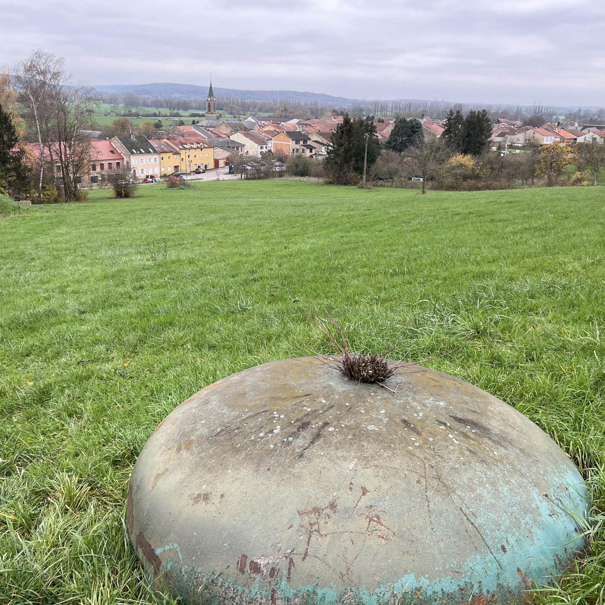
At the foot of the climb to La Planche des Belles Filles stands this modest water tower — a wooden reservoir on a steel frame, built in the mid-20th century to provide the mountain village with water pressure. Today, it forms a quiet industrial accent between fir and pine trees, overlooking the Ballon de Servance. For cyclists, it marks the last flat stretch before the climb.
7
0

If you like to hurt and question gravity, this is the right place.
0
0
It starts gently... but that's just the beginning.
1
0
Long hesitated to do it. Short but very hard, with the Pinot turn and the last ramp of the super board to tell yourself that it's really hard.
0
0
Frequently Asked Questions
How many no-traffic road cycling routes are available in Niederassel?
There are over 30 dedicated no-traffic road cycling routes around Niederassel, offering a variety of distances and difficulty levels. You'll find routes ranging from easy to difficult, ensuring options for every cyclist.
What kind of terrain can I expect on no-traffic road cycling routes in Niederassel?
The no-traffic road cycling routes in Niederassel primarily feature mostly paved and asphalt surfaces, ideal for road bikes. You'll encounter quiet roads and pleasant paths, often along the Rhine River, through natural floodplains, and dike paths. Further inland, the region offers diverse areas like the Siegauen, with open fields and natural forest sections.
Are there any family-friendly no-traffic road cycling routes in Niederassel?
Yes, Niederassel offers several easy no-traffic road cycling routes suitable for families. These routes often follow the flat, scenic paths along the Rhine or through local green spaces, providing a safe and enjoyable experience away from vehicle traffic. Look for routes marked as 'easy' for the most family-friendly options.
Where can I find beginner-friendly no-traffic road cycling routes?
Beginners can enjoy the flatter sections along the Rhine Riverside Pathway or shorter loops through the Rhine floodplains. These routes typically have minimal elevation changes and are well-suited for those new to road cycling. An example of a moderate route that could be a good step up is the Véronne Pond – Lac du Malsaucy loop from Bas-Evette, which covers 46.2 km with moderate elevation.
Are there any challenging no-traffic road cycling routes for advanced cyclists?
Absolutely. For advanced cyclists seeking a challenge, there are several difficult no-traffic road cycling routes available. These routes often feature more significant elevation gains and longer distances. An example is the demanding Ballon de Servance – La Planche des Belles Filles loop from Champagney, which spans over 113 km with substantial climbing.
What are some interesting landmarks or viewpoints along the no-traffic road cycling routes?
While cycling, you can enjoy picturesque views of the Rhine River and its natural floodplains. Notable landmarks and viewpoints include the historic St. John the Baptist Church in Niederkassel. For a unique experience, the Mondorf Ferry allows you to cross the Rhine with your bike, offering different perspectives of the river landscape. You might also encounter highlights such as Ballon d'Alsace or Ballon de Servance, which are popular natural monuments and summits in the broader region.
Are there any circular no-traffic road cycling routes in Niederassel?
Yes, many of the no-traffic road cycling routes around Niederassel are designed as loops, allowing you to start and end at the same point. This includes routes along the Rhine and through the floodplains. For example, consider the Lac du Malsaucy – Memorial to the fallen 🕊️ loop from Bas-Evette, which offers a moderate 39.3 km circular ride.
What is the best time of year to go no-traffic road cycling in Niederassel?
The spring, summer, and early autumn months generally offer the most pleasant conditions for no-traffic road cycling in Niederassel. During these seasons, the weather is typically mild, and the natural landscapes along the Rhine and in the Siegauen are at their most vibrant. Always check local weather forecasts before heading out.
What do other road cyclists enjoy most about no-traffic road cycling in Niederassel?
The area is highly rated by the komoot community, with an average score of 4.6 stars. Reviewers often praise the quiet roads, the scenic beauty of the Rhine riverside paths, and the well-maintained asphalt surfaces that make for a smooth ride. The ability to cycle away from traffic is a frequently highlighted benefit.
Are there any no-traffic road cycling routes suitable for rides under 2 hours?
Yes, there are several shorter no-traffic road cycling routes perfect for rides under two hours. These often include local loops through green spaces or shorter sections of the Rhine Riverside Pathway. For instance, the La Planche des Belles Filles – Pinot Ramp loop from Plancher-les-Mines is a moderate 14.9 km route that can be completed well within two hours, offering a good workout.
Is public transport available to access no-traffic road cycling routes in Niederassel?
Niederkassel is integrated into the regional public transport network. While specific route access points vary, you can often reach starting points for cycling routes via bus connections. It's advisable to check local public transport schedules and bike carriage policies for the most convenient access to your chosen no-traffic route.
Are there cafes or places to stop for refreshments along the no-traffic road cycling routes?
Yes, along many of the popular no-traffic road cycling routes, especially those following the Rhine or passing through towns like Mondorf, you'll find various cafes, restaurants, and beer gardens. These offer convenient spots to take a break, refuel, and enjoy the local atmosphere.
Most popular routes around Niederassel
Most popular attractions around Niederassel

Get inspired with the komoot mobile app


Explore more
Browse the best Road cycling routes in other regions.
