The best traffic-free bike rides around Dehesas De Guadix
5.0
(1)
63
riders
13
rides
Gravel biking around Dehesas De Guadix offers access to a diverse landscape characterized by arid badlands, dramatic eroded formations, and river basins. The region, part of the Granada Geopark, features extensive networks of tracks and fire roads, providing varied terrain for cycling. Riders can expect significant elevation changes and a mix of light to chunky gravel paths, alongside quiet tarmac sections. Surrounding mountain ranges like the Sierra Nevada further contribute to the varied topography.
Best no traffic gravel bike trails…
Last updated: July 2, 2026
14
riders
89.8km
06:44
1,380m
1,380m
Hard gravel ride. Very good fitness required. Mostly paved surfaces. Suitable for all skill levels.
7
riders
66.0km
05:30
1,320m
1,320m
Hard gravel ride. Very good fitness required. Mostly paved surfaces. Suitable for all skill levels.

Sign up for free
5.0
(1)
10
riders
56.3km
04:11
900m
900m
Hard gravel ride. Very good fitness required. Mostly paved surfaces. Suitable for all skill levels.
9
riders
92.4km
06:56
1,740m
1,740m
Hard gravel ride. Very good fitness required. Mostly paved surfaces. Suitable for all skill levels.
5
riders
36.5km
02:45
620m
620m
Hard gravel ride. Very good fitness required. Mostly paved surfaces. Suitable for all skill levels.
Get access to more routes and recommendations from other explorers.
Sign up for free
Already have an account?
Our route recommendations are based on thousands of hikes, rides, and runs completed by other people on komoot.
Start today with a free account
Your next adventure awaits.
Login or Signup
Popular around Dehesas De Guadix

Tips from the Community

too bad this refuge is disgusting
0
0

Double-check the trails! The river valley was completely overgrown and almost impossible to get through. It's a real ordeal to find your way back out! Not all of the trails on Komoot actually exist, and not all of the real trails are marked. Bring enough water!
0
0

The Guadahortuna River is an important waterway in the Granada region. The river rises in Montejícar and flows through several municipalities, including Alicún de Ortega, before finally flowing into the Guadiana Menor River. The name "Guadahortuna" means "River of Fortuna" and has its origins in Moorish times. The area served as a border area during the Middle Ages, where Christian troops drove out the Moors.
7
0
Small extended viewpoint with two benches and the coat of arms of Alicun de Ortega.
7
0
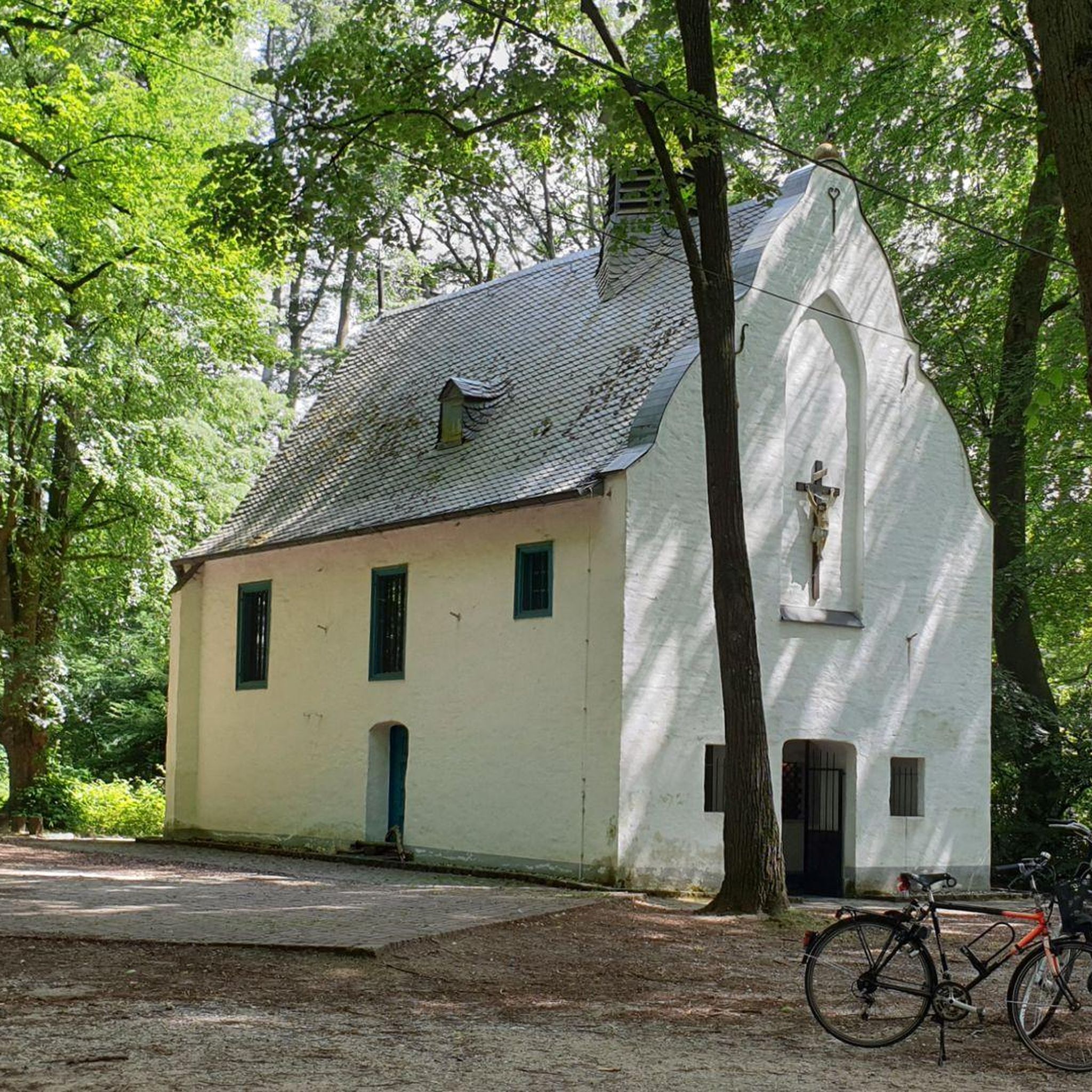
The church is now in a pitiful state. I could not find out whether this is permanent or whether they are going to restore it.
7
0
The church was built in the 16th century, during the Reconquista period. The church has undergone several restorations to preserve its original Mudéjar style and ensure its structural integrity. The church is built in the Mudéjar style, a unique combination of Islamic and Christian architecture typical of the region. The building has a basilica design with a single nave and a wooden ceiling (artesonado) typical of Mudéjar architecture. The interior is decorated with beautiful religious artwork and paintings that highlight the rich religious tradition of the church. The church is an important heritage site for Dehesas de Guadix and attracts visitors for its historical and architectural value.
7
0
Dehesas de Guadix is a small municipality. It is located in the northeast of the comarca of Los Montes and has an area of approximately 57 km²1. The municipality has approximately 426 inhabitants (2016). The history of Dehesas de Guadix goes back to the time of the Reconquista, when the kings of Spain reconquered the area from the Moors. The village was officially founded in the 15th century, when Don Diego Fernández de Iranzo received the land from the kings. One of the most remarkable features of Dehesas de Guadix is the troglodyte dwellings, which are typical of the region. These underground houses are built into the rocks and offer a unique glimpse into the traditional architecture of the area.
7
0
The coat of arms of Dehesas de Guadix is a beautiful symbol that represents the history and identity of the municipality. Here are some important elements of the coat of arms: The coat of arms is divided into three parts. First part: This part shows a mountain (monte) of sinople (green) with a house-cuve (a typical building in the region) of silver, matched with red (gules). Second part: This part shows three oliviers of sinople (green) on a field of gold (oro). Point part: This part shows wavy lines of silver and blue (azur). These elements combine natural and architectural features that are important to the region.
7
0
Frequently Asked Questions
How many no-traffic gravel bike trails are available in Dehesas De Guadix?
There are 10 dedicated no-traffic gravel bike trails around Dehesas De Guadix featured in this guide. While all are categorized as 'difficult' due to significant elevation changes and varied terrain, they offer a fantastic way to explore the region's unique landscapes away from cars.
What kind of terrain can I expect on these no-traffic gravel bike trails?
The trails in Dehesas De Guadix traverse a diverse range of terrain, from light to chunky gravel, fire roads, and even some quiet tarmac sections. You'll encounter the striking badlands topography of the Granada Geopark, with dramatic gullies and unique rock formations. Expect significant elevation changes, often requiring good to very good fitness.
Are there any circular no-traffic gravel bike routes?
Yes, many of the no-traffic gravel bike routes in the area are circular, allowing you to start and end at the same point. For example, the Gorafe Desert – Puntal de Don Diego Viewpoint loop from Central Hidroeléctrica de Negratín is a challenging circular route covering nearly 110 km with almost 2000 meters of ascent.
What natural features or landmarks can I see along the no-traffic gravel bike trails?
The trails offer stunning views of the region's unique geology. You can explore the dramatic Los Coloraos Badlands, the expansive Gorafe Desert with its eroded clay and sandstone formations, and the impressive Gorafe Desert Canyons. Don't miss the panoramic vistas from the Puntal de Don Diego Viewpoint.
What is the best time of year for gravel biking in Dehesas De Guadix to avoid traffic and enjoy the scenery?
The best time for gravel biking in Dehesas De Guadix is typically spring (March to May) and autumn (September to November). During these seasons, temperatures are milder, making long rides more enjoyable, and the natural colors of the badlands can be particularly vibrant. Summer can be very hot, and winter might bring colder temperatures, though the region generally experiences many sunny days.
Are there any family-friendly no-traffic gravel bike routes in Dehesas De Guadix?
While the routes listed in this guide are generally rated as 'difficult' due to significant elevation and distance, the region does offer an extensive network of quiet rural roads and tracks. For families, it's advisable to look for shorter, flatter sections or local tracks within villages that are less demanding. Always check the route profile and difficulty before heading out with children.
Where can I park my car when accessing these no-traffic gravel bike trails?
Parking is generally available in the towns and villages that serve as starting points for these routes. For example, routes often start from locations like Central Hidroeléctrica de Negratín, Playa de Freila, Gorafe, or Bácor. Look for designated parking areas within these communities, which typically offer convenient access to the trailheads.
Can I bring my dog on these gravel bike trails?
Many of the rural tracks and trails in the Dehesas De Guadix area are suitable for cycling with dogs, provided they are well-behaved and kept under control. However, always be mindful of local regulations, especially if passing through agricultural land or protected natural areas. Ensure your dog is accustomed to long distances and varied terrain, and always carry enough water for both of you.
Are there any shorter no-traffic gravel bike routes for those with less time or fitness?
While most routes in this guide are challenging, the Gorafe Desert – Puntal de Don Diego Viewpoint loop from Gorafe is the shortest featured route, at just over 29 km with 624 meters of ascent. It still offers a taste of the region's unique landscapes and viewpoints, making it a good option for a shorter, yet still demanding, ride.
What makes the Dehesas De Guadix region ideal for no-traffic gravel biking?
Dehesas De Guadix is exceptional for no-traffic gravel biking due to its inclusion in the UNESCO-designated Granada Geopark. This area boasts an extensive network of historical paths, livestock routes, rural roads, and forest tracks that are naturally low in vehicle traffic. The unique badlands topography, combined with the vast, open landscapes, provides an immersive and peaceful cycling experience away from urban congestion.
Are there any places to stop for refreshments or food along the routes?
While the trails themselves are often remote and traffic-free, you'll find opportunities for refreshments in the small towns and villages that the routes pass through or start from, such as Gorafe, Bácor, or near Playa de Freila. It's always recommended to carry sufficient water and snacks, especially on longer routes, as services can be sparse between villages.
What are the typical distances and elevation gains for no-traffic gravel bike routes in this area?
The no-traffic gravel bike routes in Dehesas De Guadix vary significantly in length and elevation. They range from approximately 29 km with 624 meters of ascent, like the Gorafe Desert – Puntal de Don Diego Viewpoint loop from Gorafe, up to nearly 110 km with almost 2000 meters of climbing, such as the Gorafe Desert – Puntal de Don Diego Viewpoint loop from Central Hidroeléctrica de Negratín. Most routes are challenging, requiring good fitness.
Most popular routes around Dehesas De Guadix
Most popular attractions around Dehesas De Guadix

Get inspired with the komoot mobile app


Explore more
Browse the best Gravel rides in other regions.
