The best gravel rides around Dehesas De Guadix
5.0
(1)
63
riders
14
rides
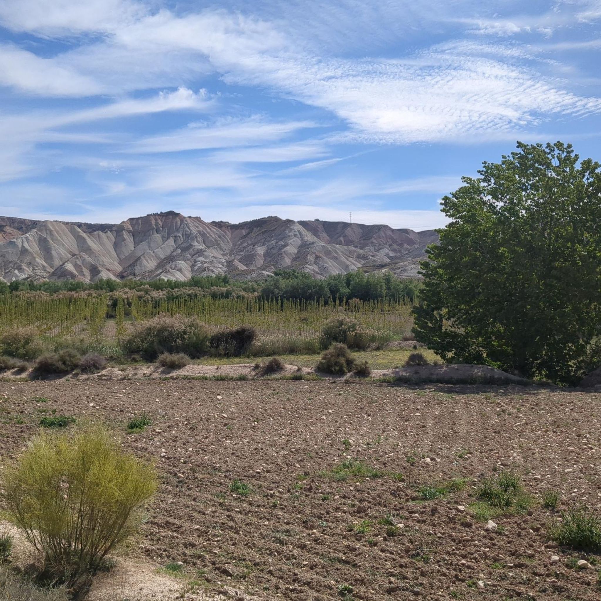
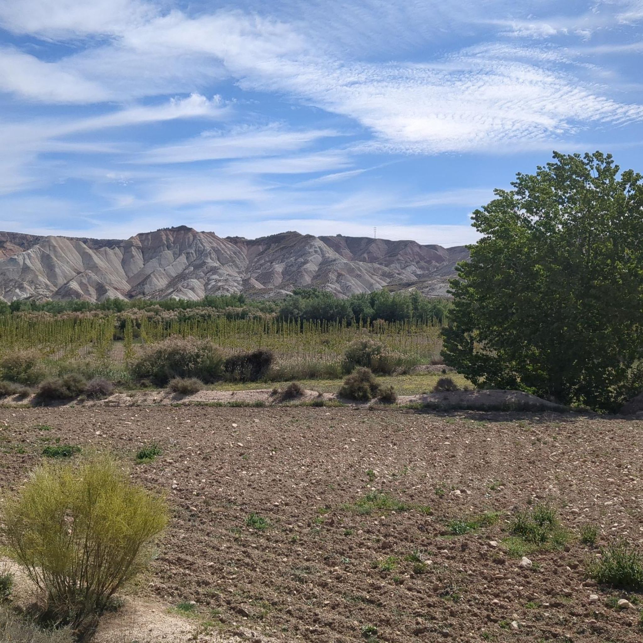
Gravel biking around Dehesas De Guadix offers routes through a landscape characterized by the Gorafe Desert and its distinctive badlands formations. The terrain features arid expanses, geological viewpoints, and varied elevations suitable for off-road cycling. This region provides a challenging environment for gravel bikers, with routes often traversing open desert and undulating paths.
Best gravel bike trails around Dehesas De Guadix
- The most popular gravel bike trail is Gorafe Desert – Los Coloraos Desert loop from Bácor, a 73.4 miles (118.1 km) trail that takes 10 hours 48 minutes to complete. This route features significant elevation gain through desert landscapes.
- Another top favourite among local gravel bikers is Gorafe Desert – Puntal de Don Diego Viewpoint loop from Central Hidroeléctrica de Negratín, a difficult 68.3 miles (110.0 km) path. This trail offers extensive views across the desert and towards the Puntal de Don Diego Viewpoint.
- Local gravel bikers also love the Puntal de Don Diego Viewpoint – Badlands of Gorafe loop from Freila, a 40.3 miles (64.9 km) trail leading through the Badlands of Gorafe, often completed in about 6 hours 45 minutes.
- Gravel biking around Dehesas De Guadix is defined by desert landscapes, badlands formations, and elevated viewpoints. The network offers options primarily for advanced riders, with a few moderate routes available.
- The guide includes highly-rated routes that showcase the best of the region's landscape. More than 40 gravel bikers have used komoot to explore Dehesas De Guadix's varied terrain.
Last updated: July 4, 2026
14
riders
89.8km
06:44
1,380m
1,380m
Hard gravel ride. Very good fitness required. Mostly paved surfaces. Suitable for all skill levels.
7
riders
66.0km
05:30
1,320m
1,320m
Hard gravel ride. Very good fitness required. Mostly paved surfaces. Suitable for all skill levels.

Sign up for free
5.0
(1)
10
riders
56.3km
04:11
900m
900m
Hard gravel ride. Very good fitness required. Mostly paved surfaces. Suitable for all skill levels.
9
riders
92.4km
06:56
1,740m
1,740m
Hard gravel ride. Very good fitness required. Mostly paved surfaces. Suitable for all skill levels.
5
riders
36.5km
02:45
620m
620m
Hard gravel ride. Very good fitness required. Mostly paved surfaces. Suitable for all skill levels.
Get access to more routes and recommendations from other explorers.
Sign up for free
Already have an account?
Our route recommendations are based on thousands of hikes, rides, and runs completed by other people on komoot.
Start today with a free account
Your next adventure awaits.
Login or Signup
Tips from the Community

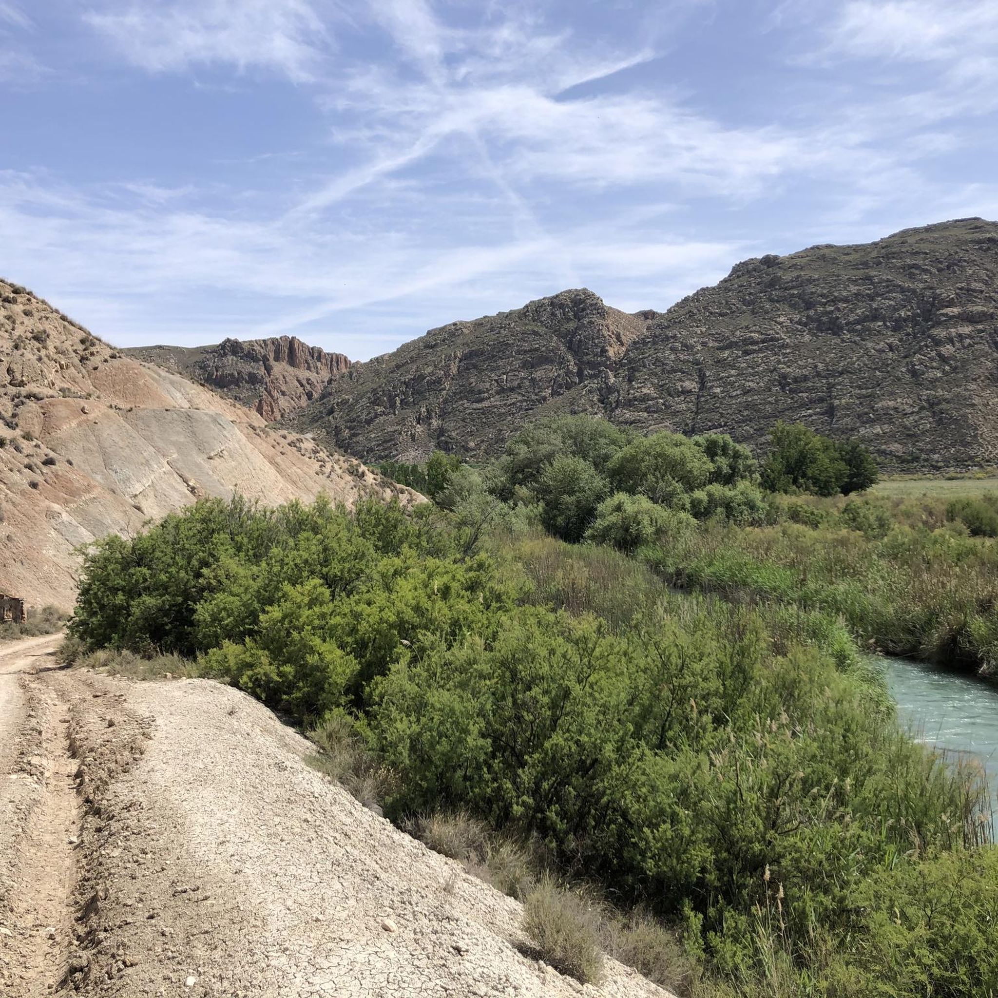
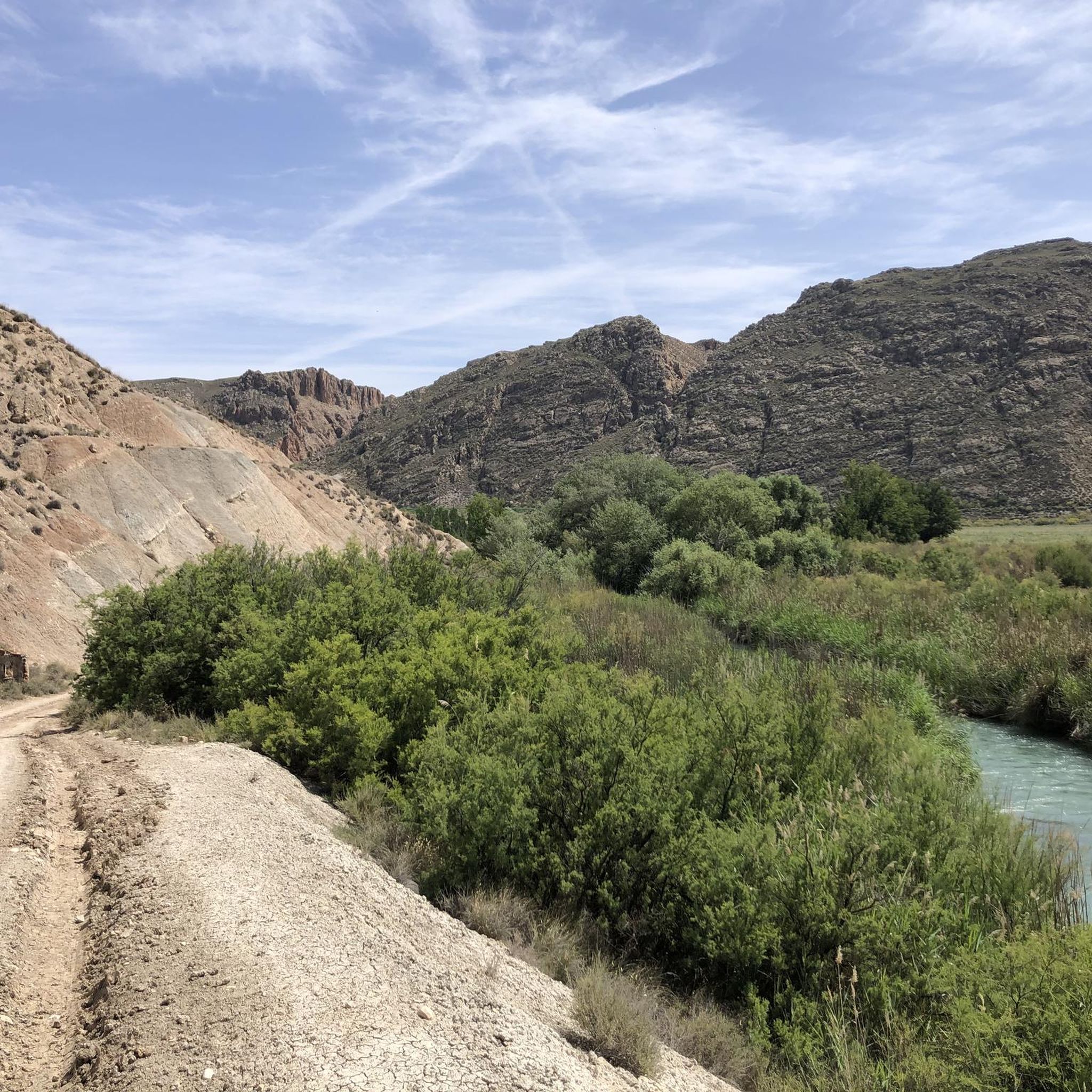
Double-check the trails! The river valley was completely overgrown and almost impossible to get through. It's a real ordeal to find your way back out! Not all of the trails on Komoot actually exist, and not all of the real trails are marked. Bring enough water!
0
0

The Guadahortuna River is an important waterway in the Granada region. The river rises in Montejícar and flows through several municipalities, including Alicún de Ortega, before finally flowing into the Guadiana Menor River. The name "Guadahortuna" means "River of Fortuna" and has its origins in Moorish times. The area served as a border area during the Middle Ages, where Christian troops drove out the Moors.
7
0
Small extended viewpoint with two benches and the coat of arms of Alicun de Ortega.
7
0
The church is now in a pitiful state. I could not find out whether this is permanent or whether they are going to restore it.
7
0
The church was built in the 16th century, during the Reconquista period. The church has undergone several restorations to preserve its original Mudéjar style and ensure its structural integrity. The church is built in the Mudéjar style, a unique combination of Islamic and Christian architecture typical of the region. The building has a basilica design with a single nave and a wooden ceiling (artesonado) typical of Mudéjar architecture. The interior is decorated with beautiful religious artwork and paintings that highlight the rich religious tradition of the church. The church is an important heritage site for Dehesas de Guadix and attracts visitors for its historical and architectural value.
7
0
Dehesas de Guadix is a small municipality. It is located in the northeast of the comarca of Los Montes and has an area of approximately 57 km²1. The municipality has approximately 426 inhabitants (2016). The history of Dehesas de Guadix goes back to the time of the Reconquista, when the kings of Spain reconquered the area from the Moors. The village was officially founded in the 15th century, when Don Diego Fernández de Iranzo received the land from the kings. One of the most remarkable features of Dehesas de Guadix is the troglodyte dwellings, which are typical of the region. These underground houses are built into the rocks and offer a unique glimpse into the traditional architecture of the area.
7
0
The coat of arms of Dehesas de Guadix is a beautiful symbol that represents the history and identity of the municipality. Here are some important elements of the coat of arms: The coat of arms is divided into three parts. First part: This part shows a mountain (monte) of sinople (green) with a house-cuve (a typical building in the region) of silver, matched with red (gules). Second part: This part shows three oliviers of sinople (green) on a field of gold (oro). Point part: This part shows wavy lines of silver and blue (azur). These elements combine natural and architectural features that are important to the region.
7
0
Beautiful striking landscape. Towards Dehesas de Guadix it starts to climb. After all we leave the valley of the Rio Fardes and drive to the valley of the rio Guadahortuna.
6
0
Frequently Asked Questions
What is the general difficulty level of gravel biking in Dehesas De Guadix?
Gravel biking in Dehesas De Guadix is primarily suited for advanced riders. Out of 11 routes, 10 are classified as difficult, with only one moderate option available. The terrain often features significant elevation changes and arid, challenging landscapes.
Are there any easy or family-friendly gravel bike trails in Dehesas De Guadix?
The region of Dehesas De Guadix is known for its challenging gravel bike routes, with most classified as difficult. There are no easy routes listed, and only one moderate option. Therefore, it may not be ideal for beginners or families seeking very easy trails.
What kind of landscapes can I expect to see while gravel biking in Dehesas De Guadix?
You can expect to traverse unique desert landscapes, including the Gorafe Desert and its distinctive badlands formations. Routes often feature arid expanses, geological viewpoints, and undulating paths, offering extensive views across the desert.
What are the typical distances and durations for gravel bike trails in Dehesas De Guadix?
The gravel bike trails in Dehesas De Guadix vary significantly in length and duration. For instance, routes can range from shorter options like the Gorafe Desert – Puntal de Don Diego Viewpoint loop from Gorafe at 29.3 km (approx. 3.5 hours) to extensive journeys such as the Gorafe Desert – Los Coloraos Desert loop from Bácor, which covers 118.1 km and can take over 10 hours.
Are there any circular gravel bike routes available in Dehesas De Guadix?
Yes, many of the gravel bike routes in Dehesas De Guadix are designed as loops. Examples include the Gorafe Desert – Puntal de Don Diego Viewpoint loop from Central Hidroeléctrica de Negratín and the Puntal de Don Diego Viewpoint – Badlands of Gorafe loop from Freila, allowing you to start and finish at the same point.
What are some notable viewpoints or attractions along the gravel bike trails?
Many routes offer stunning geological viewpoints. You can experience the unique formations of the Gorafe Desert, the dramatic Los Coloraos Badlands, and panoramic vistas from the Puntal de Don Diego Viewpoint. The Hoodoos of Cuevas del Campo are also a unique natural monument to explore.
What is the best time of year for gravel biking in Dehesas De Guadix?
Given the arid desert environment, the best time for gravel biking in Dehesas De Guadix is typically during the cooler months, such as spring (March to May) and autumn (September to November). Summers can be extremely hot, making long rides challenging, while winters are generally mild but can have occasional cold snaps.
How many gravel bike trails are available in the Dehesas De Guadix area?
There are 11 distinct gravel bike trails documented for the Dehesas De Guadix region. These routes offer a variety of experiences, predominantly catering to more experienced riders due to their difficulty.
Where can I typically access the trailheads for gravel biking in Dehesas De Guadix?
Trailheads for gravel biking in Dehesas De Guadix are often located near local villages or specific landmarks. For example, routes commonly start from places like Bácor, Freila, Central Hidroeléctrica de Negratín, or Gorafe, as indicated by the route names.
What do other gravel bikers say about the trails in Dehesas De Guadix?
Over 40 gravel bikers have used komoot to explore Dehesas De Guadix. Riders often highlight the unique desert landscapes, the challenging nature of the routes, and the extensive views, particularly from elevated viewpoints like Puntal de Don Diego.
Are there any specific routes that showcase the badlands formations?
Yes, several routes specifically highlight the badlands. The Puntal de Don Diego Viewpoint – Badlands of Gorafe loop from Freila is an excellent option that leads directly through the Badlands of Gorafe, offering an immersive experience of these geological features.
Most popular routes around Dehesas De Guadix
Most popular attractions around Dehesas De Guadix

Get inspired with the komoot mobile app


Explore more
Browse the best Gravel rides in other regions.
