The best traffic-free bike rides around Rezzoaglio
4.4
(113)
1,113
riders
10
rides
No traffic touring cycling routes around Rezzoaglio traverse the diverse landscapes of the Ligurian Apennines, nestled within the Aveto Regional Natural Park. The region is characterized by extensive forests, green meadows, and river valleys, providing varied terrain for cycling. Riders can expect routes that navigate through unspoiled streams and offer views of natural features like Lago delle Lame and the River Aveto. The area's geography includes significant elevation changes, making it suitable for challenging touring cycling experiences.
Best no traffic…
Last updated: May 19, 2026
4.3
(4)
79
riders
42.5km
03:47
1,200m
1,200m
Hard bike ride. Very good fitness required. Mostly paved surfaces. Suitable for all skill levels.
4.0
(2)
40
riders
41.3km
04:13
1,240m
1,240m
Hard bike ride. Very good fitness required. You may need to push your bike for some segments of this route.

Sign up for free
4.7
(3)
32
riders
16.8km
01:47
450m
450m
Hard bike ride. Very good fitness required. You may need to push your bike for some segments of this route.
34
riders
51.1km
05:08
1,680m
1,680m
Hard bike ride. Very good fitness required. Mostly paved surfaces. Suitable for all skill levels.
5.0
(3)
13
riders
34.3km
03:27
1,290m
1,290m
Hard bike ride. Very good fitness required. Mostly paved surfaces. Suitable for all skill levels.
Get access to more routes and recommendations from other explorers.
Sign up for free
Already have an account?
Our route recommendations are based on thousands of hikes, rides, and runs completed by other people on komoot.
Start today with a free account
Your next adventure awaits.
Login or Signup
Popular around Rezzoaglio
Other adventures around Rezzoaglio

Tips from the Community

Pria Burgheisa (Pietra Borghese) is a massive outcrop of mantle peridotites, among the best-known and most significant in the area. It lies on the southwestern edge of the Prato Mollo plateau, on the southern slopes of Mount Aiona, at an altitude of 1,465 m. It is a geosite of considerable petrographic, mineralogical, and regional geological interest, allowing us to study the evolution of a portion of the lithospheric mantle subsequently involved in the Apennine orogeny. The outcrop has a highly irregular shape: 30 m long, 10 m wide at its maximum, and 7–8 m high. The rocks are dark in color, ranging from blackish to brownish; the mass is affected by three main fracture systems, more or less orthogonal to each other, which fragment it into numerous square-shaped blocks. The surface of the blocks has a pitted appearance, as the pyroxene crystals, more resistant to erosion than olivine, remain prominent. At the outcrop, mantle foliation is evident, due to the presence of frequent pyroxenite bands. Source: Liguria Geosite Registry.
0
0

Situated at 717 meters above sea level, Santa Maria del Taro is a hamlet in the municipality of Tornolo (province of Parma), nestled in the heart of the Northern Apennines, near the border between Emilia and Liguria. Since the early Middle Ages, its strategic position along the ancient ridge road connecting the sea to the Po Valley has made it a transit and trade center, as well as a military and commercial control point. The name itself recalls the religious devotion that has permeated the town for centuries: the church-sanctuary dedicated to the Nativity of Mary, rebuilt in neoclassical style between 1807 and 1834, stands on an older structure and has been the spiritual center of the upper Taro Valley for centuries. The building, with its broad façade and stone bell tower, preserves a deep devotional tradition that is still alive. A short walk from the center is the Ponte dei Priori, a medieval humpbacked stone structure that once served as the only permanent access to the valley and symbolically marked the passage between the lands of the Malaspina and Fieschi families, two powerful feudal families of the Apennines. Over the centuries, Santa Maria del Taro has maintained an identity suspended between Emilian and Ligurian culture, evident in the features of its rural architecture, local dialects, and popular customs.
0
0
The Rifugio Casermette del Penna (1,400 m) is located within the Aveto Park, in a beautiful beech forest at the foot of Mount Penna, where the Forestry Corps barracks once stood. Renovated sustainably using local wood, photovoltaic panels, and a biomass boiler, the refuge offers 25 beds in both rooms and dormitories, as well as home-cooked meals prepared using local produce. Today, it is a popular destination for hikers, families, and groups, thanks in part to the large green lawn in front of the building: in summer, it's ideal for relaxing in the sun, picnicking, or letting children play freely. The location is perfect for exploring the trails of Mount Penna, the Lago Penna loop, the Pennino forests, or tackling more technical climbs to the rocky peaks. In winter, it's an ideal base for snowshoeing and cross-country skiing.
0
0
The Rifugio Faggio dei Tre Comuni (1,400 m), opened in 2011, is located in a beautiful clearing among the beech forests of the Ligurian-Emilian Apennines, at the symbolic meeting point of the municipalities of Bedonia, Tornolo, and Santo Stefano d'Aveto. Built of wood and concrete, it offered approximately 20 beds and was managed by the Parma branch of the Italian Alpine Club (CAI). Unfortunately, with the agreement between the CAI and the Unione Montana (Mountain Union) having expired, the refuge is now closed and abandoned. A real shame: if the facility were reopened at least during the summer months, it could once again become an ideal base for hiking and biking excursions to Monte Trevine, Monte Penna, and the source of the Taro River. The beauty of the site remains intact, and the refuge's clearing is a perfect stop for a break in the silence of the forest.
0
0
Near the hamlet of Sega, on the slopes of Mount Penna, lies the Taro River dam, built in the early 1900s to power the valley's hydroelectric power plants. Built in 1917–18 and renovated several times, the dam is still operational today, regulating the river's flow upstream from the Santa Maria del Taro and Strinabecco power plants. Nestled in a quiet, wild valley, the reservoir is a small jewel of industrial archaeology, perfectly integrated into the mountain environment. A site that tells an important story in the history of energy in the Apennines, it remains an active part of the Ligurian and upper Taro Valley hydroelectric network.
0
0
The Taro River's sources are located on the slopes of Mount Penna, at approximately 1,500 meters above sea level, in the heart of the Ligurian Apennines, within the Taro and Ceno Valleys Park. Here, in a cool beech forest, several springs merge to form the river's first rivulets. The Taro River originates as an Apennine torrent and flows for over 120 km toward the Po River, crossing valleys, plains, and areas of great natural beauty. Its course is known for its high biodiversity and the presence of well-preserved river environments, protected by protected areas and nature reserves.
0
0
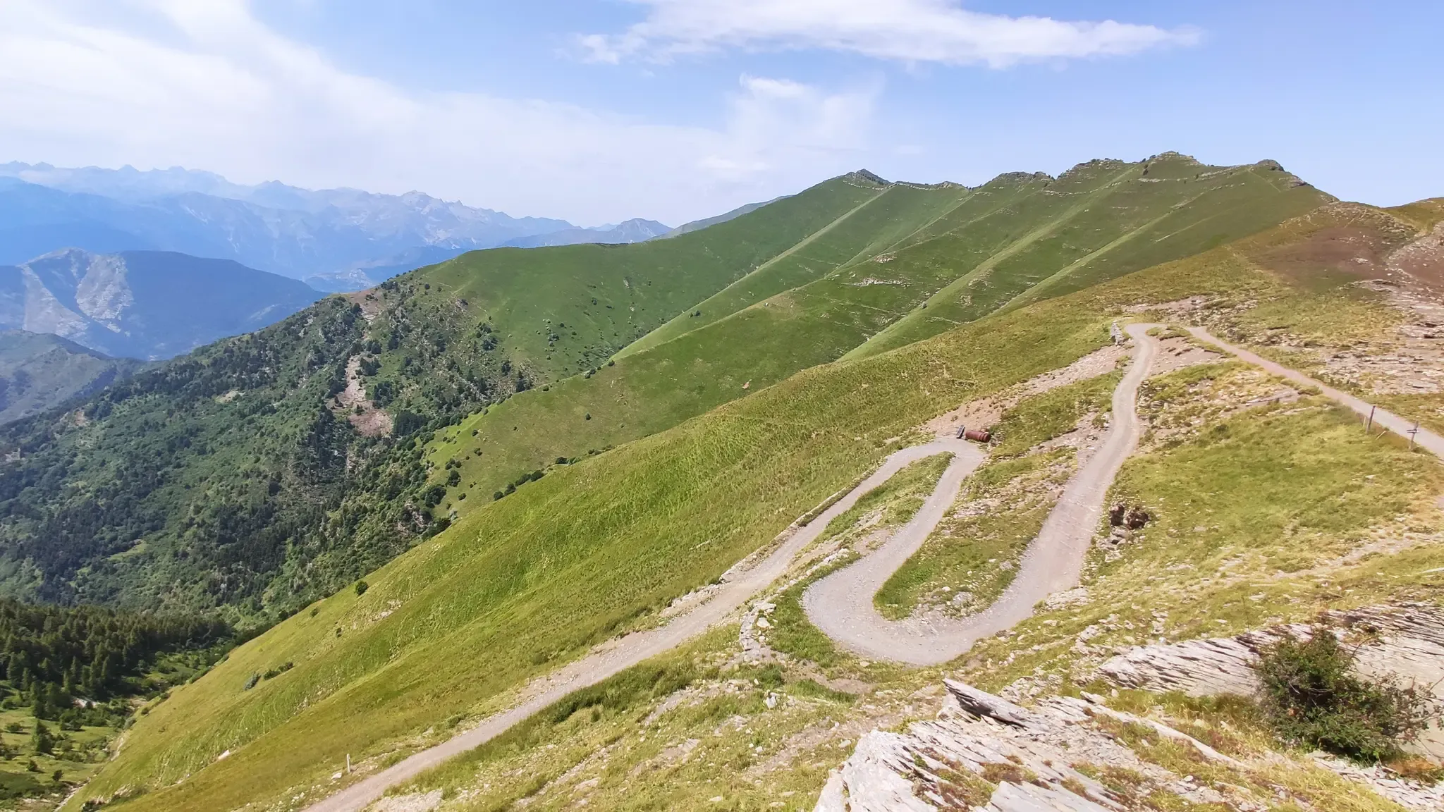
This long stretch of the dirt road that goes from Perlezzi up towards the Aiona–Pratomollo Refuge offers wide panoramic views: from the Aveto Mountains to the sea, with Lake Giacopiane appearing between the mountains like one of those bodies of water in the nativity scene, reflected on silver paper. The surface is generally hard and compact, but in some short stretches the loose gravel can reduce grip, both uphill and downhill. The descent is pleasant and never too steep, while the climb requires a certain amount of effort: the difference in altitude is felt and the ascent is constant, with no flat stretches to recover. However, the effort is well rewarded by the increasingly spectacular views that open up as you climb higher.
0
0
This stretch of the dirt road that climbs from Perlezzi towards the Aiona–Pratomollo Refuge runs entirely through a splendid beech forest. Many of the trees are large, a sign of the age and majesty of the forest. In summer, you cycle in the shade of a cool green tunnel; in autumn, the landscape is tinged with warm shades, from yellow to brown. Even in winter, the forest retains a special charm, with the branching of the beech trees clearly visible in its elegant geometry. The surface is compact and smooth, making cycling easy. The difference in height is minimal, making this stretch particularly pleasant to ride.
0
0
Frequently Asked Questions
How many no-traffic touring cycling routes are available around Rezzoaglio?
There are 11 dedicated no-traffic touring cycling routes featured in this guide for the Rezzoaglio area. These routes are generally designed for experienced cyclists due to their challenging nature and significant elevation changes.
What is the typical difficulty level of these no-traffic touring cycling routes?
The no-traffic touring cycling routes around Rezzoaglio are predominantly classified as difficult. They often feature substantial elevation gains, with some routes climbing over 1,000 meters, making them suitable for cyclists seeking a challenging and rewarding experience.
What is the best time of year to enjoy no-traffic touring cycling in Rezzoaglio?
The best time to cycle in Rezzoaglio is typically from late spring through early autumn. During these months, the weather is generally mild and pleasant, and the natural landscapes, such as the beech forests around Lago delle Lame, are particularly vibrant. Autumn offers stunning foliage, especially around the lakes.
What kind of natural attractions can I expect to see along these routes?
The routes often traverse the beautiful Aveto Regional Natural Park, offering views of extensive forests, green meadows, and unspoiled streams. You can encounter stunning natural features like Lame Lake, known for its bright green waters, and the unique Black Lake. Some routes may also pass by the Ravezza Waterfall.
Are there any circular no-traffic touring cycling routes available?
Yes, several no-traffic touring cycling routes around Rezzoaglio are designed as loops, allowing you to start and finish at the same point. Examples include the Rifugio Monte Penna – View of Lago delle Lame loop from Monte Penna and the Passo del Chiodo – Incisa Pass loop from Tornolo.
What do other touring cyclists enjoy most about cycling in Rezzoaglio?
The area is highly rated by the komoot community, with an average score of 4.37 stars. Reviewers often praise the tranquility of the no-traffic routes, the stunning natural beauty of the Aveto Regional Natural Park, and the challenging yet rewarding climbs that offer breathtaking panoramic views.
Are there any family-friendly no-traffic cycling options in the Rezzoaglio area?
While the specific touring cycling routes listed in this guide are generally challenging and rated as 'difficult', the broader Aveto Regional Natural Park offers various paths. For families, it's advisable to look for shorter, flatter sections within the park, perhaps around Lago delle Lame, which might be more suitable for a relaxed family ride, though these may not be dedicated 'touring cycling' routes.
Where can I find parking for these no-traffic touring cycling routes?
Parking is typically available in the main villages and near popular trailheads within the Aveto Regional Natural Park. For routes starting from specific points like Monte Penna or Tornolo, you can usually find designated parking areas. It's always recommended to check local signage upon arrival.
Are there places to eat or stay near the no-traffic touring cycling routes?
Rezzoaglio and its surrounding hamlets offer various options for refreshments and accommodation. You'll find local cafes, restaurants, and guesthouses. Near Lago delle Lame, for instance, there are facilities that cater to visitors. It's a good idea to check opening times, especially outside of peak season.
Can I bring my dog on these no-traffic touring cycling routes?
While the Aveto Regional Natural Park is generally dog-friendly, it's important to keep dogs on a leash, especially in protected areas and near wildlife. For touring cycling, consider your dog's endurance and comfort, as these routes can be long and challenging. Always carry enough water for both yourself and your pet.
What are some notable viewpoints or landmarks along the routes?
Many routes offer spectacular views, particularly from higher elevations like those found on the Passo del Chiodo – Monte Penna Forest loop. Mount Ramaceto, accessible via trekking paths, also provides breathtaking panoramas of the Ligurian Apennines. Historic villages like Vicosoprano and the bell tower of the Chiesa di San San Michele Arcangelo in Rezzoaglio offer cultural landmarks.
Most popular routes around Rezzoaglio
Most popular attractions around Rezzoaglio

Get inspired with the komoot mobile app


Explore more
Browse the best Cycling routes in other regions.
