The best traffic-free bike rides around Enego
4.5
(432)
11,811
riders
23
rides
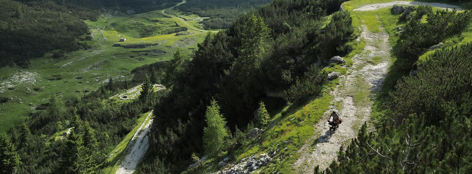
No traffic road cycling routes around Enego are situated in a mountain village at the eastern end of Italy's Altopiano di Asiago 7 Comuni. The terrain ranges from the Valsugana valley up to Mount Ortigara, reaching over 2,100 meters above sea level, offering varied elevation profiles. The region features green slopes, lush forests, expansive meadows, and the distinctive Marcesina Plateau, known for its unique microclimate. Road cyclists can expect a network of routes traversing mountainous landscapes, including wide forest paths…
Last updated: October 3, 2026
4.7
(65)
1,579
riders
109km
04:49
1,010m
1,010m
Hard road ride. Very good fitness required. Some segments of this route may be unpaved and difficult to ride.
4.3
(26)
284
riders
53.9km
02:37
780m
780m
Moderate road ride. Good fitness required. Mostly well-paved surfaces and easy to ride.

4.5
(15)
403
riders
52.4km
02:24
570m
570m
Moderate road ride. Good fitness required. Mostly well-paved surfaces and easy to ride.
4.8
(17)
293
riders
72.4km
04:13
1,720m
1,720m
Hard road ride. Very good fitness required. Mostly well-paved surfaces and easy to ride.
4.4
(12)
229
riders
43.0km
02:27
960m
960m
Hard road ride. Very good fitness required. Some segments of this route may be unpaved and difficult to ride.
Get access to more routes and recommendations from other explorers.
Already have an account?
Our route recommendations are based on thousands of hikes, rides, and runs completed by other people on komoot.
Start today with a free account
Your next adventure awaits.

Other adventures around Enego

Tips from the Community

From Caldonazzo, a beautiful cycle path leads along the shore of the lake to Pergine. For swimming, it's better to head to the neighboring Lago di Levico.
0
0
It is also worth riding on service roads off the Valsugana cycle path, but partly this involves a few meters of altitude.
0
0

Quiet village, touristy in summer due to its beautiful lake,
0
0

The Brenta cycle path is a beautiful bike route (trekking bikes, mountain bikes, and gravel bikes are recommended, as there are both paved and light dirt sections on the banks) that connects the mountains of Trento to the lagoon of Venice, passing through Bassano del Grappa and Padua. It is a total of about 175 kilometers long, has comfortable roads, and is easy for everyone to cycle.
0
0
Cima di Campo (1,425–1,512 m) in Arsiè is a well-known mountain and alpine pass in the Belluno Dolomites, famous for its cycling climb, the Forte Leone from World War I, and hiking routes. Length: Approximately 18.5 km starting from the center of Arsiè. Elevation gain and Gradient: 1,111 meters of elevation gain with an average gradient of 6% and double-digit peaks in the initial sections towards Mellame and Col Perer. Famous for being the first iconic climb of the Dolomiti Bellunesi cycling granfondo. Forte Leone: A large armored military fortress built between 1906 and 1912 to defend the border, currently undergoing renovation.
1
0
historic mountain road with eight hairpin bends, the Tagliata della Scala and the Tagliata delle Fontanelle. They are located between the Valsugana and the territory of Feltre, in Veneto. The fortifications: Between 1892 and 1895, the Tagliata della Scala in the lower part and the Tagliata delle Fontanelle in the upper part were built to defend the border. The walkway: The two parts are joined by a long covered gallery with loopholes. War: They did not play a major military role during World War I and were later abandoned.
0
0
The beautiful and fresh cycle path along the river
1
0
The cycle path towards Cismon del Grappa, very cool and shaded.
0
0
Frequently Asked Questions
How many no-traffic road cycling routes are available around Enego?
There are over 25 dedicated no-traffic road cycling routes around Enego, catering to various fitness levels. These routes offer a mix of easy, moderate, and challenging rides, ensuring there's something for every road cyclist looking for quiet roads.
What kind of terrain can I expect on Enego's no-traffic road cycling routes?
Enego's no-traffic road cycling routes traverse diverse terrain, from the edge of the Valsugana valley to higher altitudes like Mount Ortigara. You'll find routes with significant elevation gains, such as those leading towards Monte Grappa, as well as smoother, flowing sections like parts of the Valsugana Cycle Path. Many routes feature well-paved surfaces, but some may include wide forest paths or even unpaved segments, especially in mountainous areas.
Are there any easy, traffic-free road cycling routes suitable for beginners or families in Enego?
Yes, Enego offers several easier, traffic-free road cycling options. The Valsugana Cycle Path, for instance, is known for its flowing design and absence of significant climbs, making it an accessible choice. While the guide lists 4 easy routes, it's always good to check individual route details for specific suitability for beginners or families. For example, the Primolano Steps – Pedavena Brewery loop from Primolano is a moderate ride that could be suitable for those with good fitness looking for a less strenuous option.
What are some of the most scenic no-traffic road cycling routes around Enego?
Many routes offer breathtaking views. The region is characterized by green slopes, lush forests, expansive meadows, and distinctive alpine pastures. Routes exploring the Marcesina Plateau, often called the "Finland of Italy," provide unique natural beauty. The climb to Monte Grappa from Cismon del Grappa, while challenging, rewards cyclists with unforgettable panoramic views of the valley and even distant glimpses of the Dolomites and the Venice Lagoon.
What landmarks or points of interest can I see along the no-traffic road cycling routes?
Along your rides, you can discover various historical and natural attractions. For example, the Primolano Steps and Tagliata Fortification offer a glimpse into the region's past. The Ciclopista del Brenta: Primolano to Cismon del Grappa is a notable cycleway itself. You might also pass by natural wonders like the Oliero Caves or the Oliero River.
What is the best time of year for no-traffic road cycling in Enego?
The warmer seasons are generally ideal for road cycling in Enego. From spring to autumn, the weather is more favorable, and the landscapes are vibrant. The Marcesina Plateau, for instance, blossoms into immeasurable beauty during warmer months. While specific routes might be accessible earlier or later, the peak cycling season typically aligns with pleasant temperatures and clear roads.
Are there any challenging no-traffic road cycling routes for experienced cyclists?
Absolutely. Enego is well-known for its demanding climbs. Routes like the Primolano Steps – Cima di Campo loop from Primolano, with its significant elevation gain, require very good fitness. The climb to Monte Grappa from Cismon del Grappa is another challenging option, featuring a thrilling descent into the Brenta Valley and a long ascent on a military road built directly into the rock face.
What do other road cyclists enjoy most about the no-traffic routes in Enego?
The komoot community highly rates the road cycling experience in Enego, with an average score of 4.6 stars. Reviewers often praise the stunning mountainous scenery, the variety of routes from challenging climbs to serene paths, and the unique natural beauty of areas like the Marcesina Plateau. The absence of heavy traffic on these routes is a significant draw, allowing for a more immersive and peaceful cycling experience.
Are there any loop routes for no-traffic road cycling in Enego?
Yes, many of the no-traffic road cycling routes around Enego are designed as loops, allowing you to start and finish at the same point. An example is the challenging Valsugana Cycle Path – Valsugana Cycle Route loop from San Marino, which covers a substantial distance. Loop routes are convenient for exploring the region without needing return transport.
Where can I find parking for no-traffic road cycling routes in Enego?
Enego, as a destination for outdoor activities, generally offers parking options. For specific routes, it's advisable to check the starting points. Many routes begin from towns or villages like Primolano or Cismon del Grappa, where public parking is typically available. Always look for designated parking areas to ensure a smooth start to your ride.
Can I reach Enego and its cycling routes using public transport?
While Enego is a mountain village, public transport connections exist. For cyclists, it's important to check if buses or trains allow bike transport, especially for longer journeys or if you plan to use a point-to-point route. The Valsugana Cycle Path, for example, is part of a larger cycle-pedestrian route, which often implies better public transport accessibility for cyclists along its length. For detailed information on public transport to Enego, you might consult local transport authority websites.
Are there any cafes or places to stop for refreshments along the no-traffic road cycling routes?
Yes, Enego and the surrounding Altopiano di Asiago 7 Comuni region are well-equipped to welcome cyclists. Many routes pass through charming villages or near mountain huts where you can find cafes, restaurants, and places to refuel. For instance, the Primolano Steps – Pedavena Brewery loop from Primolano explicitly mentions a brewery, indicating potential refreshment stops. It's always a good idea to check the route details for specific points of interest and services.
Most popular attractions around Enego

Get inspired with the komoot mobile app


Explore more
Browse the best Road cycling routes in other regions.
