The best traffic-free bike rides around Vilminore Di Scalve
4.3
(102)
2,266
riders
25
rides
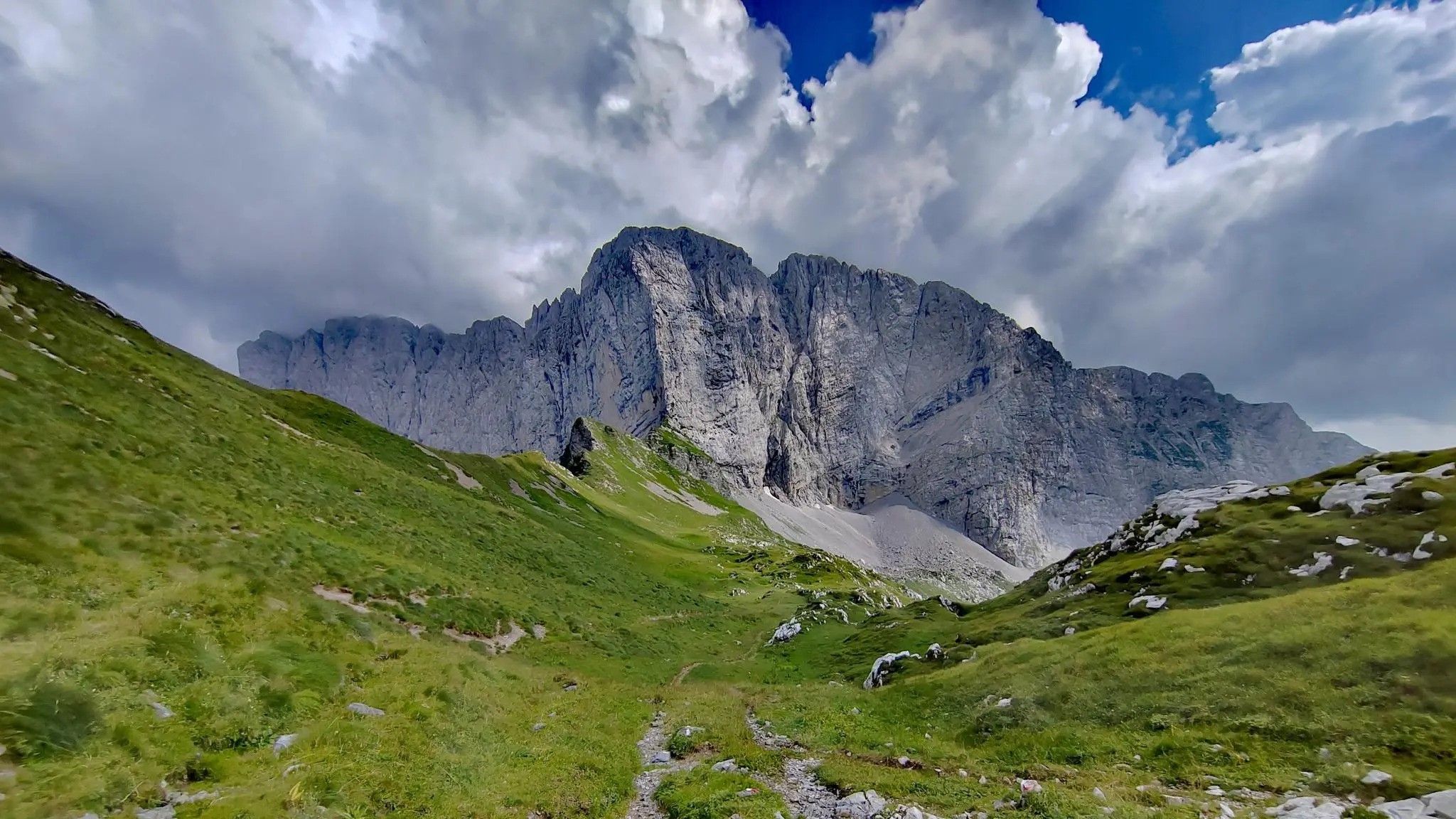
No traffic touring cycling routes around Vilminore Di Scalve traverse the Val di Scalve, a region characterized by its alpine environment with significant elevation changes. The landscape features valleys, mountain passes, and dense forests, providing varied terrain for cyclists. Key natural features include passes like Vivione and Manina, and the historical Gleno Dam. The area offers a network of routes suitable for different skill levels, from moderate rides to more challenging endeavors.
Best no traffic touring cycling routes around Vilminore Di Scalve
- The most popular no traffic touring cycling route is View of Lake Endine – Clusone Pine Forest loop from Rusio, a 45.9 miles (73.8 km) trail that takes 5 hours 1 minute to complete. This route offers views of Lake Endine and passes through pine forests.
- Another top favourite among local touring cyclists is Vivione Pass – Schilpario loop from Azzone, a difficult 39.0 miles (62.8 km) path. This route features significant climbs and alpine scenery around Vivione Pass.
- Local touring cyclists also love the Schilpario – Passo del Vivione loop from Schilpario, a 15.3 miles (24.7 km) trail leading through mountain passes, often completed in about 1 hour 57 minutes.
- Touring cycling around Vilminore Di Scalve is defined by alpine scenery, mountain passes, and forested valleys. The network offers options for different ability levels, from moderate to difficult routes.
- The routes in Vilminore Di Scalve are highly rated by the komoot community with an average score of 4.3 stars from more than 100 reviews. More than 2000 touring cyclists have used komoot to explore Vilminore Di Scalve's varied terrain.
Last updated: July 13, 2026
4.0
(5)
95
riders
55.0km
04:03
1,270m
1,270m
Hard bike ride. Very good fitness required. Mostly paved surfaces. Suitable for all skill levels.
5.0
(4)
35
riders
37.0km
02:57
1,040m
1,040m
Hard bike ride. Very good fitness required. Mostly paved surfaces. Suitable for all skill levels.

Sign up for free
5.0
(1)
25
riders
24.6km
01:51
610m
610m
Hard bike ride. Very good fitness required. Mostly paved surfaces. Suitable for all skill levels.
17
riders
48.9km
05:19
1,960m
1,960m
Hard bike ride. Very good fitness required. Mostly paved surfaces. Suitable for all skill levels.
14
riders
78.2km
06:02
2,060m
2,070m
Hard bike ride. Very good fitness required. Mostly paved surfaces. Suitable for all skill levels.
Get access to more routes and recommendations from other explorers.
Sign up for free
Already have an account?
Our route recommendations are based on thousands of hikes, rides, and runs completed by other people on komoot.
Start today with a free account
Your next adventure awaits.
Login or Signup




Tips from the Community

Here is a clear and complete summary of BORNO, based on the most authoritative online sources. I will immediately give you the essential overview, then the useful details for those who – like you – live in and frequent the Altopiano del Sole area. 🏔️ Borno in brief Borno is a mountain village in Val Camonica, located at an altitude of 912 m, on the famous Altopiano del Sole. It is considered a "pearl" of the valley for its combination of open landscapes, woods, meadows, history, and living traditions. It is one of the main centers of the area, with about 2400 inhabitants and a long history that spans the medieval era, Venetian rule, and transformations of the twentieth century.
0
0

Reachable from Borno, following a restored mule track with a concrete road surface (the last section is closed due to landslide restoration work with a signposted detour) with gradients of over 20%
0
0
Lake Lova is a picturesque hiking destination located above Borno, on the Altopiano del Sole plateau in Val Camonica. It is appreciated for its alpine landscape, tranquility, and the variety of trails that surround it. The lake is located at approximately 1,392 meters above sea level and can be reached via several hiking trails, including the Sentiero della Memoria (Path of Remembrance) that starts from the church of San Fiorino in Borno. After a short paved stretch to the Trattoria Navertino, you take a dirt path that winds through larch and fir trees, with steep sections and slippery cobblestones. The hike is immersed in a natural environment typical of the Lombard Prealps. The hike is immersed in a natural environment typical of the Lombard Prealps, with natural fountains and good cell phone coverage. A longer alternative is the Monte Mignone – Lago di Lova circular hike, approximately 11.1 km long with an elevation gain of 837 meters, to be done counterclockwise. This route offers spectacular views and passes through pastures and woods, with the lake as its focal point. Lago di Lova is also a hub for other trails: from here, you can continue towards the Rifugio San Fermo or the Rifugio Laeng, following CAI trails 106 and 182. Parking is available near the lake, making it accessible even for less experienced hikers. From a scenic perspective, the lake is nestled in a green valley surrounded by woods and pastures, with calm waters reflecting the sky and surrounding mountains. It's an ideal destination in all seasons, but particularly captivating in autumn for the colors of the foliage.
2
0
Lake Lova is a picturesque hiking destination located above Borno, on the Altopiano del Sole plateau in Val Camonica. It is appreciated for its alpine landscape, tranquility, and the variety of surrounding trails. The lake is located at approximately 1,392 meters above sea level and can be reached via several hiking trails, including the Sentiero della Memoria (Path of Remembrance) that starts from the church of San Fiorino in Borno. After a short paved stretch to the Trattoria Navertino, you take a dirt path that winds through larch and fir trees, with steep sections and slippery cobblestones. The hike is immersed in a natural environment typical of the Lombard Prealps, with natural fountains and good cell phone coverage. A longer alternative is the Monte Mignone – Lake Lova circular hike, approximately 11.1 km long with an elevation gain of 837 meters, to be done counterclockwise. This route offers spectacular views and passes through pastures and woods, with the lake as its focal point. Lake Lova is also a hub for other trails: from here, you can continue towards the San Fermo Refuge or the Laeng Refuge, following CAI trails 106 and 182. Parking is available near the lake, making it accessible even for less experienced hikers. Scenically, the lake is nestled in a green valley surrounded by woods and pastures, with calm waters reflecting the sky and surrounding mountains. It's an ideal destination in all seasons, but particularly captivating in autumn due to the colorful foliage.
0
0
Fondi di Schilpario is an Alpine village located at approximately 1,250 meters above sea level in the municipality of Schilpario (BG), in the Scalve Valley. It is a strategic starting point for numerous hikes and snowshoeing excursions, immersed in a spectacular mountain landscape. 🏞️ Main Features Altitude: 1,250 m Access: Via Provincial Road 294 towards the Vivione Pass Services: Parking, votive church (Maria Ausiliatrice and Santa Barbara), picnic tables Ambience: Fir forests, alpine pastures, views of the Presolana and Cimon della Bagozza peaks 🥾 Excursions from Fondi Campione Refuge (1,900 m) – 1.5 hours Monte Campioncino (2,102 m) – 2.5 hours Don Giulio Corini Bivouac (2,016 m) – 2.45 hours Madonnina dei Campelli – 1.5 hours Malga Campelli Bassa and Alta – 1.15–1.45 hours ❄️ In winter Starting point for snowshoeing and ski mountaineering Groomed and marked trails, including Snow Spectacular snow-covered landscape, ideal for nature photography 🙏 Interesting Facts The votive church is dedicated to Mary Help of Christians and Saint Barbara, protectors of mountaineers and miners. Nearby is a memorial to the victims of the 1944 massacre.
0
0

A very pleasant climb from Val di Scalve to Borno. Beautiful and not particularly challenging. 😊
2
0


Frequently Asked Questions
How many no-traffic touring cycling routes are available around Vilminore di Scalve?
There are over 20 dedicated no-traffic touring cycling routes around Vilminore di Scalve. These routes range in difficulty, with 2 easy, 5 moderate, and 14 difficult options, ensuring there's something for every skill level.
What kind of landscapes can I expect on these routes?
The no-traffic routes in Val di Scalve offer a rich tapestry of landscapes. You'll experience stunning alpine scenery, shaded forests, and panoramic vistas. Many routes traverse valleys and mountains, passing through charming towns and hamlets, with surfaces varying from asphalt to dirt roads and gravel.
Are there any family-friendly no-traffic cycling routes?
Yes, Vilminore di Scalve offers a couple of easy no-traffic touring cycling routes that are suitable for families. These routes often feature well-paved surfaces and lower elevation gains, making them enjoyable for all fitness levels. While specific routes are not listed as 'family-friendly' in the data, the 'easy' routes are generally best for this purpose.
Can I bring my dog on these cycling routes?
While the guide focuses on cycling routes, the Val di Scalve region is generally welcoming to dogs, especially on outdoor trails. It's always best to check individual route descriptions on Komoot for specific restrictions or recommendations regarding pets. Ensure your dog is well-behaved and kept on a leash where necessary, especially in populated areas or near wildlife.
What are some notable natural attractions or landmarks I can see along the routes?
The region is rich in natural beauty and historical sites. You can cycle near the poignant Gleno Dam and Lake, or explore routes that offer views of the Serio Falls. Other natural highlights include the Barbellino Reservoir and Lova Lake, providing serene spots for a break.
Are there any circular no-traffic routes available?
Yes, many of the no-traffic touring cycling routes around Vilminore di Scalve are designed as loops, allowing you to start and end in the same location. An example is the challenging Vivione Pass – Schilpario loop from Azzone, which covers over 62 km. Another option is the Schilpario – Passo del Vivione loop from Schilpario.
What is the best time of year to go touring cycling in Vilminore di Scalve?
The best time for touring cycling in Vilminore di Scalve is typically from spring through early autumn (May to October). During these months, the weather is generally mild, and the alpine passes are clear of snow, offering optimal conditions to enjoy the scenic routes and natural beauty of the Val di Scalve.
Where can I find parking facilities for my bike near these routes?
While specific parking facilities for cyclists are not detailed, many routes start from or pass through towns like Vilminore di Scalve, Schilpario, or Azzone. These villages typically offer public parking areas where you can safely leave your vehicle before starting your ride. It's advisable to check local signage upon arrival.
Are there cafes, restaurants, or accommodation options along the no-traffic routes?
The Val di Scalve region, including towns like Vilminore di Scalve, Schilpario, and Azzone, offers various amenities. Many routes connect small villages where you can find cafes, restaurants, and accommodation. The region research also notes the provision of water refill points along many routes, which is convenient for cyclists.
What do other touring cyclists enjoy most about cycling in Vilminore di Scalve?
The area is highly rated by the Komoot community, with an average score of 4.26 stars. Reviewers often praise the breathtaking alpine scenery, the variety of routes catering to different skill levels, and the opportunity to explore quiet, less-trafficked paths. The combination of challenging climbs and serene natural beauty is frequently highlighted.
Are there any routes that offer views of Lake Endine?
Yes, you can find routes that provide scenic views of Lake Endine. For instance, the challenging View of Lake Endine – Clusone Pine Forest loop from Rusio is a long route that offers beautiful vistas of the lake as part of its journey through varied landscapes.
Can I reach the starting points of these routes using public transport with my bike?
Public transport options in the Val di Scalve region are limited, and policies regarding bikes on buses or trains can vary. While some regional buses might accommodate bikes, it's not guaranteed, especially for touring bicycles. It's recommended to check with local transport providers directly for their current bike carriage policies before planning your trip.
Most popular routes around Vilminore Di Scalve
Most popular attractions around Vilminore Di Scalve

Get inspired with the komoot mobile app


Explore more
Browse the best Cycling routes in other regions.
