The best hikes from bus stations around Øvre Sjodalsvatnet
4.6
(1659)
8,975
hikers
22
hikes
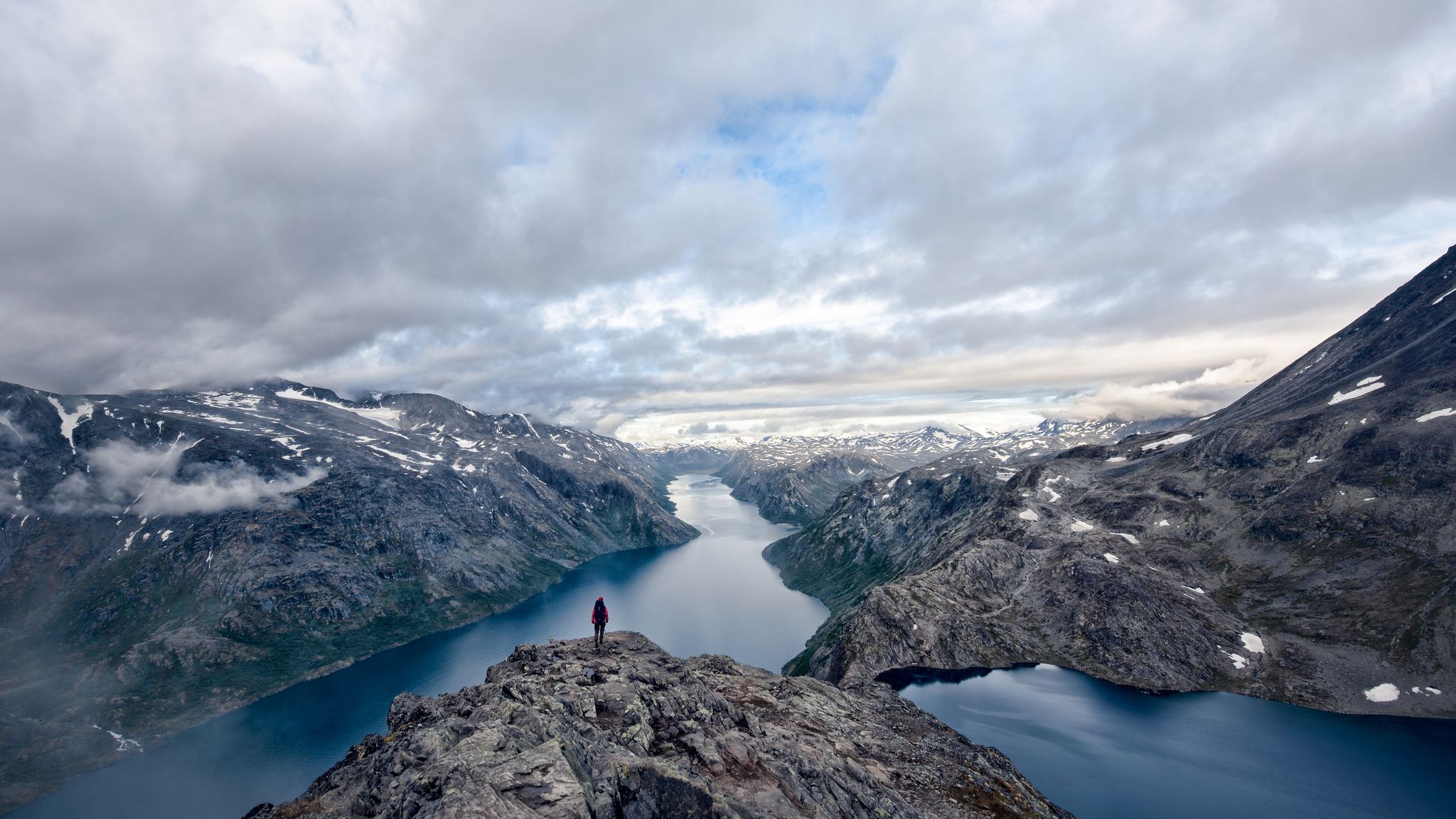
Bus station hiking trails around Øvre Sjodalsvatnet are situated in the Jotunheimen mountain range in Norway, characterized by a pristine lake, alpine surroundings, and proximity to Jotunheimen National Park. The landscape features deep valleys, waterfalls, and varied mountain terrain. The area is defined by the Sjoa river, which flows through the lake, and offers views of Lake Gjende.
Best bus station hiking trails around Øvre Sjodalsvatnet
- The most popular bus station hiking route is Bessvatnet – Bessa Waterfall loop from…
Last updated: May 17, 2026
4.8
(37)
155
hikers
16.2km
06:27
870m
870m
Hard hike. Very good fitness required. Mostly accessible paths. Sure-footedness required.
4.8
(32)
143
hikers
5.29km
02:03
390m
390m
Moderate hike. Good fitness required. Easily-accessible paths. Suitable for all skill levels.

Sign up for free
4.0
(4)
23
hikers
Moderate hike. Good fitness required. Mostly accessible paths. Sure-footedness required.
5.0
(2)
14
hikers
Moderate hike. Good fitness required. Mostly accessible paths. Sure-footedness required.
4.7
(7)
47
hikers
16.4km
06:54
800m
800m
Hard hike. Very good fitness required. Mostly accessible paths. Sure-footedness required.
Get access to more routes and recommendations from other explorers.
Sign up for free
Already have an account?
Our route recommendations are based on thousands of hikes, rides, and runs completed by other people on komoot.
Start today with a free account
Your next adventure awaits.
Login or Signup
Popular around Øvre Sjodalsvatnet
Other adventures around Øvre Sjodalsvatnet

Tips from the Community

From the wooden bridge that crosses the stream, you can admire both the crystal-clear color of the torrent's waters and its power. A stop like an entrance into the wild world.
0
0

The high pass between Sikkilsdalen and Gjende – the gateway to Jotunheimen – Sikkilsdalskardet is an important path junction. It features on both the Omveien and Jotunheimstien long-distance trails and affords glorious views.
0
0
Sikkilsdalshøa is the 5,833-foot (1,778 m) high point of a grand massif on the northern side of Sikkilsdalen on the cusp of Jotunheimen National Park. The hike up from Sikkilsdalsseter is strenuous but not overly technical. A vast panorama including Rondane, Dovre, Jotunheimen and Langsua awaits from the top on a clear day. However, it’s the view down the length of Gjendebåten, towards the famous Bessengen and into the heart of Jotunheimen that's the most impressive.
0
0

A very beautiful, multi-tiered waterfall. Definitely worth a visit.
0
0
The waterfall is a worthwhile destination for a hike.
0
0

With luck you will meet them
0
0
At 5,718 feet (1,743 m), Veslfjellet is the highest point on the famous Besseggen Ridge. In contrast to some of the narrower sections on the route, the summit is relatively broad but the views are still spectacular.
0
0

The summit of Sikkilsdalshøa (1.774 m) is enclosed within an amphitheatre of high mountains: spectacular!
0
0
Frequently Asked Questions
How many bus station hiking trails are available around Øvre Sjodalsvatnet?
There are over 20 hiking routes accessible from bus stations around Øvre Sjodalsvatnet, offering a variety of experiences for different skill levels.
Are there any family-friendly bus station hikes in the area?
Yes, the region offers some easier routes suitable for families. For a moderate option, consider the Bessa Waterfall – Waterfall Near Bessvatnet loop from Bessa minikraftverk, which is about 5.3 km long and features beautiful waterfalls.
Can I bring my dog on these bus station accessible trails?
Many trails in the Jotunheimen area are dog-friendly, but it's always best to check local regulations, especially within Jotunheimen National Park boundaries, regarding leash requirements and protected areas. Generally, dogs are welcome on trails as long as they are kept under control.
Are there any circular routes accessible from bus stops?
Yes, several circular routes are available. For example, the Bessa Waterfall – View of Lake Gjende loop from Bessa minikraftverk offers a challenging 14.3 km circular hike with stunning views. Another option is the moderate New Bridge Over the River – Bessegg Waterfall loop from Bessa minikraftverk.
What kind of natural features or attractions can I expect to see along these routes?
The trails around Øvre Sjodalsvatnet offer breathtaking alpine scenery. You can expect to see picturesque lakes like Øvre Sjodalsvatnet and Lake Gjende, and impressive waterfalls such as the Bessa Waterfall. The region is also known for its proximity to Jotunheimen National Park, with its mighty waterfalls and deep valleys.
What is the typical difficulty level of bus station hikes around Øvre Sjodalsvatnet?
The trails vary in difficulty. While there are a few easy routes, the majority (around 14) are considered moderate, and some (around 7) are difficult. For instance, the Bessvatnet – Bessa Waterfall loop from Bessa minikraftverk is a difficult 17.4 km hike with significant elevation gain.
What is the best time of year for bus station hikes in this region?
The best time for hiking around Øvre Sjodalsvatnet is typically during the summer months (June to September) when the weather is milder, and trails are free of snow. The Valdresflye Scenic Road (Route 51), which runs along the lake, is usually open during this period, facilitating bus access to trailheads.
Are there any places to eat or stay near the bus-accessible trailheads?
Yes, the area offers facilities for visitors. The Maurvangen campground and Bessheim mountain lodge are conveniently located near the southwestern shore of Øvre Sjodalsvatnet, providing options for accommodation and often having cafes or dining facilities.
What do other hikers enjoy most about hiking in Øvre Sjodalsvatnet?
The area is highly rated by the komoot community, with an average score of 4.6 stars. Reviewers often praise the stunning alpine environment, the diverse range of trails, and the spectacular views of lakes and waterfalls within the Jotunheimen mountains.
Are there any trails that offer views of Lake Gjende?
Yes, several trails provide excellent views of Lake Gjende. The challenging Bessa Waterfall – View of Lake Gjende loop from Bessa minikraftverk and the moderate New Bridge Over the River – View of Lake Gjende loop from Bessa minikraftverk are both designed to showcase these breathtaking vistas.
How long do the bus station hikes typically take?
The duration varies significantly depending on the route's distance and difficulty. Shorter, moderate trails like the Bessa Waterfall – Waterfall Near Bessvatnet loop from Bessa minikraftverk can take around 2 hours, while more difficult and longer routes, such as the Bessvatnet – Bessa Waterfall loop from Bessa minikraftverk, can take over 7 hours to complete.

Get inspired with the komoot mobile app


Explore more
Browse the best Hikes in other regions.
