Easy hikes and walks around Øvre Sjodalsvatnet
4.6
(1677)
9,062
hikers
54
hikes
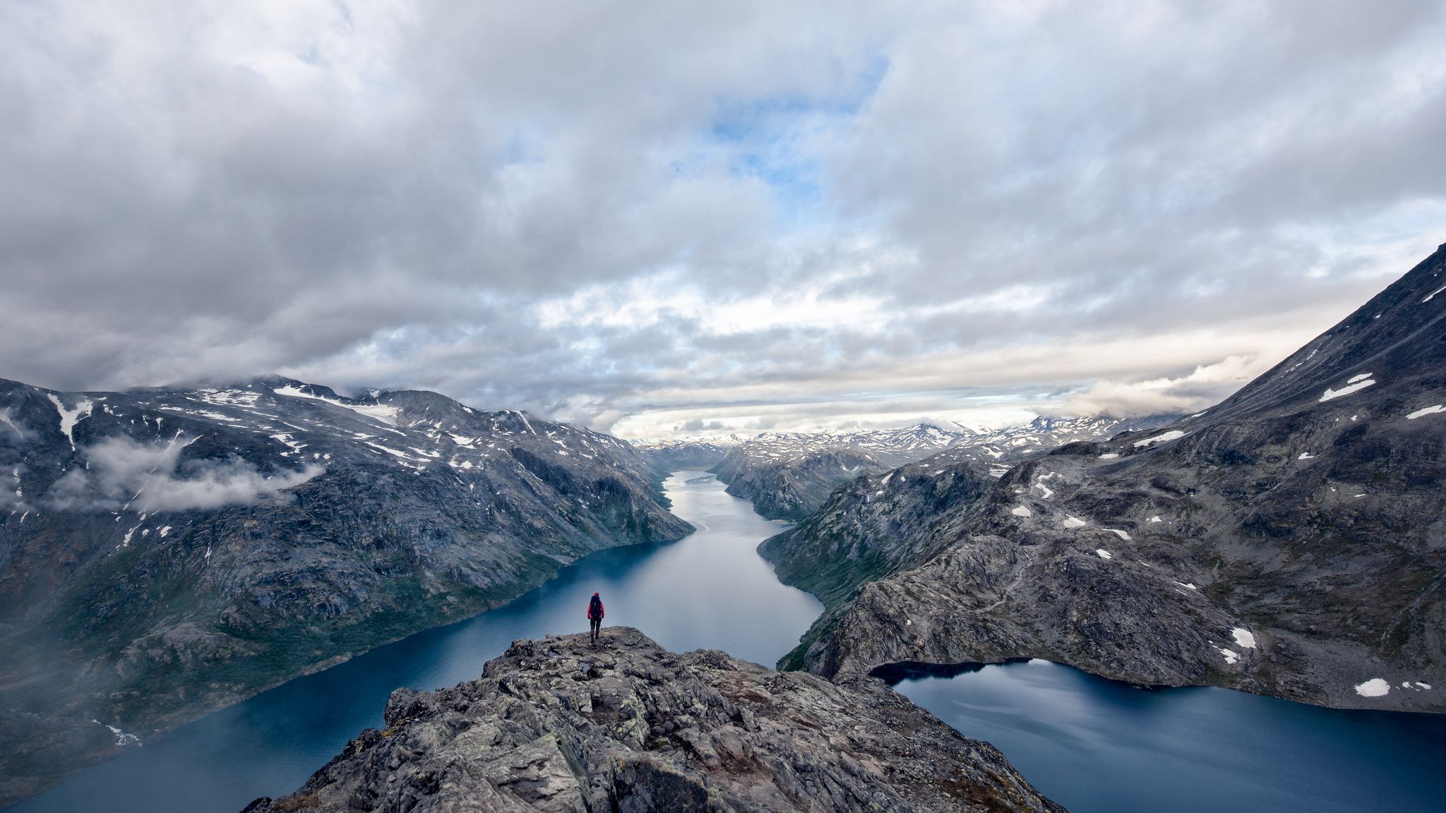
Easy hiking trails around Øvre Sjodalsvatnet offer access to the eastern part of the Jotunheimen mountain range, characterized by alpine landscapes and the clear waters of Øvre Sjodalsvatnet lake. The area features varied terrain, including the Sjoa river system and the Fjosranden Esker, a visible gravel ridge. Hikers can explore paths with minimal elevation gain, suitable for various fitness levels. This region provides a natural setting for outdoor activities, with routes often following riverbanks or traversing gentle slopes.
Best easy hiking trails around Øvre Sjodalsvatnet
- The most popular easy hiking route is Besseggen Rapids – Maurvangen loop from Gjendesheimkrysset, a 4.3 miles (6.9 km) trail that takes 1 hour 46 minutes to complete. This path offers views of the Sjoa river rapids with minimal elevation changes.
- Another top favourite among local hikers is Stuttgonglie Nature Reserve – Hulderstigen loop from Stuttgonglie naturreservat, an easy 3.4 miles (5.4 km) path. This route leads through the Stuttgonglie Nature Reserve, featuring varied natural surroundings.
- Local hikers also love the Hulderstigen Trail – Bridge over the Sjoa loop from Russtangen, a 3.8 miles (6.1 km) trail leading through natural landscapes and crossing the Sjoa river, often completed in about 1 hour 37 minutes.
- Hiking around Øvre Sjodalsvatnet is defined by its alpine landscapes, the Sjoa river system, and the visible Fjosranden Esker. The network offers options for different ability levels, focusing on easy hiking trails.
- The routes in Øvre Sjodalsvatnet are highly rated by the komoot community with an average score of 4.6 stars from more than 1,300 reviews. More than 6,300 hikers have used komoot to explore Øvre Sjodalsvatnet's varied terrain.
Last updated: June 30, 2026
6
hikers
1.06km
00:16
10m
10m
Easy hike. Great for any fitness level. Easily-accessible paths. Suitable for all skill levels.
4.7
(3)
30
hikers
6.89km
01:46
30m
30m
Easy hike. Great for any fitness level. Easily-accessible paths. Suitable for all skill levels.

Sign up for free
4.8
(181)
676
hikers
Easy hike. Great for any fitness level. Easily-accessible paths. Suitable for all skill levels.
3.6
(8)
20
hikers
Easy hike. Great for any fitness level. Easily-accessible paths. Suitable for all skill levels.
4
hikers
2.63km
00:42
20m
30m
Easy hike. Great for any fitness level. Easily-accessible paths. Suitable for all skill levels.
Get access to more routes and recommendations from other explorers.
Sign up for free
Already have an account?
Our route recommendations are based on thousands of hikes, rides, and runs completed by other people on komoot.
Start today with a free account
Your next adventure awaits.
Login or Signup
Popular around Øvre Sjodalsvatnet
Other adventures around Øvre Sjodalsvatnet

Tips from the Community

From the wooden bridge that crosses the stream, you can admire both the crystal-clear color of the torrent's waters and its power. A stop like an entrance into the wild world.
0
0

With luck you will meet them
0
0

Beautiful road through a spectacular area
0
0

At this point you decide whether you want to take the risk of a dead end. No crossing possible if there is too much water. But the path and the views are still worth it. 😉
0
0

Marshy but passable area. Well-signposted route and signs to learn about local flora and fauna
0
0

Here are just the last steps of the hike.
3
0

Gjendesheim Hut is one of the main huts in Jotunheimen National Park. Built at the eastern end of the majestic Lake Gjende, it offers an unparalleled gateway to the Bessegen, a ridge highly famous for its fantastic panoramas. Excellent base camp for exploring the national park, you can also find all the amenities there to complete your bag, food or equipment, before setting off on an adventure. A bus regularly connects the town of Otta to the refuge. Paid parking is also available. Finally, at the nearby port, a ferry to take you to the refuges that border Lake Gjende.
3
0
Frequently Asked Questions
How many easy hiking trails are there around Øvre Sjodalsvatnet?
There are 8 easy hiking trails around Øvre Sjodalsvatnet. In total, the region offers 56 hiking routes across various difficulty levels, providing a wide range of options for exploring the alpine landscapes.
What kind of terrain can I expect on easy hikes in Øvre Sjodalsvatnet?
Easy hikes around Øvre Sjodalsvatnet generally feature varied terrain with minimal elevation gain. You can expect paths that follow riverbanks, traverse gentle slopes, and offer views of the Sjoa river system and the Fjosranden Esker. The trails are designed to be accessible, though sturdy shoes are always recommended for outdoor activities in this alpine environment.
Are there any easy circular routes around Øvre Sjodalsvatnet?
Yes, several easy circular routes are available. For instance, the Besseggen Rapids loop from Maurvangen is a short, easy loop. Another option is the Besseggen Rapids – Maurvangen loop from Gjendesheimkrysset, which offers views of the Sjoa river rapids.
Can I bring my dog on the easy hiking trails?
Generally, dogs are welcome on hiking trails in Norway, but it's important to keep them on a leash, especially during lambing season (April to October) and in protected areas. Always check local regulations for specific trails or national park rules within the Jotunheimen region to ensure a pleasant and responsible experience for everyone.
Are the easy trails suitable for families with children?
Yes, many of the easy trails around Øvre Sjodalsvatnet are suitable for families. Routes with minimal elevation gain and shorter distances, such as the Besseggen Rapids loop from Maurvangen, are great for younger hikers. The varied natural surroundings, including the Sjoa river, offer engaging scenery for children.
What natural features or landmarks can I see on easy hikes?
On easy hikes, you can explore the pristine waters of Øvre Sjodalsvatnet, the Sjoa river system, and the visible Fjosranden Esker, a well-preserved gravel ridge. The area is also close to the stunning alpine scenery of the Jotunheimen mountain range. While specific highlight links are not available for these features, they are prominent natural landmarks in the region.
Is there parking available near the easy hiking trails?
Yes, parking is generally available. County Road 51 runs along the western side of Øvre Sjodalsvatnet, making the area easily accessible by car. Specific parking areas are often found near trailheads or popular starting points like Maurvangen campground and Bessheim mountain lodge.
How can I reach the easy hiking trails by public transport?
While County Road 51 provides good road access, public transport options directly to specific easy trailheads might be limited. It's advisable to check local bus schedules or regional transport services that operate along County Road 51, especially during peak hiking season, to see if stops are available near your desired starting point.
What is the best time of year for easy hiking in Øvre Sjodalsvatnet?
The best time for easy hiking around Øvre Sjodalsvatnet is typically during the late spring, summer, and early autumn months (June to September). During this period, the weather is generally milder, trails are clear of snow, and the natural landscape is vibrant. Always check local weather forecasts before heading out.
Are there any accommodation options near the easy hiking trails?
Yes, there are convenient accommodation options near the lake. Maurvangen campground and Bessheim mountain lodge are both located near the shores of Øvre Sjodalsvatnet, providing comfortable bases for hikers. These locations are often starting points for various trails.
What do other hikers say about the easy trails in Øvre Sjodalsvatnet?
The routes in Øvre Sjodalsvatnet are highly rated by the komoot community, with an average score of 4.6 stars from more than 1,300 reviews. Hikers often praise the beautiful alpine landscapes, the clear waters of the lake, and the accessibility of the trails, making them enjoyable for various fitness levels.
Are there any easy hikes that feature waterfalls?
While the Sjoa river system is prominent, the region research mentions options around Bessa Waterfall. Although specific easy routes directly to Bessa Waterfall are not detailed in the provided data, the general area offers diverse natural features, and it's worth exploring local maps or asking at accommodation centers for easy access points to smaller cascades or rapids along the Sjoa river.
How long do easy hikes around Øvre Sjodalsvatnet typically take?
The duration of easy hikes varies. For example, the Besseggen Rapids – Maurvangen loop from Gjendesheimkrysset is about 4.3 miles (6.9 km) and takes approximately 1 hour 46 minutes. Shorter loops, like the Besseggen Rapids loop from Maurvangen, can be completed in under 20 minutes, while others, like the Stuttgonglie Nature Reserve – Hulderstigen loop, take around 1 hour 28 minutes for 3.4 miles (5.4 km).

Get inspired with the komoot mobile app


Explore more
Browse the best Hikes in other regions.
