The best family-friendly hikes and walks around Parco Naturale Orsiera-Rocciavrè
4.4
(5449)
26,175
hikers
52
hikes
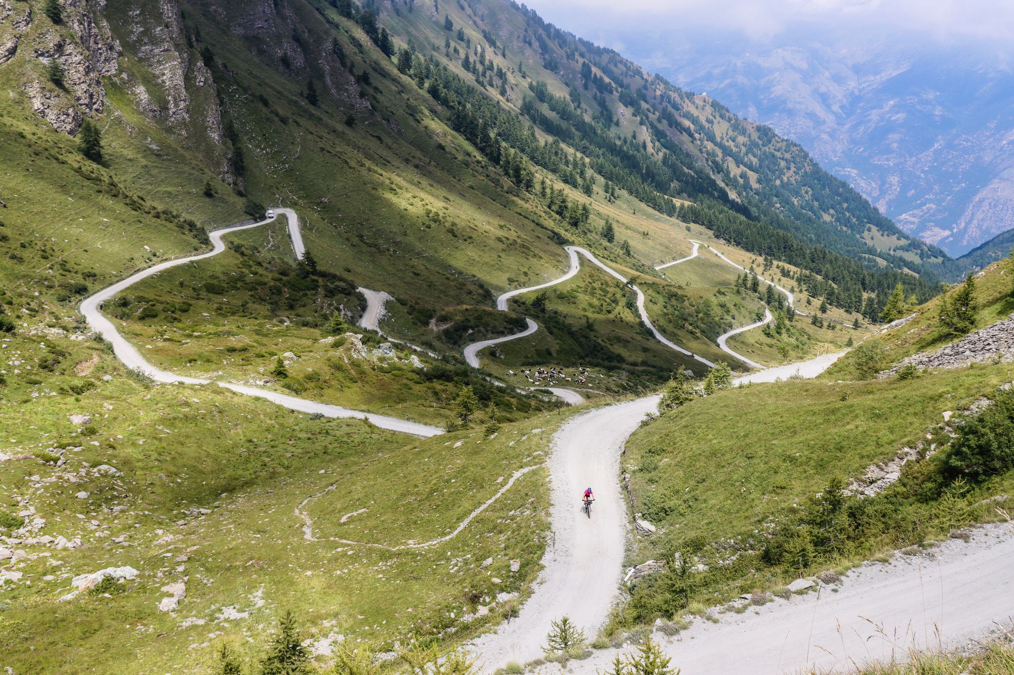
Family friendly hiking trails around Parco Naturale Orsiera-Rocciavrè traverse a dramatic alpine environment in Piedmont, Italy, characterized by rugged mountains, deep valleys, and dense forests. The landscape features U-shaped valleys, moraines, and cirque lakes such as Lake Laus, alongside varied alpine flora including larches and beeches. Elevations within the park range significantly, offering diverse terrain for exploration.
Best family friendly hiking trails around Parco Naturale Orsiera-Rocciavrè
- The most popular family friendly hiking route is Franks' Trail: Rifugio Amprimo Loop, an easy 2.5 miles (4.1 km) trail that takes 1 hour 17 minutes to complete. This route offers a gentle loop suitable for families.
- Another top favourite among local hikers is Forest hike to Rifugio Amprimo (via Route 513), a moderate 3.9 miles (6.2 km) path. This trail leads through forested areas towards the Rifugio Amprimo.
- Local hikers also love the Forest trail to Rifugio Amprimo (via Trail 521), a 7.4 miles (11.8 km) trail leading through dense forest, often completed in about 3 hours 45 minutes.
- Hiking around Parco Naturale Orsiera-Rocciavrè is defined by rugged mountains, deep valleys, and pristine alpine meadows. The network offers options for various ability levels, including easy to moderate family hikes.
- The routes in Parco Naturale Orsiera-Rocciavrè are highly rated by the komoot community with an average score of 4.4 stars from over 4300 reviews. More than 22000 hikers have used komoot to explore Parco Naturale Orsiera-Rocciavrè's varied terrain.
Last updated: August 22, 2026
4.7
(35)
250
hikers
4.06km
01:17
150m
160m
Embark on Franks' Trail: Rifugio Amprimo Loop, an easy hike that guides you through a lovely wooded environment. You will pass through forests of beech and silver firs, with potential glimpses of Rocciamelone as you approach Rifugio Amprimo. This loop covers 2.5 miles (4.1 km) with an elevation gain of 506 feet (154 metres), and you can typically complete it in about 1 hour and 17 minutes.
To begin your adventure, head to Lago delle Rane, where you will find an equipped area with convenient parking. This makes access straightforward for anyone planning a visit. The trail is well-maintained and suitable for a wide range of hikers, including families with small children, ensuring a pleasant experience for everyone.
This route is part of the historical Sentiero dei Franchi, adding a layer of cultural significance to your walk. As you hike, keep an eye out for alpine frogs near Lago delle Rane, also known as Frogs' Paradise. The welcoming Rifugio Amprimo, situated at 1385 meters, offers pleasant front lawns for relaxing before you complete the loop.
4.5
(40)
259
hikers
6.22km
02:05
290m
290m
Embark on a moderate 3.9-mile (6.2 km) hike to Rifugio Amprimo, gaining 964 feet (294 metres) in elevation over approximately 2 hours and 5 minutes. You will follow Route 513, winding through changing forest landscapes. The path begins in beech woods, gradually opening up to reveal larches and firs as you ascend, offering a varied and engaging natural experience.
To start your adventure, head to the Cortavetto parking area, which is the official trailhead for this route. While the trail is well-marked, it is always a good idea to check local conditions before you go. Remember that Rifugio Amprimo offers traditional alpine cuisine and overnight stays, but it is wise to book ahead if you plan to eat there. This ensures you can fully enjoy the refuge's hospitality after your hike.
This route is part of the historic Sentiero dei Franchi and takes you into the beautiful Orsiera Rocciavrè Park. As you reach Rifugio Amprimo, you will find yourself on a grassy plateau at the forest's edge, perfect for relaxing. From here, you can enjoy panoramic views of the impressive Rocciamelone group, making it an ideal spot to soak in the mountain atmosphere.

Sign up for free
4.7
(25)
112
hikers
6.36km
03:33
610m
620m
Prepare for a challenging hike on the Lago Laus and Colle Superiore di Malanotte Trail, a difficult route spanning 4.0 miles (6.4 km). You will ascend 1997 feet (609 metres) over approximately 3 hours and 32 minutes, making it a demanding journey. The path leads you through varied terrain, including steep sections and loose rocks as you climb towards Colle Superiore di Malanotte. Your efforts are rewarded with sweeping views of the Chisone Valley and the impressive Punta Cristalliera. The trail culminates at the tranquil Lago Laus, a natural lake set in a green basin, complete with a unique islet.
When planning your visit, be aware that the road to Rifugio Selleries is typically closed from November 1st to May 31st. During these months, you will need to start your hike from Pra Catinat, which significantly increases both the distance and elevation gain. If you plan to hike in winter, be prepared for snow and ice, as certain steep sections may require specialized gear like ice axes and crampons. Always exercise caution, especially near any waterfall descents, as surfaces can be slippery.
This route offers a deep dive into the natural beauty of Parco Naturale Orsiera-Rocciavrè, showcasing its rugged alpine landscape. The journey provides a unique perspective on the region's geology and ecosystems, from the challenging ascent to the serene lake environment. It stands out as a rewarding option for experienced hikers seeking both physical exertion and stunning natural scenery within the park.
4.2
(6)
43
hikers
12.7km
06:16
1,050m
1,060m
Prepare for a challenging hike on Trail 420, leading you from Coazze to Colle del Vento. This difficult route covers 7.9 miles (12.7 km) and demands a significant effort, with an elevation gain of 3460 feet (1055 metres). You should plan for about 6 hours and 16 minutes to complete it. As you ascend, you'll pass through dense forests and open alpine meadows, offering a real sense of wilderness. The path eventually opens up to reveal expansive views from Colle del Vento, looking out towards the Cristalliera mountains.
To begin your hike, head to Borgata Tonda in Coazze, where you will find convenient parking close to the trailhead. Given the duration and difficulty of this route, it is wise to start early in the morning to allow ample daylight for your journey. Always check weather conditions before you go, especially for mountain trails like this one. Make sure you carry enough water and provisions for the entire day, as services along the trail are limited.
This trail takes you through the Orsiera-Rocciavrè Nature Park, a region rich in natural and historical elements. You will encounter remnants of abandoned villages, like Borgata Dogheria, which offer a glimpse into the area's past. Keep an eye out for the Rocca del Gias, a large gneiss boulder with local legends attached to it. The route also features the refreshing Fontana Sisi spring, a welcome stop on your ascent.
2
hikers
11.8km
03:45
380m
380m
The Forest trail to Rifugio Amprimo (via Trail 521) offers a rewarding moderate hike through the scenic Piemonte countryside. This route covers 7.4 miles (11.8 km) with an elevation gain of 1246 feet (380 metres), typically taking around 3 hours and 45 minutes to complete. You will experience a mix of forest paths and true alpine terrain, passing by the charming Cappella San Lorenzo Toglie, a perfect spot to pause and enjoy the peaceful atmosphere.
To begin your adventure, head to the Cortavetto parking area, which is easily accessible via San Giorio di Susa. The trail starts on gravel roads before transitioning into natural mountain paths, offering a gradual immersion into the landscape. While the trail is well-maintained, it's always a good idea to check local conditions before you go, especially during shoulder seasons.
This route is notable for leading to Rifugio Amprimo, a popular mountain refuge where you can enjoy a meal and even local draft beer. The refuge is known for its excellent food, so consider booking ahead if you plan to dine there. Above the refuge, you might discover an old collection of buildings where cheese is made, offering a unique glimpse into local traditions and a chance to purchase some if it's open.
Get access to more routes and recommendations from other explorers.
Sign up for free
Already have an account?
Our route recommendations are based on thousands of hikes, rides, and runs completed by other people on komoot.
Start today with a free account
Your next adventure awaits.
Login or Signup
Popular around Parco Naturale Orsiera-Rocciavrè
Other adventures around Parco Naturale Orsiera-Rocciavrè

Tips from the Community

One of the various water sources in the area. It is also place number 10 of the treasure hunt "Caccia al Toponimo" organized by the Coazze Tourist Office
1
0
Signs advise against passing on the path that goes through the hamlet due to dilapidated huts. With due caution, it is however perfectly passable.
0
0
The building is not in optimal condition. It is possible to enter the first part to shelter from the wind. After that, there is a locked door.
0
0

Bellissimo pianoro di origine glaciale situato nel vallone di Sangonetto. Raggiungibile da diversi sentieri dalle borgate dell’Indiritto, è una facile meta e punto di passaggio per percorsi più impegnativi verso la testata del vallone
0
0

beautiful refuge in the Selleries valley
0
0


Hill of the wind in name and in fact, I recommend taking good shelter
0
0

The Selleries refuge is located in the municipality of Roure (TO), in the Chisone valley, in the Cottian Alps, at 2,035 m above sea level. It can be easily reached by mountain bike from the paved road, but also on foot. The craft beers are excellent.
0
0
Frequently Asked Questions
How many family-friendly hiking trails are available in Parco Naturale Orsiera-Rocciavrè?
There are nearly 50 family-friendly hiking trails in Parco Naturale Orsiera-Rocciavrè, ranging from easy strolls to more challenging routes. You'll find a good mix, with 4 easy and 26 moderate trails perfect for families.
What kind of terrain can we expect on family hikes in Parco Naturale Orsiera-Rocciavrè?
The park offers diverse terrain, from gentle forest paths to more rugged alpine environments. You can expect trails through dense forests of Scotch pines, larches, and beeches, as well as open alpine meadows. Some routes feature moderate ascents, while others are relatively flat, making it easy to find a suitable path for all family members.
Are there any easy circular routes suitable for families?
Yes, for an enjoyable circular walk, consider Franks' Trail: Rifugio Amprimo Loop. This easy route is just over 4 km long with minimal elevation gain, making it perfect for a family outing.
What are some notable natural features or landmarks we can see along the family trails?
Many trails lead to beautiful natural features. You can explore charming cirque lakes like Lake Laus, or visit areas with large stone blocks such as the Cassafrera basin. The park is also known for its pristine alpine meadows and diverse flora and fauna, offering opportunities for wildlife spotting.
What is the best time of year for family hiking in Parco Naturale Orsiera-Rocciavrè?
The best time for family hiking is generally from late spring to early autumn (May to October). During these months, the weather is milder, trails are clear of snow, and the alpine flora is in full bloom. Summer offers warmer temperatures, while early autumn provides stunning fall foliage.
Are there any dog-friendly options for family hikes in the park?
Many trails within Parco Naturale Orsiera-Rocciavrè are dog-friendly, but it's always best to keep your dog on a leash, especially in areas with wildlife or near livestock. Always check specific trail regulations before you go. The park's varied landscapes offer plenty of space for your furry friends to enjoy the outdoors with you.
Are there mountain huts or places to eat along the family-friendly routes?
Yes, the park features several mountain huts that can serve as excellent rest stops or even overnight accommodation. For example, the Amprimo Mountain Hut is accessible via routes like Forest hike to Rifugio Amprimo (via Route 513), offering a chance to enjoy local Piedmontese cuisine. Other notable huts include Toesca Hut and Selleries Hut.
What do other hikers enjoy most about family hiking in Parco Naturale Orsiera-Rocciavrè?
The area is highly rated by the komoot community, with an average score of 4.4 stars. Reviewers often praise the tranquil forest paths, the stunning alpine scenery, and the well-maintained trails that make for a pleasant experience for all ages. The opportunity to spot wildlife like chamois and marmots is also frequently highlighted.
Is public transport available to reach trailheads in the park?
While some areas of Parco Naturale Orsiera-Rocciavrè might be accessible by local bus services, public transport options can be limited, especially for reaching more remote trailheads. It's advisable to check local schedules in advance or consider driving to ensure flexibility for family outings.
Are there any specific trails that offer good opportunities for wildlife spotting with kids?
The diverse ecosystems of Parco Naturale Orsiera-Rocciavrè make it an excellent spot for wildlife. Trails that pass through alpine meadows and dense forests, such as the Forest trail to Rifugio Amprimo (via Trail 521), increase your chances of spotting chamois, marmots, or various bird species. Encourage children to be quiet and observant to enhance their chances of seeing animals in their natural habitat.
Are there any permits required for hiking in Parco Naturale Orsiera-Rocciavrè?
Generally, no specific permits are required for day hiking on marked trails within Parco Naturale Orsiera-Rocciavrè. However, it's always good practice to respect park regulations, stay on designated paths, and avoid disturbing wildlife. For specific activities like camping or larger group events, it's advisable to check with the park authority directly.
Most popular routes around Parco Naturale Orsiera-Rocciavrè
Most popular attractions around Parco Naturale Orsiera-Rocciavrè

Get inspired with the komoot mobile app


Explore more
Browse the best Hikes in other regions.
