The best traffic-free bike rides around Reserva Natural Garganta de los Infiernos
5.0
(3)
503
riders
6
rides
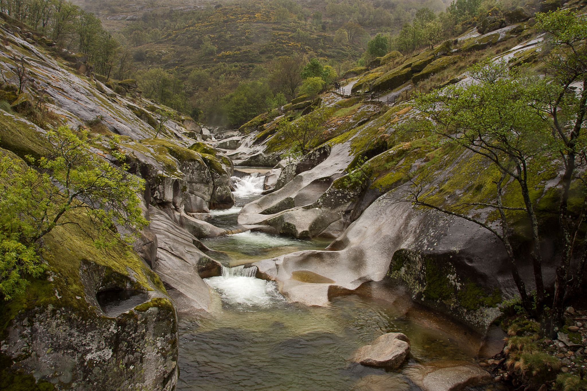
Road cycling around Reserva Natural Garganta de los Infiernos offers diverse landscapes and challenging terrain within the Jerte Valley, nestled between the Sierra de Tormantos and the Sierra de Gredos. The region features significant altitude changes, ranging from 300 to 2,290 meters, providing varied inclines and descents. Granite and gneiss rock formations, shaped by river erosion, create a dynamic environment of drops, streams, and pools, forming a visually stimulating backdrop for no traffic road cycling routes. This protected natural area…
Last updated: October 29, 2026
36
riders
63.6km
03:54
1,730m
1,730m
Hard road ride. Very good fitness required. Mostly well-paved surfaces and easy to ride.
26
riders
36.6km
02:15
1,000m
1,000m
Hard road ride. Very good fitness required. Mostly well-paved surfaces and easy to ride.

15
riders
60.0km
03:51
1,500m
1,500m
Hard road ride. Very good fitness required. Mostly well-paved surfaces and easy to ride.
43
riders
41.6km
02:22
960m
960m
Hard road ride. Very good fitness required. Mostly well-paved surfaces and easy to ride.
5.0
(1)
31
riders
45.9km
02:49
1,050m
1,050m
Hard road ride. Very good fitness required. Some segments of this route may be unpaved and difficult to ride.
Our route recommendations are based on thousands of hikes, rides, and runs completed by other people on komoot.
Start today with a free account
Your next adventure awaits.
Popular around Reserva Natural Garganta de los Infiernos

Other adventures around Reserva Natural Garganta de los Infiernos

Tips from the Community


The Jerte River rises in the Gredos mountain range and flows through the impressive valley of the same name in northern Extremadura. Along its way, it feeds gorges, natural pools, and lush forests, becoming a true oasis, especially in spring, when cherry blossoms cover the landscape.
0
0

17 kilometers of mountain pass (on both sides, Ambroz Valley from Hervás or Jerte Valley from Cabezuela del Valle). From Cabezuela del Valle, the first 12 kilometers average an average gradient of 7%, with some 10% gradients, and from the 12th kilometer onward, there are some rest stops with wonderful views. This side has a gradient of approximately 900 meters, up to 1,430 meters.
0
0

Located in the north of the province of Cáceres, the port of Honduras provides spectacular views of the two large valleys it connects: the Ambroz valley and the Jerte valley. From both Gargantilla and Cabezuela del Valle, hikers can avoid the road and crown this pass along trails and dirt tracks that are part of the GR 10.
0
0

Beautiful port between the Ambroz Valley and the Jerte Valley with a constant slope of about 6%
0
0

The historic monastery on the outskirts of the town of Cuacos de Yuste is the last resting place of Emperor Charles V. The Monastery of Yuste was originally built in 1407 and was rebuilt and expanded over the centuries.
1
1
The ascent from the town of Garganta la Olla is tough. Long 13.36 km with an average slope of 5.2%, you gain almost 700 m to reach the pass at 1,285 meters above sea level before descending towards Piornal. Beautiful views of the mountain peaks and valleys of Jerte.
1
0
A beautiful mountain town of Garganta la Ollа in the foothills of the Sierra de Tormantos, dominated by the Sierra de Gredos at 1400 meters above sea level.
1
1
Frequently Asked Questions
How many no traffic road cycling routes are available in Reserva Natural Garganta de los Infiernos?
There are currently 6 dedicated no traffic road cycling routes available in and around the Reserva Natural Garganta de los Infiernos. These routes offer a range of distances and elevations, focusing on providing a serene cycling experience away from heavy vehicle traffic.
What is the best time of year to cycle in the Reserva Natural Garganta de los Infiernos?
The Jerte Valley, where the reserve is located, is particularly stunning during spring for its famous cherry blossom season and in autumn for its vibrant foliage. These periods offer pleasant temperatures and breathtaking scenery, making them ideal for road cycling. Summer can be warm, but higher altitude routes provide cooler conditions.
Are there challenging no traffic road cycling routes in the Reserva Natural Garganta de los Infiernos?
Yes, the region offers several challenging routes with significant elevation changes, thanks to the Sierra de Tormantos and Sierra de Gredos mountains. For example, the Piornal Pass – Puerto de Piornal (1,285 m) loop from Garganta la Olla is a difficult route covering over 85 km with nearly 2,000 meters of ascent, perfect for experienced cyclists seeking a demanding ride.
Can I find circular no traffic road cycling routes in the area?
Yes, many of the no traffic road cycling routes in the Reserva Natural Garganta de los Infiernos are designed as loops. An example is the Jaraíz de la Vera from Garganta la Olla — circular of the Mojón Blanco, which offers a challenging 41 km circular ride with over 950 meters of climbing.
What natural attractions can I see along the no traffic road cycling routes?
The routes often pass by or offer access to stunning natural features. You can visit the iconic Los Pilones Natural Pools, famous for their 'giant's kettles' carved into the granite. The Chorrero de la Virgen Viewpoint offers impressive views of a waterfall, and the historic Carlos V Bridge provides a scenic stop with clear water pools.
Are there any moderate no traffic road cycling options for less experienced riders?
While many routes are challenging, there are moderate options available. The Monastery of Yuste – Garganta la Olla loop from Cuacos de Yuste is a moderate route covering about 22 km with around 379 meters of elevation gain, offering a more accessible experience while still enjoying the region's beauty.
What kind of terrain can I expect on these no traffic road cycling routes?
The terrain varies significantly, from the picturesque valley roads of the Jerte Valley to the challenging ascents and descents of the Sierra de Tormantos and Sierra de Gredos. You'll encounter granite and gneiss rock formations shaped by river erosion, creating a dynamic landscape of drops, streams, and pools, all on paved roads suitable for road bikes.
What do other road cyclists enjoy most about cycling in Reserva Natural Garganta de los Infiernos?
The area is highly rated by the komoot community, with an average score of 4.0 stars. Reviewers often praise the stunning natural beauty, the challenging climbs and rewarding descents, and the opportunity to cycle on quiet roads away from traffic, especially through the scenic Jerte Valley and past unique geological formations like Los Pilones.
Are there any specific viewpoints along the no traffic road cycling routes?
Yes, the region is rich with panoramic views. The Chorrero de la Virgen Viewpoint is a notable spot offering breathtaking vistas of the waterfall and surrounding landscape. Many routes also traverse mountain passes like Collado de las Losas, providing expansive views of the valleys and peaks.
Which villages can I pass through on these no traffic road cycling routes?
Cycling through the Jerte Valley allows you to experience charming villages such as Jerte, Cabezuela del Valle, and Tornavacas. These villages offer a glimpse into local life and can be great spots for a break or to refuel during your ride.
Is there a route that includes a significant climb to a high point?
Absolutely. The region is known for its mountainous terrain. The Monastery of Yuste – Puerto de Piornal (1,285 m) loop from Cuacos de Yuste includes a climb to Puerto de Piornal, offering a substantial ascent and rewarding views from a higher altitude.
Most popular routes around Reserva Natural Garganta de los Infiernos
Most popular attractions around Reserva Natural Garganta de los Infiernos

Get inspired with the komoot mobile app


Explore more
Browse the best Road cycling routes in other regions.
