The best family-friendly hikes and walks around Setesdal Vesthei - Ryfylkeheiane landskapsvernområde
4.4
(1085)
4,737
hikers
75
hikes
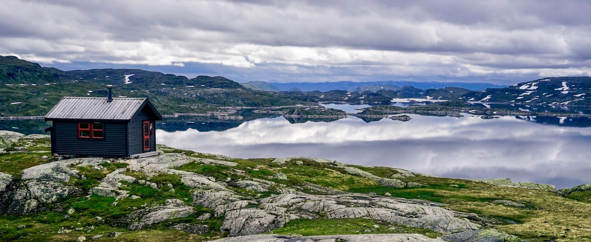
Family friendly hiking trails around Setesdal Vesthei - Ryfylkeheiane landskapsvernområde traverse Norway's second-largest nature reserve, offering a vast and varied landscape. The region features undulating highlands with birch forests and numerous lakes in the south, transitioning to grazing plains and rocky outcrops at higher elevations. Further north, the terrain becomes more rugged, characterized by glacier-polished bedrock and moraine ridges. On the western Ryfylke side, the landscape drops into gorges and fjords, providing diverse hiking environments.
Best family friendly hiking trails…
Last updated: July 12, 2026
1.0
(1)
15
hikers
9.83km
02:41
140m
140m
Moderate hike. Good fitness required. Easily-accessible paths. Suitable for all skill levels.
4.7
(23)
133
hikers
4.93km
01:59
290m
290m
Moderate hike. Great for any fitness level. Mostly accessible paths. Sure-footedness required.

Sign up for free
5.0
(1)
23
hikers
14.2km
04:36
620m
620m
Hard hike. Good fitness required. Sure-footedness, sturdy shoes and alpine experience required.
5.0
(2)
13
hikers
7.07km
02:22
370m
370m
Moderate hike. Good fitness required. Easily-accessible paths. Suitable for all skill levels.
4.3
(3)
15
hikers
6.50km
02:04
160m
160m
Moderate hike. Good fitness required. Mostly accessible paths. Sure-footedness required.
Get access to more routes and recommendations from other explorers.
Sign up for free
Already have an account?
Our route recommendations are based on thousands of hikes, rides, and runs completed by other people on komoot.
Start today with a free account
Your next adventure awaits.
Login or Signup
Popular around Setesdal Vesthei - Ryfylkeheiane landskapsvernområde
Other adventures around Setesdal Vesthei - Ryfylkeheiane landskapsvernområde

Tips from the Community

Small and quiet beach. Enjoy the tranquillity and take a refreshing dip in the cool water.
0
0

Øygardstøl is the start point for the route to the Kjeragbolten, one of Norway's most famous natural landmarks. Before setting out, consider that it's a 7-mile (11 km) out and back with around 2,600 feet (800 m) of elevation gain. It's only doable as a run in the summer months.
0
0

The tunnel is easy to navigate and well lit
1
1

Short hike out of town towards Lysetunnelen. Fantastic view of the town and the end of the fjord.
0
0

The parking lot is the starting point for the hike to Kjerag. The daily rate is 300 NOK but there are also free toilets. There is now even a "storage extension" across the street in case that parking lot is full.
2
0

Parking costs 300 NOK. Overnight stays forbidden for campers!
0
0

Sufficient parking spaces are available. Cheap 300 crowns a day 🫣
2
0

Very steep accent to the plateau above the fjord
1
1
Frequently Asked Questions
How many family-friendly hiking trails are available in Setesdal Vesthei - Ryfylkeheiane landskapsvernområde?
There are over 70 hiking trails in the region, with more than 30 specifically categorized as easy, making them ideal for families. You'll find a wide variety of routes suitable for different ages and abilities.
What kind of landscapes can we expect on family hikes in this region?
The region offers incredibly diverse landscapes. You can expect undulating highlands with birch forests and thousands of small lakes in the south, transitioning to grazing plains and rocky outcrops further north. Some trails feature streams and rocky plateaus, while others offer stunning views over fjords like the Lysefjord. Even in summer, you might spot snowfields on higher peaks, adding to the dramatic scenery.
Are there any circular routes suitable for families?
Yes, there are several circular routes perfect for families. For example, the Rest Area With a View – Hovdenuten Summit loop from Hovden kapell is a moderate 4.9 km loop that offers scenic views. Another option is the Troll Cairns – Storenos loop from Hovden kapell, a 7 km moderate trail.
What are some interesting natural features or landmarks we might see on a family hike?
You'll encounter many captivating natural features. Keep an eye out for the unique Island Chain in Setesdal Vesthei Ryfylkeheiane Landscape Protection Area, which creates a magical atmosphere. You might also discover impressive viewpoints like the Rest Area Near Støylskardnuten, offering panoramic vistas. The region is also home to the southernmost population of wild reindeer, so you might spot them from a distance.
Are there any cabins or huts along the family-friendly trails where we can rest or stay overnight?
Yes, the region has a network of DNT (Norwegian Trekking Association) cabins, some of which are accessible via family-friendly routes. The Bossbu Cabin by Botnsvatnet is a modern, self-catering cabin beautifully situated on a lake, perfect for a longer break or an overnight stay. Many cabins offer basic facilities like kitchens and wood stoves.
What is the best time of year for family hiking in Setesdal Vesthei - Ryfylkeheiane?
The best time for family hiking is typically during the summer months, from late June to early September. During this period, the weather is generally milder, trails are clear of snow, and the diverse alpine vegetation is in full bloom. Even then, be prepared for varying conditions, as snowfields can persist on higher peaks.
Are dogs allowed on the family-friendly hiking trails?
Generally, dogs are welcome on trails in Setesdal Vesthei - Ryfylkeheiane. However, it's crucial to keep them on a leash, especially during the bird nesting season (April 1 to August 20) and in areas where wild reindeer are present. Always check local regulations for specific routes or protected areas you plan to visit.
What do other hikers enjoy most about family hiking in this region?
The area is highly rated by the komoot community, with an average score of 4.4 stars. Reviewers often praise the vast, untouched natural beauty, the variety of landscapes from birch forests to rocky plateaus, and the sense of solitude and immersion in nature. The well-maintained DNT cabins and the opportunity to spot wild reindeer are also frequently highlighted.
Are there any easy trails that lead to a beach or water access for kids?
While many trails feature lakes and streams, the Rågeloni Beach route offers a moderate 9.8 km hike that leads to a beach, providing a lovely destination for families to relax by the water after their walk.
What should we pack for a family hike in Setesdal Vesthei - Ryfylkeheiane?
Given the varied mountain weather, it's wise to pack layers of clothing, including waterproof and windproof outerwear, even in summer. Bring plenty of water, snacks, a first-aid kit, a map, and a compass or GPS device. Sturdy hiking boots are essential, and sun protection is recommended. For longer hikes, consider packing extra food and a headlamp.
Is public transport available to reach trailheads for family hikes?
Access to many trailheads in Setesdal Vesthei - Ryfylkeheiane landskapsvernområde often requires a car, as public transport options can be limited, especially for more remote starting points. However, some larger villages or hubs might offer bus connections. It's best to research specific routes and their accessibility in advance.
Most popular routes around Setesdal Vesthei - Ryfylkeheiane landskapsvernområde
Most popular attractions around Setesdal Vesthei - Ryfylkeheiane landskapsvernområde

Get inspired with the komoot mobile app


Explore more
Browse the best Hikes in other regions.
