The best family-friendly hikes and walks in the Saint Elias Mountains
4.5
(59)
435
hikers
6
hikes
Family friendly hiking trails in the Saint Elias Mountains are found within a vast, largely undeveloped wilderness characterized by the convergence of four major mountain ranges. The region features extensive glaciation, with over one-third of the area covered in glacial ice, including North America's largest piedmont glacier. Diverse ecosystems range from boreal forests and alpine meadows to scenic river valleys, supporting varied wildlife. This landscape offers a profound sense of remoteness and dramatic geological features for hikers.
Best family friendly…
Last updated: July 12, 2026
3
hikers
2.31km
00:47
120m
120m
Easy hike. Great for any fitness level. Easily-accessible paths. Suitable for all skill levels.
32.4km
08:37
330m
330m
Hard hike. Very good fitness required. Easily-accessible paths. Suitable for all skill levels.

Sign up for free
4.8
(13)
72
hikers
14.9km
04:19
390m
390m
Moderate hike. Good fitness required. Easily-accessible paths. Suitable for all skill levels.
4.3
(14)
60
hikers
Easy hike. Great for any fitness level. Easily-accessible paths. Suitable for all skill levels.
3.0
(1)
9
hikers
3.14km
00:51
40m
40m
Easy hike. Great for any fitness level. Easily-accessible paths. Suitable for all skill levels.
Our route recommendations are based on thousands of hikes, rides, and runs completed by other people on komoot.
Start today with a free account
Your next adventure awaits.
Login or Signup
Popular around Saint Elias Mountains



Tips from the Community

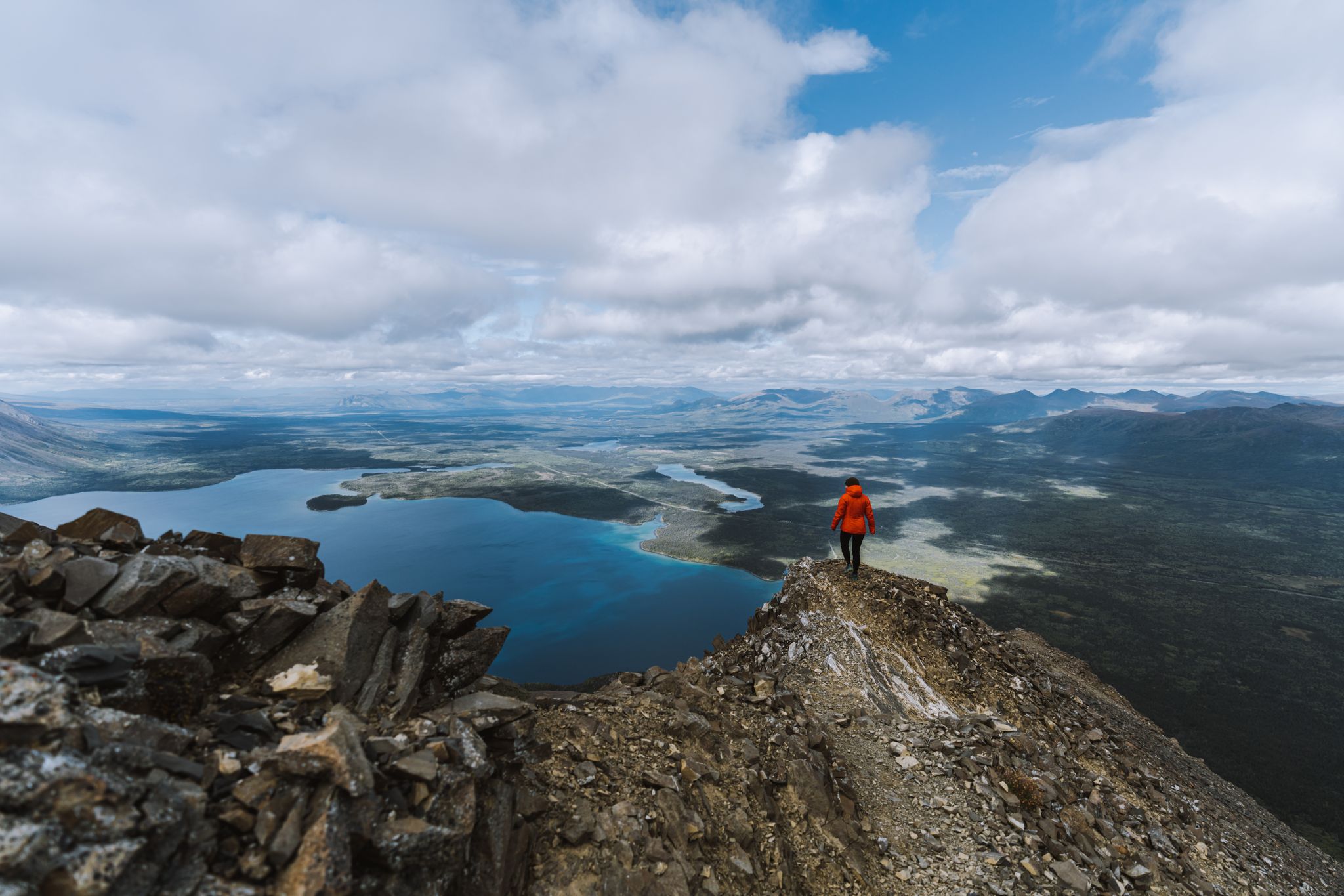
The Alsek Valley is one of those rare places where the landscape feels untouched and endless. Framed by the towering peaks of the St. Elias Range, the valley stretches toward the horizon with braided rivers, glacier-fed lakes, and wide tundra plains that glow with color in summer. Hiking here means stepping into true wilderness, where silence fills the air and every turn reveals another sweeping view. It’s a place to slow down, breathe deeply, and feel the vastness of the Yukon all around you. The trail that winds through the valley extends for about 25 km one way, so you can hike as far as you like, just make sure to plan according to daylight and conditions. If you plan to camp overnight, a backcountry permit from Kluane National Park is required.
0
0
The Dezadeash River winds through the Alsek Valley, surrounded by wide-open views of the St. Elias Mountains. Its slow-moving waters reflect the rugged peaks and shifting skies, creating a stunning backdrop for a hike. The trails along the valley offer easy access to the riverbanks, where you might spot moose, trumpeter swans, or even the distant shimmer of Kluane’s glaciers.
0
0

Alsek Valley Road leads up to the Thunderegg Creek floodplain, which can swell after heavy rain and snowmelt, becoming impassable. The road is a gravel route branching south from the Alaska Highway and is often used for hiking. There are a few information signs along the road about the local ecology and landscapes.
0
0
Soldiers Summit Interpretive Trail parallels the Alaska Highway, leading to the Alaska Highway Monument, where the Alaska Highway was officially opened on November 20, 1942. Here, U.S. and Canadian officials, military, and construction workers met for the ceremony marking the completion of the 2,700-kilometre highway.
0
0
Soldiers Summit Trail is a well-maintained trail that offers views of the Alaska Highway, Kluane Lake, and the rugged St. Elias Mountains. There is not much tree coverage on this trail, but there are great views almost the entire way up. This spot is an excellent way to stretch out on a road trip.
0
0
The Alaska Highway Monument is a stone pillar with information about the Alaska Highway, and a wooden observation deck with additional informational plaques and benches. It overlooks Kluane Lake, between two flags —one of the United States and one of Canada.
0
0

This small lake, right on the trail, offers great photo opportunities. A bench for a rest is nearby.
0
0
About halfway along the trail you leave the forest and get a great view of the mountains of the Auriol Range.
0
0
Frequently Asked Questions
How many family-friendly hiking trails are available in the Saint Elias Mountains?
There are 7 family-friendly hiking trails detailed in this guide for the Saint Elias Mountains, ranging from easy strolls to more challenging routes suitable for active families.
What is the best time of year for family hiking in the Saint Elias Mountains?
The best time for family hiking in the Saint Elias Mountains is typically during the summer months, from late May to early September. During this period, trails are generally free of snow, weather is milder, and wildlife viewing opportunities are abundant. Always check local conditions before heading out, as weather can change rapidly in mountainous regions.
Are there any easy, short hikes suitable for families with young children?
Yes, there are several easy options perfect for families. The Soldiers Summit — Kluane National Park and Reserve trail is an easy 2.3 km route with minimal elevation gain. Another great choice is the Dezadeash River Trail, which offers a gentle 5.7 km loop with very little elevation change, ideal for a relaxed family outing.
What kind of natural features or landmarks can we expect to see on these trails?
The Saint Elias Mountains are renowned for their dramatic landscapes. On family-friendly trails, you can expect to see stunning glacial vistas, pristine lakes, and diverse ecosystems. Notable features include the beautiful Kathleen Lake (Mät’àtäna Män), and expansive views of valleys like the Ä’äy Chù (Slims River) Valley. Some trails also offer glimpses of the massive Kaskawulsh Glacier.
Are there any circular routes for family hikes?
Yes, several routes offer a circular experience, which is often convenient for families. The Kathleen Lake (Mät’àtäna Män) – View of Kluane Lake loop is a 7.7 km circular trail, though rated difficult due to elevation. For an easier option, the Dezadeash River Trail is a pleasant 5.7 km loop.
What do other hikers say about the family-friendly trails in the Saint Elias Mountains?
The family-friendly trails in the Saint Elias Mountains are highly rated by the komoot community, with an average score of 4.39 out of 5 stars from 55 ratings. Reviewers often praise the stunning, untouched wilderness, the sense of remoteness, and the opportunities for wildlife spotting, making for memorable family adventures.
Are there opportunities for wildlife spotting on these family hikes?
Absolutely. The Saint Elias Mountains are home to abundant wildlife. While hiking, families might spot caribou, Dall sheep, moose, and various bird species like trumpeter swans. Keep an eye out for signs of bears and wolves, and always practice safe wildlife viewing by maintaining a respectful distance.
What should we pack for a family hike in the Saint Elias Mountains during summer?
Even in summer, mountain weather can be unpredictable. It's essential to pack layers of clothing, including waterproof and windproof outer shells. Bring plenty of water, snacks, a first-aid kit, sun protection (hat, sunscreen), insect repellent, and sturdy hiking boots. A map and compass or a GPS device are also recommended, especially for longer trails.
Are there any trails that lead to glaciers or offer glacier views?
Yes, the region is famous for its extensive glaciation. While many trails offer distant views, the Root Glacier Trail near Kennecott is a popular and accessible option that leads directly to the glacier's surface, providing stunning views of the ice. You can also get impressive views of the Kaskawulsh Glacier from certain viewpoints and trails.
Are there any historical sites or points of interest along the family-friendly routes?
While the focus is on natural beauty, the region has a rich mining history. The abandoned Kennecott Mill Town, a National Historic Landmark, is a significant historical site and serves as a trailhead for various adventures, including some that might be suitable for older families or those seeking a more challenging experience.
Do I need any special permits for family hikes in the Saint Elias Mountains?
For most day hikes within Wrangell-St. Elias National Park and Preserve, permits are generally not required. However, if you plan to do extensive backcountry camping or specific activities, it's always best to check the official park website for the latest regulations. For Kluane National Park and Reserve, some multi-day routes may require registration or permits. You can find more information on the National Park Service website: nps.gov.
Most popular routes in the Saint Elias Mountains
Most popular attractions in the Saint Elias Mountains

Get inspired with the komoot mobile app


Explore more
Browse the best Hikes in other regions.
