Easy hikes and walks in the Saint Elias Mountains
4.6
(94)
749
hikers
19
hikes
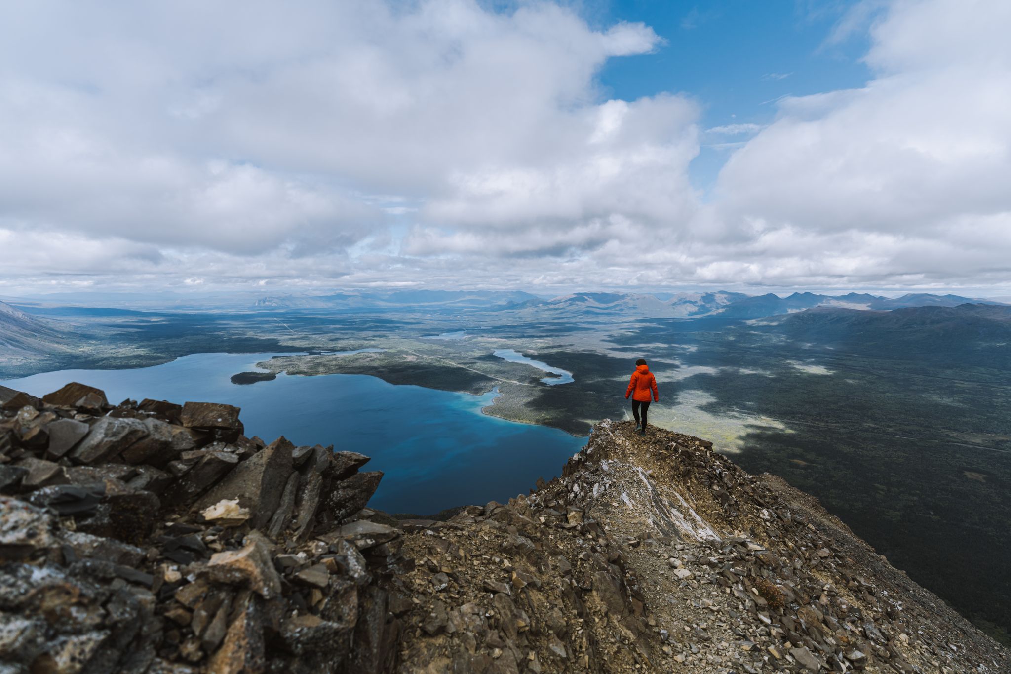
Easy hiking trails in the Saint Elias Mountains traverse a landscape defined by towering peaks, immense glaciers, and wild rivers within one of North America's largest protected areas. This region features diverse ecosystems, ranging from boreal forests to alpine environments, shaped by both volcanism and glaciation. Hikers can explore a rugged wilderness that includes some of the continent's largest glaciers and highest mountains. The terrain offers a variety of experiences, from lowlands to sub-alpine areas.
Best easy hiking trails in the Saint Elias Mountains
- The most popular easy hiking route is Russell Fiord Trail, a 1.3 miles (2.1 km) trail that takes 37 minutes to complete. This path offers scenic views near the fiord.
- Another top favourite among local hikers is Soldiers Summit — Kluane National Park and Reserve, an easy 1.4 miles (2.3 km) path. This trail leads through a historically significant area with views of the surrounding park.
- Local hikers also love the Situk Lake Trail, a 3.9 miles (6.3 km) trail leading through diverse ecosystems, often completed in about 1 hour 36 minutes.
- Hiking in the Saint Elias Mountains is defined by towering peaks, immense glaciers, and wild rivers. The network offers options for different ability levels, including many easy hiking trails.
- The routes in Saint Elias Mountains are highly rated by the komoot community with an average score of 4.4 stars from over 50 reviews. More than 400 hikers have used komoot to explore Saint Elias Mountains's varied terrain.
Last updated: September 29, 2026
5.0
(1)
5
hikers
2.31km
00:47
120m
120m
Easy hike. Great for any fitness level. Easily-accessible paths. Suitable for all skill levels.
3
hikers
1.24km
00:24
60m
60m
Easy hike. Great for any fitness level. Easily-accessible paths. Suitable for all skill levels.

2
hikers
2.10km
00:37
60m
60m
Easy hike. Great for any fitness level. Easily-accessible paths. Suitable for all skill levels.
6.31km
01:36
10m
10m
Easy hike. Great for any fitness level. Easily-accessible paths. Suitable for all skill levels.
2.12km
00:33
10m
10m
Easy hike. Great for any fitness level. Easily-accessible paths. Suitable for all skill levels.
4.1
(17)
69
hikers
Easy hike. Great for any fitness level. Easily-accessible paths. Suitable for all skill levels.
5.0
(2)
14
hikers
5.37km
01:51
280m
280m
Easy hike. Great for any fitness level. Easily-accessible paths. Suitable for all skill levels.
4.3
(3)
16
hikers
3.14km
00:51
40m
40m
Easy hike. Great for any fitness level. Easily-accessible paths. Suitable for all skill levels.
4.0
(4)
12
hikers
1.39km
00:23
20m
20m
Easy hike. Great for any fitness level. Easily-accessible paths. Suitable for all skill levels.
Get access to more routes and recommendations from other explorers.
Already have an account?
Our route recommendations are based on thousands of hikes, rides, and runs completed by other people on komoot.
Start today with a free account
Your next adventure awaits.
Popular around Saint Elias Mountains



Tips from the Community

This viewpoint with benches and a fire pit marks the official end of the Rock Glacier Trail. Although the trail ends here, some continue climbing up the rock glacier along an undefined trail. Only attempt this if you have proper footwear, and are prepared for loose rocks and some scrambling. Otherwise, this is a great spot to stop, relax and take in the view before turning around.
1
0
This trailhead sits at the west end of Haines Road and has parking and access to Rock Glacier Trail. The trail starts along a raised boardwalk through a marsh, and then starts a climb along rockier terrain along a rock glacier. There are interpretive panels along the trail with information about the rock glacier and its surrounding area.
0
0

Soldiers Summit Interpretive Trail parallels the Alaska Highway, leading to the Alaska Highway Monument, where the Alaska Highway was officially opened on November 20, 1942. Here, U.S. and Canadian officials, military, and construction workers met for the ceremony marking the completion of the 2,700-kilometre highway.
0
0
Soldiers Summit Trail is a well-maintained trail that offers views of the Alaska Highway, Kluane Lake, and the rugged St. Elias Mountains. There is not much tree coverage on this trail, but there are great views almost the entire way up. This spot is an excellent way to stretch out on a road trip.
0
0
The Alaska Highway Monument is a stone pillar with information about the Alaska Highway, and a wooden observation deck with additional informational plaques and benches. It overlooks Kluane Lake, between two flags —one of the United States and one of Canada.
0
0


This hike should not be missed. It leads up to just above the tree line and with a bit of luck, you can observe Dall sheep.
1
0

The Spruce Beetle Trail trailhead is just off the Alaska Highway, 11 miles northwest of Haines Junction. The trail is an educational trail about the life cycle of the Spruce Beetle (bark beetle on spruce trees in Canada) and its impact on Yukon forests. https://parks.canada.ca/pn-np/yt/kluane/activ/randonnee-hiking/dendoctrone-epinette-spruce-beetle
1
0
Frequently Asked Questions
How many easy hiking trails are available in the Saint Elias Mountains?
There are 9 easy hiking trails in the Saint Elias Mountains, offering diverse experiences across this vast region. In total, the area features 16 hiking routes, catering to various skill levels.
What kind of natural features can I expect to see on easy hikes in the Saint Elias Mountains?
The Saint Elias Mountains are renowned for their dramatic landscapes. On easy hikes, you can expect to encounter immense glaciers, wild rivers, and towering peaks. The region is home to some of North America's largest glaciers, such as the Malaspina and Hubbard Glaciers, and features diverse ecosystems from boreal forests to alpine environments. You might also spot various wildlife.
Are there any family-friendly easy hikes in the Saint Elias Mountains?
Yes, several easy trails are suitable for families. For instance, the Russell Fiord Trail is a short, scenic path near the fiord. Another option is the Harlequin Lake Trail, which offers gentle terrain and beautiful lake views.
What is the best time of year for easy hikes in the Saint Elias Mountains?
The best time for easy hikes in the Saint Elias Mountains is typically during the summer months, from June to early September. During this period, the weather is generally milder, trails are more accessible, and you can enjoy the full splendor of the diverse ecosystems, including spectacular wildflower displays.
What do other hikers say about the easy trails in the Saint Elias Mountains?
The easy hiking trails in the Saint Elias Mountains are highly rated by the komoot community, with an average score of 4.4 stars from over 50 reviews. Hikers often praise the stunning natural beauty, the sense of wilderness, and the accessibility of trails that lead to incredible viewpoints and natural features.
Are there any easy circular routes for hiking in the Saint Elias Mountains?
Yes, there are easy circular routes available. The Kathleen Lake Campground – Kathleen Lake (Mät’àtäna Män) loop from Kathleen Lake is a great example, offering a pleasant walk around the lake. Another option is the Spruce Beetle Trail loop from Spruce Beetle, which is a shorter, easy loop.
Can I see any glaciers up close on an easy hike?
While many glaciers in the Saint Elias Mountains are vast and remote, some easy trails offer views or access to glacial features. The Rock Glacier Trail provides an opportunity to experience a unique glacial landscape. For more extensive glacier views, you might consider trails that offer panoramic vistas of features like the Kaskawulsh Glacier.
Are there any historical sites or landmarks accessible via easy trails?
While many historical sites like the Kennecott mining area are deeper within the park, some easy trails offer glimpses into the region's past or lead to significant landmarks. The Soldiers Summit — Kluane National Park and Reserve trail, for example, leads through a historically significant area with views of the surrounding park.
What kind of wildlife might I encounter on easy hikes?
The diverse ecosystems of the Saint Elias Mountains support abundant wildlife. On easy hikes, you might have opportunities to spot black bears, brown bears, grizzly bears, caribou, moose, Dall sheep, and mountain goats, especially in areas like the lowlands and sub-alpine environments. Always maintain a safe distance and be aware of your surroundings.
Are there any easy trails that offer views of lakes or rivers?
Yes, many easy trails provide beautiful views of the region's numerous lakes and wild rivers. The Situk Lake Trail leads through diverse ecosystems and offers views of the lake. The Dezadeash River Trail provides scenic views of the Dezadeash River.
What are some notable viewpoints accessible on easy hikes?
While many viewpoints require more strenuous efforts, some easy trails offer rewarding vistas. The View of Ä’äy Chù (Slims River) Valley is a significant highlight in the region, offering expansive views. Trails around lakes like Kathleen Lake (Mät’àtäna Män) also provide picturesque scenery.
Are there any easy trails that lead to or near waterfalls?
While specific easy trails leading directly to major waterfalls are less common in the provided data, the region's rugged terrain and numerous rivers suggest that smaller cascades might be encountered. For more prominent waterfalls, you might need to explore slightly more moderate routes, such as parts of the Crystalline Hills Trail mentioned in regional research, which leads to waterfalls.
Most popular routes in the Saint Elias Mountains
Most popular attractions in the Saint Elias Mountains

Get inspired with the komoot mobile app


Explore more
Browse the best Hikes in other regions.
