The best traffic-free bike rides around Burgsalach
4.4
(193)
1,082
riders
49
rides
Gravel biking around Burgsalach offers a diverse landscape characterized by rolling hills, scenic river valleys, and extensive forests, situated on the edge of the Altmühltal Nature Park. The region features varied terrain, including sections of the Upper German-Rhaetian Limes, a UNESCO World Heritage site, providing historical context to the rides. Cyclists can expect a mix of established paths and quieter routes, often incorporating former railway lines and picturesque small valleys. This area is well-suited for no traffic gravel bike trails, offering engaging ascents and descents through natural and historical settings.
Best no traffic gravel bike trails around Burgsalach
- The most popular no traffic gravel bike trail is Between Anlauter and Thalach - Graveling in the Altmühltal Nature Park, a 30.1 miles (48.4 km) trail that takes 3 hours 40 minutes to complete. This moderate route explores the river valleys within the Altmühltal Nature Park.
- Another top favourite among local gravel bikers is View of Kipfenberg Castle – Burgsteinfelsen near Dollnstein loop from Titting, a difficult 88.5 miles (142.4 km) path. This route offers expansive views, including Kipfenberg Castle and the unique Burgsteinfelsen.
- Local gravel bikers also love the Burgsteinfelsen near Dollnstein – Burgsteinfelsen near Dollnstein loop from Weißenburg (Bay), a 78.6 miles (126.4 km) trail leading through the Altmühltal region and past historical Weißenburg, often completed in about 6 hours 48 minutes.
- Gravel biking around Burgsalach is defined by rolling hills, tranquil river valleys, and routes along former railway lines, often passing Roman Limes fortifications. The network offers options for different ability levels, from moderate rides through nature parks to more challenging long-distance loops.
- The routes in Burgsalach are highly rated by the komoot community with an average score of 4.6 stars from more than 140 reviews. More than 900 gravel bikers have used komoot to explore Burgsalach's varied terrain.
Last updated: July 11, 2026
5.0
(3)
19
riders
48.4km
03:40
440m
440m
Moderate gravel ride. Good fitness required. Some segments of this route may be unpaved and difficult to ride.
4.9
(12)
54
riders
142km
07:43
1,160m
1,160m
Hard gravel ride. Very good fitness required. Mostly paved surfaces. Suitable for all skill levels.

Sign up for free
5.0
(3)
25
riders
Hard gravel ride. Very good fitness required. Mostly paved surfaces. Suitable for all skill levels.
5.0
(1)
16
riders
Hard gravel ride. Very good fitness required. Mostly paved surfaces. Suitable for all skill levels.
5.0
(2)
24
riders
36.8km
01:53
190m
190m
Moderate gravel ride. Good fitness required. Mostly paved surfaces. Suitable for all skill levels.
Get access to more routes and recommendations from other explorers.
Sign up for free
Already have an account?
Our route recommendations are based on thousands of hikes, rides, and runs completed by other people on komoot.
Start today with a free account
Your next adventure awaits.
Login or Signup
Popular around Burgsalach

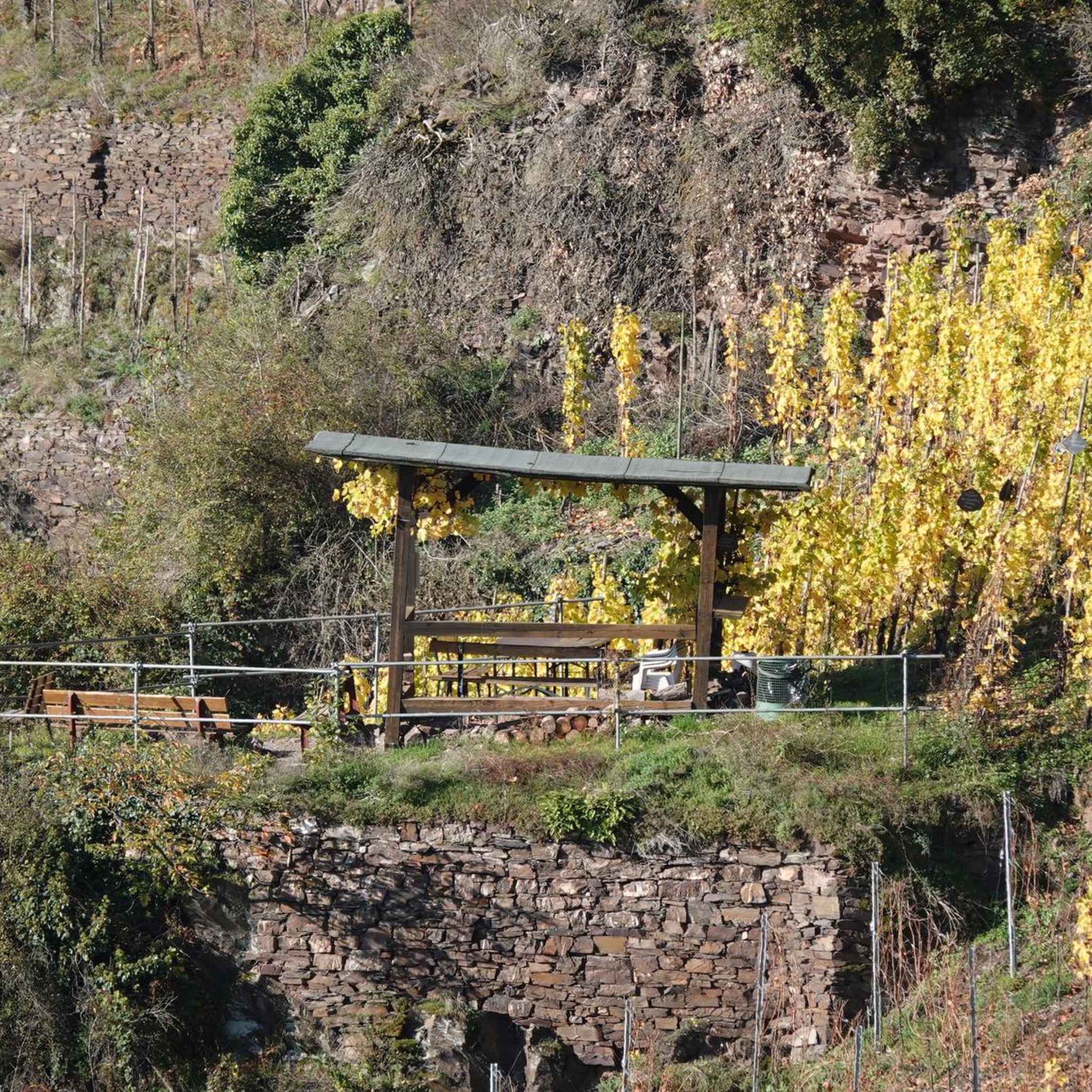
Tips from the Community

Great reservoir on the Main-Danube Canal. Definitely worth a visit..
1
0

Unfortunately, most of the water castle is currently closed due to construction work.
0
0

As of early 2026: Several years ago, the buildings and grounds seemed destined for ruin. The castle, one of the oldest Franconian aristocratic residences, is surrounded by forests and meadows. First mentioned in 1470, the building owes its nickname, "Water Castle," to the water-filled main moat surrounding the castle and the nearby Gutzenweiher pond. A private investor took it on as his retirement project a few years ago and completed the conversion and renovation work in 2025. It is now in the process of becoming a tourist attraction with a hotel and restaurant, as well as an attractive venue for events and conferences. For more information, see https://syburg2025.de/
2
0

The Eckersmühlen lock was built between 1980 and 1985 as part of the construction of the Main-Danube Canal federal waterway and opened on June 15, 1991. It is located partly within the territory of the town of Roth, part of the municipality of Haimpfarrich, and the town of Hilpoltstein, part of the municipality of Heuberg, and is designed as an economy lock with three economy basins south of the lock basin. From the upstream water of the lock, water from the Eckersmühlen section can be fed into Lake Roth via a 300 m long tunnel. Downstream of the lock, the Kleine Roth is diverted beneath the canal in a 200 m long culvert, but can also discharge water from Lake Roth via an inlet structure if necessary.
0
0


You should almost wait until a ship comes.
3
0

Great bike path, great roads, really fun
1
0
Frequently Asked Questions
How many no-traffic gravel bike trails are available around Burgsalach?
There are over 50 dedicated routes around Burgsalach that are ideal for traffic-free gravel biking. These routes offer a diverse range of experiences, from easy spins to more challenging rides, all designed to keep you away from busy roads.
What kind of terrain can I expect on these no-traffic gravel trails?
The region around Burgsalach, particularly within the Altmühltal Nature Park, offers a varied landscape. You can expect a mix of rolling hills, scenic river valleys, and extensive forests. Many trails utilize former railway lines, like sections of the Gredl Cycle Path, which provide smooth, consistent surfaces. Other paths will take you through charming small valleys with more varied gravel surfaces, ensuring an engaging ride.
Are there easy or family-friendly no-traffic gravel routes near Burgsalach?
Yes, the area offers several easy routes perfect for beginners or families. For instance, the route Between Anlauter and Thalach - Graveling in the Altmühltal Nature Park is a moderate option that provides a great introduction to the region's gravel paths without being overly strenuous. Look for routes marked as 'easy' in the guide for the most relaxed experiences.
What historical or natural landmarks can I see along the no-traffic gravel bike trails?
Many routes pass by significant historical and natural attractions. You can explore remnants of the Roman Limes, a UNESCO World Heritage site, or discover unique geological formations like the Stone Channel near Rohrbach. Other highlights include the European Watershed Sculpture on the Gredl Cycle Path and the tranquil Bechthaler Pond.
What do other gravel bikers enjoy most about the no-traffic routes in Burgsalach?
The komoot community highly rates the gravel biking experience around Burgsalach, with an average score of 4.6 stars. Riders often praise the peacefulness of the trails, the beautiful natural scenery of the Altmühltal Nature Park, and the well-maintained gravel paths that keep them away from traffic. The blend of natural beauty and historical sites is also frequently highlighted.
Are there any routes that offer scenic viewpoints or panoramic vistas?
Absolutely. The rolling hills of the Altmühltal provide numerous opportunities for scenic views. While specific viewpoints vary by route, many trails offer glimpses of charming river valleys and expansive forest landscapes. For example, the challenging route View of Kipfenberg Castle – Burgsteinfelsen near Dollnstein loop from Titting offers impressive vistas, including views of Kipfenberg Castle.
Can I find circular no-traffic gravel routes around Burgsalach?
Yes, many of the no-traffic gravel routes around Burgsalach are designed as loops, allowing you to start and end at the same point. This is convenient for parking and exploring the area efficiently. The route Weißenburg Market Square – Pappenheim loop from Weißenburg (Bay) is a good example of a longer circular option.
What is the best season for gravel biking in Burgsalach to avoid traffic and enjoy the scenery?
Spring and autumn are generally considered the best seasons for gravel biking in Burgsalach. During these times, the weather is typically mild, and the natural landscapes are particularly vibrant with blooming flowers or colorful foliage. The trails are also less crowded than in peak summer, enhancing the 'no traffic' experience. Winter can be beautiful but may present challenges with snow or ice on some paths.
Are there any specific natural areas or gorges to explore by gravel bike?
Yes, the region features several beautiful natural areas and gorges. The Anlautertal Between Bechthal and Bürg is a notable highlight, offering a picturesque cycle way through a valley. You can also explore the Arbachtal, which provides a more rugged gorge experience.
Are there any routes that pass by lakes or water features?
Yes, some routes will take you past serene water bodies. For example, the route View of the Rothsee with its marina – Rothsee loop from Heideck offers views of the Rothsee. Additionally, the Bechthaler Pond is a charming natural highlight that can be incorporated into various rides.
Most popular attractions around Burgsalach

Get inspired with the komoot mobile app


Explore more
Browse the best Gravel rides in other regions.
