The best traffic-free bike rides around Dürnbucher Forst
4.5
(4367)
24,243
riders
397
rides
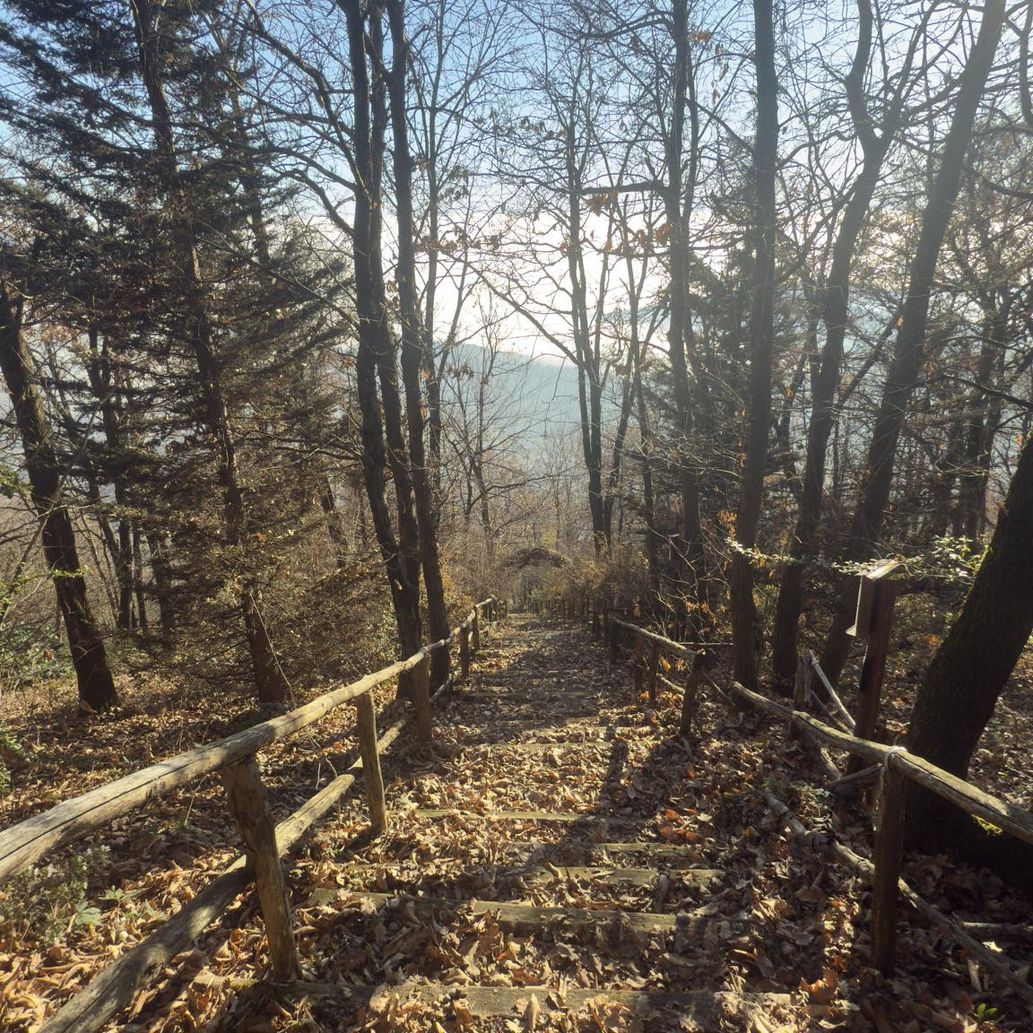
No traffic touring cycling routes around Dürnbucher Forst traverse a landscape characterized by predominantly coniferous and mixed forests, gentle hills, and diverse natural features. Elevations range from 350 to 450 meters above sea level, providing varied terrain suitable for cycling. The region includes unique inland dunes in the north and wet meadows in the south, with numerous springs feeding streams and fish ponds. Quiet roads and well-maintained cycleways offer an enjoyable experience for touring cyclists.
Best no traffic touring cycling routes around Dürnbucher Forst
- The most popular no traffic touring cycling route is Chapel of Umbertshausen – Maria Hilf Chapel loop from Münchsmünster, a 18.1 miles (29.2 km) moderate trail that takes 2 hours 12 minutes to complete, winding through varied forest landscapes and past historical chapels.
- Another top favourite among local touring cyclists is Kleines Donautor Vohburg – Vohburg Danube Gate loop from Münchsmünster, an easy 11.8 miles (19.0 km) path. This route offers views of the Danube Gate and passes through open fields and riverside areas.
- Local touring cyclists also love the Train Moated Castle – Hopfenlager Siegburg loop from Train, a 10.7 miles (17.2 km) trail leading through hop-growing areas and past historical sites, often completed in about 1 hour 9 minutes.
- Touring cycling around Dürnbucher Forst is defined by coniferous and mixed forests, gentle hills, inland dunes, and streams, often passing through hop-growing regions. The network offers options for different ability levels, from easy loops to more moderate rides.
- The routes in Dürnbucher Forst are highly rated by the komoot community with an average score of 4.5 stars from over 3700 reviews. More than 21000 touring cyclists have used komoot to explore Dürnbucher Forst's varied terrain.
Last updated: July 11, 2026
4.3
(4)
32
riders
29.2km
02:13
180m
180m
Moderate bike ride. Good fitness required. Mostly paved surfaces. Suitable for all skill levels.
4.3
(10)
105
riders
Moderate bike ride. Good fitness required. Mostly paved surfaces. Suitable for all skill levels.

Sign up for free
4.0
(2)
15
riders
17.2km
01:09
90m
90m
Easy bike ride. Great for any fitness level. Mostly paved surfaces. Suitable for all skill levels.
8
riders
Moderate bike ride. Good fitness required. Mostly paved surfaces. Suitable for all skill levels.
5.0
(1)
7
riders
69.4km
04:23
630m
630m
Hard bike ride. Very good fitness required. You may need to push your bike for some segments of this route.
Get access to more routes and recommendations from other explorers.
Sign up for free
Already have an account?
Our route recommendations are based on thousands of hikes, rides, and runs completed by other people on komoot.
Start today with a free account
Your next adventure awaits.
Login or Signup
Popular around Dürnbucher Forst

Tips from the Community

The Abens The Abens is a river in Upper and Lower Bavaria. It rises at Bruchholz between Dürnzhausen in the northwest and Sünzhausen in the southeast, in the district of Pfaffenhofen an der Ilm. The Roman fort of Eining took its name, Abusina, from the nearby Abens. The origin of this river name is unclear. The first element could be derived from the Indo-European word "abā" (water). Other sources suggest that the river name in Celtic was "Abusā" and that the ending -ina initially referred only to the fort. In its upper reaches, the Abens flows through the Hallertau, a hilly region characterized by hop cultivation. From its source between Dürnzhausen and Sünzhausen, the river initially flows eastward, then northeastward, crossing the border into the district of Freising after just over a kilometer. The Abens River then passes through the villages of Abens, Hirnkirchen, Seysdorf, and Halsberg before reaching the market town of Au in the Hallertau region. There, it turns north and runs largely parallel to Federal Highway 301 until Abensberg. The river then passes through the villages of Enzelhausen and Rudelzhausen before reaching the border with the district of Kelheim and thus Lower Bavaria. From there, it continues northward to the small town of Mainburg. From this point, the Abens meanders northward before passing under Federal Highway 93. It then flows on to the market town of Siegenburg, which it skirts to the west. Finally, the river reaches Biburg with its noteworthy Romanesque church and then passes Frauenberg hill with the equally impressive Baroque pilgrimage church of Allersdorf. Around this point, the valley opens into a wide plain that slopes gently westward toward the Danube. The river then turns west at the level of the small town of Abensberg and reaches the spa town of Bad Gögging. West of Bad Gögging, the river turns north again and merges with the Ilm, which runs parallel to the Danube and is of roughly the same size. Both rivers carry an average flow of approximately 3.2 m³/s of water at this point. The original mouth of the Abens into the Danube was likely located approximately here. However, as a result of artificial regulation measures in the 1920s, the mouth was moved about three kilometers north. The Abens now flows into the Danube after approximately 71.1 km, west of the village of Eining. Source: Excerpts from www.wikipedia.de
3
0

A very good route for cycling, walking, etc.
0
0

There is also an information board for the Schambachtalbahn cycle path
0
0

I recommend stopping off for an ice cream or coffee at the Dolce Vita ice cream parlor in Neustadt an der Donau.
0
0

**Old Town of Abensberg**! This charming town in the Kelheim district of Lower Bavaria is known for its lovingly restored old town center and offers a fascinating blend of history and culture. Here are some highlights you shouldn't miss: ### Historical Highlights 1. **Magnificent Town Houses**: The old town is lined with beautiful, historic town houses that reflect the charm of bygone times. 2. **Town Hall**: The historic town hall is an architectural gem and a central point in the old town, often serving as a meeting point for events. 3. **Maderturm**: This striking tower is a town landmark and offers great views over the old town and the surrounding area. ### Sights - **Kuchlbauer Beer World**: Near the old town is the famous Kuchlbauer Beer World, which celebrates Bavarian brewing and is a popular destination for beer lovers. - St. Nicholas Parish Church: This impressive church is another highlight and an important part of Abensberg's cultural heritage. - City Wall: Parts of the old city wall are still preserved and testify to Abensberg's historical significance. ### Atmosphere and Special Features - Abensberg's old town exudes a welcoming atmosphere, perfect for strolling and lingering. The narrow streets are lined with small shops, cafés, and restaurants offering local specialties. - The town is also known for its events, including the Gillamoos, a traditional folk festival that attracts many visitors. ### Summary Abensberg's old town is a place where history and culture come alive. Whether exploring the historic buildings or enjoying the local cuisine, there's plenty to discover and experience here!
1
0

Nice bike tour, also with children
0
0

Many kilometers are driven on the dam. At least you can see the Danube from time to time.
1
0
Frequently Asked Questions
How many no-traffic touring cycling routes are available in Dürnbucher Forst?
Dürnbucher Forst offers a wide selection of no-traffic touring cycling routes. You can find over 380 routes, with nearly 200 classified as easy, ensuring plenty of options for a peaceful ride.
What kind of terrain can I expect on these no-traffic routes?
The Dürnbucher Forst features predominantly coniferous forests, with some beech and mixed woodlands. The terrain is generally gently hilly, ranging from 350 to 450 meters above sea level, offering a pleasant challenge without being overly strenuous. You might also encounter unique inland dunes in the northern part and wet meadows in the south.
What natural features can I discover along the no-traffic cycling routes?
While cycling through Dürnbucher Forst, you can explore diverse natural features. Look out for the distinctive Inland dunes in the Seeholz near Offenstetten, numerous springs feeding streams like the Wolfsgraben, and small fish ponds. The Old Danube Oxbow, Pförring, and the Confluence of the Paar and Danube are also notable natural highlights.
Are there any historical or cultural landmarks to see while cycling?
Yes, several points of interest are scattered throughout the region. You can visit the Mariahilf Chapel or see the five-meter-high memorial column commemorating the "Seliger Bauer von Vohburg." Other notable landmarks include the St. Ulrich Collegiate Church, Ainau, and the Stadtplatz Fountain Monolith.
Are the no-traffic routes suitable for families with children?
Many of the no-traffic routes in Dürnbucher Forst are well-suited for families. The gentle hilly terrain and quiet, well-maintained cycleways provide a safe and enjoyable environment for cyclists of all ages. Routes like the Kleines Donautor Vohburg – Vohburg Danube Gate loop from Münchsmünster are classified as easy and offer shorter distances.
Can I bring my dog on these cycling routes?
Yes, Dürnbucher Forst is generally dog-friendly. Many of the quiet forest paths are suitable for cycling with a leashed dog. However, always be mindful of local regulations and other trail users, especially in more populated areas or near wildlife habitats.
Where can I find refreshments or places to rest along the routes?
For a refreshing break, the Birkenheide Beer Garden is a welcoming spot that offers bicycle parking. Additionally, the region's connection to the Hallertau hop-growing area means you might find local establishments offering refreshments, especially in nearby towns.
What are the surface conditions like on the no-traffic cycling paths?
The no-traffic cycling paths in Dürnbucher Forst generally feature well-maintained surfaces. A cycle path along the B300, for instance, is known for its smooth asphalt, providing an enjoyable ride. Expect a mix of paved and well-compacted gravel paths through the forest sections.
Is public transport accessible for reaching these no-traffic routes?
While Dürnbucher Forst is primarily accessed by car, some nearby towns may offer public transport connections. It's advisable to check local bus or train schedules for access points to the forest, especially if you plan to start your tour without a car.
What do other touring cyclists appreciate most about the no-traffic routes in Dürnbucher Forst?
The area is highly rated by the komoot community, with an average score of 4.5 stars from over 3,700 ratings. Reviewers often praise the tranquility of the forest, the well-maintained paths, and the opportunity to cycle through diverse landscapes without vehicle traffic. The gentle hills and natural beauty are frequently highlighted.
Are there any circular no-traffic cycling routes available?
Yes, many of the no-traffic touring routes in Dürnbucher Forst are designed as loops, allowing you to start and end at the same point. Examples include the Chapel of Umbertshausen – Maria Hilf Chapel loop from Münchsmünster and the Train Moated Castle – Hopfenlager Siegburg loop from Train.
What are the typical distances and durations for no-traffic touring routes here?
The no-traffic touring routes in Dürnbucher Forst vary in length and duration to suit different preferences. You can find shorter, easy routes like the Kleines Donautor Vohburg – Vohburg Danube Gate loop, which is about 19 km and takes around 1 hour 10 minutes. Longer, more challenging options, such as the Biburg Monastery Church – Abensberg Town Fortifications loop, can be over 50 km and take around 3 hours 20 minutes.
Most popular routes around Dürnbucher Forst
Most popular attractions around Dürnbucher Forst

Get inspired with the komoot mobile app


Explore more
Browse the best Cycling routes in other regions.
