The best family-friendly hikes and walks around Walchensee
4.5
(33060)
172,936
hikers
699
hikes
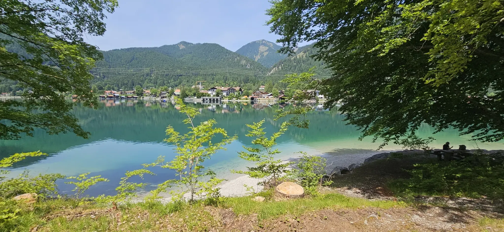
Family friendly hiking trails around Walchensee are set within the Bavarian Alps, a region characterized by its strikingly clear, turquoise lake waters and surrounding prominent mountains. The landscape features dense forests and a dramatic alpine setting, with much of the lake designated as a protected area. This deep alpine lake, formed by tectonic forces and glaciation, offers a diverse terrain ranging from lakeside paths to mountain ascents.
Best family friendly hiking trails around Walchensee
- The most popular family friendly hiking route is View of Walchensee – Lake Walchensee loop from Walchensee, a 5.5 miles (8.9 km) trail that takes 2 hours 56 minutes to complete. This moderate route offers expansive views of the lake and surrounding peaks.
- Another top favourite among local hikers is Jochberg Summit – Walchensee loop from Walchenseekraftwerk, a moderate 6.4 miles (10.4 km) path. This trail leads to the Jochberg summit, providing striking views of both Walchensee and Kochelsee.
- Local hikers also love the View of Walchensee – Walchensee East Shore loop from Niedernach, a 9.1 miles (14.6 km) trail leading through forested areas along the lake's eastern shore, often completed in about 3 hours 59 minutes.
- Hiking around Walchensee is defined by clear alpine lakes, dense forests, and prominent mountain peaks like Herzogstand and Jochberg. The network offers options for different ability levels, from moderate lakeside paths to more challenging mountain ascents.
- The routes in Walchensee are highly rated by the komoot community with an average score of 4.5 stars from over 30,000 reviews. More than 170,000 hikers have used komoot to explore Walchensee's varied terrain.
Last updated: June 26, 2026
3,225
hikers
15.1km
06:57
1,110m
1,100m
Hard hike. Very good fitness required. Sure-footedness, sturdy shoes and alpine experience required.
4.8
(2081)
8,858
hikers
9.48km
04:12
660m
660m
Moderate hike. Good fitness required. Mostly accessible paths. Sure-footedness required.

Sign up for free
4.7
(453)
2,104
hikers
8.86km
02:23
100m
100m
Moderate hike. Good fitness required. Easily-accessible paths. Suitable for all skill levels.
4.7
(156)
575
hikers
14.7km
04:01
210m
210m
Moderate hike. Good fitness required. Easily-accessible paths. Suitable for all skill levels.
4.5
(75)
396
hikers
11.0km
03:39
510m
510m
Moderate hike. Good fitness required. Mostly accessible paths. Sure-footedness required.
Get access to more routes and recommendations from other explorers.
Sign up for free
Already have an account?
Our route recommendations are based on thousands of hikes, rides, and runs completed by other people on komoot.
Start today with a free account
Your next adventure awaits.
Login or Signup
Popular around Walchensee
Other adventures around Walchensee

Tips from the Community

beautiful place to take a break and enjoy the lake
3
0

Beautiful lake, great paths, nice view of the mountains
0
0

Beautiful view over the lake
0
0

Beautiful view over Lake Walchensee. It also serves as a reservoir for the hydroelectric power plant. A cycling and hiking path runs along the eastern shore. Unfortunately, on the western shore, you have to use most of the B11 by bike.
0
0

beautiful view of the village of Walchensee
0
0


One of the most beautiful lakes in Bavaria with sensational colors.
0
0

Open meadow with resting potential to enjoy an unobstructed view of the valley.
3
0
Frequently Asked Questions
How many family-friendly hiking trails are available around Walchensee?
The Walchensee region offers a wide variety of hiking opportunities, with over 700 routes in total. For families, there are more than 240 easy trails and 280 moderate trails, ensuring plenty of options suitable for all ages and fitness levels.
What kind of terrain can we expect on family hikes around Walchensee?
Walchensee's family-friendly trails offer diverse terrain, from leisurely lakeside paths to more challenging mountain ascents. Many routes feature well-maintained forest paths, some with gentle inclines, while others might include steeper sections with rewarding panoramic views. The area is known for its clear, turquoise waters and dense forests, providing a beautiful backdrop for your hike.
Are there any circular routes suitable for families around Walchensee?
Yes, Walchensee has several excellent circular routes perfect for families. For a moderate option with stunning views, consider the Jochberg Summit – Walchensee loop from Walchenseekraftwerk. This trail offers rewarding vistas without being overly strenuous for active families.
What are some easy, kid-friendly hikes with beautiful views?
For an accessible hike with lovely scenery, the View of Walchensee – Lake Walchensee loop from Walchensee is a great choice. It's a moderate route that provides wonderful perspectives of the lake and surrounding landscape, suitable for families looking for a pleasant outing.
Can we bring our dog on the hiking trails around Walchensee?
Many trails around Walchensee are dog-friendly, allowing you to enjoy the beautiful scenery with your furry companion. However, it's always advisable to keep dogs on a leash, especially in nature protection areas and near livestock, and to be mindful of other hikers and wildlife. Always carry water for your dog and clean up after them.
Are there any specific landmarks or points of interest to look out for on family hikes?
Absolutely! Walchensee is rich in natural beauty and interesting spots. You can enjoy views of the pristine Lake Walchensee itself, or seek out the View of Sassau Island on Lake Walchensee, which is a protected nature reserve. For a unique historical touch, you might also find the whimsical Viking Village, a preserved movie set, interesting to explore.
What is the best time of year for family hikes around Walchensee?
The best time for family hikes around Walchensee is generally from late spring to early autumn (May to October). During these months, the weather is usually pleasant, trails are clear, and the natural beauty of the Bavarian Alps is at its peak. Summer offers opportunities for swimming in the lake, while autumn provides stunning foliage.
Are there any stroller-friendly walks in the Walchensee area?
While some parts of the wider Walchensee loop might be suitable, specific stroller-friendly paths can be found, particularly along the flatter sections close to the lake shore. These paths often offer easy access and smooth surfaces, perfect for families with young children in strollers. Always check route details for terrain information before heading out.
Where can we find parking for family hiking trails around Walchensee?
There are various parking options available around Walchensee, especially near popular trailheads and villages like Walchensee itself or Niedernach. Many routes, such as the View of Walchensee – Walchensee East Shore loop from Niedernach, often have designated parking areas nearby. It's advisable to arrive early, especially on weekends and during peak season, as spots can fill up quickly.
Are there places to swim or picnic near the family hiking routes?
Yes, Walchensee is famous for its crystal-clear waters, making it ideal for swimming. You'll find numerous designated areas like the Walchensee Lakeside Picnic Area, the Pebble beach and swimming at Lake Walchensee, and a Swimming spot and rest area on the north shore. These spots are perfect for a refreshing dip or a family picnic after your hike.
What do other hikers enjoy most about family-friendly hiking in Walchensee?
The Walchensee region is highly rated by the komoot community, with an average score of 4.5 stars. Reviewers often praise the stunning turquoise waters, the diverse trails suitable for all ages, and the breathtaking panoramic views from peaks like Herzogstand and Jochberg. The combination of alpine scenery and clear lake waters makes it a truly memorable family hiking destination.
Are there any challenging family hikes for older children or more experienced families?
For families seeking a more challenging adventure, the Walchensee area offers trails with significant elevation gain and rewarding views. The Herzogstand summit cross – View of Lake Walchensee loop from Walchensee is a difficult route that provides incredible panoramic vistas of Walchensee, Kochelsee, and the wider Bavarian Alps. This hike requires good fitness and sturdy shoes.
Most popular routes around Walchensee
Most popular attractions around Walchensee

Get inspired with the komoot mobile app


Explore more
Browse the best Hikes in other regions.
