The best waterfall hikes and walks around Walchensee
4.5
(34709)
173,804
hikers
72
hikes
Waterfall hiking trails around Walchensee are set within the Bavarian Alps, a region characterized by its deep alpine lake, surrounding mountain peaks, and diverse forest landscapes. The area features a mix of challenging mountain ascents and gentler paths along the lake's shores and through valleys. Elevations vary significantly, with prominent peaks like Herzogstand reaching 1,731 meters, offering panoramic views. The terrain includes forested slopes, open alpine meadows, and riverbeds leading to various waterfalls.
Best waterfall hiking trails around Walchensee
- The…
Last updated: August 5, 2026
4.7
(148)
459
hikers
5.62km
01:49
200m
200m
Moderate hike. Great for any fitness level. Mostly accessible paths. Sure-footedness required.
4.4
(17)
78
hikers
22.3km
08:27
1,130m
1,140m
Hard hike. Very good fitness required. Sure-footedness, sturdy shoes and alpine experience required.

Sign up for free
5.0
(24)
117
hikers
19.0km
06:51
780m
780m
Hard hike. Very good fitness required. Mostly accessible paths. Sure-footedness required.
5.0
(2)
14
hikers
5.84km
02:50
480m
480m
Hard hike. Good fitness required. Sure-footedness, sturdy shoes and alpine experience required.
4.6
(55)
304
hikers
15.4km
05:49
680m
680m
Hard hike. Very good fitness required. Mostly accessible paths. Sure-footedness required.
Get access to more routes and recommendations from other explorers.
Sign up for free
Already have an account?
Our route recommendations are based on thousands of hikes, rides, and runs completed by other people on komoot.
Start today with a free account
Your next adventure awaits.
Login or Signup
Popular around Walchensee
Other adventures around Walchensee

Tips from the Community

Beautiful panorama. Children can dip their feet in the water, while adults enjoy the sound of the water😁
0
0
Great path along the stream. The bird educational trail is also nice. Several information boards briefly introduce local animals such as the nuthatch, bullfinch, or woodpecker.
0
0

Good view into the Karwendel
0
0

It's not the Jachen, but the Große Laine.
0
0

Those wanting to reach the waterfall or head towards Rabenkopf/Beniwand by mountain bike should take the forest road on the right-hand side heading into the valley. The narrow footpath on the left is closed to bicycles. It's a much nicer route for hiking and also the more scenic one towards Hirschhörnl.
0
0

Simply sit here, enjoy the view and let your mind wander.
0
0


Long trousers are needed, lots of ticks are sitting along side the small way, waiting in the high grass for you to pass by
0
0
Frequently Asked Questions
How many waterfall hiking trails are available around Walchensee?
There are over 75 waterfall hiking trails around Walchensee, offering a wide range of options from easy strolls to challenging mountain ascents. The komoot community has explored these routes over 167,000 times.
What makes Walchensee a good destination for waterfall hikes?
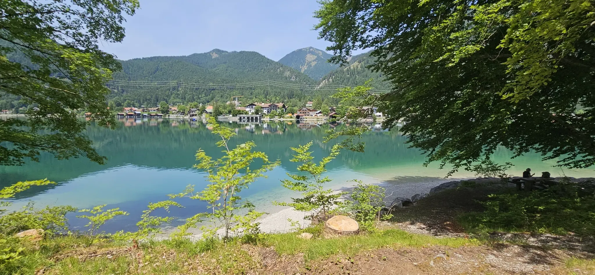
Walchensee, nestled in the Bavarian Alps, offers a unique combination of stunning natural beauty, diverse terrain, and clear alpine waters. The region features prominent peaks like Herzogstand and Jochberg, providing a dramatic backdrop to the various forested slopes and riverbeds where waterfalls can be found. It's often called the 'Bavarian Caribbean' due to its turquoise-green waters, enhancing the scenic beauty of the hikes.
What do other hikers say about the waterfall trails around Walchensee?
The waterfall hiking trails around Walchensee are highly rated by the komoot community, with an average score of 4.5 stars from over 29,000 reviews. Hikers frequently praise the clear alpine waters, forested slopes, and the rewarding mountain vistas encountered along the routes.
Are there easy waterfall hikes suitable for beginners near Walchensee?
Yes, Walchensee offers several easy waterfall hikes perfect for beginners or those looking for a relaxed outing. There are 8 easy routes available, often featuring gentle paths along lake shores or through valleys. An example is the Along the Lainbach – Lainbach Waterfall loop from Kochel am See, a moderate 5.7 km trail that follows the Lainbach river to its waterfall.
Are there challenging waterfall hikes for experienced hikers?
Absolutely. For experienced hikers seeking a challenge, there are 26 difficult waterfall hiking routes around Walchensee. These trails often involve significant elevation gains and require good fitness and sturdy shoes. A notable option is the Glasbach Waterfall – Benediktenwand summit loop from Jachenau, a 22.2 km trail leading through varied mountain terrain, often taking over 8 hours to complete.
Can I find circular waterfall routes around Walchensee?
Yes, many waterfall hikes around Walchensee are designed as circular routes, allowing you to start and end at the same point. For instance, the Rocky Riverbed Rest Spot – Glasbach Waterfall loop from Jachenau is a moderate 9.9 km circular path that explores the Glasbach riverbed and its waterfall.
Are there family-friendly waterfall hikes in the Walchensee area?
The Walchensee region offers several family-friendly options. Many easy trails, particularly those around the Zwergern peninsula or specific loops around the lake, are suitable for all fitness levels and can even be enjoyed with prams. When choosing a waterfall hike, look for routes marked as 'easy' or 'moderate' with shorter distances.
Are dogs allowed on waterfall hiking trails around Walchensee?
Generally, dogs are welcome on hiking trails around Walchensee. However, it's always advisable to keep them on a leash, especially in nature reserves or areas with livestock, and to respect local regulations. Ensure your dog is fit enough for the chosen trail and carry water for them.
What are the parking options for waterfall hikes near Walchensee?
Parking is generally available at popular trailheads and villages around Walchensee, such as Kochel am See or Jachenau. Some parking areas may require a fee. It's recommended to arrive early, especially on weekends or during peak season, as spots can fill up quickly.
What can I see along the waterfall hiking trails besides the waterfalls?
Beyond the beautiful waterfalls, the trails around Walchensee offer access to stunning natural features and points of interest. You can enjoy views of Lake Walchensee itself, often referred to as the 'Bavarian Caribbean,' or catch glimpses of Sassau Island. Some routes might pass by historical sites like the Walchensee Power Station or offer panoramic views from mountain peaks like Herzogstand.
What is the best time of year to visit Walchensee for waterfall hikes?
The best time for waterfall hikes around Walchensee is typically from spring to autumn (April to October) when the weather is mild and the trails are clear. In spring, waterfalls are often at their most powerful due to snowmelt. While hiking up to Herzogstand is possible year-round, winter hikes in deep snow can be challenging and require appropriate gear and caution regarding avalanche risks.
Are there any specific landmarks or attractions near the waterfall trails?
Yes, the Walchensee area is rich in landmarks. Besides the lake itself, you might encounter the historic St. Anne's Little Monastery or cross charming structures like the Bridge and Ford Crossing near Jachenau. The region also boasts the impressive Walchensee Power Station, a significant hydroelectric plant, and the whimsical Viking Village movie set.
Most popular routes around Walchensee
Most popular attractions around Walchensee

Get inspired with the komoot mobile app


Explore more
Browse the best Hikes in other regions.
