The best hikes from bus stations in Friðland Að Fjallabaki
4.7
(635)
5,445
hikers
18
hikes
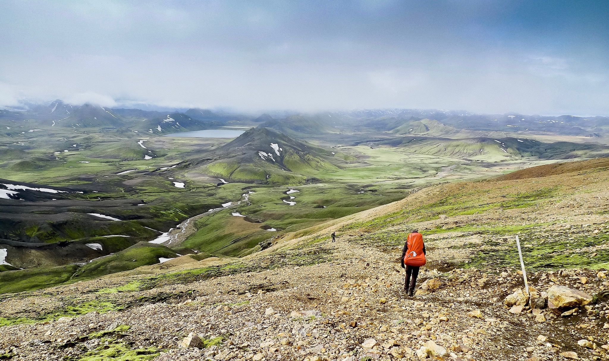
Bus station hiking trails in Friðland Að Fjallabaki traverse a unique volcanic landscape in the Icelandic Highlands. This region features colorful rhyolite mountains, extensive lava fields, and active geothermal areas. Hikers encounter distinctive craters and deep valleys, offering varied terrain shaped by ancient glaciers and volcanic activity. The area provides views of glaciers and is characterized by its dramatic and often stark scenery.
Best bus station hiking trails in Friðland Að Fjallabaki
- The most popular bus station hiking route is…
Last updated: September 29, 2026
4.9
(93)
754
hikers
6.35km
02:47
280m
280m
Hard hike. Good fitness required. Sure-footedness, sturdy shoes and alpine experience required.
4.8
(13)
119
hikers
Hard hike. Good fitness required. Sure-footedness, sturdy shoes and alpine experience required.

5.0
(3)
71
hikers
Hard hike. Great for any fitness level. Sure-footedness, sturdy shoes and alpine experience required.
4.9
(9)
35
hikers
12.7km
05:16
520m
520m
Hard hike. Very good fitness required. Sure-footedness, sturdy shoes and alpine experience required.
5.0
(2)
58
hikers
4.21km
02:08
270m
270m
Hard hike. Good fitness required. Sure-footedness, sturdy shoes and alpine experience required.
Get access to more routes and recommendations from other explorers.
Already have an account?
Our route recommendations are based on thousands of hikes, rides, and runs completed by other people on komoot.
Start today with a free account
Your next adventure awaits.
Popular around Friðland Að Fjallabaki
Other adventures in Friðland Að Fjallabaki


Tips from the Community

The best-stocked shop on the route
0
0

Not only do the mountains around Landmannalaugar shimmer in bright colors, but stones of all shades can also be found in this valley. The valley is crossed before the ascent to Blahnukur. A small river further enriches the colorful backdrop at the foot of Blahnukur.
0
0

Both tributaries are very hot, but the water cools down considerably after a few meters. Very crowded! No changing rooms: you have to make do with the towel you brought with you.
0
0
In a large tent you can warm yourself up a bit and enjoy the snacks you brought with you.
1
2
Here you can find warm drinks and simple food.
0
0

Great glacier foothills and a great place to relax for a while (as long as the weather plays along).
0
0

When you climb up to Brennisteinsalda you have a great view of the Laugahraun lava field and the geothermal area. Even if you don't want to climb all the way up, you still have a great view here.
0
0
For us, this was the starting route to Brennisteinsalda, which can be seen here. The many contrasting colors are simply great.
0
0
Frequently Asked Questions
How many bus-accessible hiking trails are available in Friðland Að Fjallabaki?
There are 19 hiking trails in Friðland Að Fjallabaki that are accessible from bus stations. These routes offer a unique way to explore the region's volcanic landscapes.
What kind of landscapes can I expect to see on these bus station hikes?
The trails accessible from bus stations in Friðland Að Fjallabaki traverse a diverse and dramatic landscape. You'll encounter colorful rhyolite mountains, vast lava fields, black sands, and significant geothermal areas with hot springs and steam vents. The region is known for its unique geological formations, including craters and obsidian flows, offering an otherworldly experience.
Are there any circular routes available from bus stations?
Yes, several circular routes are available. For instance, you can explore the area around Bláhnúkur Summit with the Bláhnúkur Summit – View of Bláhnúkur loop from Landmannalaugar, or take the Landmannalaugar Lava Fields – Landmannalaugar Campground loop from Landmannalaugar to experience the unique lava formations.
What are some notable natural attractions along these trails?
Many trails offer access to stunning natural attractions. You can hike to the Bláhnúkur Summit for panoramic views, or explore the vibrant Ljótipollur Crater Lake. The Geothermal Area in Friðland að Fjallabaki is also a prominent feature, showcasing the region's volcanic activity.
What is the difficulty level of bus-accessible hikes in Friðland Að Fjallabaki?
All 19 bus-accessible hiking trails in Friðland Að Fjallabaki are rated as difficult. Hikers should be prepared for challenging terrain, significant elevation changes, and potentially long distances. Proper gear and experience are recommended.
Can I find facilities like campgrounds near the bus stops?
Yes, Landmannalaugar Campground is a key hub and often serves as a starting point for many trails accessible by bus. It provides basic facilities and is famous for its natural hot springs, known as the "People's Pools," perfect for relaxing after a hike.
What do other hikers say about the trails in Friðland Að Fjallabaki?
The hiking experiences in Friðland Að Fjallabaki are highly rated by the komoot community, with an average score of 4.73 stars from 489 reviews. Hikers frequently praise the region's unique and colorful volcanic landscapes, the sense of wilderness, and the stunning vistas from peaks like Bláhnúkur.
Are there any specific trails that highlight the region's geothermal features?
Absolutely. Many trails pass through or near active geothermal areas. The Geothermal Area in Friðland að Fjallabaki is a central feature, and routes like the Landmannalaugar Campground – Bláhnúkur Summit loop from Landmannalaugar offer opportunities to witness steam vents and colorful mineral deposits.
What is the best time of year to hike these bus-accessible trails?
The hiking season in Friðland Að Fjallabaki is generally limited due to its location in the Icelandic Highlands. The best time to visit is typically during the summer months, from late June to early September, when the roads are open, and weather conditions are most favorable for hiking.
What should I wear or bring for hiking in Friðland Að Fjallabaki?
Given the challenging terrain and unpredictable weather in the Icelandic Highlands, it's crucial to wear sturdy hiking boots, layered clothing (including waterproof and windproof outer layers), and bring essentials like a map, compass or GPS, sufficient water, and snacks. The weather can change rapidly, even in summer.
Are there any trails that offer views of glaciers?
While Friðland Að Fjallabaki itself is north of Mýrdalsjökull, many trails within the reserve offer distant views of glaciers, adding another dramatic element to the diverse landscape. The elevated viewpoints, such as from Bláhnúkur Summit, often provide the best opportunities for these expansive vistas.
Most popular routes in Friðland Að Fjallabaki
Most popular attractions in Friðland Að Fjallabaki

Get inspired with the komoot mobile app


Explore more
Browse the best Hikes in other regions.
