The best traffic-free bike rides in Bruchköbel
4.5
(10294)
46,506
riders
415
rides
No traffic touring cycling routes in Bruchköbel traverse a landscape characterized by gentle river valleys, extensive forests, and open fields within the heart of Hesse, Germany. The region offers well-developed cycling infrastructure, connecting to significant regional paths like the Nidda Cycle Path and the historic Hohe Straße. Terrain generally features low gradients along rivers and moderate inclines through forested areas, providing varied experiences for touring cyclists.
Best no traffic touring cycling routes in Bruchköbel
- The most popular no traffic touring…
Last updated: October 12, 2026
4.8
(20)
84
riders
48.1km
02:53
330m
330m
Moderate bike ride. Good fitness required. Mostly paved surfaces. Suitable for all skill levels.
4.7
(6)
17
riders
Moderate bike ride. Good fitness required. Mostly paved surfaces. Suitable for all skill levels.

5.0
(3)
33
riders
Easy bike ride. Great for any fitness level. Mostly paved surfaces. Suitable for all skill levels.
5.0
(1)
25
riders
Easy bike ride. Great for any fitness level. Mostly paved surfaces. Suitable for all skill levels.
4.4
(10)
58
riders
41.9km
02:35
210m
210m
Moderate bike ride. Good fitness required. Mostly paved surfaces. Suitable for all skill levels.
Get access to more routes and recommendations from other explorers.
Already have an account?
Our route recommendations are based on thousands of hikes, rides, and runs completed by other people on komoot.
Tips from the Community

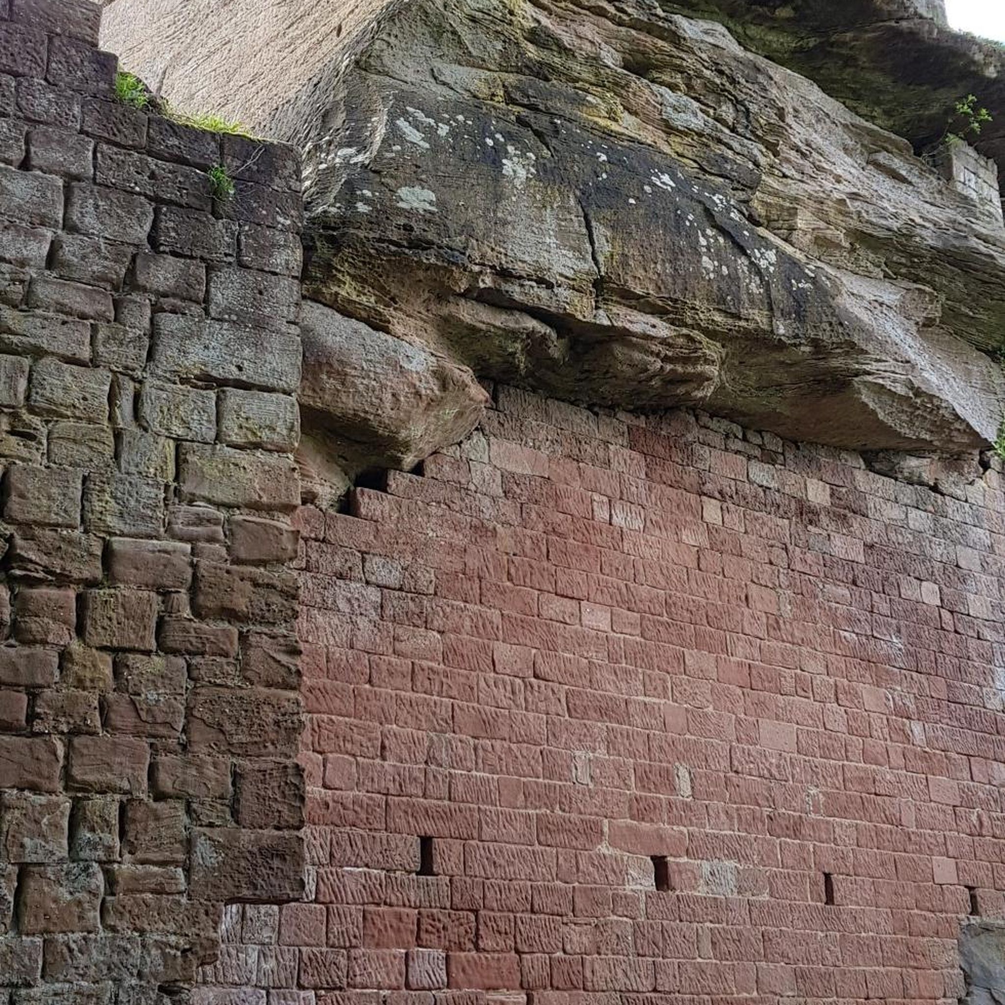
Origins and Early Modern Period 14th century: Probable origin and construction of the first mill on the Kinzig. 1667: First secure documentary mention, granted to the miller Hans Georg Krembs. 18th century: Expansion to include an oil and millet mill and later a snuff mill.
0
0
The history of the Rückinger Mühle dates back to the 14th century. The most important milestones include: the documented mention in 1667, its operation as a grist mill for the flour brand „Kinzigstolz“ until a major fire in 1959, and the conversion to green electricity generation using Francis shaft turbines in 1961. (Note: The abbreviation „KI“ has no historical significance in the history of this mill; in the modern context, „NaTourHuKi“ simply stands for a nature and culture project on the Kinzig).
0
0

it's beautifully rustic here
0
0

Opening hours 2026: Tue 15:00 - 21:00 Wed 15:00 - 21:00 Thu 15:00 - 21:00 Fri 15:00 - 22:00 Sat 12:00 - 22:00 Sun 12:00 - 21:00 Mon Day off Highlight: Wednesday evenings fresh pizza from the pizza maker on pre-order. What is still being finalized (for the 2026 season!): - Accessible toilet - Bicycle repair station
0
0

Beautiful path along the Kinzig river.
0
0

From here on, the riverside path on the right bank of the Kinzig is wildly romantic and beautiful.
0
0

The Kinzig is a river approximately 86 kilometers long. It rises in Sterbfritz, flows southwest through the Main-Kinzig district of Hesse, and flows into the Main from the right in Hanau. The Kinzig is a second-order river in low mountain ranges. It overcomes an elevation of 301 meters and has a bed gradient of 3.5 per thousand. The Kinzig's catchment area covers 1,058 square kilometers, and the calculated mean discharge (MQ) at the mouth of the Kinzig is 10.97 cubic meters per second. The Kinzig was first documented in 796 as "iuxta fluvium Kincihen." In 815, the name was written as "Chinzicha," around 900 as "Kincicha"/"Kinzicham," in 1364 as "Kinzige," in 1584 as "Kintzig," in 1607 as "Bintz," in 1681 as "Kintz," in 1716 as "Kins," in 1769 as "Kinzing," and in 1802 as "Kinzig." In the river's headwaters, there was the now-defunct village of Kinzig, mentioned in 815 as "Chirizichheimero." The village and river were often confused by monastery scribes at that time with "Chizzicha" (now Bad Kissingen), both of which were described as being located in the Saalegau. The name presumably derives from the ancient Celtic *ku̯anti̯o- meaning "flat hill, valley." The name was therefore derived from the mountainous region from which the Kinzig flows. Source: Wikipedia
1
0
The Kinzig is a river approximately 86 kilometers long. It rises in Sterbfritz, flows southwest through the Main-Kinzig district of Hesse, and flows into the Main from the right in Hanau. The Kinzig is a second-order river in low mountain ranges. It overcomes an elevation of 301 meters and has a bed gradient of 3.5 per thousand. The Kinzig's catchment area covers 1,058 square kilometers, and the calculated mean discharge (MQ) at the mouth of the Kinzig is 10.97 cubic meters per second. The Kinzig was first documented in 796 as "iuxta fluvium Kincihen." In 815, the name was written as "Chinzicha," around 900 as "Kincicha"/"Kinzicham," in 1364 as "Kinzige," in 1584 as "Kintzig," in 1607 as "Bintz," in 1681 as "Kintz," in 1716 as "Kins," in 1769 as "Kinzing," and in 1802 as "Kinzig." In the river's headwaters, there was the now-defunct village of Kinzig, mentioned in 815 as "Chirizichheimero." The village and river were often confused by monastery scribes at that time with "Chizzicha" (now Bad Kissingen), both of which were described as being located in the Saalegau. The name presumably derives from the ancient Celtic *ku̯anti̯o- meaning "flat hill, valley." The name was therefore derived from the mountainous region from which the Kinzig flows. Source: Wikipedia
2
0
Frequently Asked Questions
How many no-traffic touring cycling routes are available in Bruchköbel?
Bruchköbel offers a wide selection of traffic-free touring cycling routes, with over 360 options to explore. These include approximately 170 easy routes, 100 moderate routes, and 80 more challenging tours, ensuring there's something for every skill level.
What kind of terrain can I expect on the no-traffic cycling routes around Bruchköbel?
The no-traffic routes in Bruchköbel feature diverse terrain. Many follow gentle, low-gradient paths along rivers like the Nidda and Kinzig, ideal for relaxed rides. Other routes, such as those connecting to the historic Hohe Straße, often utilize paved farm roads and can include moderate inclines, offering panoramic views. The area generally avoids heavy traffic, providing a tranquil cycling experience.
Are there any family-friendly, car-free cycling routes in Bruchköbel?
Yes, Bruchköbel is well-suited for family cycling with many car-free options. The sections of the Nidda Cycle Path accessible from Bruchköbel are particularly gentle and well-developed, making them perfect for families. Routes along the Kinzig River also offer flat, pleasant rides. An example of an easy, family-friendly route is the Waldspielplatz Bruchköbel – Kinzig River in Hanau loop from Bruchköbel, which is just over 12 km.
What natural attractions can I see along the no-traffic cycling routes?
Cycling in Bruchköbel offers access to beautiful natural features. The Vilbel Castle with moat – Confluence of the Nidder and the Nidda loop from Hanau Nord route, for instance, takes you near the Nidda River, where you can experience the Nidda-Auen nature reserve, known for its renatured river course and diverse plant and animal life. The Kinzig River also provides picturesque natural settings.
Are there any historical landmarks or points of interest along the routes?
Yes, several routes offer glimpses into the region's history. The Hohe Straße, a historic ridge-way and part of the ancient Via Regia, is accessible from Bruchköbel. You can explore this historic path on routes like the Large bench Windecken – Hohe Straße (Via Regia) loop from Bruchköbel. Additionally, cycling routes can connect you to cultural stops like Philippsruhe Palace in Hanau, a beautiful Baroque palace with extensive gardens.
What is the best time of year for no-traffic touring cycling in Bruchköbel?
The best time for touring cycling in Bruchköbel is generally from spring through autumn. During these seasons, the weather is mild, and the natural landscapes along the Nidda and Kinzig rivers, as well as the surrounding fields and forests, are at their most vibrant. The well-maintained paths are enjoyable in pleasant conditions.
Are there any circular no-traffic cycling routes available?
Yes, many of the no-traffic touring cycling routes around Bruchköbel are designed as loops, allowing you to start and end at the same point. Examples include the Kinzigsteg Bridge – Kinzig Riverside Trail loop from Hanau Nord, which is an easy 16.5 km ride, and the longer Large bench Windecken – Hohe Straße (Via Regia) loop from Bruchköbel.
What do other touring cyclists enjoy most about cycling in Bruchköbel?
The area is highly rated by the komoot community, with an average score of 4.6 stars from over 7,800 ratings. Reviewers often praise the tranquil atmosphere of the car-free paths, the scenic river landscapes, and the well-developed cycling infrastructure that makes exploring the region by bike a pleasure.
Can I access these no-traffic routes using public transport?
Bruchköbel is well-connected, and many cycling routes are accessible via public transport. The city's design ensures good connections, and you can often reach starting points for routes from local train stations or bus stops, making it convenient to combine cycling with public transport.
Are there places to eat or stay near the no-traffic cycling routes in Bruchköbel?
Bruchköbel and its surrounding towns offer various cafes, pubs, and restaurants where cyclists can refuel. You'll find options ranging from traditional German eateries to cafes for a quick break. For overnight stays, there are accommodations available in Bruchköbel and nearby Hanau, catering to different preferences and budgets.
What are the surfaces like on the no-traffic cycling routes?
The surfaces on Bruchköbel's no-traffic cycling routes are generally well-maintained and suitable for touring bikes. You'll encounter a mix of paved paths, asphalt roads, and compacted gravel paths, particularly along river sections and designated cycle routes like the Nidda Cycle Path. This variety ensures a comfortable ride for most touring cyclists.
Most popular routes in Bruchköbel

Get inspired with the komoot mobile app


Explore more
Browse the best Cycling routes in other regions.
