The best hikes from bus stations in Ahrschleife bei Altenahr
4.5
(17857)
73,717
hikers
399
hikes
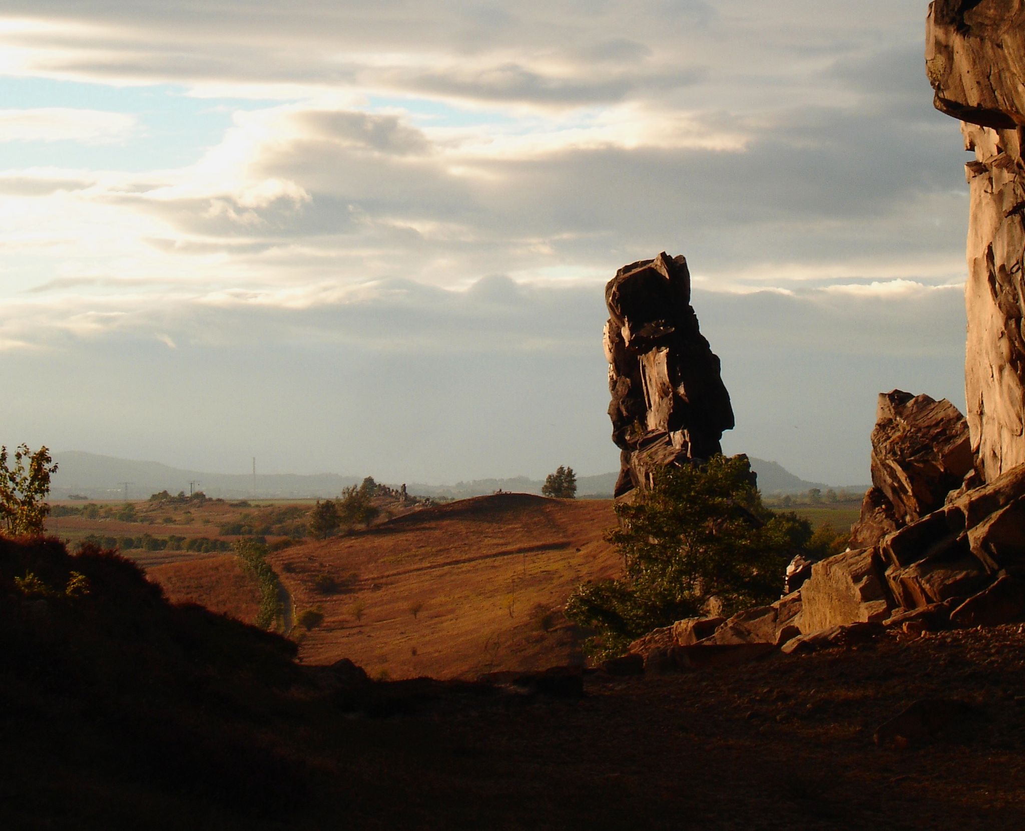
Bus station hiking trails in Ahrschleife bei Altenahr traverse a landscape shaped by the Ahr River, featuring gentle hills, dramatic rocky outcrops, and steep vineyards. The region's terrain includes varied environments from wide meadow plateaus to quiet forest paths, offering diverse hiking experiences. Key natural features include the Ahr River's meanders, terraced vineyards, and prominent rock formations like Teufelsloch. The surrounding Ahrgebirge provides elevated viewpoints with panoramic vistas.
Best bus station hiking trails in Ahrschleife bei Altenahr
- The most popular bus station hiking route is View of Are Castle – View of Burg Are loop from Altenahr, a 5.5 miles (8.8 km) trail that takes about 2 hours 43 minutes to complete. This difficult route offers views of the historic Are Castle.
- Another top favourite among local hikers is Engelsley Cliff on the Ahr – View of Are Castle loop from Altenahr, a difficult 4.4 miles (7.0 km) path. This trail provides views of the Engelsley Cliff and Are Castle.
- Local hikers also love the Altenahr Historic Town Centre – Altenahrer Eck loop from Altenahr, a 4.5 miles (7.3 km) trail leading through vineyards and past the Altenahrer Eck viewpoint, often completed in about 2 hours 10 minutes.
- Hiking in Ahrschleife bei Altenahr is defined by river valleys, steep vineyards, and rocky outcrops. The network offers options for various ability levels, from moderate paths to more challenging routes.
- The routes in Ahrschleife bei Altenahr are highly rated by the komoot community with an average score of 4.6 stars from over 16,000 reviews. More than 73,000 hikers have used komoot to explore Ahrschleife bei Altenahr's varied terrain.
Last updated: July 9, 2026
4.7
(186)
572
hikers
8.39km
02:36
280m
280m
Moderate hike. Good fitness required. Mostly accessible paths. Sure-footedness required.
4.6
(93)
357
hikers
7.00km
02:07
220m
220m
Hard hike. Good fitness required. Sure-footedness, sturdy shoes and alpine experience required.

Sign up for free
4.7
(29)
124
hikers
7.41km
02:13
240m
240m
Moderate hike. Good fitness required. Easily-accessible paths. Suitable for all skill levels.
5.0
(4)
28
hikers
2.67km
00:49
90m
90m
Moderate hike. Great for any fitness level. Mostly accessible paths. Sure-footedness required.
4.9
(79)
306
hikers
4.42km
01:29
120m
120m
Hard hike. Great for any fitness level. Sure-footedness, sturdy shoes and alpine experience required.
Get access to more routes and recommendations from other explorers.
Sign up for free
Already have an account?
Our route recommendations are based on thousands of hikes, rides, and runs completed by other people on komoot.
Start today with a free account
Your next adventure awaits.
Login or Signup
Popular around Ahrschleife bei Altenahr
Other adventures in Ahrschleife bei Altenahr

Tips from the Community

Ascent to the Are castle ruins from the village of Altenahr.
4
0

On June 12/13, 1910, a historic flood occurred in the Ahr valley with considerable damage in the towns of Altenahr, Dernau, Walporzheim and Neuenahr, as were comparable flood events before and after on July 21, 1804, June 24, 1888, January 16, 1918 and January 11, 1920.
2
0
This is where the section begins that is known to tourists as the Ahr Valley. It is characterized by wine growing on the southern slopes, mostly on the northern bank, and the picturesque rocky landscape that the river has created as it cuts into the Ahr Mountains about 300 meters deep. As it continues, the Ahr reaches the area of the district town of Bad Neuenahr-Ahrweiler, before finally flowing into the Rhine south of Remagen in the area of the town of Sinzig.
2
0
The Ahr Valley is named after the Ahr, a left tributary of the Rhine. It begins at the source of the Ahr near Blankenheim in the Euskirchen district of North Rhine-Westphalia and generally runs eastwards. At its southernmost point it reaches the district of Ahrweiler, and thus Rhineland-Palatinate. Running through the collective municipality of Adenau, the valley bends to the northeast at the confluence with the Adenauer Bach and reaches the collective municipality of Altenahr, from whose main town the typical west-east course resumes, albeit interrupted by river loops.
2
0

During wine week there will be a wine kiosk here and you can buy a holder to put your wine glass in 😀
17
1
The devil once went to the Ahr valley and was so pleased with the land and its people, but especially the excellent red wine, that he forgot his way home. One day, while he was resting on the mountain opposite Are Castle, his grandmother approached him in the form of a beautiful girl. In the arms of the lovesick devil, she quickly changed back into the disgusting old woman he knew all too well. Angrily, he grabbed his grandmother and threw her back through the rock face into hell. This is how the Teufelsloch came into being, which can still be seen above Altenahr today.
20
0

The trail is also accessible for inexperienced hikers 😉
3
0
Very beautiful and calming view ☺️
3
0
Frequently Asked Questions
How many bus station hiking trails are available in Ahrschleife bei Altenahr?
There are over 400 hiking routes in Ahrschleife bei Altenahr that are easily accessible from bus stations. These include a wide variety of trails, with 168 easy, 199 moderate, and 41 difficult options to choose from.
What kind of landscapes and natural features can I expect on these bus-accessible hikes?
The region offers a diverse landscape shaped by the Ahr River, featuring 'wildly romantic' bends and the characteristic Ahrschleife (Ahr Loop). You'll encounter steep, terraced vineyards, dramatic rocky outcrops like the Teufelsloch, and expansive views from the surrounding Ahrgebirge mountains. Many routes also lead through quiet forests and wide meadow plateaus.
Are there any circular hiking routes accessible from bus stations?
Yes, many of the bus-accessible routes are circular. For example, the Altenahr Historic Town Centre – Altenahrer Eck loop from Altenahr is a moderate 7.3 km circular hike offering great views. Another option is the Teufelsloch Rock Arch Trail – Devil's Hole loop from Altenahr, a moderate 2.6 km route that takes you past a unique rock formation.
What are some notable landmarks or viewpoints I can visit on a bus station hike?
Many trails offer access to stunning landmarks and viewpoints. You can explore the romantic ruins of Are Castle Ruins, which provides magnificent panoramic views over Altenahr and the Ahrgebirge. The View of Are Castle from the Nückelchen Pavilion and the View from Schrock are also popular spots. Don't miss the Teufelsloch (Devil's Hole), a striking rock formation accessible on several routes.
Are there family-friendly hiking options from bus stops in Ahrschleife bei Altenahr?
Yes, there are numerous family-friendly routes. The region offers paths suitable for various fitness levels, including easier trails that are perfect for families. The Teufelsloch Rock Arch Trail – Devil's Hole loop from Altenahr is a shorter, moderate option that can be enjoyable for families.
Can I bring my dog on the bus-accessible hiking trails?
Most hiking trails in Ahrschleife bei Altenahr are dog-friendly, allowing you to enjoy the beautiful scenery with your canine companion. However, it's always recommended to keep dogs on a leash, especially in vineyards, near wildlife, or on busier sections of trails. Please be mindful of local regulations and other hikers.
What is the best time of year to hike in Ahrschleife bei Altenahr?
The Ahrschleife bei Altenahr region is beautiful year-round, but spring and autumn are particularly popular. In spring, the vineyards burst into life, and wildflowers bloom. Autumn offers stunning foliage and the grape harvest season, with many local wine festivals. Summer is also great for hiking, though it can be warmer, while winter provides a quiet, serene experience, often with snow-dusted landscapes.
Are there challenging hikes accessible by bus in this region?
Absolutely. For experienced hikers seeking a challenge, there are 41 difficult routes accessible from bus stations. An example is the View of Are Castle – View of Burg Are loop from Altenahr, an 8.8 km difficult hike with significant elevation gain. Another demanding option is the Engelsley Cliff on the Ahr – View of Are Castle loop from Altenahr, a 7 km difficult route with impressive views.
What do other hikers enjoy most about hiking in Ahrschleife bei Altenahr?
The area is highly rated by the komoot community, with an average score of 4.6 stars from over 16,000 ratings. Reviewers often praise the diverse landscapes, from the dramatic rocky outcrops and steep vineyards to the serene river views. The well-maintained trails and the blend of natural beauty with historical sites like Are Castle are frequently highlighted.
Are there places to eat or drink near the bus-accessible trailheads?
Yes, charming villages like Altenahr are central to many bus routes and offer various opportunities for refreshments. You'll find local restaurants, cafes, and wine taverns where you can enjoy regional cuisine and the famous Ahr wines after your hike. The region is known for its wine culture, with institutions like the world's oldest wine cooperative, Winzergenossenschaft Mayschoß-Altenahr, nearby.
What is the AhrSteig and can I access it from a bus station?
The AhrSteig is a significant long-distance hiking trail that includes sections with spectacular views and charming vineyards. Yes, parts of the AhrSteig are accessible from bus stations, allowing you to experience sections of this renowned route. From Easter 2026, new 'AhrSchleifen' (Ahr Loops) circular trails are also planned to expand the hiking options around the AhrSteig.
Most popular routes in Ahrschleife bei Altenahr
Most popular attractions in Ahrschleife bei Altenahr

Get inspired with the komoot mobile app


Explore more
Browse the best Hikes in other regions.
