The best walks and hikes in Ahrschleife bei Altenahr
4.5
(17790)
74,516
hikers
1,026
hikes
Hiking in Ahrschleife bei Altenahr offers diverse landscapes characterized by the Ahr river's largest meander loop and steep rock formations. The region features terraced vineyards and exposed slate formations of the Rhenish Slate Mountains. This 205-hectare nature reserve provides a variety of trails through its unique river landscape. The terrain includes both gentle paths along the river and more challenging ascents to viewpoints.
Best hiking trails in Ahrschleife bei Altenahr
- The most popular hiking route is Altenahrer Gipfelweg 3 Gipfel – 1 Weg, a 9.3 miles (14.9 km) trail that takes 4 hours 27 minutes to complete. This moderate route connects multiple peaks, offering panoramic views of the Ahr Valley.
- Another top favourite among local hikers is Devil's Hole – Ascent to Teufelsloch loop from Altenahr, a moderate 3.9 miles (6.2 km) path. This trail leads to the natural monument of Teufelsloch, a notable rock formation.
- Local hikers also love the Wanderparadies Sahrbachtal – ab Altenahr, a 12.7 miles (20.5 km) trail leading through varied forest and valley landscapes, often completed in about 6 hours 4 minutes.
- Hiking in Ahrschleife bei Altenahr is defined by steep rock formations, terraced vineyards, and the winding Ahr river. The network offers options for different ability levels, from leisurely walks to more demanding ascents.
- The routes in Ahrschleife bei Altenahr are highly rated by the komoot community with an average score of 4.6 stars from over 16,000 reviews. More than 73,000 hikers have used komoot to explore Ahrschleife bei Altenahr's varied terrain.
Last updated: June 27, 2026
4.7
(270)
1,008
hikers
14.9km
04:27
430m
430m
Moderate hike. Good fitness required. Mostly accessible paths. Sure-footedness required.
4.5
(122)
443
hikers
20.6km
06:05
580m
580m
Hard hike. Very good fitness required. Easily-accessible paths. Suitable for all skill levels.

Sign up for free
4.7
(245)
815
hikers
4.19km
01:13
90m
90m
Moderate hike. Great for any fitness level. Mostly accessible paths. Sure-footedness required.
4.7
(286)
970
hikers
Moderate hike. Good fitness required. Mostly accessible paths. Sure-footedness required.
4.6
(178)
647
hikers
8.90km
02:48
310m
310m
Hard hike. Good fitness required. Sure-footedness, sturdy shoes and alpine experience required.
Get access to more routes and recommendations from other explorers.
Sign up for free
Already have an account?
Our route recommendations are based on thousands of hikes, rides, and runs completed by other people on komoot.
Start today with a free account
Your next adventure awaits.
Login or Signup
Other adventures in Ahrschleife bei Altenahr

Tips from the Community

The pretty little Sankt-Quirinus Chapel in Krälingen dates from the 15th century. https://www.pfarrei-ahreifel.de/pfarreien/berg/Kraelingen/index.html
0
0

Small rest and viewpoint.
0
0

Be careful of the elevation gain and the initial climb. These are difficult for those who aren't very fit. I recommend hiking boots, as the terrain is partly rocky, often uneven, and sometimes slippery (when going downhill). You should also pay close attention to mountain drops. The cottage doesn't always indicate the exact location (forest!). Despite the good map, I went in the wrong direction three times and ended up walking about 1 km longer. I didn't find a bench or shelter along the entire route. You can only sit down at the Steinerberghaus; otherwise, you have to keep going. I hiked with my dog, which wasn't a problem.
3
0

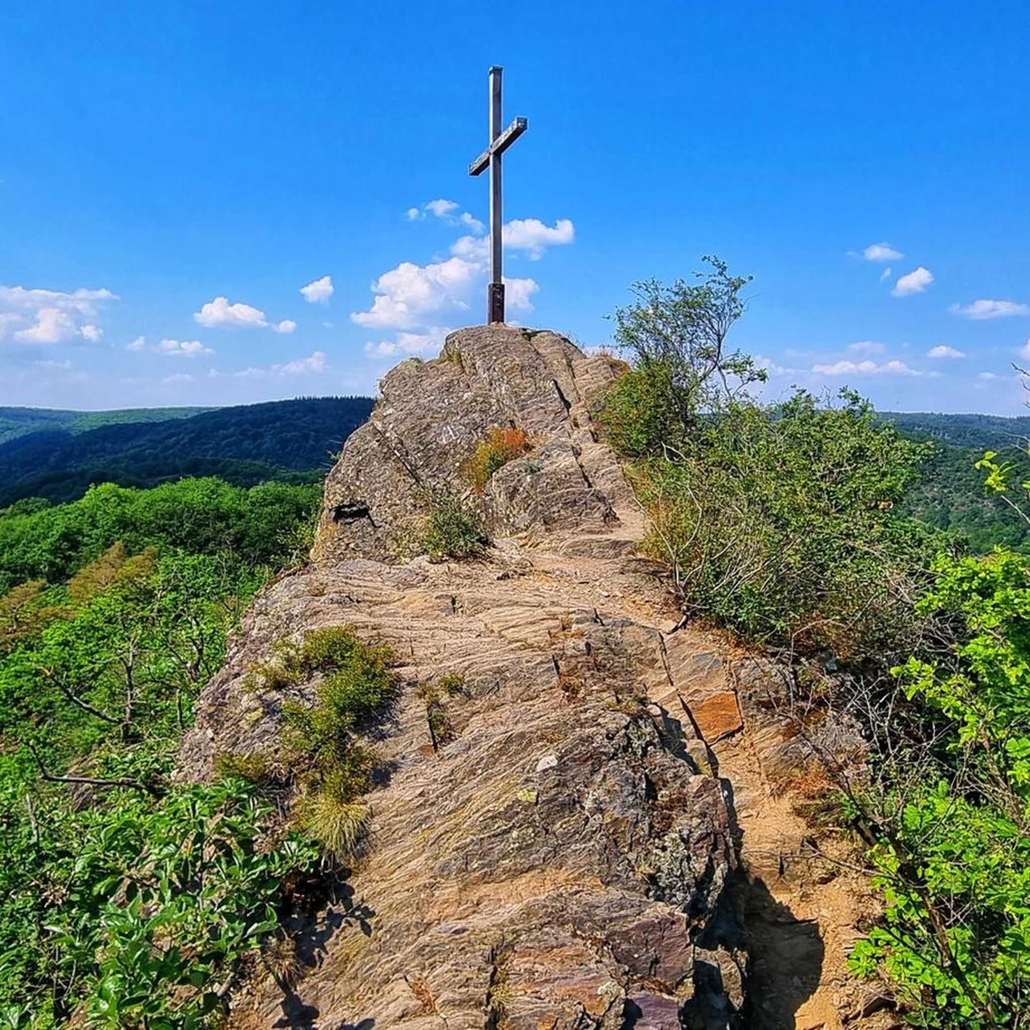
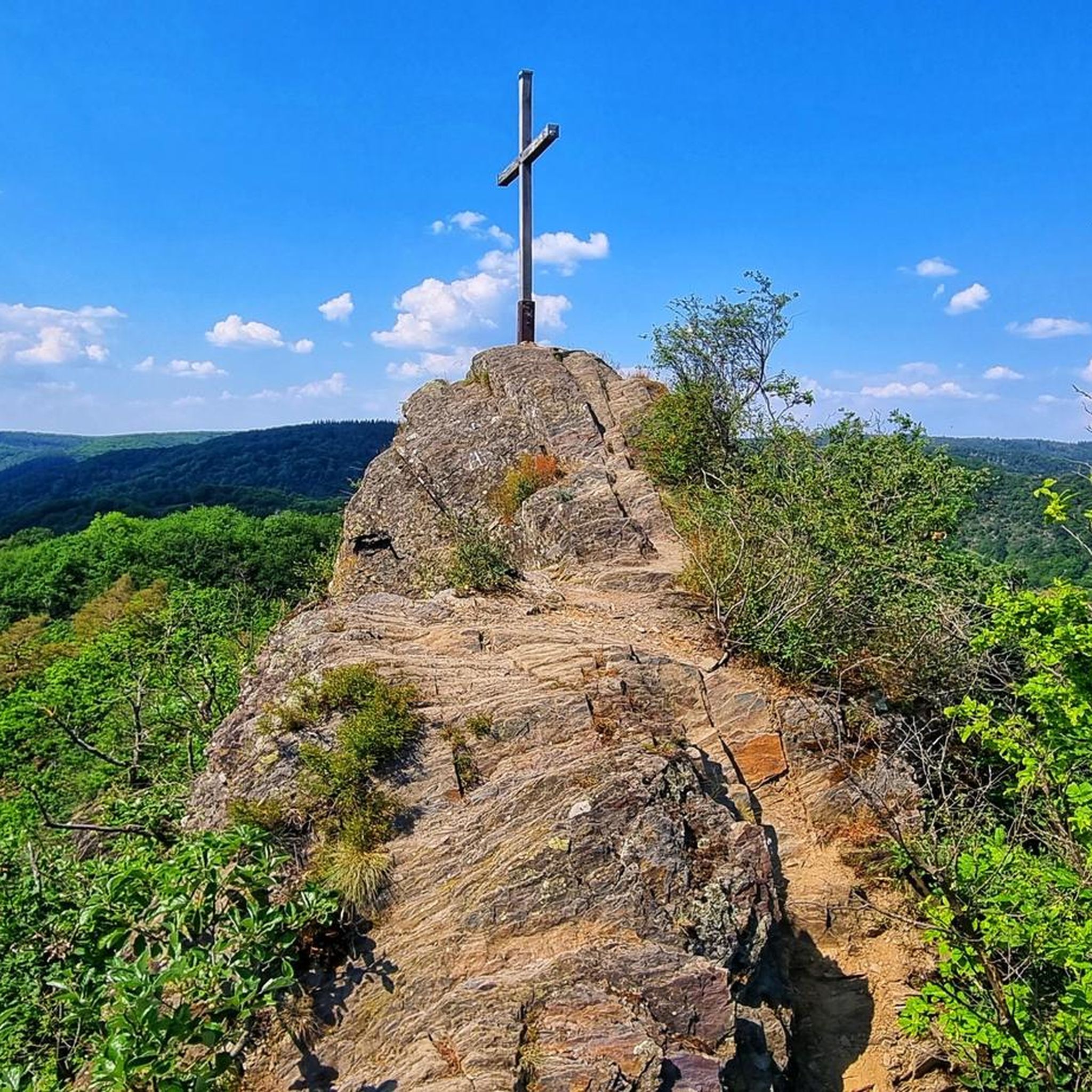
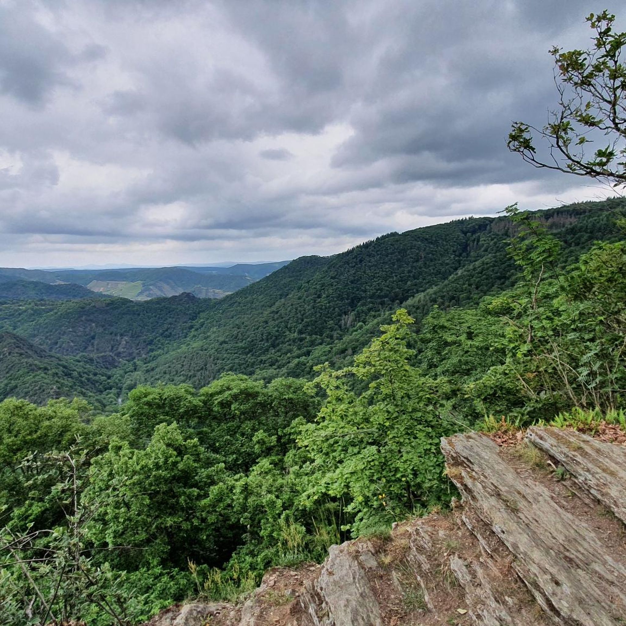
The Ahr Loop is a striking bend in the Ahr River near Altenahr, formed by the Engelsley mountain ridge. The Engelsley is a rocky ridge with two peaks, the north and south peaks, both of which offer breathtaking views of the Ahr Loop and the surrounding Ahr Valley.
0
0

A beautiful resting place
0
0

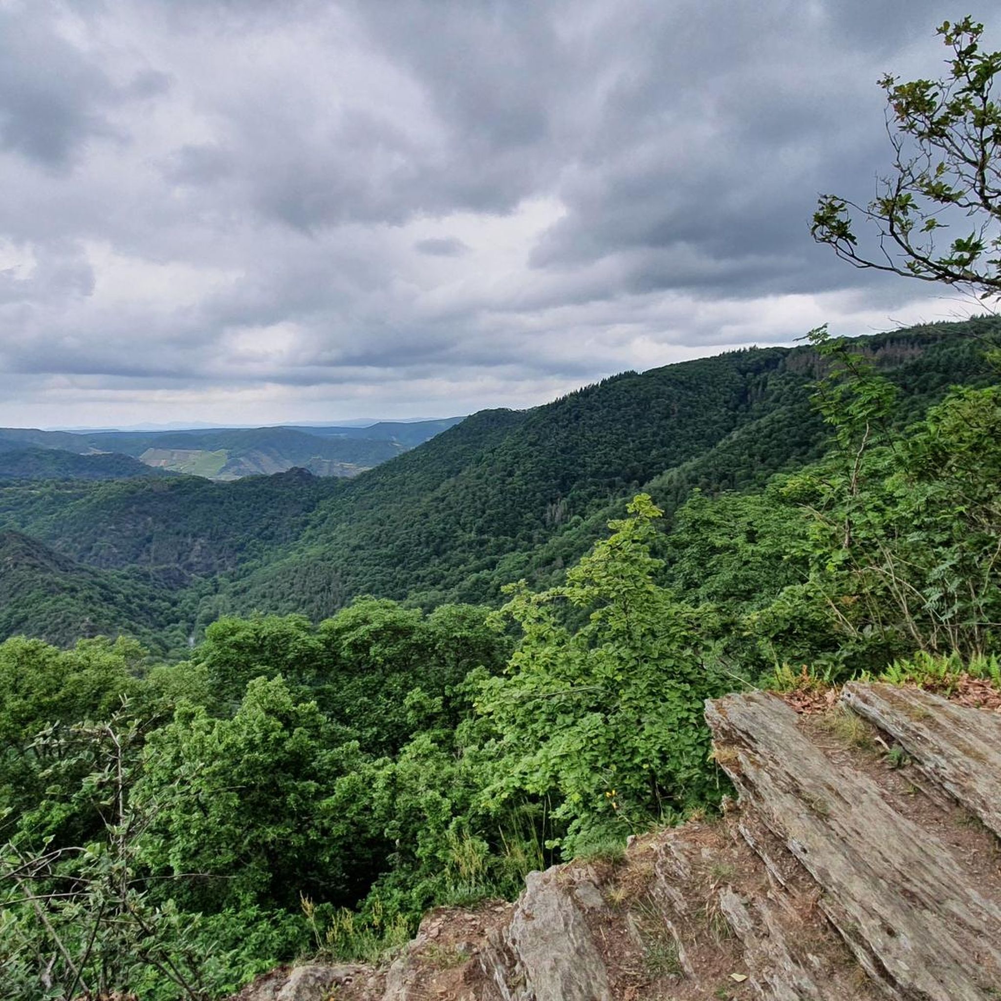
A very beautiful view of the valley.
1
0

The influence of the volcanoes is also visible in this part of the Eifel. The view from the castle is special. What is special in the Ahr valley are the vines that grow on the slopes on both sides of the river. Wine is grown here and wine villages can be found, and where there are wine villages there are also wine festivals.
10
1

The views of the grape slopes, the winding river, the white houses and the peaks are beautiful.
5
0
Frequently Asked Questions
How many hiking trails are available in Ahrschleife bei Altenahr?
Ahrschleife bei Altenahr offers a vast network of over 1000 hiking routes. These range from easy strolls along the river to more challenging ascents through the vineyards and rocky landscapes.
What kind of terrain can I expect on hikes in Ahrschleife bei Altenahr?
The terrain in Ahrschleife bei Altenahr is highly varied. You'll find gentle paths along the Ahr river, steep rock formations, and terraced vineyards. The region is part of the Rhenish Slate Mountains, so some trails feature exposed slate and require good footing. Options are available for all ability levels, from leisurely walks to demanding climbs.
Are there any family-friendly hiking options in Ahrschleife bei Altenahr?
Yes, Ahrschleife bei Altenahr has many trails suitable for families. While specific routes aren't listed as 'family-friendly' in the data, the region offers numerous easy and moderate paths that are perfect for a day out with children. Look for routes with less elevation gain and shorter distances for a comfortable family experience.
Can I bring my dog on the hiking trails in Ahrschleife bei Altenahr?
Most hiking trails in Ahrschleife bei Altenahr are dog-friendly, allowing you to explore the beautiful landscape with your canine companion. It's always recommended to keep dogs on a leash, especially in nature reserves, near livestock, or in areas with wildlife. Be sure to check local regulations for specific trails.
What are some notable landmarks or viewpoints to see while hiking?
The region is rich in natural and historical landmarks. A must-see is the natural monument Devil's Hole, a fascinating rock formation. For historical views, the Are Castle Ruins offer fantastic panoramic vistas of Altenahr and the Ahr Valley. Other popular viewpoints include View from Schrock and View of Altenahr from the Kreisstadtblick viewpoint.
Are there any circular hiking routes in the area?
Yes, Ahrschleife bei Altenahr features many circular hiking routes. For example, the moderate Devil's Hole – Ascent to Teufelsloch loop from Altenahr is a popular 6.2 km option that takes you to the famous natural monument. Another moderate circular route is the Devil's Hole – Teufelsloch (Ahr Valley) loop from Altenahr, covering about 9.9 km.
What is the best time of year to go hiking in Ahrschleife bei Altenahr?
Ahrschleife bei Altenahr is beautiful year-round, but spring and autumn are particularly popular. Spring brings blooming wildflowers and fresh greenery, while autumn offers stunning colors in the vineyards and forests. The region is also known for its wine, making the harvest season a vibrant time to visit. Summer is great for longer days, but can be warm, while winter offers a quieter, often snow-dusted landscape.
How can I reach the hiking trails using public transport?
The Ahrschleife bei Altenahr region is easily accessible via the Ahrtalbahn (Ahr Valley Railway). You can travel directly to Altenahr station, which serves as a convenient starting point for many trails. This makes it easy to enjoy the hikes without needing a car.
Where can I find parking for hiking in Ahrschleife bei Altenahr?
Parking is generally available in and around the village of Altenahr, which is a central hub for many hiking routes. Look for designated parking areas near the town center or trailheads. It's advisable to arrive early during peak season to secure a spot.
What do other hikers say about the trails in Ahrschleife bei Altenahr?
The hiking trails in Ahrschleife bei Altenahr are highly regarded by the komoot community, holding an average rating of 4.6 stars from over 16,000 reviews. Hikers frequently praise the diverse landscapes, the stunning views of the Ahr river meander, and the well-maintained paths that cater to various fitness levels.
Are there any challenging hikes for experienced hikers?
Yes, for experienced hikers seeking a challenge, Ahrschleife bei Altenahr offers several difficult routes. One such option is the Wanderparadies Sahrbachtal – ab Altenahr, a 20.5 km trail with significant elevation changes, typically taking over 6 hours to complete. Another demanding route is the Teufelsloch (Ahr Valley) – Devil's Hole loop from Altenahr, which covers 12.8 km with substantial ascent.
Are there places to eat or stay near the hiking trails?
Yes, the Ahrschleife bei Altenahr region, particularly around Altenahr and the charming wine villages along the Ahr, offers various gastronomy and accommodation options. You'll find restaurants, cafes, and guesthouses conveniently located, allowing you to refuel and relax after your hike.
Most popular routes in Ahrschleife bei Altenahr
Most popular attractions in Ahrschleife bei Altenahr

Get inspired with the komoot mobile app


Explore more
Browse the best Hikes in other regions.
