The best volcano hikes and walks in Cotopaxi
4.8
(379)
3,256
hikers
3
hikes
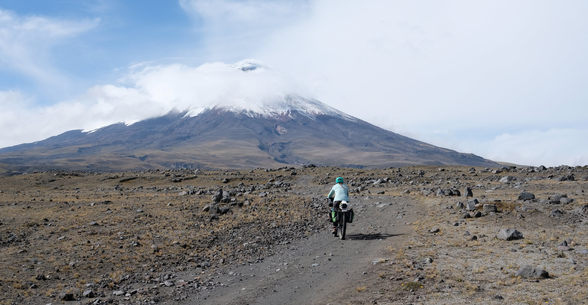
Volcano hiking trails in Cotopaxi are characterized by dramatic volcanic landscapes, high-altitude páramo grasslands, and glacial features. The region is dominated by the active Cotopaxi volcano, one of the world's highest, alongside other prominent peaks like Rumiñahui. Hikers can explore valleys shaped by ancient mudflows and observe diverse ecosystems, including the Limpiopungo Lagoon nestled amidst the volcanoes.
Best volcano hiking trails in Cotopaxi
- The most popular volcano hiking route is Corazón Summit loop from Quebrada Ingacorral, an 8.8 miles (14.2 km) trail that takes 5 hours 29 minutes to complete. This difficult route offers challenging ascents to the summit of Corazón, providing expansive views of the surrounding volcanic terrain.
- Another top favourite among local hikers is José Rivas Refuge – View from Cotopaxi loop from Parque Nacional Cotopaxi, a difficult 4.3 miles (6.9 km) path. This trail leads to the José Rivas Refuge on Cotopaxi's slopes, offering close-up views of the glacier and high-altitude landscapes.
- Local hikers also love the Corazón Summit loop from Chaupi, a 6.4 miles (10.2 km) trail leading through varied volcanic terrain and páramo, often completed in about 4 hours 2 minutes.
- Hiking in Cotopaxi is defined by majestic volcanic peaks, high-altitude páramo, and glacial landscapes. The network offers varied trails for different skill levels, from moderate ascents to challenging summit routes.
- The routes in Cotopaxi are highly rated by the komoot community with an average score of 4.8 stars from over 300 reviews. More than 3000 hikers have used komoot to explore Cotopaxi's varied terrain.
Last updated: July 7, 2026
4.8
(4)
90
hikers
14.2km
05:30
1,020m
1,020m
Hard hike. Very good fitness required. Easily-accessible paths. Suitable for all skill levels.
5.0
(6)
83
hikers
6.94km
04:50
1,210m
1,210m
Hard hike. Very good fitness required. Mostly accessible paths. Sure-footedness required.

Sign up for free
4.0
(1)
10
hikers
10.2km
04:02
760m
760m
Moderate hike. Good fitness required. Easily-accessible paths. Suitable for all skill levels.
Our route recommendations are based on thousands of hikes, rides, and runs completed by other people on komoot.
Start today with a free account
Your next adventure awaits.
Login or Signup
Popular around Cotopaxi


Tips from the Community

It went easier than expected. The air is thin up here but doable.
0
0

the view from this height is not always good. Often foggy. However, when the cloud cover breaks open, the lowlands stretch far into the distance. The sun plays with the many yellow and green tones as far as the eye can see.
1
0
This shelter is 4864 steps closer to the moon - for us Europeans - an astonishing height. Cozy inside, it also defies the adverse conditions you'll find outside on your way to the glacier (or the summit). No alcohol is served, there is a highly concentrated cocoa-flavoured sugar solution for refreshment. They like it sweet in the south. No wonder our guide preferred a hearty soup, which is served here as if you were somewhere in the lowlands.
3
1

Keep your eyes open as you drive through the park. Wild horses, falcons, llamas and curious Andean foxes keep crossing the path.
2
0
Indescribably beautiful view during the ascent to the base camp at 4864m.
1
1

The Refugio José Rivas is located at 4,864 m altitude. There you can stay overnight by prior reservation or simply strengthen yourself for the hike with coca tea or hot chocolate. There are also some snacks.
1
2

Great mountain to do. Beautiful typical conical volcano peak. Busy and tough!
3
0

We went from El Chaupi to the Corazón. Our ascent began at the entrance to the Reserva, where we left the car. Then we followed the dirt road to the marked junction of the path to Corazón. From now on we went on muddy paths through the Paramo up to a ridge that led us directly to the summit. This path climbs very steeply in places. One point, a rather exposed rock transition, is a bit daring to cross, but almost everyone can master it with concentration and the use of hands. However, normal dogs have problems here. The point is about 30 minutes from the summit. After overcoming this passage, it goes on with easy scrambling to the summit. If several people are on the move, a helmet is a good idea because of the risk of stones being kicked. I have now been to the Corazón twice and unfortunately, despite the early start (ascent from 6:30 a.m.), the weather never allowed me a clear view of the summit. The photos of the Ilinizas, the Cotopaxi, Ruminahui, Sincholagua and even the Antisana were only possible at the beginning of the hike. The ascent to the summit took about 4 hours. We had taken a few breaks.
1
0
Frequently Asked Questions
What kind of hiking trails can I expect in Cotopaxi?
Cotopaxi National Park offers a range of volcano hiking trails, from moderate to difficult. You'll find paths leading to high-altitude refuges, around scenic lagoons, and up challenging summits. The terrain often involves high-altitude páramo grasslands and volcanic landscapes, with significant elevation gains.
Are there any easy or family-friendly volcano hikes in Cotopaxi?
While many trails are challenging, the Limpiopungo Lagoon loop is an easy, moderate 3.5 km walk suitable for most fitness levels and families. It offers stunning views of Cotopaxi's reflection and opportunities for birdwatching. Our guide features a moderate route, the Corazón Summit loop from Chaupi, which is a good option for those seeking a less strenuous volcano experience than the more difficult summit attempts.
What are some notable points of interest along the volcano hiking trails?
Hikers can explore several unique attractions. The José Rivas Refuge on Cotopaxi's slopes is a popular destination, offering incredible glacier views. The picturesque Limpiopungo Lagoon is another highlight, often reflecting the majestic Cotopaxi. You might also encounter wild horses and other unique wildlife specific to the páramo ecosystem.
What is the best time of year to hike the volcano trails in Cotopaxi?
The dry season, typically from June to September, is generally considered the best time for hiking in Cotopaxi National Park. During these months, you're more likely to experience clear skies and better visibility of the volcanoes, though weather in the high Andes can be unpredictable year-round.
Do I need a permit or guide for hiking in Cotopaxi National Park?
Entry to Cotopaxi National Park generally requires registration. While many trails can be hiked independently, a guide is mandatory for summiting Cotopaxi itself, especially for the full glacier climb, due to the technical skills and specialized equipment required. Always check current park regulations before your visit.
Are there any circular hiking routes around the volcanoes?
Yes, there are several circular routes that allow you to experience the volcanic landscapes. For instance, the Corazón Summit loop from Quebrada Ingacorral offers a challenging circular hike around the Corazón volcano. The Limpiopungo Lagoon also has an easy circular trail.
What kind of wildlife can I see on the volcano trails?
The páramo ecosystem of Cotopaxi National Park is home to diverse wildlife. You might spot Andean ducks, coots, wild horses, white-tailed deer, llamas, and alpacas. If you're lucky, you could even see condors soaring overhead or, rarely, cougars. The Wildlife in Cotopaxi National Park highlight provides more details.
Can I bring my dog on the volcano hiking trails in Cotopaxi National Park?
Regulations regarding pets in national parks can vary and change. It's advisable to check the most current rules directly with Cotopaxi National Park authorities before planning your visit with a dog, as protected areas often have restrictions to protect wildlife and natural habitats.
What should I wear for a volcano hike in Cotopaxi?
Due to the high altitude and unpredictable Andean weather, layering is crucial. Bring warm clothing, including a waterproof and windproof outer shell, a hat, gloves, and sturdy hiking boots. Sun protection (sunscreen, sunglasses) is also essential due to the strong equatorial sun at high elevations.
How do other hikers rate the volcano trails in Cotopaxi?
The komoot community highly rates the volcano hiking experiences in Cotopaxi, with an average score of 4.8 stars. Hikers often praise the spectacular volcanic landscapes, the challenge of the high-altitude trails, and the unique wildlife encounters.
Are there any waterfalls to visit near the volcano trails?
Yes, the region around Cotopaxi offers natural attractions beyond the main volcanoes. You can find waterfalls such as The Seven Waterfalls of Zapanal, which provide a different natural experience and can be a refreshing addition to your trip.
Is public transport available to or within Cotopaxi National Park?
Public transport options directly into and within Cotopaxi National Park are limited. Many visitors opt for organized tours, private transport, or taxis from nearby towns like Latacunga or Machachi. It's best to arrange transportation in advance, especially if you plan to access specific trailheads or the José Rivas Refuge parking area.
Most popular attractions in Cotopaxi

Get inspired with the komoot mobile app


Explore more
Browse the best Hikes in other regions.
