The best hikes from bus stations around Shap
4.5
(378)
4,417
hikers
12
hikes
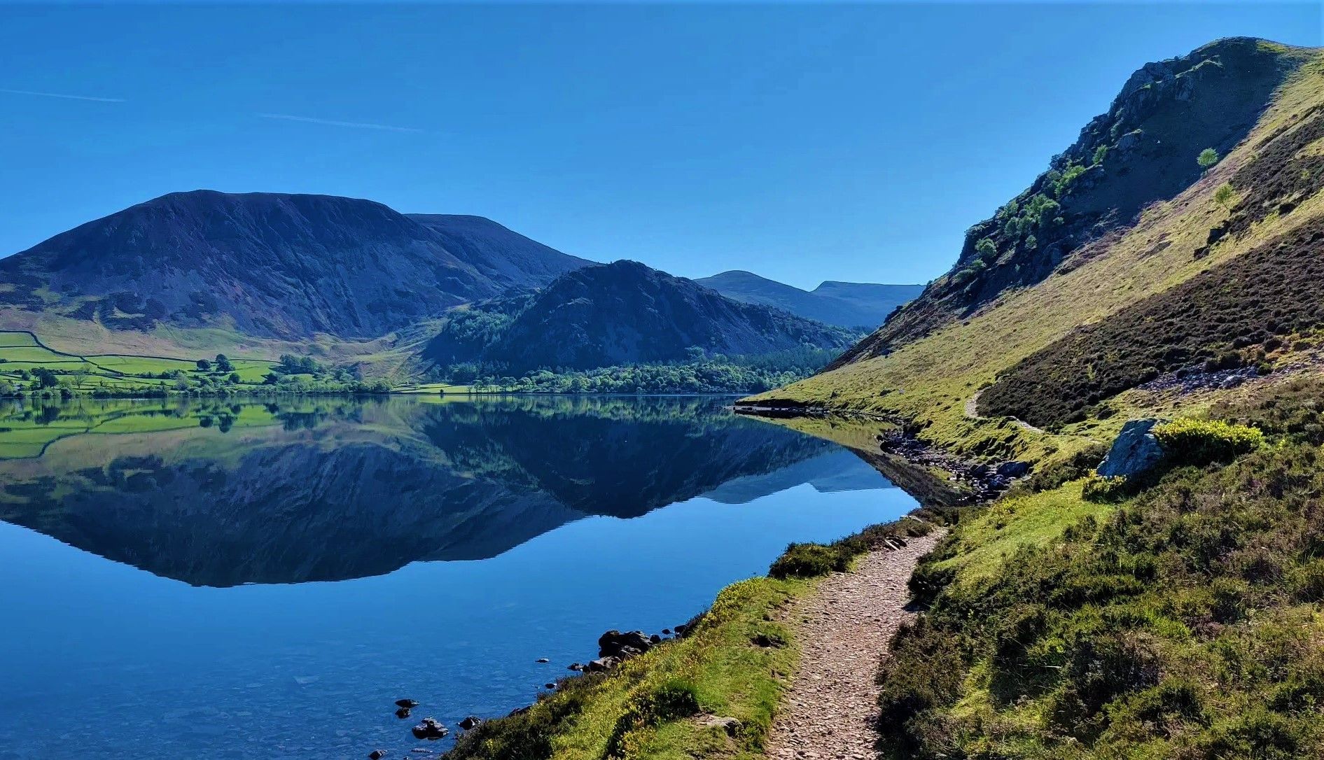
Bus station hiking trails around Shap offer access to a diverse landscape in the eastern Lake District. The region is characterized by the gentle beauty and vast expanses of the Shap Fells, which include outlying fells and varied terrain. Hikers can also explore tranquil areas such as Swindale and the Lowther Valley, featuring wooded sections and the winding River Lowther. The area's unique geology includes exposed Shap granite and visible Silurian rock formations.
Best bus station hiking trails around Shap
…Last updated: June 23, 2026
4.0
(5)
25
hikers
8.67km
02:22
130m
130m
Moderate hike. Good fitness required. Easily-accessible paths. Suitable for all skill levels.
3.7
(3)
21
hikers
5.04km
01:20
50m
50m
Easy hike. Great for any fitness level. Easily-accessible paths. Suitable for all skill levels.

Sign up for free
4.0
(1)
6
hikers
14.5km
03:59
230m
230m
Moderate hike. Good fitness required. Easily-accessible paths. Suitable for all skill levels.
4
hikers
5.73km
01:31
60m
60m
Easy hike. Great for any fitness level. Easily-accessible paths. Suitable for all skill levels.
3
hikers
21.8km
06:08
420m
420m
Hard hike. Very good fitness required. Easily-accessible paths. Suitable for all skill levels.
Get access to more routes and recommendations from other explorers.
Sign up for free
Already have an account?
Our route recommendations are based on thousands of hikes, rides, and runs completed by other people on komoot.
Start today with a free account
Your next adventure awaits.
Login or Signup


Tips from the Community

Rosgill Hill 290.4m P20.6 (953ft) (Hill ID: 504064) [JNSA 13865] Lake District National Park Definitive List summit
0
0

The public road from Swindale crosses the private concrete road owned by United Utilities. At these crossroads is a fantastic view over the valley which the concrete road cuts through.
0
0

Nice falls at the top of Swindale which shows a lot of the great conservation work done by the RSPB and United Utilities.
0
0

The name "Fairy Crag" may refer to a local belief in fairies in times gone by. Old Westmorland has a strong tradition of fairy myths associated with water. For example, fairies are said to prefer fast-flowing streams and rivers and it was said that stone footbridges over mountain streams - in the right conditions - are good places to see fairies. Source: https://www.edenriverstrust.org.uk/wp-content/uploads/2018/12/Shap.pdf Even for those who do not believe in those myths (undoubtedly a small minority ;-)), this is an enchantingly beautiful place, for which I think the word "fairy" was invented.
0
0

Beautiful unspoilt valley. used by walkers, climbers, cyclist, nature lovers.
1
0
Frequently Asked Questions
How many bus station hiking trails are available around Shap?
There are 12 dedicated hiking trails around Shap that conveniently start directly from bus stations, making it easy to explore the region without a car.
What is the general difficulty level of bus station hikes in Shap?
The bus station hikes around Shap cater to various fitness levels. You'll find 4 easy routes, 7 moderate routes, and 1 more challenging option, ensuring there's something for everyone.
Are there any easy, family-friendly walks accessible from Shap bus stations?
Yes, several routes are suitable for families. For an easy and relatively short option, consider the Chippy Chippy – The Goggleby Stone loop from Shap, which is about 5 km long and features the notable Goggleby Stone monolith. Another easy choice is The Goggleby Stone – Chippy Chippy loop from Shap.
What natural features can I expect to see on these bus station hikes?
The trails offer a diverse landscape. You'll encounter the gentle beauty of the Shap Fells, quiet valleys like Swindale, and unique geological features such as the distinctive pink Shap granite. Some routes may also offer distant views towards the vast Haweswater Reservoir, the highest lake in the Lake District.
Are the bus station hiking routes in Shap circular?
Many of the routes starting from Shap bus stations are designed as circular walks, allowing you to experience varied scenery without retracing your steps. Examples include the Chippy Chippy – Fairy Crag loop from Shap and the Chippy Chippy – Flat Approach to Shap loop from Shap.
What historical landmarks or points of interest can I visit on a bus station hike?
You can incorporate historical sites into your hike. The evocative ruins of 12th-century Shap Abbey, set in a secluded valley, are a significant point of interest. Additionally, the The Cockpit Stone Circle is a notable historical site that can be reached on some routes.
What do other hikers say about the trails around Shap?
The hiking trails around Shap are highly regarded by the komoot community, with an average rating of 4.5 stars. Hikers often praise the sense of solitude on the fells, the tranquil valley walks, and the opportunity to discover hidden gems like Shap Abbey.
Are there any viewpoints or scenic spots along the bus station trails?
Yes, the region offers several scenic viewpoints. While hiking, you might encounter spots with views towards the Shap Fells or the Lowther Valley. Notable viewpoints in the wider area include Loadpot Hill Trig Point and Grey Crag Summit, offering expansive vistas of the Cumbrian landscape.
What is the best time of year to hike around Shap?
Shap offers rewarding hiking experiences throughout the year. Spring and autumn provide pleasant temperatures and vibrant colours, while summer allows for longer daylight hours. Even in winter, the quiet fells can be stunning, though appropriate gear and caution are essential due to potentially challenging conditions.
Can I expect to see any wildlife while hiking near Shap?
The diverse landscapes of Shap provide excellent opportunities for wildlife spotting. The area around Haweswater Reservoir is an RSPB reserve, known for peregrines, dippers, and redstarts. Hikers in the Shap Fells have also reported sightings of large birds of prey and deer. Red squirrels and otters can also be found in the region.
Are there any longer, more challenging bus station hikes available?
For those seeking a longer, moderate challenge, the Swindale Valley – Fairy Crag loop from Shap covers approximately 14.5 km and takes you through the tranquil Swindale Valley, offering a more extended exploration of the area's natural beauty.
Most popular attractions around Shap

Get inspired with the komoot mobile app


Explore more
Browse the best Hikes in other regions.
