The best city hikes and walks in Dunkelsteinerwald
4.6
(8864)
49,981
hikers
120
hikes
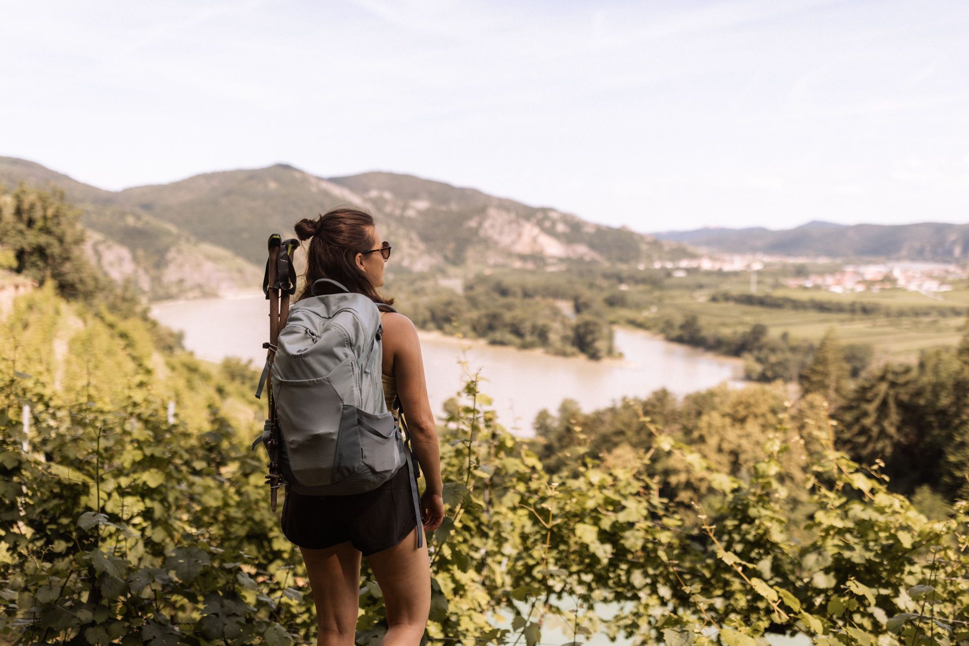
Urban hiking trails in Dunkelsteinerwald are situated in a hill country in Lower Austria, characterized by rolling hills, dense forests, and views of the Danube Valley. The region lies south of the Danube between Melk and Mautern, and south of Krems. Elevations within the area contribute to varied urban routes, often providing panoramic vistas. The landscape features a mix of natural elements and historic townscapes.
Best urban hiking trails in Dunkelsteinerwald
- The most popular urban hiking route is Steiner Gate,…
Last updated: October 9, 2026
5.0
(4)
52
hikers
10.9km
02:48
60m
60m
Moderate hike. Good fitness required. Easily-accessible paths. Suitable for all skill levels.
4.0
(2)
17
hikers
Easy hike. Great for any fitness level. Easily-accessible paths. Suitable for all skill levels.

4.6
(32)
148
hikers
6.08km
01:47
170m
170m
Easy hike. Great for any fitness level. Easily-accessible paths. Suitable for all skill levels.
9
hikers
Easy hike. Great for any fitness level. Easily-accessible paths. Suitable for all skill levels.
9
hikers
Easy hike. Great for any fitness level. Easily-accessible paths. Suitable for all skill levels.
Get access to more routes and recommendations from other explorers.
Already have an account?
Our route recommendations are based on thousands of hikes, rides, and runs completed by other people on komoot.
Start today with a free account
Your next adventure awaits.
Popular around Dunkelsteinerwald
Other adventures in Dunkelsteinerwald

Tips from the Community

In the best weather with good visibility of the city of Krems.
0
0
A walk to the Piaristenkirch’n on the Frauenberg is a real experience. The church was already the first parish church of Krems in the 11th century. Later it was rebuilt in the late Gothic style. Only the west wall and the tower are reminiscent of the Romanesque period. Inside it looks quite magnificent, as the church was baroqueized in the 18th century and equipped with paintings by Kremser Schmidt. Previously, Krems was almost entirely Protestant. Count Michael Adolf von Althan brought the Jesuits to the city in 1616 and had the college and school built. After their dissolution, the Piarists took over the church and college in 1776. Their grammar school existed until 1871. Today, the IMC University of Applied Sciences is housed in the former college. Lecture halls have even been set up in the old wine cellars, which is really original. The church and community are looked after by Piarist priests and Father Patrick. Services are held every Sunday and public holiday at eleven o'clock.
0
0
Get to know Krems from the other side. Start the tour at Gozo, following the footsteps of the World Heritage Trail.
0
0

Magnificent view from Kremser Kreuzberg (320m) - over Krems and the surrounding landscape.
0
0

Definitely worth seeing. A real highlight!
0
0
The Gozzoburg is a high medieval city castle in Krems an der Donau in Lower Austria. The city castle is among the most important buildings in the early Gothic style in Lower Austria. The building consists of an eastern and a western wing, which are connected by the original building fabric.
0
0
The multi-part building complex of the Gozzoburg originated as a town castle from the second half of the 11th century and was expanded in the 3rd quarter of the 13th century by the citizen Gozzo. In the east wing is the so-called St. Catherine's Chapel from around 1260. The chapel was probably profaned at the end of the 17th century and divided into two residential floors in the first quarter of the 19th century. After these additions had been removed again, Gothic architectural details such as remains of wall paintings and architectural sculpture are still preserved today.
0
0
The Gozzoburg is one of the most significant secular medieval structures north of the Alps and, with the St. Catherine's Chapel it contains, is particularly worth preserving both historically and artistically.
0
0
Frequently Asked Questions
How many urban hiking trails are available in Dunkelsteinerwald?
Dunkelsteinerwald offers a wide selection of urban hiking trails, with over 120 routes to explore. Most of these, around 100, are considered easy, making them accessible for various fitness levels.
What do other hikers enjoy most about urban hiking in Dunkelsteinerwald?
The komoot community highly rates urban hikes in Dunkelsteinerwald, with an average score of 4.6 stars from over 7,500 ratings. Hikers frequently praise the diverse landscapes, the charming towns, and the scenic views, especially those overlooking the Danube and the Wachau region.
Are there any easy urban hikes suitable for beginners or families?
Yes, many urban routes in Dunkelsteinerwald are easy and suitable for beginners or families. For instance, the Steiner Gate, Krems – Krems on the Danube loop from Krems an der Donau is an easy 3.2 km walk. Another accessible option is the Steiner Gate, Krems – Steiner Gate loop from Krems Campus-Kunstmeile, which is also around 3.2 km and easy.
What kind of views can I expect on urban hikes in Dunkelsteinerwald?
Urban hikes in Dunkelsteinerwald often provide captivating views. Many trails offer magnificent panoramas over the Danube River and the UNESCO World Heritage-listed Wachau cultural landscape. You can also expect to see charming townscapes, historic architecture, and the region's characteristic rolling hills and forests.
Are there any urban loop trails in Dunkelsteinerwald?
Yes, several urban routes in Dunkelsteinerwald are designed as convenient loop trails. An example is the Steiner Gate, Krems – Krems on the Danube loop from Stein-Mautern, which offers a moderate 11 km circular experience. Another option is the Krems on the Danube – Obere Landstraße, Krems loop from Krems an der Donau, an easy 4.2 km loop.
What historical landmarks or attractions can I see along urban trails?
While the region is known for its natural beauty, urban trails often pass by historical sites. In towns like Krems, you can explore historic quarters and landmarks such as the Steiner Gate. Further afield, you might find views of significant sites like the Aggstein Castle Ruins or the Hohenegg Castle Ruins, which offer glimpses into the region's rich past.
Can I reach urban hiking trails in Dunkelsteinerwald using public transport?
Many urban hiking trails, especially those starting in towns like Krems, are well-connected by public transport. Krems an der Donau is a significant transport hub, making it easy to access routes directly from the city center or nearby train and bus stations. It's advisable to check local transport schedules for specific starting points.
Are there cafes or places to eat near the urban hiking trails?
Given the urban focus, you will find numerous cafes, restaurants, and eateries conveniently located near the starting points and along many urban hiking trails, particularly in towns like Krems. These offer opportunities to refuel and enjoy local cuisine during or after your walk.
What is the best time of year for urban hikes in Dunkelsteinerwald?
Urban hikes in Dunkelsteinerwald can be enjoyed year-round. Spring and autumn offer pleasant temperatures and beautiful scenery, with blooming wild roses in spring and vibrant foliage in autumn. Even in winter, urban trails can be charming, especially in towns adorned with festive lights, though some paths might be slippery if there's snow or ice.
Are urban hiking trails in Dunkelsteinerwald dog-friendly?
Generally, urban hiking trails in Dunkelsteinerwald are dog-friendly, allowing you to bring your canine companion. However, it's always recommended to keep dogs on a leash, especially in populated areas, near wildlife, or where specific signage indicates. Always carry water for your dog and be prepared to clean up after them.
What is the typical length and elevation gain for urban hikes in this region?
Urban hikes in Dunkelsteinerwald vary in length and elevation, but many are relatively short and have moderate elevation changes. For example, the View of Krems – Obere Landstraße, Krems loop from Krems Campus-Kunstmeile is about 6.1 km with around 170 meters of elevation gain, offering a good balance of distance and views without being overly strenuous.
Most popular routes in Dunkelsteinerwald
Most popular attractions in Dunkelsteinerwald

Get inspired with the komoot mobile app


Explore more
Browse the best Hikes in other regions.
