The best traffic-free bike rides in Pachaug State Forest
4.3
(4)
189
riders
10
rides
No traffic road cycling routes in Pachaug State Forest traverse Connecticut's largest state forest, offering a diverse landscape for cyclists. The region features expansive woodlands of oak, maple, and Atlantic White Cedar, alongside open swamps and riverine systems. Cyclists can navigate public roadways that wind through the forest, providing a tranquil experience away from busy traffic. The terrain includes gentle gradients and some hills, with elevations up to 441 feet at Mount Misery Overlook.
Best no traffic road cycling routes…
Last updated: July 6, 2026
4
riders
37.5km
02:05
400m
400m
Moderate road ride. Good fitness required. Some segments of this route may be unpaved and difficult to ride.
4
riders
44.3km
02:14
370m
370m
Moderate road ride. Good fitness required. Mostly well-paved surfaces and easy to ride.

Sign up for free
2
riders
Moderate road ride. Good fitness required. Mostly well-paved surfaces and easy to ride.
3
riders
36.5km
01:50
360m
360m
The Buck Hill – Prince Hill loop from East Brooklyn offers a unique road cycling adventure through the varied landscapes of eastern Connecticut. You'll pedal through forested areas and open…
5
riders
Easy road ride. Great for any fitness level. Mostly well-paved surfaces and easy to ride.
Get access to more routes and recommendations from other explorers.
Sign up for free
Already have an account?
Our route recommendations are based on thousands of hikes, rides, and runs completed by other people on komoot.
Start today with a free account
Your next adventure awaits.
Login or Signup


Other adventures in Pachaug State Forest

Tips from the Community

Danielson is a beautiful borough in the town of Killingly, and it has two historic districts to its name: The Danielson Main Street Historic District and Broad Street-Davis Park Historic District. In total, there are about 135 historic buildings in one form or another, all built in Colonial Revival, Italianate, or Queen Anne style. Some of the most striking-looking buildings are the Westfield Congregational Church, Bugbee Memorial Library, and Brooklyn Savings Bank. So this is a great place for you to take a break, have a coffee, and enjoy the historic ambience you find yourself surrounded by.
0
0
On a quiet back road not far from Brooklyn, Connecticut, going through pristine countryside, you will find yet another beautiful covered bridge. The Blackwell Brook Bridge, also known as Levi's Mill Bridge, is built in the typical truss design, but the side is exposed so you can see through the trusses.
0
0

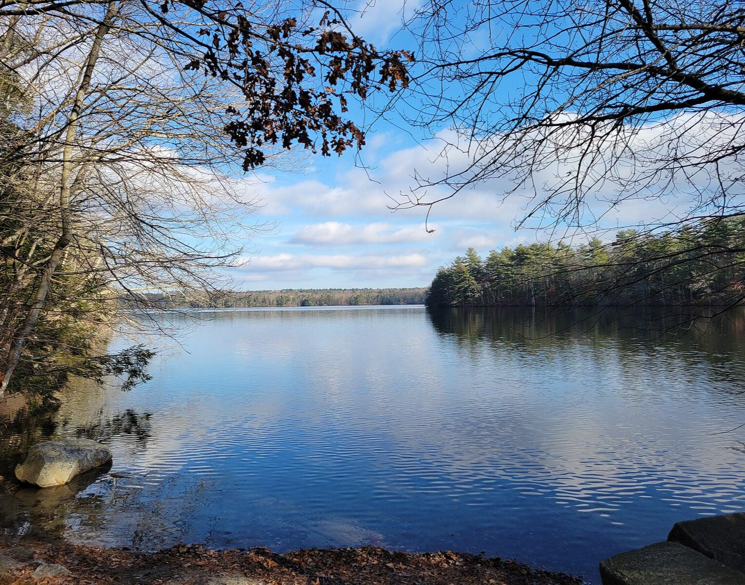
Explore the beauty of Lantern Hill Pond, a stunning lake visible from both the road and the top of Lantern Hill. The natural surroundings around the edges make it a great spot to pause, hop off your bike, and soak in the views.
0
0
Danielson is a beautiful borough in the town of Killingly, and it has two historic districts to its name. The Danielson Main Street Historic District and Broad Street-Davis Park Historic District. In total, there are about 135 historic buildings in one form or another, all built in Colonial Revival, Italianate, or Queen Anne style. Some of the most striking-looking buildings are the Westfield Congregational Church, Bugbee Memorial Library, and Brooklyn Savings Bank. So this is a great place for you to take a break, have a coffee, and enjoy the historic ambience you find yourself surrounded by.
0
0
On a quiet backroad not far from Brooklyn, Connecticut, going through pristine countryside, you will find yet another beautiful covered bridge. The Blackwell Brook Bridge, also known as Levi's Mill Bridge, is built in the typical truss design, but the side is exposed so you can see through the trusses.
0
0
The Brooklyn Green Historic District is a beautiful area, and it is the fulcrum of the town, in particular around the town green. This area includes the beautiful white meeting house dating back to 1771, which stands central to the whole place. Then there is the old town hall, the church, and the houses dating back to between 1750 and 1850, all constructed in late Colonial, Federal, or Greek Revival styles. It is a super beautiful place.
1
0

Woodstock Avenue Open Space and Sabin Street Open Space are next to each other, just separated by Little River. Ride past these tracts of green space in the fall and enjoy the trees changing color.
0
0

The Perkins Wildlife Corridor has an interesting array of trees and ponds that you can see some of from the road or more comprehensively if you step off the bike and take a break.
0
0
Frequently Asked Questions
How many no-traffic road cycling routes are available in Pachaug State Forest?
There are 9 dedicated no-traffic road cycling routes in Pachaug State Forest, offering a variety of distances and elevation gains for different skill levels. You can find routes ranging from easy to difficult.
What are the difficulty levels of the no-traffic road cycling routes?
The no-traffic road cycling routes in Pachaug State Forest cater to various skill levels. There are 5 easy routes, 3 moderate routes, and 1 difficult route, ensuring options for beginners and experienced cyclists alike.
Are there any easy, no-traffic road cycling routes suitable for beginners or families?
Yes, Pachaug State Forest offers several easy, no-traffic road cycling routes. A great option is the Old Mystic – View of Mystic River loop from Shewville Road Open Space, which is 17.4 km with minimal elevation gain. Another easy choice is the Blackwell Brook Covered Bridge – Bush Hill loop from East Brooklyn, spanning 28.8 km.
What kind of scenery can I expect on these no-traffic road cycling routes?
You can expect diverse and picturesque scenery. Routes wind through dense woodlands of oak, maple, and Atlantic White Cedar, past open swamps, and along riverine systems. You might also encounter ponds like Beach Pond and Green Fall Pond, and the meandering Pachaug River, providing serene waterside views.
Are there any longer or more challenging no-traffic road cycling routes?
For a more challenging ride, consider the Woodstock Avenue Open Space – Blackwell Brook Covered Bridge loop from East Brooklyn. This moderate route covers nearly 48 km with almost 500 meters of elevation gain. Another moderate option is the Lewis Pond loop from Eleanor and Flood Reed Memorial Woodlands, which is about 37.5 km with 395 meters of climbing.
What are some notable natural features or attractions to look out for while cycling?
While cycling, you might pass by the Pachaug-Great Meadow Swamp, a National Natural Landmark known for its unique Atlantic white cedar swamp. The forest also features the Rhododendron Sanctuary, which is particularly vibrant when in bloom around June and July. Keep an eye out for various ponds and the Pachaug River.
What do other cyclists say about road cycling in Pachaug State Forest?
The no-traffic road cycling experience in Pachaug State Forest is highly regarded by the komoot community, with an average rating of 4.7 out of 5 stars. Cyclists often praise the quiet, less-trafficked roads and the beautiful, diverse natural landscapes that make for a tranquil ride.
Are there any rail trails suitable for no-traffic road cycling in the area?
Yes, the Washington Secondary Rail Trail offers a great no-traffic option. This easy route spans over 32.5 km and provides a smooth, mostly flat surface ideal for road bikes, winding through scenic areas.
What is the best time of year for no-traffic road cycling in Pachaug State Forest?
Pachaug State Forest offers enjoyable cycling throughout much of the year. Spring and fall provide pleasant temperatures and beautiful foliage. The Rhododendron Sanctuary is especially beautiful in June and July when the flowers are in bloom. Always check local weather conditions before heading out.
Where can I find more information about the general regulations for cycling in Connecticut State Forests?
For general information regarding recreational trail use, including cycling, within Connecticut's state parks and forests, you can refer to the official guidelines provided by the Connecticut Department of Energy and Environmental Protection (DEEP) on their website: portal.ct.gov/DEEP/State-Parks/Recreation-Information/Recreational-Trail-Use-Information.
Are the roads within Pachaug State Forest generally paved and suitable for road bikes?
Yes, many public roadways within Pachaug State Forest are suitable for road cycling. These roads are often less trafficked and wind through the forest, providing a tranquil experience on mostly paved surfaces, as highlighted by various Komoot routes in the area.
Most popular routes in Pachaug State Forest

Get inspired with the komoot mobile app


Explore more
Browse the best Road cycling routes in other regions.
