Naturpark Rieserferner-Ahrn - Parco Naturale Vedrette Di Ries-Aurina
Naturpark Rieserferner-Ahrn - Parco Naturale Vedrette Di Ries-Aurina
Top 20 Natural Monuments in Naturpark Rieserferner-Ahrn - Parco Naturale Vedrette Di Ries-Aurina
Best natural monuments in Naturpark Rieserferner-Ahrn - Parco Naturale Vedrette Di Ries-Aurina are characterized by dramatic alpine landscapes and rich natural heritage. This nature reserve in South Tyrol, Italy, is the most glacier-rich nature park in the region, featuring 38 peaks over 3,000 meters. It forms part of a larger protected area network, offering high mountains, eternal ice, numerous mountain lakes, and waterfalls. The park's geological features and hydrological elements make it a notable destination for exploring alpine environments.
Best…
Last updated: July 5, 2026
First Reinbach Waterfall
Highlight • Waterfall
Translated by Google •
Tip by

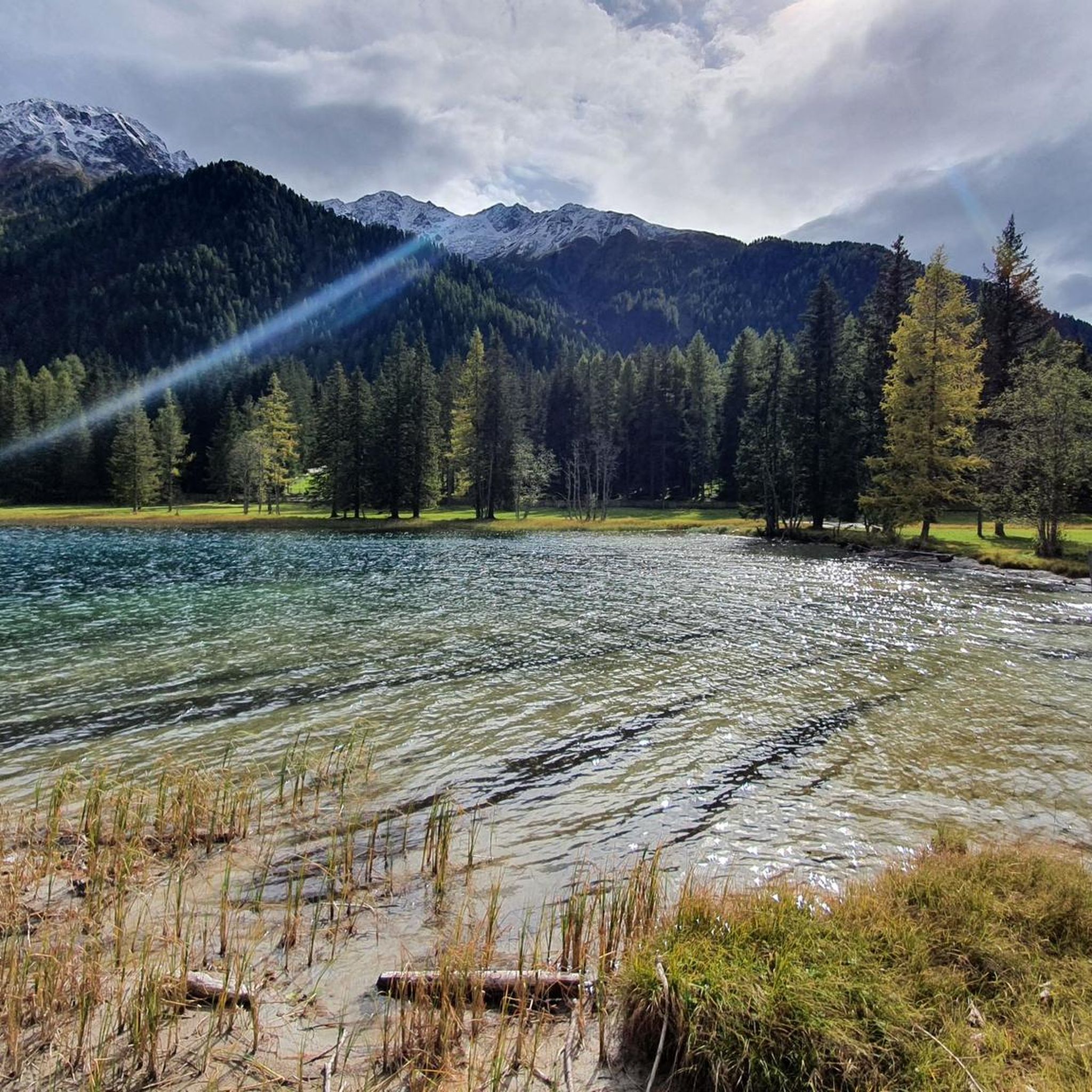
Lake Anterselva – Antholzer See
Highlight (Segment) • Lake
Translated by Google •
Tip by

Sign up now to discover places like this
Get recommendations on the best single tracks, peaks, & plenty of other exciting outdoor places.
Sign up for free
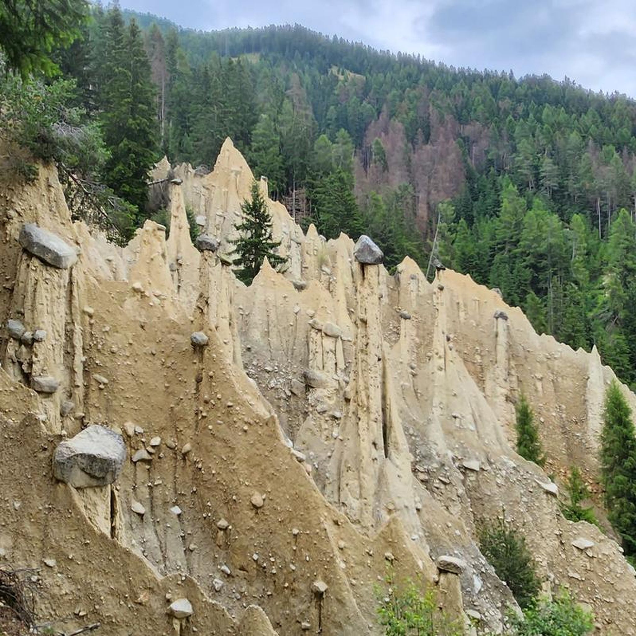
Platten Earth Pyramids
Highlight • Natural Monument
Translated by Google •
Tip by

Lake Anterselva
Highlight • Lake
Translated by Google •
Tip by
Lakeside Trail around Lake Anterselva
Highlight • Trail
Translated by Google •
Tip by
Sign up for free to discover even more natural monuments in Naturpark Rieserferner-Ahrn - Parco Naturale Vedrette Di Ries-Aurina.
Sign up for free
Already have an account?
Start today with a free account
Your next adventure awaits.
Login or Signup
Popular around Naturpark Rieserferner-Ahrn - Parco Naturale Vedrette Di Ries-Aurina
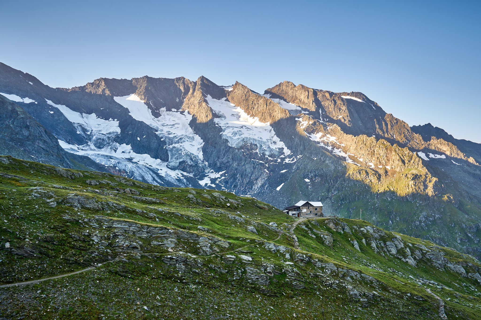
A superb hut-to-hut adventure over the main Alpine ridge – Dreiländertour
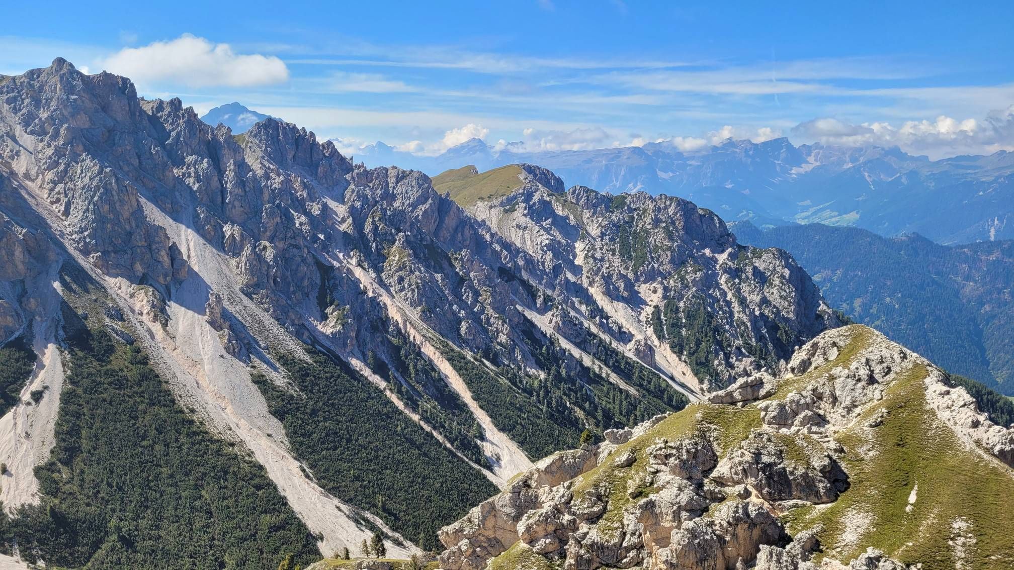
Impressive hikes in the mountains around South Tyrol’s Bruneck

The most beautiful waterfalls of the Alps
Hiking in Naturpark Rieserferner-Ahrn - Parco Naturale Vedrette Di Ries-Aurina
Road Cycling Routes in Naturpark Rieserferner-Ahrn - Parco Naturale Vedrette Di Ries-Aurina
MTB Trails in Naturpark Rieserferner-Ahrn - Parco Naturale Vedrette Di Ries-Aurina
Running Trails in Naturpark Rieserferner-Ahrn - Parco Naturale Vedrette Di Ries-Aurina

Mountain Hikes in Naturpark Rieserferner-Ahrn - Parco Naturale Vedrette Di Ries-Aurina
Cycling in Naturpark Rieserferner-Ahrn - Parco Naturale Vedrette Di Ries-Aurina

Gravel biking in Naturpark Rieserferner-Ahrn - Parco Naturale Vedrette Di Ries-Aurina
Other adventures in Naturpark Rieserferner-Ahrn - Parco Naturale Vedrette Di Ries-Aurina


Tips from the Community

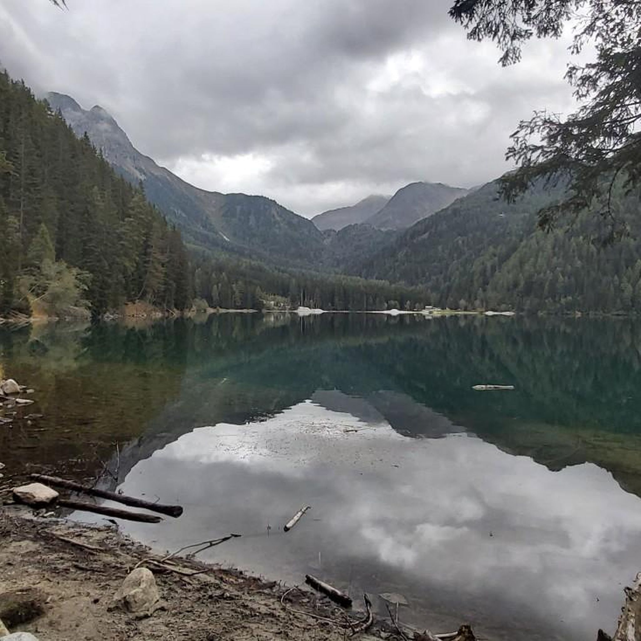
The lake's water shimmers in impressive turquoise-green hues. With a surface area of approximately 44 hectares, it is the third-largest natural lake in South Tyrol. It has a maximum depth of 38 meters. It probably formed at the end of the last Ice Age by a natural landslide or rockslide that blocked the valley and dammed the water. Due to its altitude and low water temperature (below 17°C year-round), it is not a bathing lake, but a typical cold mountain lake. A lovely path, partly on wooden boardwalks, leads us around the lake.
1
0

The first waterfall of the Reinbach Cascade is reachable after about a 20-minute hike from the parking lot. The path there is wide, easy to walk, and runs along the Francis Contemplation Trail, which has several stations inviting you to reflect. At the waterfall itself, there is a viewing point from which you can enjoy the cascading water and the surrounding nature. Particularly noteworthy is the "Sister Water" contemplation point, a modern representation of the Sacred Heart of Jesus that reminds us of the spiritual significance of water. This section of the hike is easy, also suitable for families, and offers a first impressive glimpse of the power of the Reinbach Waterfalls.
4
0

The Riva waterfalls (or Campo Tures waterfalls) are located in Cantuccio, between the Aurina Valley and the Riva Valley. There are three waterfalls (high, medium and low) and they are even more spectacular the more the snow has melted on the Vedrette di Ries.
0
0

There is a beautiful hiking trail around Lake Antholz with lovely views
3
0

The Antholzer See is located at the end of the Antholzer valley, at the foot of the Staller Sattel, at an altitude of 1642m. With an area of 43 hectares and a depth of 43 m, it is the third largest lake in South Tyrol. You can walk around the lake on a path that is about 3.5 km long, with a difference in altitude of about 90 m.
11
0
You can walk around the lake on a path that is about 3.5 km long, with a difference in altitude of about 90 m. During the hike you will always have a great view of the lake with its wonderful colors.
9
0
The Antholzer See is located at the end of the Antholzer valley, at the foot of the Staller Sattel, at an altitude of 1642m. With an area of 43 hectares and a depth of 43 m, it is the third largest lake in South Tyrol. You can walk around the lake on a path that is about 3.5 km long, with a difference in altitude of about 90 m.
14
1
Beautiful path with great views of Lake Antholz and the surrounding mountains.
9
1
Frequently Asked Questions
What are some of the most impressive natural monuments to visit in Naturpark Rieserferner-Ahrn?
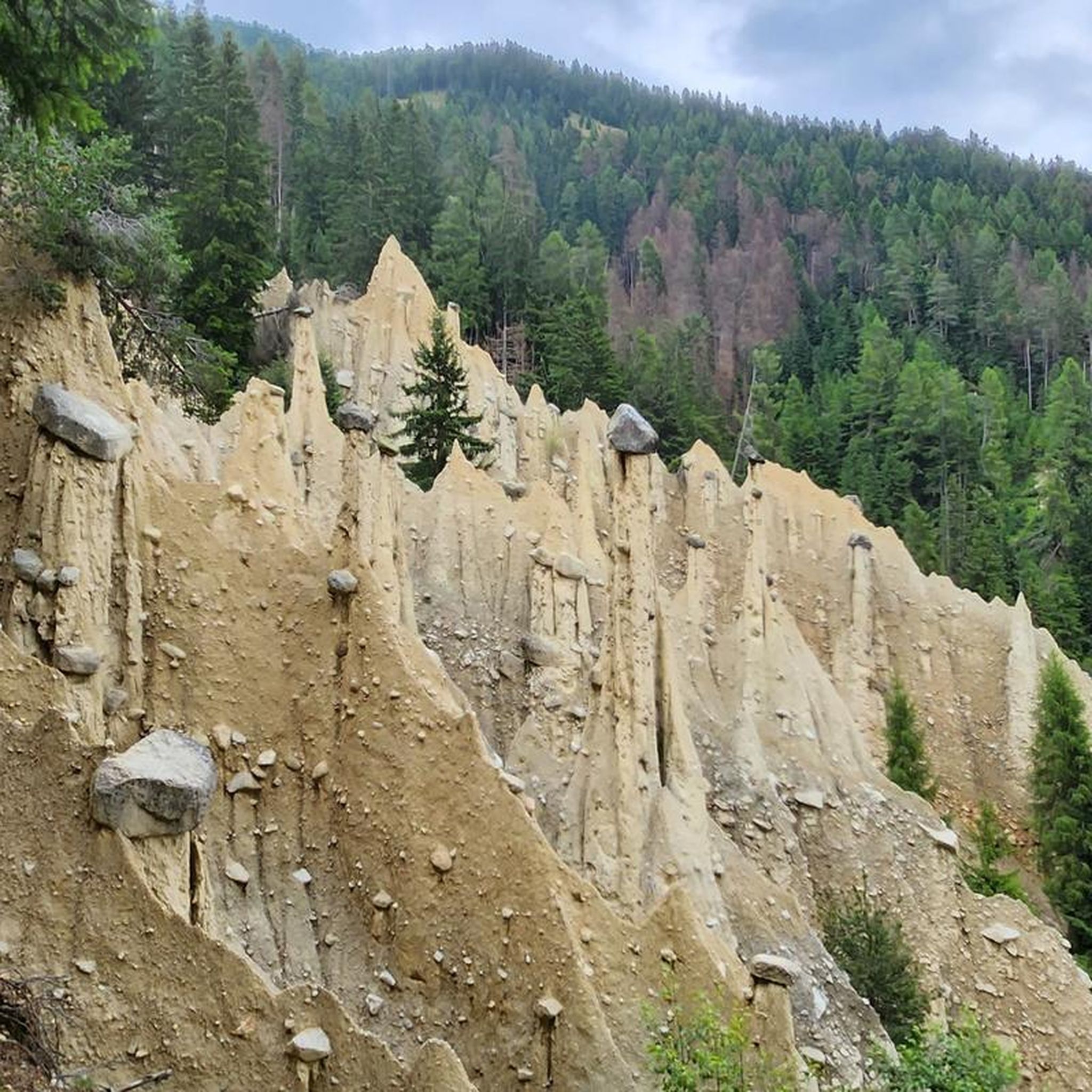
The Naturpark Rieserferner-Ahrn is home to several remarkable natural monuments. Among the most popular are the powerful First Reinbach Waterfall near Campo Tures, the serene Lake Anterselva – Antholzer See, and the unique Platten Earth Pyramids, which showcase fascinating geological processes.
What unique geological features can be found in Naturpark Rieserferner-Ahrn?
The park is renowned for its diverse geological features. You can witness the bizarre shapes of the Platten Earth Pyramids, formed by erosion. The region is also characterized by its glaciated peaks, such as Hochgall and Schneebiger Nock, and numerous mountain lakes and thundering waterfalls like the Reinbach Waterfalls, all testaments to the powerful natural forces at play.
Are there family-friendly natural monuments in Naturpark Rieserferner-Ahrn?
Yes, several natural monuments are suitable for families. The First Reinbach Waterfall is easily accessible via a contemplative trail. The path around Lake Anterselva – Antholzer See is also family-friendly, featuring 16 installations that offer insights into local flora and fauna. The Platten Earth Pyramids also offer an engaging visit for children, though some parts of the trail require surefootedness.
What outdoor activities can I do near these natural monuments?
The Naturpark Rieserferner-Ahrn offers a wide range of outdoor activities. You can explore numerous hiking trails, including the easy Lake Antholz Nature Trail. For those interested in running, there are various routes like the Lake Anterselva – Staller Pass loop. Road cycling enthusiasts can also find routes such as the Stalle Pass loop.
What is the best time to visit Naturpark Rieserferner-Ahrn to see its natural monuments?
The best time to visit largely depends on the activities you plan. For hiking and enjoying the waterfalls and lakes, late spring to early autumn (May to October) offers pleasant weather and full accessibility. During winter, the park transforms into a snowy landscape, offering opportunities for winter sports, though some higher-altitude natural monuments might be less accessible.
Are there accessible viewpoints for the natural monuments?
Many natural monuments in the park offer accessible viewpoints. For instance, the path leading to the Reinbach Waterfalls provides excellent viewing opportunities. The circular path around Lake Anterselva – Antholzer See also offers continuous great views of the lake and surrounding mountains.
Can I bring my dog to the natural monuments in Naturpark Rieserferner-Ahrn?
Many trails and areas within Naturpark Rieserferner-Ahrn are dog-friendly, but it's always recommended to keep dogs on a leash, especially in protected areas and near wildlife. Specific rules may apply to certain natural monuments or trails, so checking local signage or park regulations is advisable.
How long does it take to explore the natural monuments?
The duration varies greatly depending on the monument. A visit to the Reinbach Waterfalls can take a couple of hours, while a full circuit around Lake Anterselva – Antholzer See is about 3.5 km and takes roughly an hour. Exploring the Platten Earth Pyramids also typically takes a few hours, including the walk to and from the site.
What are the options for parking near the natural monuments?
Parking facilities are generally available near popular natural monuments. For example, there is parking near the starting point for the Reinbach Waterfalls and at Lake Anterselva – Antholzer See. It's advisable to arrive early during peak season to secure a spot, especially for well-known attractions.
Are there any circular walks or trails around the natural monuments?
Yes, several natural monuments offer circular walks. The most notable is the path around Lake Anterselva – Antholzer See, which is approximately 3.5 km long and provides continuous scenic views. Many hiking routes in the park are also designed as circular trails, allowing you to experience the diverse landscapes.
What do visitors enjoy most about the natural monuments in Naturpark Rieserferner-Ahrn?
Visitors frequently praise the sheer beauty and power of the natural landscapes. The impressive flow of the Reinbach Waterfalls, the serene atmosphere and clear waters of Lake Anterselva, and the unique, ever-changing formations of the Platten Earth Pyramids are often highlighted. The opportunity to connect with nature and witness geological wonders is a major draw.
Can I reach the natural monuments using public transport?
Public transport options are available to access various parts of the Naturpark Rieserferner-Ahrn, including areas near some natural monuments. Buses often connect villages within the Ahrntal valley and to major hubs, providing access points for trails and attractions. It's recommended to check local bus schedules for specific routes and timings.
Most popular routes in Naturpark Rieserferner-Ahrn - Parco Naturale Vedrette Di Ries-Aurina
Most popular attractions in Naturpark Rieserferner-Ahrn - Parco Naturale Vedrette Di Ries-Aurina

Get inspired with the komoot mobile app


Explore more
Extend your search for the best caves by checking out these guides of the top ones in Naturpark Rieserferner-Ahrn - Parco Naturale Vedrette Di Ries-Aurina:
