Top 13 Natural Monuments around Herguijuela De La Sierra
Best natural monuments around Herguijuela de la Sierra are situated within the Las Batuecas-Sierra de Francia Natural Park, a UNESCO Biosphere Reserve. This region features a diverse landscape with forests of oak, chestnut, and pine, alongside Mediterranean vegetation, supported by a mild microclimate. The area's abrupt topography, characterized by quartzite formations and significant elevation changes, creates a dramatic setting for various natural attractions. This natural environment makes it an ideal destination for exploring its scenic beauty and biodiversity.
Best natural…
Last updated: July 1, 2026
San Marcos Lagoon
Highlight • Lake
Translated by Google •
Tip by

Soto Bridge - Alagón River
Highlight • Bridge
Translated by Google •
Tip by

Sign up now to discover places like this
Get recommendations on the best single tracks, peaks, & plenty of other exciting outdoor places.
Sign up for free
Peña de Francia
Highlight • Summit
Showing Translation
Tip by

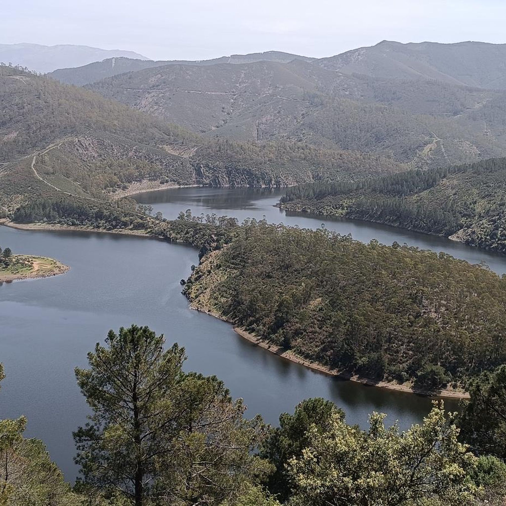
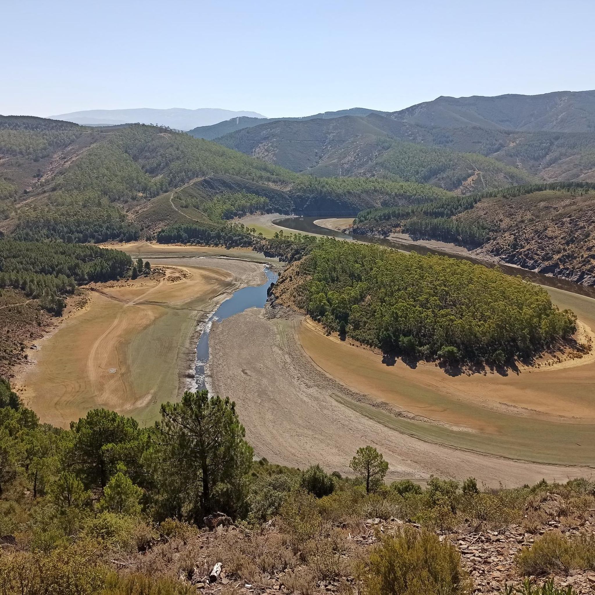
View of Meandro del Melero
Highlight • Viewpoint
Translated by Google •
Tip by
Ascent to Peña de Francia
Highlight (Segment) • Summit
Altitude: 1732m
Distance: 12km
Height difference: 720m
Average Slope: 6%
Translated by Google •
Tip by

Sign up for free to discover even more natural monuments around Herguijuela De La Sierra.
Sign up for free
Already have an account?
Start today with a free account
Your next adventure awaits.
Login or Signup

Tips from the Community

Really such a top that stands out with over 1700 meters, offering a beautiful view all around.
12
0

The Soto Bridge, also known as the Roman Bridge of Sotoserrano, is a historic stone structure that spans the Alagón River in the Las Batuecas-Sierra de Francia Natural Park. It is located in the town of Sotoserrano, famous for being at the confluence of three rivers: the Alagón, the Francia, and the Cuerpo de Hombre. The bridge is one of the town's symbols and a key point on several hiking and cycling routes.
2
0
It offers spectacular views over the Sierra de Francia, the Sierra de Béjar, the Campo Charro region, northern Cáceres, and even the Serra da Estrela in Portugal. You can drive up via the SA-203 road (from La Alberca or El Cabaco), although it is often closed due to snow in winter. There are also hiking trails, such as the GR-10, starting from La Alberca.
5
0
La Peña de Francia is one of the most emblematic places in the province of Salamanca, located in the Las Batuecas-Sierra de Francia Natural Park, within the municipality of El Cabaco, about 81 km from Salamanca and near La Alberca.
4
0
The Meandro del Melero is an impressive river formation located in the region of Las Hurdes, on the border between the provinces of Cáceres and Salamanca. This meander is created by the Alagón River, which forms a spectacular turn in its course, offering a unique panoramic view.
3
0

Peña de Francia is a peak known by many cyclists and is undoubtedly worth crowning. It gives its name to the wonderful Natural Park and with its 1,727 m high it offers you the best panoramic views in all directions. Take the time to take photos from the two viewpoints located next to the Sanctuary of Our Lady of Peña de Francia.
4
1

Full of water it is spectacular, so before going I would check how the Alagón is with water.
1
0
A Roman bridge over the Alagón river. Very close to the town of Sotoserrano. Good views of the river and the surrounding passage.
2
1
Frequently Asked Questions
What are some popular natural monuments to visit around Herguijuela de la Sierra?
Visitors frequently enjoy the Ascent to Peña de Francia, which offers stunning views from its 1732-meter summit. Another highly regarded spot is Peña Huevo, providing postcard-worthy vistas of the Batuecas and Sierra de Francia Natural Park. For a tranquil experience, San Marcos Lagoon is a quiet paradise surrounded by a beautiful natural landscape.
Are there family-friendly natural monuments in the area?
Yes, several natural monuments are suitable for families. San Marcos Lagoon is a peaceful spot perfect for a relaxed outing. The View of Meandro del Melero offers an impressive river formation that can be enjoyed by all ages. Additionally, the historic Soto Bridge - Alagón River is a great place for a family stroll, offering scenic views of the river.
What kind of natural features can I expect to see in the region?
The region around Herguijuela de la Sierra, nestled within the Las Batuecas-Sierra de Francia Natural Park, boasts diverse natural features. You'll find majestic summits like Peña de Francia and Peña Huevo, tranquil lakes such as San Marcos Lagoon, and dramatic river formations like the Meandro del Melero. The landscape is characterized by abrupt topography, quartzite formations, and lush forests of oak, chestnut, pine, and Mediterranean vegetation, all thriving due to a beneficial microclimate.
Are there opportunities for hiking near these natural monuments?
Absolutely. The area is ideal for hiking, with numerous marked trails connecting Herguijuela de la Sierra to other towns and natural features. You can explore routes like the 'Route of the Three Rivers' or the 'Herguijuela - Fuente Mundo Trail'. For more detailed options, you can find a variety of hiking routes in the Hiking around Herguijuela De La Sierra guide.
What about cycling routes in the area?
The region offers excellent cycling opportunities, with routes that take you through the stunning natural park. You can find routes like the 'Parque Natural de las Batuecas y Sierra de Francia — circular desde La Alberca' or the 'Meandro Melero - circular from Sotoserrano'. For a comprehensive list of cycling trails, refer to the Cycling around Herguijuela De La Sierra guide.
Are there any historical natural monuments?
Yes, the Soto Bridge - Alagón River, also known as the Roman Bridge of Sotoserrano, is a significant historical natural monument. This ancient stone structure spans the Alagón River and is a key point on several hiking and cycling routes, offering a glimpse into the region's past while surrounded by natural beauty.
Where can I find the best panoramic views?
For breathtaking panoramic views, the Ascent to Peña de Francia is highly recommended. At 1732 meters, it provides some of the best vistas in all directions. Peña Huevo, with its peak at 1414 meters, also offers spectacular views of the Batuecas and Sierra de Francia Natural Park. The View of Meandro del Melero provides a unique perspective of the Alagón River's impressive meander.
What is the best time of year to visit the natural monuments around Herguijuela de la Sierra?
Thanks to its beneficial microclimate, the area enjoys mild temperatures year-round, making it suitable for visits in most seasons. Spring and autumn are particularly pleasant for hiking and outdoor activities, with vibrant flora and comfortable weather. Summer offers lush greenery, while winter can provide a different, serene beauty, especially on clear days for panoramic views.
Are the trails around the natural monuments difficult?
The difficulty of trails varies. For example, the Peña Huevo and Ascent to Peña de Francia are considered intermediate climbs. However, there are also easier options, such as the 'Herguijuela - Fuente Mundo Trail' for hiking. You can check the difficulty grades for specific routes in the Hiking around Herguijuela De La Sierra guide.
What makes the Las Batuecas-Sierra de Francia Natural Park special?
The Las Batuecas-Sierra de Francia Natural Park, where Herguijuela de la Sierra is located, is a UNESCO Biosphere Reserve. It's renowned for its significant scenic and ecological value, boasting an abundant variety of flora and fauna. The park's diverse landscape includes ancient forests, dramatic quartzite formations, and a rich cultural heritage, all supported by a unique microclimate that ensures mild temperatures throughout the year.
What should I bring for a visit to these natural monuments?
When visiting the natural monuments, it's advisable to bring appropriate footwear for hiking, sufficient water, and sun protection. Depending on the season, layers of clothing are recommended due to potential temperature changes, especially at higher elevations. Binoculars can enhance wildlife spotting and enjoying distant views. Always check local weather conditions before your visit.
Are there places to eat or stay near the natural monuments?
Herguijuela de la Sierra and nearby towns within the Las Batuecas-Sierra de Francia Natural Park offer various options for accommodation and dining. You'll find local cafes, restaurants, and guesthouses that provide a comfortable base for exploring the natural monuments. It's recommended to check availability and book in advance, especially during peak seasons.
Most popular routes around Herguijuela De La Sierra
Most popular attractions around Herguijuela De La Sierra

Get inspired with the komoot mobile app


Explore more
Extend your search for the best caves by checking out these guides of the top ones around Herguijuela De La Sierra:
