The best walks and hikes around Herguijuela De La Sierra
4.5
(334)
1,892
hikers
81
hikes
Hiking trails around Herguijuela de la Sierra are situated within the Las Batuecas-Sierra de Francia Natural Park, a UNESCO Biosphere Reserve. The region features mountainous terrain with diverse forests of oak, chestnut, and pine. Rivers like the Alagón and Batuecas create water features, including waterfalls and river walks. Panoramic views of the surrounding area, including La Sierra del Castillo and the Alagón Valley, are common.
Best hiking trails around Herguijuela de la Sierra
- The most popular hiking route is Route…
Last updated: August 30, 2026
4.49km
01:19
120m
120m
Easy hike. Great for any fitness level. Easily-accessible paths. Suitable for all skill levels.
4.4
(14)
80
hikers
Moderate hike. Good fitness required. Easily-accessible paths. Suitable for all skill levels.

Sign up for free
4.3
(7)
60
hikers
Easy hike. Great for any fitness level. Easily-accessible paths. Suitable for all skill levels.
19
hikers
Easy hike. Great for any fitness level. Easily-accessible paths. Suitable for all skill levels.
4.0
(2)
16
hikers
11.0km
03:08
250m
250m
Moderate hike. Good fitness required. Easily-accessible paths. Suitable for all skill levels.
Get access to more routes and recommendations from other explorers.
Sign up for free
Already have an account?
Our route recommendations are based on thousands of hikes, rides, and runs completed by other people on komoot.
Start today with a free account
Your next adventure awaits.
Login or Signup

Tips from the Community

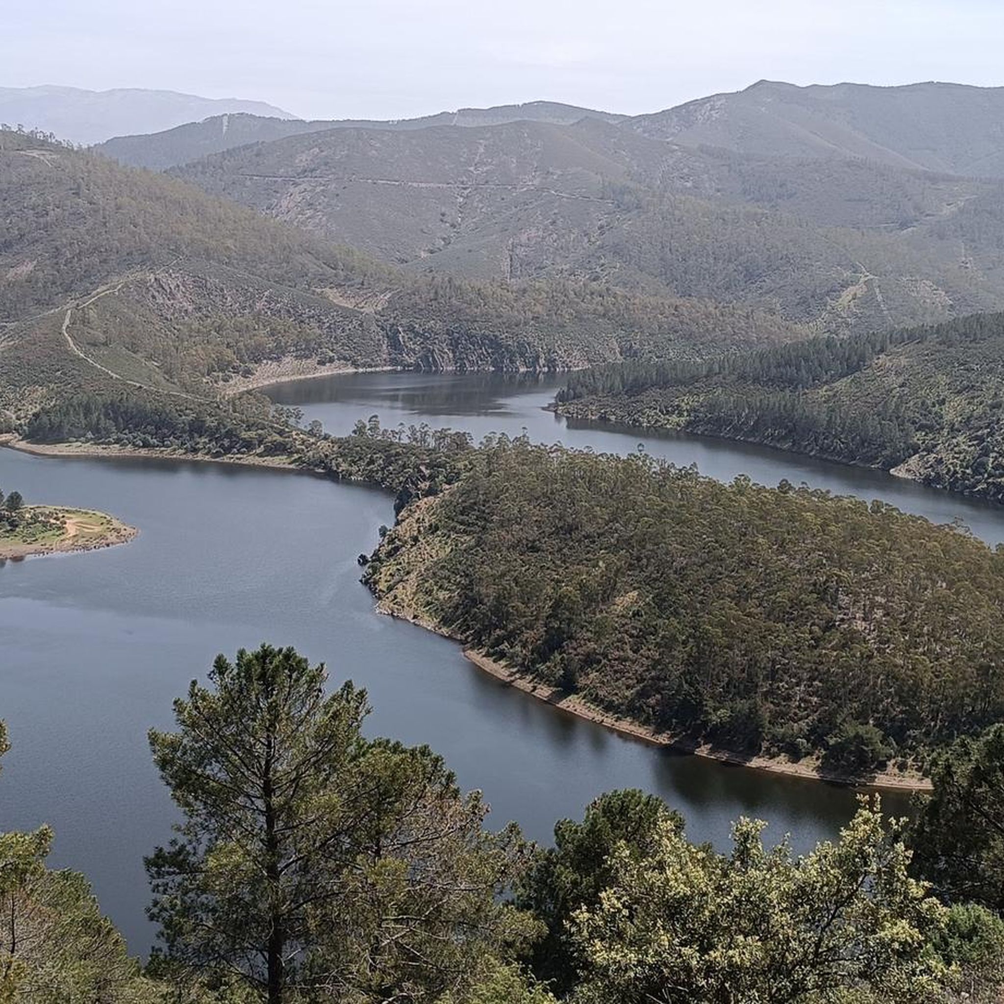
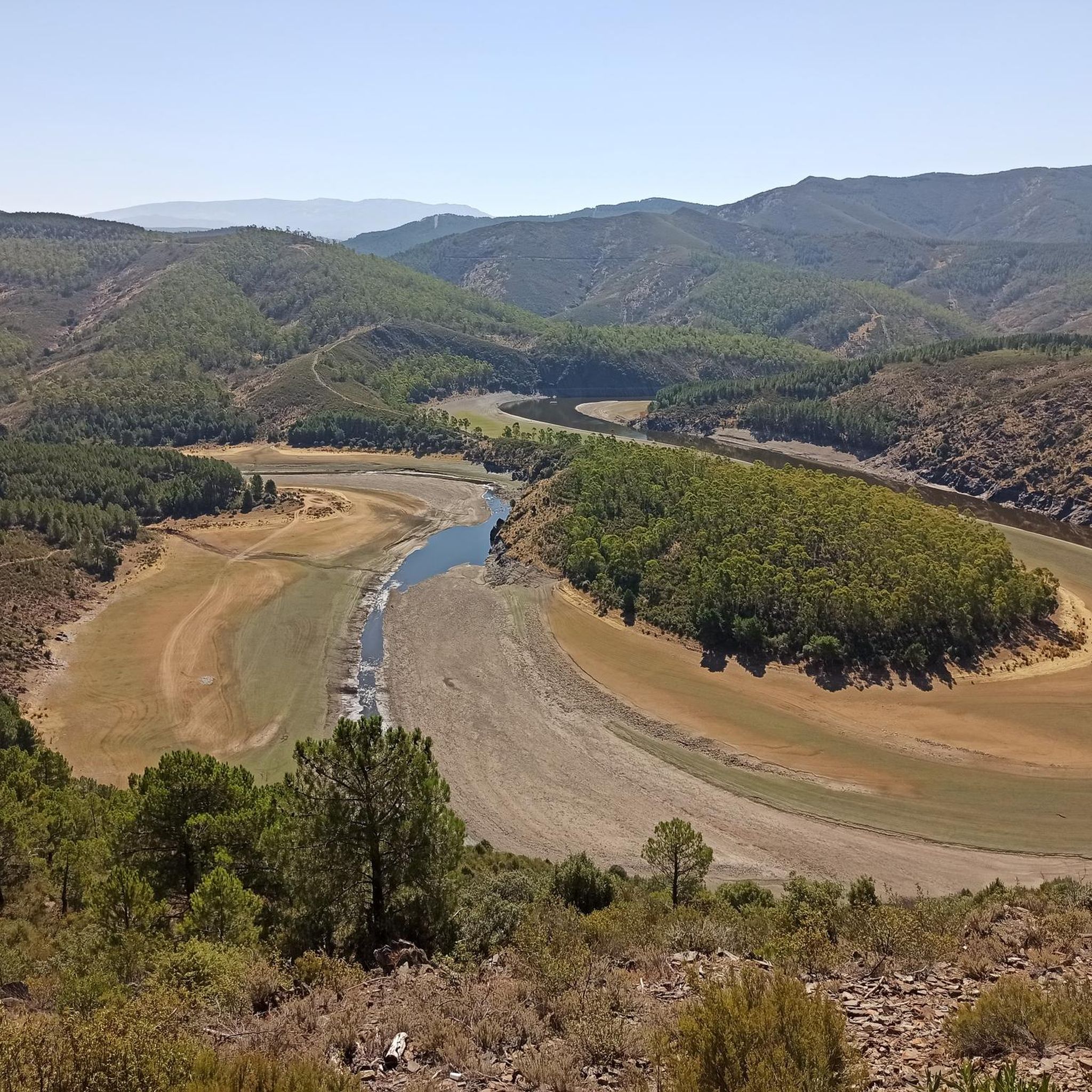
The Meandro del Melero is an impressive river formation located in the region of Las Hurdes, on the border between the provinces of Cáceres and Salamanca. This meander is created by the Alagón River, which forms a spectacular turn in its course, offering a unique panoramic view.
3
0

Milestone that marks 'The Mozárabe Way' between Galisteo and Riomalo below.
1
0
Long before reaching the viewpoint, we can already have impressive views. From the last parking lot to the viewpoint, there is a gentle climb along the road for almost two kilometers.
1
0
Spectacular views of the Melero Meander. You can access the same viewpoint with a wheelchair and baby strollers via a wooden ramp that zigzags down the slope.
1
0

Full of water it is spectacular, so before going I would check how the Alagón is with water.
1
0

One of the most beautiful landscapes in the provinces of Castilla y León and Extremadura (the meander of the Alagón River forms part of the border between the provinces). It is recommended to visit when there is enough water in the river. What we see is Isla de Romerosa formed by the meander of the Alagón river - a jewel of nature!
2
1

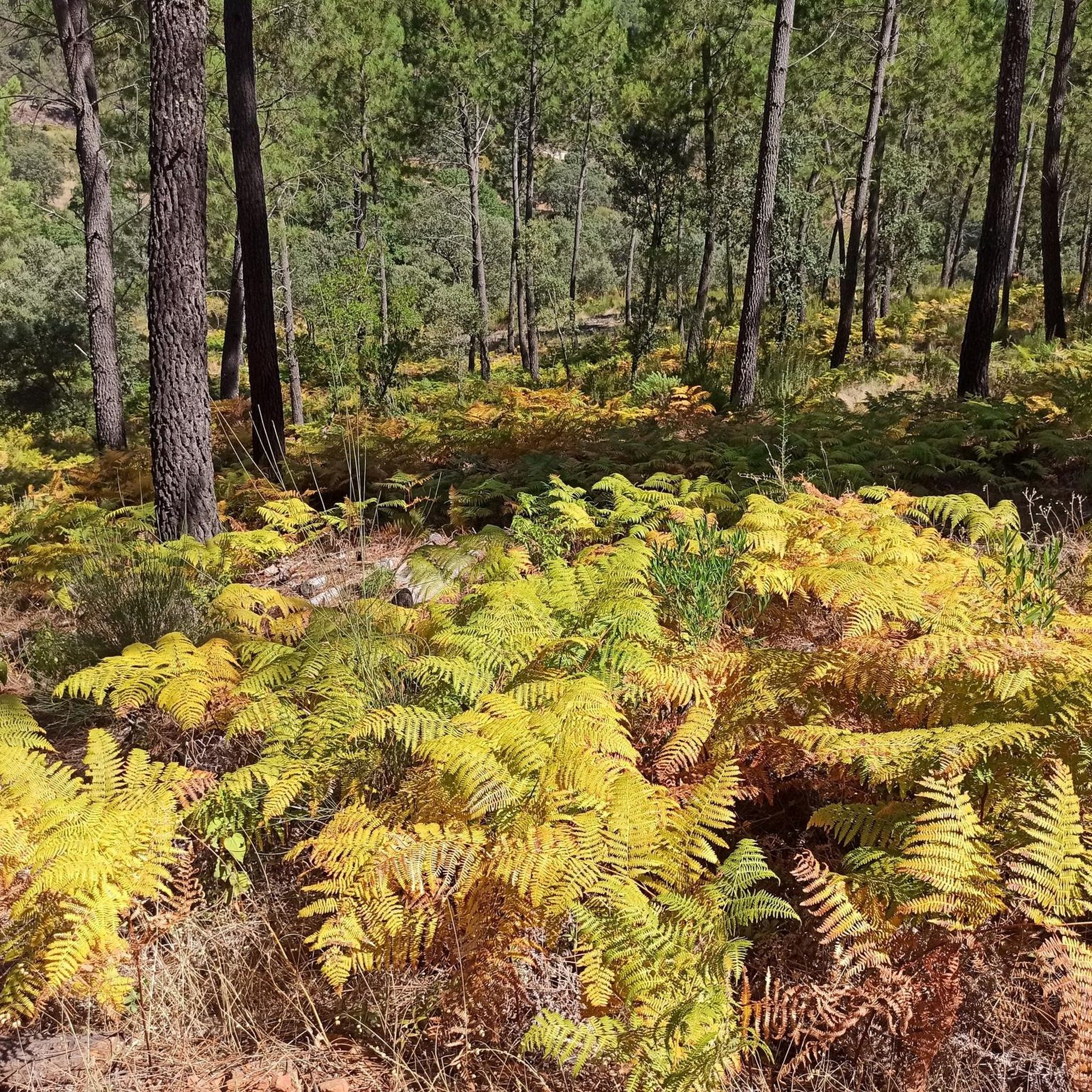
An easy itinerary that runs through the heart of the Parque de la Sierra Francia surrounded by a wonderful landscape of forests and mountains. An ideal tour to do with the whole family.
1
0
Views from the Mirador de La Antigua.
6
0
Frequently Asked Questions
How many hiking trails are available around Herguijuela de la Sierra?
There are over 60 hiking trails around Herguijuela de la Sierra, offering a wide range of options for different skill levels and preferences. The region is part of the Las Batuecas-Sierra de Francia Natural Park, providing diverse landscapes to explore.
Are there easy hiking trails suitable for beginners or families?
Yes, the area offers nearly 20 easy hiking trails perfect for beginners or families. An example is the Herguijuela - Fuente Mundo Trail, an easy 4.5 km path with a moderate elevation gain, which can be completed in about 1 hour 19 minutes. Another accessible option is the "Castaños Centenarios" path, known for its ancient chestnut trees.
Can I find challenging routes for experienced hikers?
Yes, for more experienced hikers seeking a challenge, there are 9 difficult routes available. These trails often feature significant elevation changes and cover more rugged terrain within the mountainous landscape of the Sierra de Francia.
Are there any circular hiking routes in the area?
Many trails in Herguijuela de la Sierra are circular, allowing you to start and end at the same point. A popular moderate circular route is the Route of the Three Rivers - circular from Sotoserrano, which is 8.4 km long and takes approximately 2 hours 20 minutes. The region also features unique "Art in Nature" circular routes like the Camino de los Prodigios.
What kind of natural features or panoramic viewpoints can I expect to see on the trails?
Hikers can enjoy breathtaking panoramic views of the surrounding area, including La Sierra del Castillo, the Alagón Valley, and the Sierra de Candelario. The View of the Alagón River – Melero Meander Viewpoint loop from Piscina Natural de Riomalo offers stunning vistas of the striking Meandro Melero, a significant natural attraction.
Are there any trails that pass by waterfalls or significant water features?
Yes, the region is rich in water features due to rivers like the Alagón and Batuecas. The Valle de las Batuecas to Chorro de las Batuecas Trail, for instance, features a 12-meter waterfall. You can also explore the Chorrito de las Batuecas – Hermitage of Saint John the Baptist loop from Río Batuecas, an easy 3.8 km route that highlights these aquatic elements.
What do other hikers say about the trails in Herguijuela de la Sierra?
The trails in Herguijuela de la Sierra are highly rated by the komoot community, with an average score of 4.5 stars from over 230 reviews. Hikers often praise the diverse landscapes, well-maintained paths, and the stunning natural beauty of the Las Batuecas-Sierra de Francia Natural Park.
What are some notable attractions or villages to visit near the hiking trails?
Beyond the trails, you can explore charming traditional villages like Mogarraz, Miranda del Castañar, and La Alberca, known for their cultural heritage and architecture. The Sanctuary of Our Lady of the Peña de Francia, located on one of the highest peaks, also offers expansive views and cultural significance.
When is the best time of year to go hiking in Herguijuela de la Sierra?
The region offers pleasant hiking conditions for much of the year. Spring and autumn are particularly ideal, with mild temperatures and vibrant natural colors. Summer can be warm, but shaded forest trails provide relief, while winter offers a unique, quieter experience, though some higher routes may be more challenging.
Are there any trails that feature unique cultural or artistic elements?
Yes, the area is home to unique "Art in Nature" trails, such as the Camino de los Prodigios, Asentadero-Bosque de los Espejos, Camino de las Raíces, and Camino del Agua. These circular routes blend hiking with artistic installations seamlessly integrated into the natural landscape, offering a distinctive cultural dimension to your outdoor experience.
Can I bring my dog on the hiking trails in Herguijuela de la Sierra?
Many trails in the Las Batuecas-Sierra de Francia Natural Park are dog-friendly, allowing you to enjoy the natural beauty with your canine companion. However, it's always recommended to keep dogs on a leash, especially in protected areas, to respect wildlife and other hikers.
Most popular attractions around Herguijuela De La Sierra

Get inspired with the komoot mobile app


Explore more
Browse the best Hikes in other regions.
