The best cycling routes around Herguijuela De La Sierra
4.2
(17)
265
riders
24
rides
Touring cycling around Herguijuela De La Sierra features routes through the Sierra de Francia mountain range, characterized by significant elevation changes and forested areas. The region includes parts of the Parque Natural de las Batuecas, offering varied terrain for cyclists. River valleys and scenic viewpoints are common along the routes, providing diverse landscapes.
Best touring cycling routes around Herguijuela De La Sierra
- The most popular touring cycling route is Parque Natural de las Batuecas y Sierra de Francia — circular…
Last updated: July 2, 2026
4.5
(2)
17
riders
Hard bike ride. Very good fitness required. Mostly paved surfaces. Suitable for all skill levels.
3.3
(3)
8
riders
27.3km
02:01
430m
430m
Moderate bike ride. Good fitness required. Mostly paved surfaces. Suitable for all skill levels.

Sign up for free
5.0
(1)
36
riders
58.5km
04:17
1,210m
1,200m
Hard bike ride. Very good fitness required. Mostly paved surfaces. Suitable for all skill levels.
4.0
(1)
34
riders
49.1km
03:37
1,130m
1,130m
Hard bike ride. Very good fitness required. Mostly paved surfaces. Suitable for all skill levels.
5.0
(1)
16
riders
37.2km
02:52
990m
990m
Hard bike ride. Very good fitness required. Mostly paved surfaces. Suitable for all skill levels.
Get access to more routes and recommendations from other explorers.
Sign up for free
Already have an account?
Our route recommendations are based on thousands of hikes, rides, and runs completed by other people on komoot.
Start today with a free account
Your next adventure awaits.
Login or Signup

Tips from the Community

At the village's social meeting point, the Plaza Mayor with its arcades, stands a beautiful granite pilgrim's cross.
11
0
Striking about the houses are the stone support beams above the doorposts. Religious texts are engraved on them and there are dates from the 1700s and 1800s. After the reconquista, when the area was repopulated, many Jews came to live in the village. Because the church forbade the Jews to practice their religion, they had to prove that they had joined the Catholic church by engraving biblical texts above their houses.
10
0
Beautiful view here, now the last stretch to the top with 200 altitude meters to go.
0
0

Beautiful view at an altitude of 1735 meters
0
0
Really such a top that stands out with over 1700 meters, offering a beautiful view all around.
12
0

What to see in Mogarraz The Faces of Mogarraz More than 800 portraits painted on the facades, the work of artist Florencio Maíllo, who transformed the village into an open-air museum. This initiative originated from photos taken in the 1960s for residents' national identity cards. Main Square The central oval-shaped square, surrounded by traditional mountain houses with timber framing and stone walls. Church of Our Lady of the Snows A Renaissance-style church, built between the 16th and 17th centuries. Bell Tower An old defensive tower, separate from the church, used as a watchtower in the Middle Ages. Ethnographic Museum – House of Crafts Exhibits traditional crafts such as embroidery, shoemaking, and goldsmithing.
2
0
Founded during the 12th-century repopulation of León by Alfonso IX, within the district of Miranda del Castañar. Declared a Historic-Artistic Site in 1998 and a member of the network of the Most Beautiful Villages of Spain. Its mountain architecture combines stone, wood, and adobe, with flower-adorned balconies and heraldic details.
2
0
The Soto Bridge, also known as the Roman Bridge of Sotoserrano, is a historic stone structure that spans the Alagón River in the Las Batuecas-Sierra de Francia Natural Park. It is located in the town of Sotoserrano, famous for being at the confluence of three rivers: the Alagón, the Francia, and the Cuerpo de Hombre. The bridge is one of the town's symbols and a key point on several hiking and cycling routes.
2
0
Frequently Asked Questions
How many touring cycling routes are available around Herguijuela De La Sierra, and what are their difficulty levels?
There are over 20 touring cycling routes in the area. The majority, around 19, are classified as difficult, offering significant climbs through the Sierra de Francia. There are also 4 moderate routes and 1 easy option, providing choices for various skill levels.
Are there any family-friendly touring cycling routes in Herguijuela De La Sierra?
While many routes feature significant elevation changes, there is at least one easy touring cycling route available. For families looking for a less strenuous ride, consider exploring the flatter sections near river valleys or shorter, well-maintained paths. Always check the route's elevation profile before heading out.
Are there any long-distance touring cycling routes in the region?
Yes, the area offers several longer routes. For example, the La Alberca Main Square – Mogarraz loop from Cepeda covers approximately 36 miles (58 km) through hilly terrain and traditional villages, making it a good option for a longer day out.
What kind of terrain can I expect on the touring cycling routes around Herguijuela De La Sierra?
The terrain is diverse, characterized by the Sierra de Francia mountain range. You'll encounter significant elevation changes, forested areas, and sections through natural parks like the Parque Natural de las Batuecas. Routes often include river valleys and scenic viewpoints, with surfaces ranging from paved roads to rural tracks.
Are there circular touring cycling routes available?
Yes, many routes in the area are circular, allowing you to start and end in the same location. An example is the Parque Natural de las Batuecas y Sierra de Francia — circular desde La Alberca, which is a challenging 25.6-mile (41.2 km) loop.
What are some notable viewpoints or attractions I can see along the touring cycling routes?
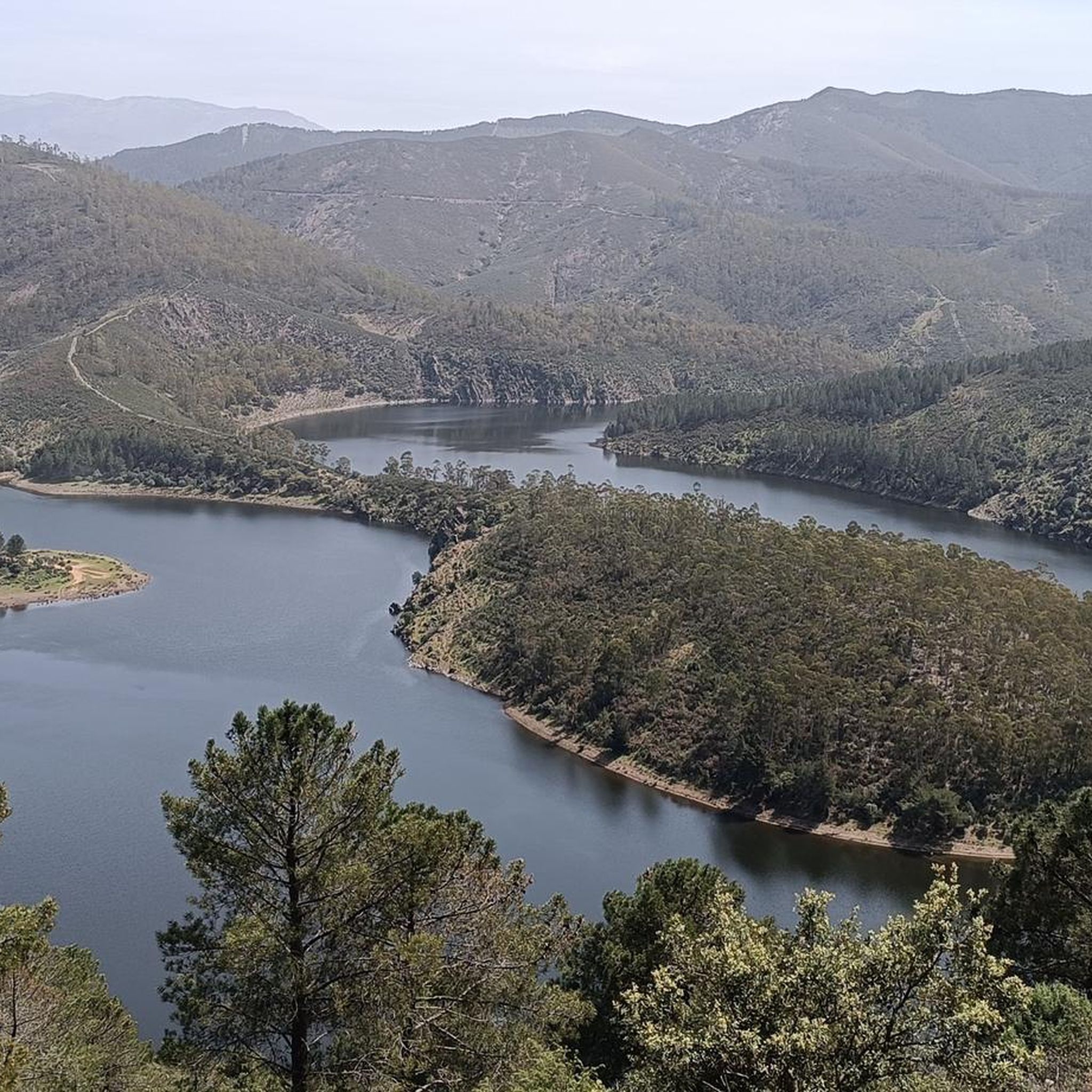
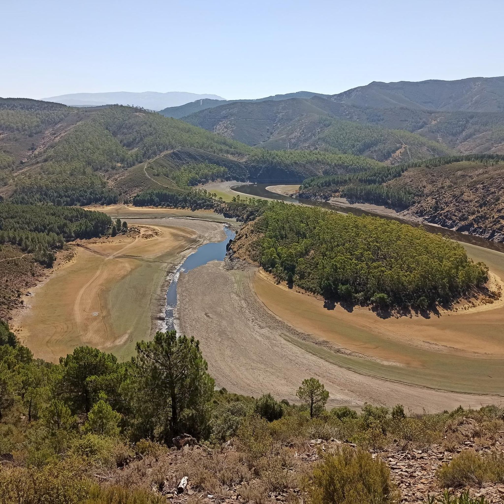
The region is rich in natural beauty and cultural landmarks. Along your rides, you might encounter stunning vistas like the View of Meandro del Melero. Other points of interest include the Sanctuary of Our Lady of the Peña de Francia and the tranquil San Marcos Lagoon.
What do other touring cyclists enjoy most about cycling in Herguijuela De La Sierra?
The area is highly rated by the komoot community, with an average score of 4.4 stars from more than 10 reviews. Cyclists often praise the challenging mountain passes, the beauty of the natural park landscapes, and the scenic river valleys. The variety of routes catering to different abilities is also frequently highlighted.
Are there any moderate touring cycling routes for those looking for a balanced challenge?
Certainly. The Meandro Melero - circular from Sotoserrano is a popular moderate route, offering a mix of terrain over 17 miles (27.3 km). It includes sections along river bends and through rural landscapes, providing a rewarding experience without the extreme difficulty of some other trails.
When is the best time of year for touring cycling in Herguijuela De La Sierra?
The region's climate makes spring and autumn ideal for touring cycling, with milder temperatures and beautiful scenery. Summer can be quite warm, especially in the valleys, so early mornings or late afternoons are preferable if cycling during this season. Winter can bring colder temperatures and potential snow at higher elevations.
Are there any routes that offer significant climbs for advanced touring cyclists?
Yes, the region is known for its challenging ascents. The Mogarraz – Ascent to Peña de Francia loop from Mogarraz is a difficult route covering approximately 30 miles (49 km) with over 1100 meters of elevation gain, providing a substantial test for experienced riders.
Are there places to stop for refreshments or food along the touring cycling routes?
Many routes pass through or near traditional villages such as La Alberca, Mogarraz, and Cepeda. These villages typically offer cafes, restaurants, and small shops where you can refuel and enjoy local cuisine. It's always a good idea to carry sufficient water and snacks, especially on longer or more remote sections.
Is parking available near the touring cycling routes?
Parking is generally available in the towns and villages that serve as starting points for many routes, such as La Alberca, Sotoserrano, and Mogarraz. Look for designated public parking areas. It's advisable to arrive early during peak seasons to secure a spot.
Most popular attractions around Herguijuela De La Sierra

Get inspired with the komoot mobile app


Explore more
Browse the best Cycling routes in other regions.
