Top 20 Natural Monuments around Puerto Castilla
Best natural monuments around Puerto Castilla are characterized by diverse natural features, including high mountain peaks, deep gorges, and refreshing waterfalls. This region offers varied terrain for exploration, with elevations reaching over 2400 meters. The landscape is shaped by mountain ranges like the Sierra de Gredos and Sierra de Béjar, providing numerous viewpoints for those exploring the area.
Best natural monuments around Puerto Castilla
- The most popular natural monuments is Charco del Trabuquete, a waterfall that features a natural…
Last updated: May 20, 2026
Charco del Trabuquete
Highlight • Waterfall
Translated by Google •
Tip by

Torreón (Calvitero Summit)
Highlight • Summit
Translated by Google •
Tip by

Sign up now to discover places like this
Get recommendations on the best single tracks, peaks, & plenty of other exciting outdoor places.
Sign up for free
Canchal de la Ceja
Highlight • Summit
Translated by Google •
Tip by
Garganta de la Nava
Highlight (Segment) • Gorge
Translated by Google •
Tip by

Calvitero Peak (2,397 m), Sierra de Béjar
Highlight • Summit
Translated by Google •
Tip by
Sign up for free to discover even more natural monuments around Puerto Castilla.
Sign up for free
Already have an account?
Start today with a free account
Your next adventure awaits.
Login or Signup
Other adventures around Puerto Castilla

Tips from the Community

the water is super cold even in summer!!!
0
0

Located in the charming and quiet town of Guijo de Santa Bárbara, Charco del Trabuquete is a simple, although somewhat demanding, route that runs through the Jaranda Gorge. A route dotted with cliffs and cliffs through which streams and river gorges with crystal-clear waters flow. It is undoubtedly a natural environment of great beauty nestled between the Sierra de Gredos and the Sierra de Tormantos.
0
0

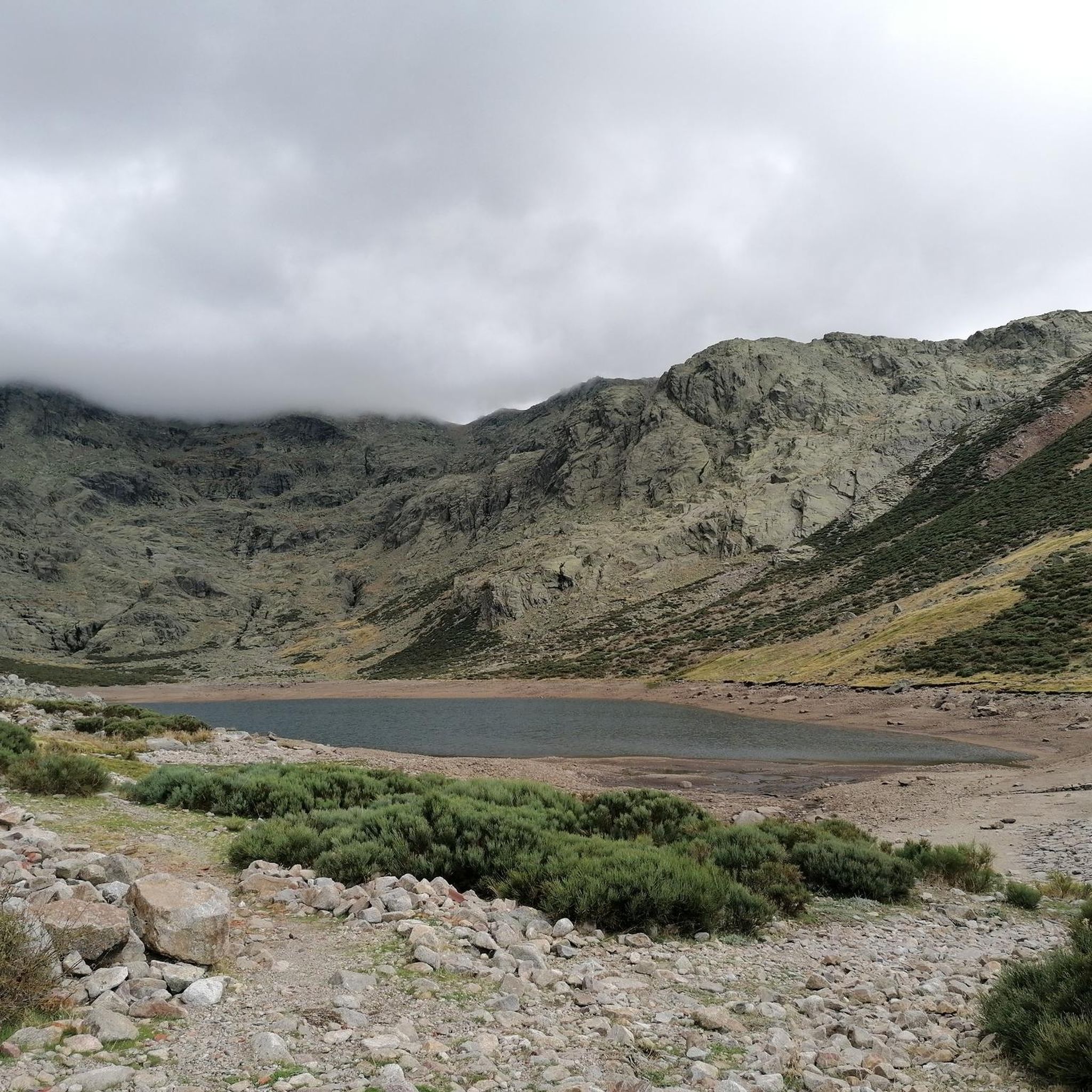
Another of the most important peaks of the Sierra de Candelario Park, the Calvitero rises above 2400 meters above sea level, offering wonderful panoramic views worthy of a postcard.
2
0
It is the highest peak in the province of Salamanca at 2,427 meters above sea level. The views are amazing but to get here you will have to make a significant physical effort since the journey is very demanding. Remember that the important thing is to enjoy the road and this beautiful landscape.
2
0
Following the well-known Route of the Trabuquete you will find this wonderful pool with a natural waterfall on the river Garganta de Jaranda. Undoubtedly the highlight of the route, not only for its turquoise waters but also for the beautiful landscape that surrounds it.
1
1
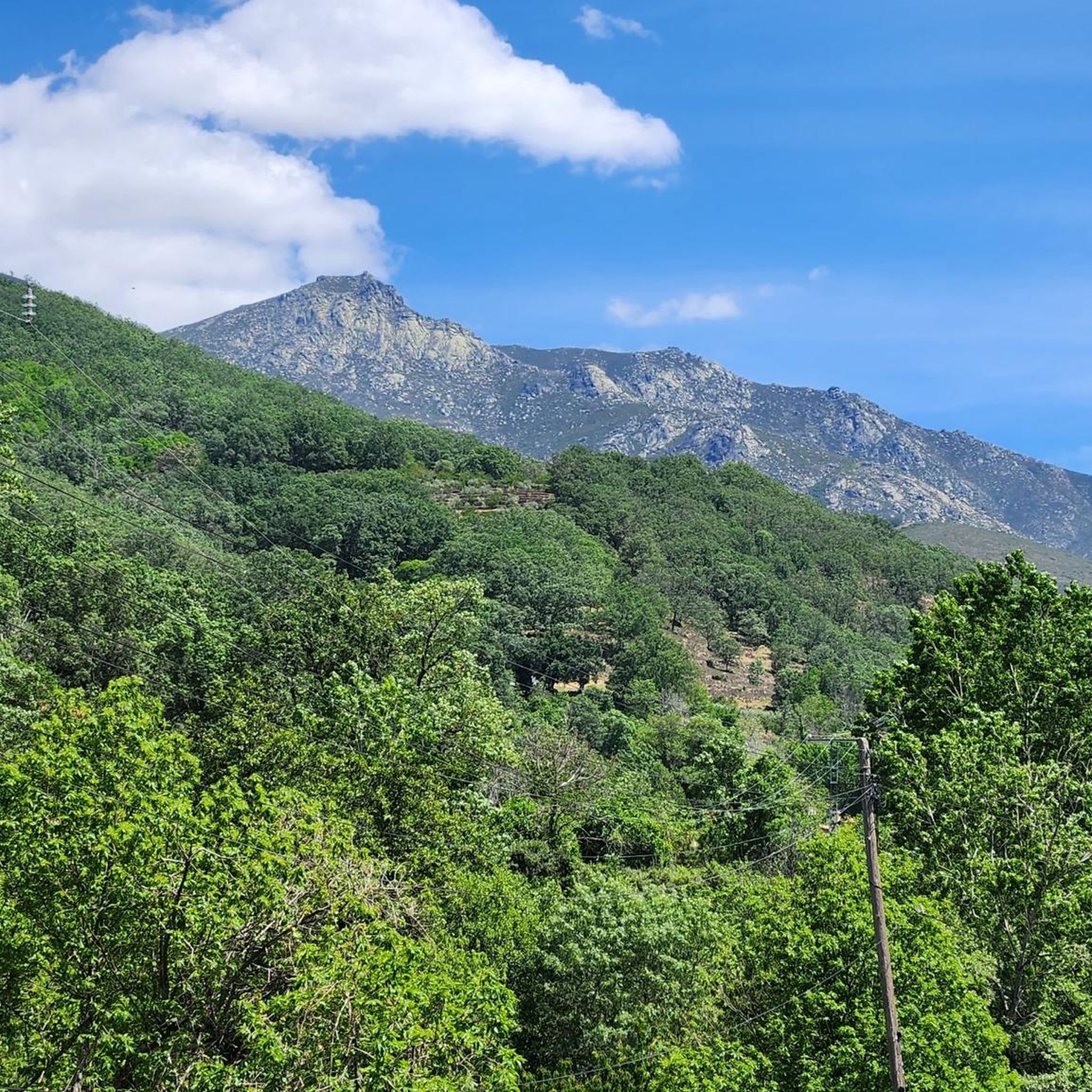
Popularly known as "the roof of Extremadura", the top of the Torreón or Calvitero is located at 2400 meters above sea level and without a doubt the views from there are amazing! An ascent that is demanding but with several alternatives to choose from and all of them with spectacular views.
3
0

This impressive granite canyon offers incredible views of the rock formations along the course of the river. There are several waterfalls that fall at different heights and form pools of crystal clear water. This section is, for the most part, an adapted stone walkway that zigzags along the gorge. However, there are also parts of loose stones.
3
0

The highest point in the province of Cáceres
1
1
Frequently Asked Questions
What are the most popular natural features to explore around Puerto Castilla?
The area around Puerto Castilla is known for its diverse natural features, including high mountain peaks, deep gorges, and refreshing waterfalls. Among the most popular are Charco del Trabuquete, a waterfall with a natural pool, and the summits of Torreón (Calvitero Summit) and Canchal de la Ceja, which offer extensive views.
Are there any challenging hikes to high mountain peaks in the region?
Yes, the region offers challenging ascents to high mountain peaks. Torreón (Calvitero Summit), at 2400 meters above sea level, is popularly known as 'the roof of Extremadura' and provides amazing views after a demanding climb. Similarly, Canchal de la Ceja is the highest mountain in the Sierra de Béjar at 2,428 meters.
Where can I find beautiful waterfalls and natural pools near Puerto Castilla?
You can visit Charco del Trabuquete, a stunning waterfall on the Garganta de Jaranda river, known for its turquoise waters and natural pool. Another option is Garganta de la Nava, an impressive granite canyon featuring several waterfalls and pools of clear water.
What kind of terrain can I expect when exploring the natural monuments?
The terrain around Puerto Castilla is varied, characterized by mountain ranges like the Sierra de Gredos and Sierra de Béjar. You'll encounter high mountain ascents, granite canyons, and river-carved landscapes. Some areas, like parts of Garganta de la Nava, even feature adapted stone walkways, though loose stones can also be present.
Are there hiking trails near these natural monuments?
Yes, there are numerous hiking trails in the vicinity. You can find detailed routes and information on the Hiking around Puerto Castilla guide. Popular options include the Laguna del Duque Trail and the challenging Canchal de la Ceja and Laguna del Duque Loop.
What outdoor activities can I do near the natural monuments?
Beyond exploring the natural monuments themselves, the area offers a range of outdoor activities. You can find various MTB Trails around Puerto Castilla, including the Puerto del Tremedal Loop Trail. For runners, there are Running Trails around Puerto Castilla, such as the Hoya Moros and El Torreón Loop.
What do visitors enjoy most about the natural monuments in this region?
Visitors frequently praise the stunning panoramic views from summits like Torreón (Calvitero Summit) and Calvitero Peak. The beautiful turquoise waters and surrounding landscapes of waterfalls like Charco del Trabuquete are also highly appreciated, as are the impressive rock formations and clear water pools within gorges like Garganta de la Nava.
Are there any viewpoints offering extensive vistas of the area?
Yes, the region is rich in viewpoints, especially from its numerous summits. Torreón (Calvitero Summit), at 2400 meters, provides amazing, extensive views. Similarly, Canchal de la Ceja and Calvitero Peak also offer wonderful panoramic views of the mountain ranges.
How long does it take to visit some of the natural monuments?
The duration of a visit varies. For instance, reaching Charco del Trabuquete involves a walk of about 3 km to the natural pool. Ascending summits like Torreón (Calvitero Summit) can be a demanding, longer excursion due to the elevation and challenging terrain.
What are the highest points I can reach in the natural monuments around Puerto Castilla?
The highest points include Canchal de la Ceja, which stands at 2,428 meters (7,965 feet) and is the highest mountain in the Sierra de Béjar. Torreón (Calvitero Summit) is also a significant peak, located at 2400 meters above sea level.
Are there any natural monuments that are less crowded but still beautiful?
Charco del Trabuquete, while popular, requires a walk of about 3 km to reach the natural pool. This means it tends to be less crowded than other more easily accessible natural pools in the wider area, allowing for a more serene experience amidst its beautiful turquoise waters and landscape.
Most popular routes around Puerto Castilla
Most popular attractions around Puerto Castilla

Get inspired with the komoot mobile app


Explore more
Extend your search for the best caves by checking out these guides of the top ones around Puerto Castilla:
